8 miles Misty then sunny
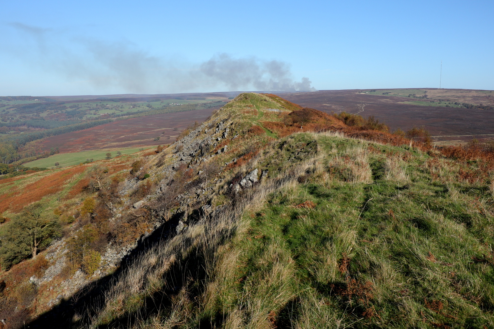
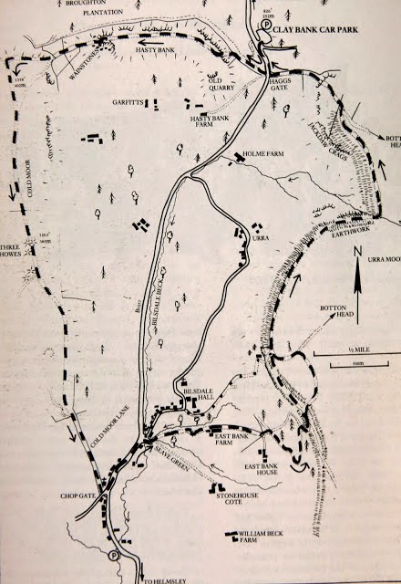
We parked at the top of Clay Bank and crossed the road to climb Hasty Bank. Extensive forest clearance has changed the outlook since we were last here. Instead of following the Cleveland Way route to the escarpment we branched left on a small path above the farm track to Hasty Bank Farm. This winds its way upwards eventually reaching the Old Quarry, shown on the map below.
 |
| Today's walk from The Walker's Guide to the Cleveland Hills |
 |
| Where has the forest gone? |
 |
| Hasty Bank is hidden in the mist |
 |
| Veering left on a small track ... |
 |
| ... eventually leads us to the old quarry |
 |
| ... and the Lady of Bilsdale |
The reason for this diversion was that we wanted to pay our annual respects to 'The Lady of Bilsdale', described by Tom Scott Burns as 'the enigmatic face of a lady carved on a rock wall who gazes eternally down into Bilsdale'.
This ancient stone face was carved into the side of the Old Quarry, perhaps by one of the workers. The track leads up and around Hasty Bank and at the top we came to the quarry on our right and walked over to admire the Lady and share her view of Bilsdale, albeit not a good one in today's mist.
 |
| Bilsdale in the mist |
Leaving the Lady we walked across the moor top to reach the Wainstones, where we picked our way carefully through the rocks before descending into Garfitts Gap and climbing onto Cold Moor.
TSB explains that the name Wainstones is believed to derive from the Saxon 'wanian' - to howl, and that the naming of the stones means 'stones of lamentation'. TSB mentions that his favourite graffitti to be found on the Wainstones is 'RO WOOING TD 1712' but we have yet to come across it.
 |
| We reach The Wainstones |
 |
| Looking up at The Wainstones |
 |
| Dropping down to Garfitts Gap |
 |
| On top of Cold Moor |
We walked along the summit of Cold Moor (1318') for 2.5 miles into a strong south westerly wind, sorry to miss views towards the Pennines in the west and Roseberry Topping and Easby Moor to the east because of the poor visibility.
Eventually we took a clear fork to the left, taking us gently down to the village of Chop Gate. This track is known as Cold Moor Lane and we passed through a gate where the path becomes a hollow lane. TSB says that it is possible that this passageway was established by prehistoric man and has continued in use throughout history to the present day.
 |
| Seave Green from Cold Moor Lane |
 |
| Losing height on Cold Moor Lane |
 |
| Passing through the moor gate to the hollow lane beyond |
 |
| Hollow Lane to Chop Gate |
We soon reached Chop Gate where we emerged at the old Wesleyan Chapel that is almost hidden between houses.
TSB says the reason for the strange location of the chapel is that the landowner, Lord Feversham, was C of E and totally against a non-conformist church being established in the dale. However a local shop keeper sold the Methodists this plot of land and the chapel was built in 1858. It reportedly contains an interesting harmonium (pump organ) but its doors were firmly locked today. A couple of years ago the chapel was for sale but the sale does not appear to have taken place and the building and grounds appear to be deteriorating.
 |
| Wesleyan Chapel at Chop Gate |
TSB says that the name Chop Gate is thought to be derived from the old Scandinavian term kaup meaning pedlar and with a number of pannier tracks converging on the village it must have been like a market place in times gone by.
We turned left into the B1257 and walked along to Seave Green whose name is thought to derive from its owner in 1301, Nicholas del Seves. Here we crossed the road to the tarmac track to Bilsdale Hall. On the left we passed Chisel Hill Mill which ceased operation in 1930 and later became a recording studio that was used by Chris Rea in the 1980s.
 |
| Walking on the B1257 towards Seave Green |
 |
| Entering Seave Green |
 |
| Passing Chisel Hill |
Reaching Bilsdale Hall we left our route to follow a lane to St Hilda's Church where we planned a stop for coffee and scones.
A walk of less than 5 minutes brought us to the attractive church which was rebuilt in 1851 in the shape and style of the original church. We were surprised to see that the church has been re-roofed since our last visit in summer of 2017.
 |
| Sheep near Bilsdale Hall |
 |
| Blue faced Leicesters come to see us at the gate |
 |
| St Hilda's with smart new roof |
Unfortunately the church was locked so we sat in the sun which had now emerged to enjoy our coffee and scones before exploring the graveyard. There are some ancient stones, many with interesting though maudlin verses, but years of grass-strimming has caked a green deposit on the stones making the inscriptions very hard to read.
 |
| We accept the invitation |
 |
| "A daughter wife and mother sleeps below, how many ties were severed with one blow, wives daughters mothers all ye mortals see, how scant the term of human life may be, live a true life and death in vain will call, who lives in Jesus will not die at all" |
 |
"Beware dear friends and weep not here, Here must I lie Till Christ appear, And in his coming hope to have, A joyful rising from the grave"
|
|
 |
| "Sleep on blest creature in thy urn, Our sobs and tears cannot awake thee, Weel (sic) stay until it be our turn" |
We wandered back to Baysdale Hall and re-joined TSB's route and began the steep climb up to follow the alternative dotted path on the map above, going steeply uphill to reach Urra Moor.
 |
| At St Hilda's Church |
 |
| Rear of church, roofing incomplete on this side |
 |
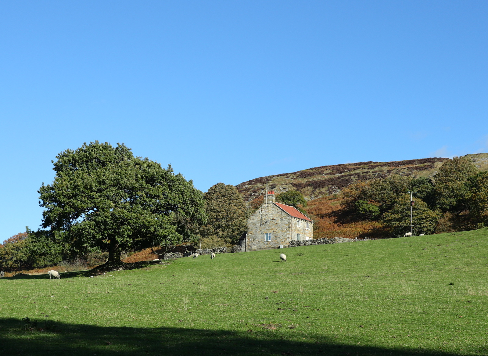
| Bilsdale Hall |
 |
| Looking back at Bilsdale Hall from our climb to Urra Moor |
 |
| Nearly at the top |
After pausing to admire the view and regain our breath we turned left and followed the ridge, with a succession of sweeping views of Bilsdale below us. As well as being on the ridge of the moor we also noticed we were walking alongside the remains of an earthworks. This earthworks stretches for 2.5 miles and its origin is forgotten, perhaps defensive, or it may have been an animal enclosure. It was known as Cliff Dyke, and a couple of centuries ago as Cromwell's Lines.
TSB mentions two witches who inhabited Bilsdale's moors, Peg Humphreys and her companion Alice Wood, who was said to take the form of a cat or hare.
 |
| On Urra Moor |
 |
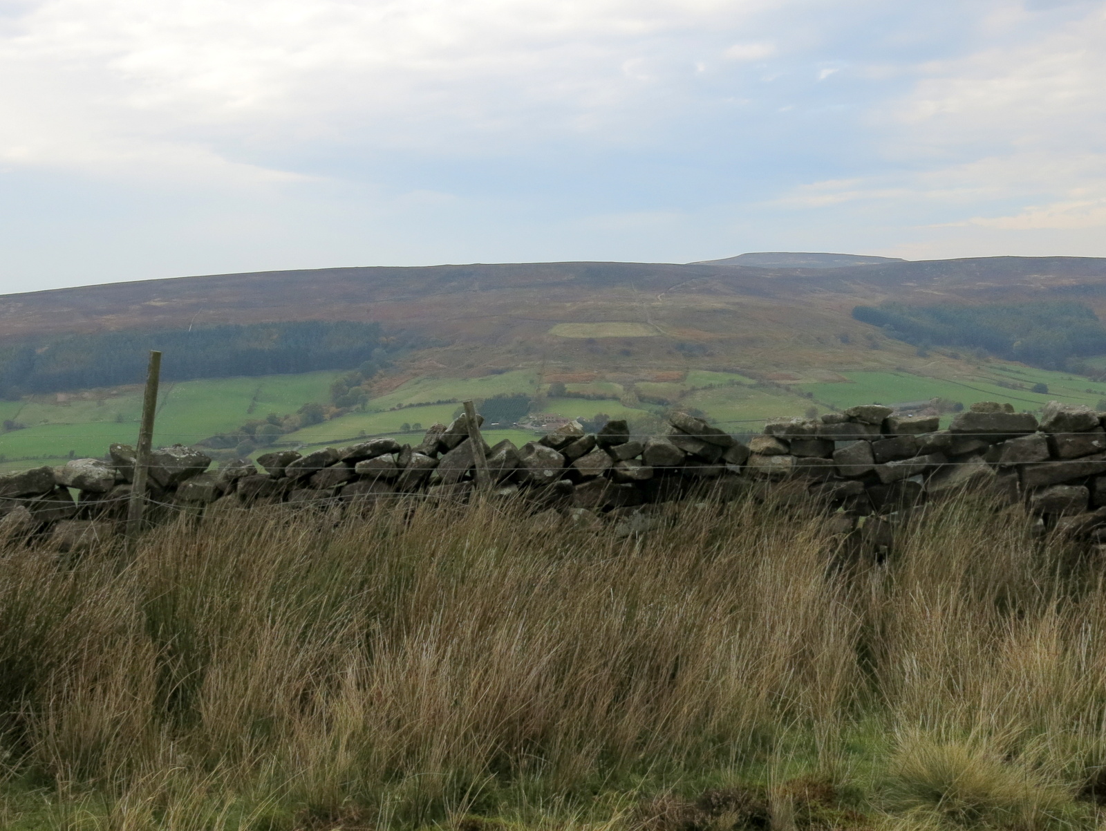
| Looking across at our outward path on Cold Moor |
 |
| A long walk along the escarpment |
We followed the earthworks and eventually came to a little valley where we crossed a stream known as Maiden Spring, at 1300'. The track and surrounding ground were very boggy at this point.
Leaving the beck we continued to follow the earthworks until rejoining the Cleveland Way track on Carr Ridge. We turned left and walked steeply down to Haggs Gate to rejoin the main road for a few yards returning us to Clay Bank Car Park and the car.
 |
| Carr Ridge |
 |
| Looking back into Bilsdale |
 |
| Looking over at Hasty Bank, showing the results of logging |
 |
| Great Broughton below |
 |
The moor gate and descent to Clay Bank
|