Along the Old Drovers' Road from Osmotherley
7 miles Cold and fine
We approached Osmotherley from the A19 and parked on the High Street outside the old Thompson's Shop.
 |
| Today's walk from The Walker's Guide to the Cleveland Hills |
 |
| Thompson's Shop, renovations appear to have stopped for now |
 |
| Quarry Lane |
Tom Scott Burns explains in his notes for the walk that the village was ravaged by William the Conqueror in 1069 and was still described as waste land in its entry in the Domesday Book in 1085.
He also relates that the village was raided by the Scots on several occasions and a raid in 1315 was so severe that the village was excused all taxation because of the distress it had suffered. A few years later, in 1348, the Black Death carried off nearly half the population of Osmotherley.
Also in the Domesday Book Osmotherley is known as Asmundreslac, which means 'Asmund's clearing'. We would walk past a cottage bearing this name on our return.
After booting up we went past the Market Cross into Quarry Lane and walked uphill admiring the fine buildings and spotting a couple of weather vanes and a restored pinfold before turning left into Ruebury Lane.
 |
| Weather vanes in Osmotherley |
 |
| Turn left onto Ruebury Lane and the Cleveland Way |
We quickly gained height until we looked back down on Osmotherley. A little further, when the lane becomes a track, is the Lady Chapel founded by Queen Catherine of Aragon in 1515. It is still a religious retreat and we followed the twelve stations of the cross as we approached it.
 |
| Viewpoint at Ruebury Lane |
 |
| The 4th Station of the Cross |
 |
| Lady Chapel |
 |
| Lady Chapel, not open to visitors today |
Leaving the Lady Chapel we dropped down to a track where we turned right, now following the Cleveland Way. This track has a fine view over the Vale of York and we walked along picking out landmarks such as The Tontine on the A19 below.
 |
| Leaving the grounds of the Lady Chapel |
 |
| The Cleveland Way track is muddy after recent rain |
 |
| Bear right into South Wood |
 |
| The Tontine Hotel below |
We followed the Cleveland Way along the ridge of Summer Game Hill and Swinestye Hill, and then through the trees of South Wood.
 |
| South Wood |
We walked uphill through the birch trees of South Wood to reach transmitter masts. When we walked past this transmitter station in 2014 we noticed a nice sign on the old gate which is mentioned by Wainwright in his 1973 Coast To Coast Guide. Unfortunately the gates have been replaced and the sign thrown away with the old post.
 |
| Transmitter station |
 |
| The old sign, now no more |
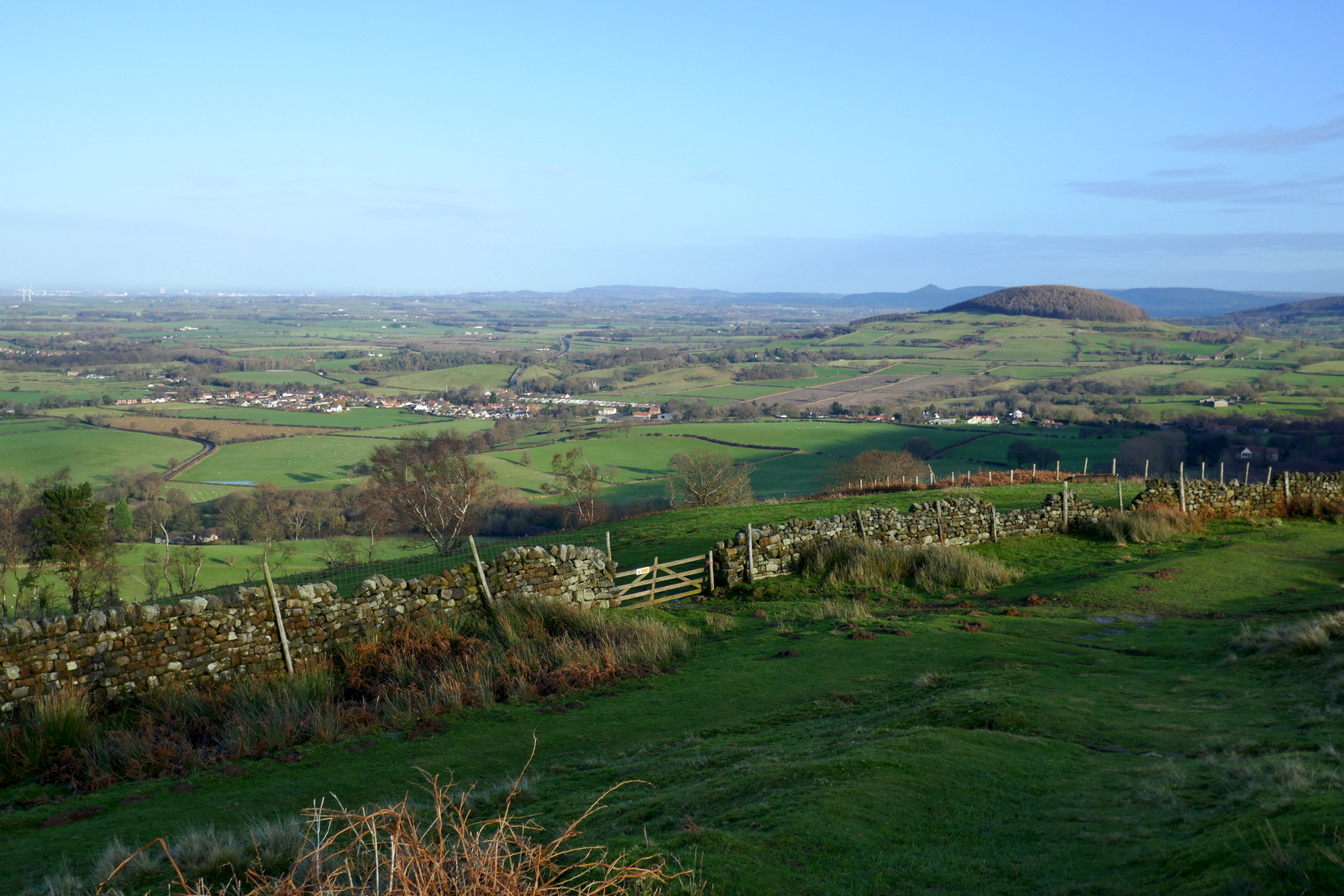
The track continues straight past the transmitter masts at Beacon Hill and directly onwards until reaching the gate to Scarth Wood Moor. We followed the Cleveland Way path across Scarth Wood Moor, all the time enjoying a fine prospect towards the Cleveland Hills, and in the foreground, Whorl Hill.
 |
| Trig Point at Beacon Hill, the start of the Lyke Wake Walk |
 |
| These pillars appear similar to the brickwork of the Starfish site, see later |
 |
| The gate at Scarth Wood Moor |
 |
| Swainby down below, Whorl Hill to the right |
 |
| We turn right at Scarth Nick, away from the Lyke Wake Walk |
Eventually we reached a wooden sign at the deep trough of Scarth Nick, pointing towards Cod Beck Reservoir and left the Cleveland Way to soon join the tarmac road that runs from Swainby to Sheepwash.
We now walked into a bitter head wind through Scarth Nick to reach Sheepwash. TSB explains that during the Ice Age of approximately 20,000 years ago, a glacier from the north enveloped an area 20 - 30 miles wide and 1,000 or more feet thick. It failed to cover the moors but crept into Scugdale depositing materials from Scotland, Cumbria and Durham. Sand, gravel and stones left by meltwater formed the conspicuous mound of Round Hill, the present car park at Sheepwash.
Reaching the water splash at Sheepwash we saw quite a few walkers and as we approached Crabdale Beck we were pleased to meet Joanne, a walker from our own neck of the woods.
 |
| Walking towards Cod Beck Reservoir |
 |
| Well met at Sheepwash! Our hiking friend Joanne |
 |
| Crabdale Beck |
We wanted to stop for coffee but Crabdale Beck was hidden from the sun so we climbed to Pamperdale Moor and the sun, where we stopped to enjoy our scones.
 |
| The bank makes a comfortable seat for coffee |
Coffee over, we now walked along High Lane alongside the forestry plantation above Cod Beck Reservoir. This was once a Drovers' Road and TSB suggests that it was probably used by prehistoric man, the Romans and before the present day road was made, as a corridor through the Cleveland Hills.
 |
| High Lane |
As we reached the end of the plantation we saw an unusual brick building which we have previously investigated and found to be a WWII Starfish, one of five such sites built during the last war to protect industry at Teesside by the following means:
A series of iron tanks, raised on gantries, would be set out. These tanks held inflammable liquid that could be ignited and quenched on demand. The fires were lit as soon as German bombers began an attack. When they were quenched, the resulting steam looked like the smoke of a burning city, and enemy pilots would drop their bombs harmlessly on the moors instead. Such decoys were officially known as ‘SF’ or ‘Special Fire’ locations, but were generally called ‘Starfish’ sites.
 |
| The Starfish, seen from High Lane |
 |
| Concrete base nearby - were the tanks set out here? |
 |
| A new steel door prevents access |
 |
| New bollards, not sure of their purpose! |
The bricks of the starfish are very similar to those in the pillars near the transmitter station.
Leaving the Starfish we continued along High Lane and as we reached the tarmac road from Osmotherley we passed the ruins of Solomon's Temple, which was built by the eccentric Solomon Metcalf in 1812 and had images of the sun, moon and stars on its walls. Now only fallen stones mark the spot.
Shortly afterwards we reached Chequers Farm. This interesting building was an old inn and held a licence for 300 years until 1945. When it was a hostelry it was famous for keeping an old peat fire alight for 150 years! The sign of the Inn was a chequers board and TSB says this was derived from the chequers that were handed to the drovers to be exchanged for refreshment at the inn. The sign was the cryptic message "Be not in haste, Step in and taste, Ale tomorrow for nothing." Of course, as we all know, tomorrow never comes. The old sign has been mounted behind glass on the farm wall.
Our path descended past White House Farm and then continued across a small bridge over a stream and steeply uphill to where the path crosses a field and into Osmotherley.
 |
| Dropping down to the bridge at Cote Ghyll |
 |
| Path from Cote Ghyll to Osmotherley |
We entered the village passing an old chapel that is obviously still in use. Tom Scott Burns tells us that John Wesley preached in Osmotherley in 1745 and the chapel was built nine years later. Wesley returned to preach again at Osmotherley in June 1761, and probably used this chapel.
 |
| Narrow path into Osmotherley |
 |
| Takes us past the old Wesleyan Chapel |
We emerged onto the road opposite the Queen Catherine Hotel, and walked behind the pub to look at the 12th Century St Peter's Church, which is almost hidden from view from the High Street.
It was unlocked and we went inside to look around. The tower is 15th century and the walls are built on Norman remains. There are fragments of Saxon crosses and part of a hogback (Saxon grave marker) in the porch.
 |
| St Peter's Church, Osmotherley |
 |
| Looking towards the altar |
 |
| Part of Saxon cross |
 |
| Festive decorations |
This is an interesting walk with lots to see. We had a short drive and settled in front of a roaring fire in a welcoming pub to discuss the day's events.
 |
| "To Asmundreslac!" |