"There must be dales in Paradise
Which you and I will find.."

Friday 15 November 2019


Exploring Scugdale from Carlton Bank


7 miles           Cold and dull, but dry


We drove up Carlton Bank to the Lord Stones Cafe and parked in their car park, knowing that we would repay their hospitality on our return.


Today's walk from The Walker's Guide to the Clevelaand Hills

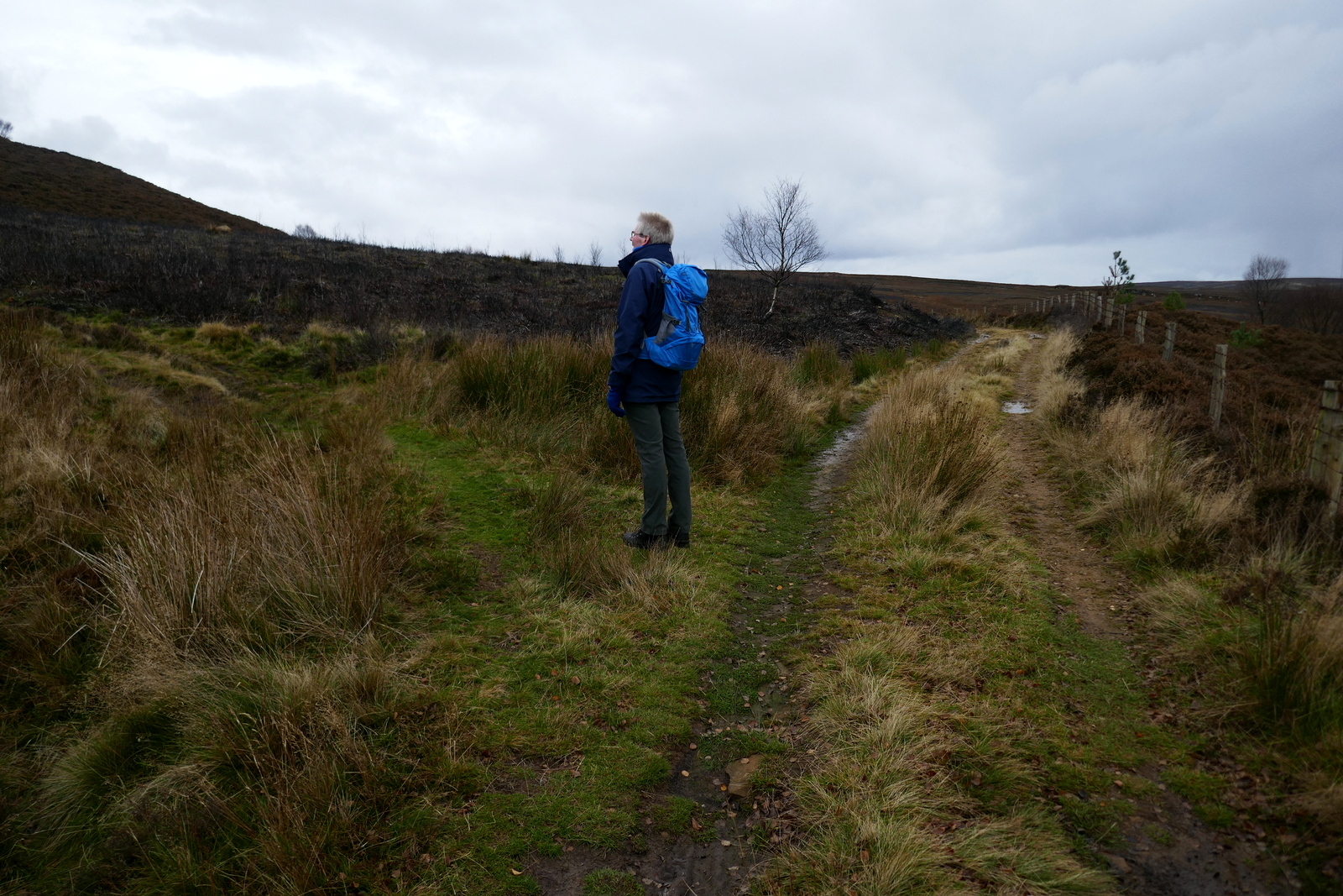
After booting up we walked back along the Carlton road for a few yards until we reached a new Cleveland Way sign. Here we turned left off the road and almost immediately turned right off the Cleveland Way to follow the wide access road for the old Gliding Club (now demolished) steadily uphill.

Turn left at the wooden Cleveland Way sign

Following the old glider club track uphill

We are saluted by geese as we start to climb


Reaching the moor top we turned left off the access road where a footpath sign indicated our track across the heather.  The first feature one comes to on this path is the rocky outcrop of Stone Ruck.  Tom Scott Burns explains that Ruck is derived from the Old Norse bruga meaning 'to pile or heap up', as in a cairn.  


Looking left as we climb towards Cringle Moor


Wet tracks after recent heavy rain

Stone Ruck


We followed the path for a mile or so across the moor until we came to Brian's Pond which looked dark and uninviting.  There was no sign of life in th pond so we continued on our way climbing steadily over Clough Gill Top, where a signpost indicates a choice of routes.

Brian's Pond


Go right at the sign just after the pond

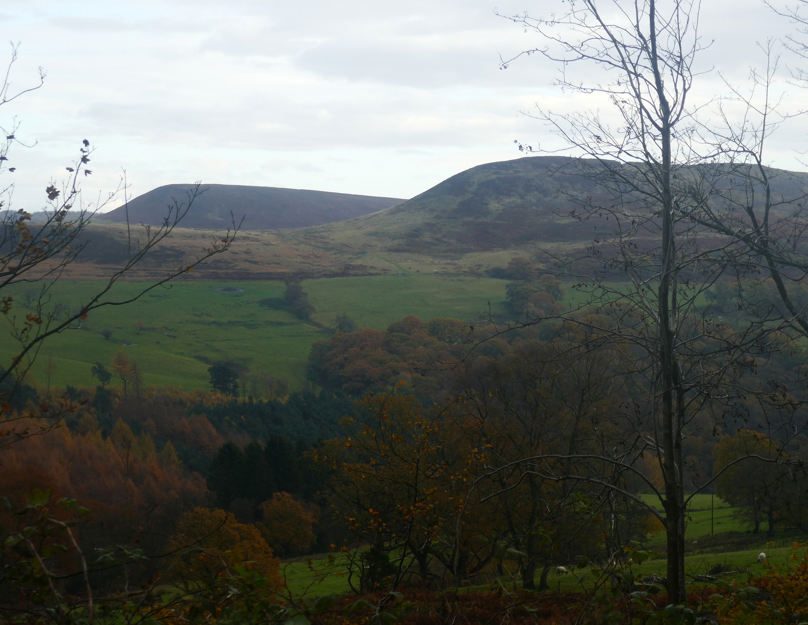
We took the right fork that ascends steadily to the moor rim where we suddenly came upon the valley of Scugdale.   To our right were the rocks of Barker's Crags and below us the buildings of Scugdale Hall.

Left is Holiday House and centre is Scugdale Hall

Panarama showing the whole of Scugdale
Barker's Crags

TSB refers to Scugdale as 'the sheltered dale' from the Danish skygger - to overshadow.  

We descended across a couple of fields to reach the dale road where we turned left to walk towards the top of the valley and High House.   Over the years the dales road has been strengthened with stones, tarmac,  pottery and bricks and we found several old bricks embedded in the lane bearing the name Old Linthorpe.  


We saw several Linthorpe bricks embedded in the road surface


A google search shows that these bricks were manufactured by a George Grubb Dalton, Brick Manufacturer, Builder & Contractor, Linthorpe, Middlesbrough, who is recorded in the London Gazette as giving Notice of Intended Dividends on the 13th November 1888.

Descending into the dale...

... to reach the Dale Road that runs from here to Swainby


We followed the dales road south to reach High House. TSB records that in this old farmhouse lived Harry Cooper who was reputed to be the tallest man in the world, standing at 8'6".  He left Scugdale to join Barnum's Circus in America and died in 1898 at the age of 41.


The house is currently unoccupied and its outbuildings falling into ruin.  Just beyond the house we turned right off the lane into fields at a dilapidated stile.  This part of the walk appears untrodden but there are guiding way-marks at field boundaries and we descended to reach and cross Scugdale Beck where we found (as on our previous visit) the old bridge that continues to serve no useful purpose, having been displaced by winter storms some years ago. 


Approaching High House

Unoccupied but by no means a ruin

Over the stile at High House...

Spoil heaps at the head of Scugdale

Descending to Scugdale Beck


We have to cross the beck to reach the bridge!

After crossing the beck we climbed up a steep bank to join the faint path that took us down the valley of Scugdale, walking under old alum workings. When we reached some sheltered grassy banks just before Holiday House Farm we stopped and enjoyed our coffee and scones looking across at Scugdale Hall.

Walking westwards along the valley

Holiday House comes into view

Barker's Crag and Scugdale Hall from our coffee stop

Holiday House was shown on 1940's maps as such. It seems a strange name and we would like to know why it is so called.


We get a noisy reception as we pass the rear of the farm

Hardy looking calves 

Holiday House Farm

Passing Holiday House we followed its long access track to the dale road, where we turned left and walked for a mile or so to reach the farm buildings of Fog Close.  Here we turned right into the farm's track although we didn't see the footpath sign, and then right again through a gate, also unsigned, before reaching the farm buildings. Here we turning left and walking up the side of the farm towards Live Moor we came upon a waymark at last.


Following the farm track westwards

We are led by a trio of escapees from a nearby field

There used to be a footpath sign here!

And there was once another on this gate..

After a steep climb to reach Live Moor we followed the escarpment with a misty view down into the charmingly named and little known valley of Snotterdale, to which there is no road or path access. 


Looking back to Scugdale from Fog Close Farm

Snotterdale

A waymark at last! Climbing to Live Moor

Nearly at Live Moor

Panorama of Snotterdale


Opposite a conifer plantation the path turns left across Carlton Moor where we were soon walking on the old gliding station runway, before crossing to join the Cleveland Way/Coast to Coast walk that follows the ridge with spectacular views all the way to a trig point at 1338 feet.  


Low flying RAF plane buzzes us on Live Moor


Bear left off the main track to climb to Carlton Moor


The old glider club runway


Fine view of Whorl Hill and Faceby from the Cleveland Way


Follow the Cleveland Way along the ridge


We followed the Cleveland Way into a bitter north easterly wind and soon caught up with a lone hiker carrying a big pack.  He told us he was walking the Cleveland Way and didn't know where he would lay his head tonight.  We were full of admiration but pleased we didn't have to do it!


A rain squall, hope it misses us..


Lone Cleveland Way walker


Weather station on Carlton Moor


Carlton village below
On reaching the trig point we took the steep and stony path down to the road and then, after de-booting, to the Lord Stones Cafe where we cheerfully repaid our parking debt by purchasing a couple of pints of Black Sheep Ale.


Trig point and boundary stone


Descending to the Lords Stone cafe


Saturday 9 November 2019


Hawnby Hill and Hazel Head from Hawnby


7 miles                    Wet and cold


Following a couple of wet days we wanted a walk that would be fairly firm underfoot and this walk should do.  It combines the best of moorland, woods, pasture and villages.  It's mostly good underfoot and not too difficult, but as there are a couple of good climbs, it isn't too easy.


Today's walk from The Walker's Guide to the Hambleton Hills


We arrived at Hawnby from the B1257 Stokesley to Helmsley road via the Laskill turn off and parked at the roadside shown by the P in the map above, just up the road from the old Inn at Hawnby.

We were pleased to see builders hard at work on the old Inn and chatted to one.  He told us that the new manager was due to take over the pub in February to supervise decorating.  He thought it would be open for Spring.  Good news for the village and for us too, of course.


Renovations at The Inn at Hawnby

The car dashboard reported 3 degrees outside temperature and we got straight into wet weather gear, setting off in heavy rain. 

The upper village sits right under Hawnby Hill (298m) whose twin, Easterside Hill, can be seen over towards the B1257.   These two hills, known as Corallian Outliers, once formed part of the Tabular Hills and have a very distinctive shape.


Setting off in a downpour

Hawnby below

Into the bracken

Climbing Hawnby Hill

Crossing a field we climbed through dying bracken to reach the top of Hawnby Hill and from here there is a good view in all directions; to the left down to Arden Hall and to the right, Easterside Hill. 


Looking left down to St Agnes Farm


Looking right to Easterside Hill

We now had a fine ridge walk along the top of Hawnby Hill and soon reached the highest point, a cairn at 978 feet.  A new addition  is a memorial bench just by the cairn, where one could sit with a fine view down to Arden Hall, but today's rain kept us moving.


Cairn and memorial bench at 978'

Memorial bench

Fairy ring on Hawnby Hill


We walked along the ridge to the end of Hawnby Hill enjoying picking out familiar sights and walks that we could see from this vantage point, and then descended to Hawnby Moor and the moor gate at Sunley Slack.


We reach the end of the ridge, Sunley Slack ahead

Looking back at our steep descent

Into the weather

We passed the moor gate and walked along the sandy path of Sunley Slack coming to a fork in the road after about a mile.  We took the left fork and followed the path, seemingly walking straight towards Bilsdale Mast.  To our right was Round Hill which is simply a collection of rocks and a bump in the heather. 


Moor gate

As big as dinner plates!


Looking back at Hawnby Hill on right and Easterside Hill

Sunley Slack

Eventually we came to a series of direction posts on our right.  We ignored the first two and about 20 feet past the third we turned sharp left on a small track to cross the moor.

There is very little sign of the path indicated by Tom Scott Burns on the map above, and we made our way sometimes through heather and sometimes on sheep tracks, all the time heading towards Hazel Head Wood which we could see to our left in the distance.

Reaching the wood we walked alongside it, gradually dropping downhill until the ruined Wesleyan Chapel suddenly came into view. Alongside the wood are numerous ants' nests, some up to three feet tall.  On previous walks we have stopped at the chapel for our coffee but rain and a brisk wind sent us into the wood for shelter.


Approaching the old Wesleyan chapel

We wade into the woods for shelter


Old ruins in Hazel Head Wood

We soon came to some ruined buildings.  TSB says these once belonged to High Hazel Head Farm which was last inhabited in 1946, surprisingly recent considering the state of the ruins.  As we examined the ruins the rain stopped and we decided that the stone blocks of the ruin would make chairs and table for our coffee stop.


We saw three of these way marks left apparently on trust

It's stopped raining so..

.. let's have coffee

Refreshed, we followed a grassy track through the dark wood until, bearing left, we exited the wood above Hazel Head Car Park and the Osmotherley to Hawnby road. The rain had stopped and the walking was much more enjoyable.


Leaving Hazel Head Wood


Turn into Ellers Wood at sign

We followed the road left for a short time before turning right into Ellers Wood at a footpath sign.  This stretch had seemed unwalked and the faint path made difficult by self-seeded saplings on our last visit here, but today the path was distinct and took us straight to a bridge over the River Rye.  


Through the saplings....

.. to The Bridge over the River Rye

In full flow

We stood on the bridge for a few moments watching the river, which was in spate following the heavy rain.


After crossing the river we briefly joined a farm track before passing through a gate into a sheep field.  We followed the edge of the field, alongside the river to reach a row of telegraph poles.  Here we turned left to follow the poles uphill to reach a stile.


Steady climb alonside the telegraph poles

Once over the stile we followed the track into conifers. These are the trees of Blueberry Wood and we found this whole area to be full of young pheasants which ran along the path in front of us.

Eventually we emerged from the conifers above St Agnes House Farm and to a surprise view of Hawnby Hill.


Buzzard at Blueberry Wood

Walking alongside Blueberry Wood

Surprise view of Hawnby Hill

St Agnes Farm

Passing above St Agnes House Farm we crossed a stile and dropped down to a ford where we crossed a footbridge into Low Wood.  Soon we came to the attractive arched bridge over the Rye, not mentioned by TSB as it post dates his book, being built to replace a bridge washed away by flooding in 2005.  See here 


Wet wool at St Agnes Farm

Walking alongside game bird fence

The first of three bridges 

The beck here is normally a trickle!

The arched bridge over the River Rye comes into view


Looking upstream from the bridge


From the bridge we had a short scramble up to a track leading right, coming out of the woods at the lonely Carr House.  From here we followed way marks (but no path) through several fields of sheep before eventually reaching the road just outside Hawnby.


Wet pheasants everywhere

Damp but dignified

Hill End House Farm

Arden Hall 

Looking towards Arden Hall

'At least this grass will clean our boots off..'

'Sod it!'

Cattle make the last half mile the dirtiest

The rain starts again as we arrive at Hawnby

A short drive took us to The Buck at Chop Gate where we discussed today's walk, which had been enjoyable despite the wet weather.


Debrief at The Buck