Kildale to Baysdale and its Lost Abbey
9 miles Cold and grey
We parked in the lay-by in Kildale village and walked out of the village along the same road, towards Little Kildale.
 |
| Today's walk from The Walker's Guide to the Cleveland Hills |
 |
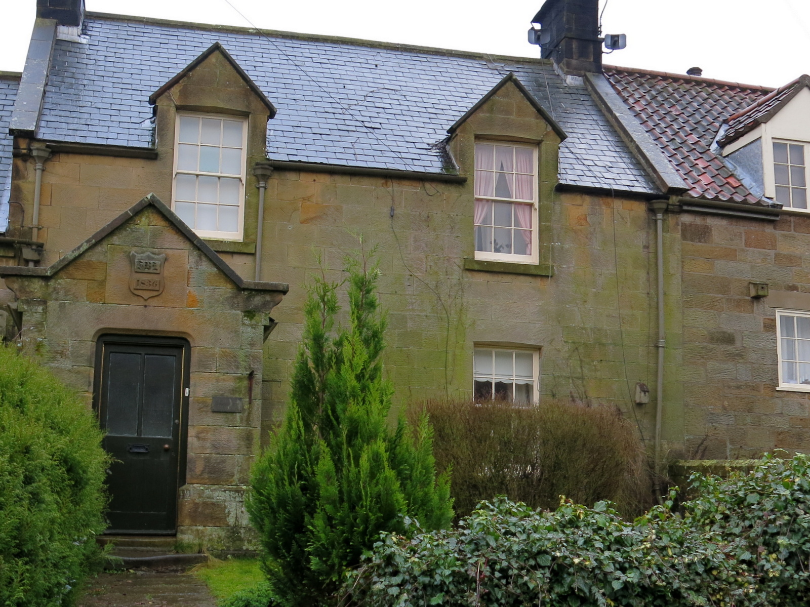
| The Old School House. dated 1836 |
 |
| Memorial Stone to John Wesley |
 |
| The Lodge and.... |
 |
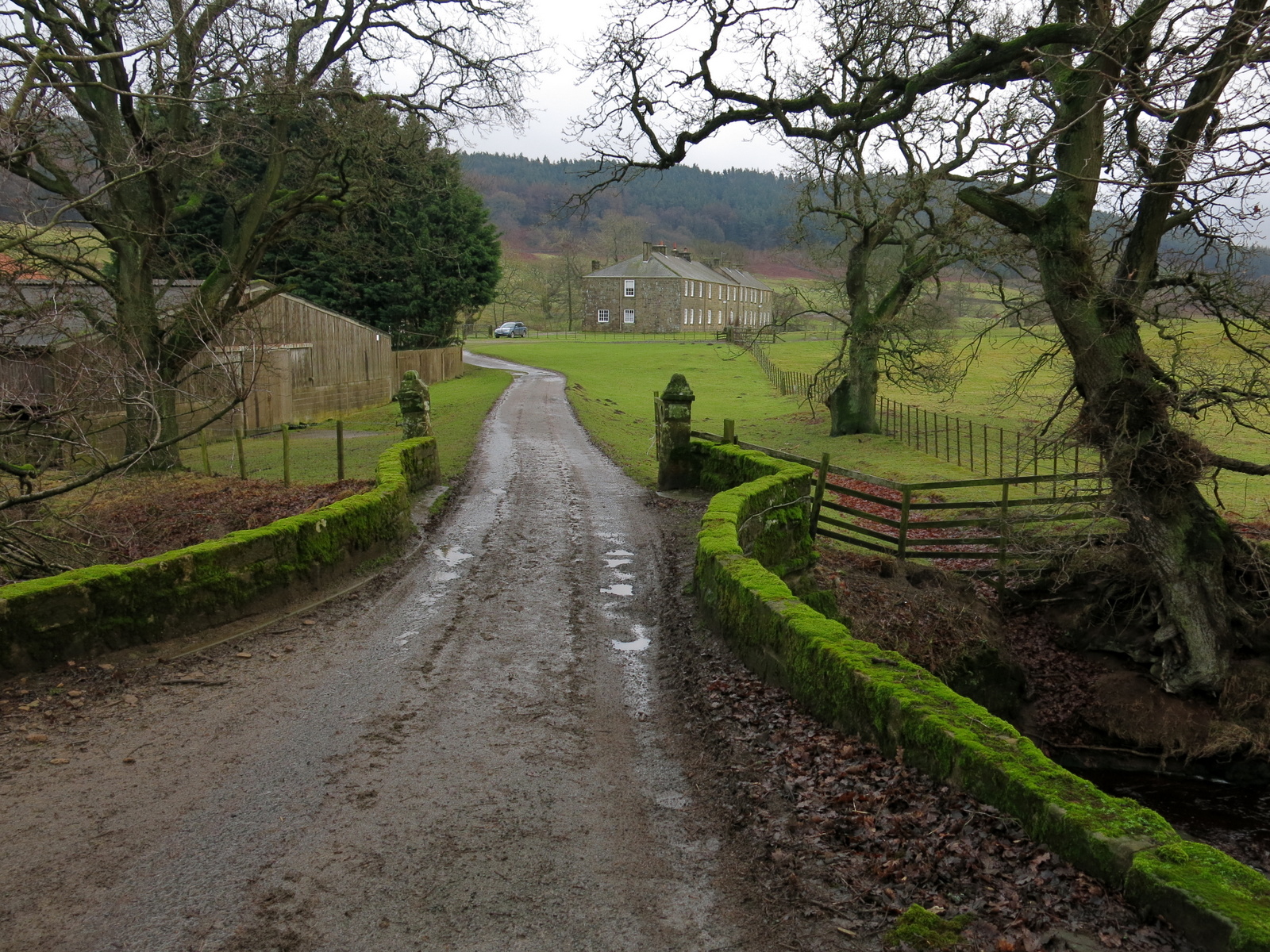
| Kildale Hall |
A car had gone through the hedge in front of Kildale Hall at some point allowing us our first good look at the building which is normally hidden from view.
Tom Scott Burns informs us that Kildale is a village of great antiquity. There are several 'Kildals' in Norway and the village was probably named by the Vikings. It was called Childale in the Domesday Book. In 1156 there was a wooden castle built by the Percys, Earls of Northumberland, on the site where the church now stands.
Reaching Green Gate Lane we walked along the tarmac towards Little Kildale.
 |
| Green Gate Lane and Little Kildale |
 |
| Dinner at Little Kildale |
 |
| Looking across Kildale to New Row |
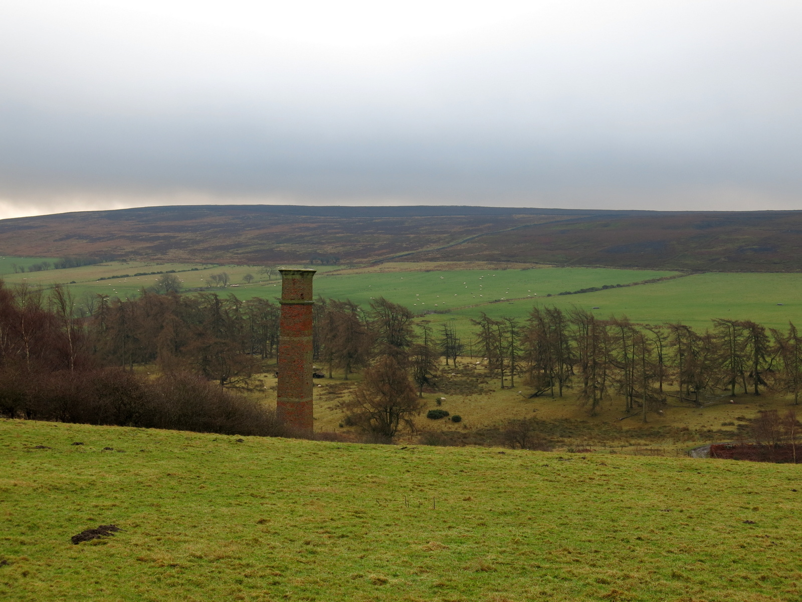
We walked through Little Kildale Wood and came to Warren Farm where we turned right to head towards the moor. We descended for a while to cross the source of the River Leven and we admired a fine brick chimney on our left. TSB tells us that this is the remains of an ironstone mine that was operational between 1866 and 1874. We walked over to inspect it and saw that work is ongoing and a sign stating that it will re-open to the public in April 2020.
 |
| Warren Farm |
 |
| Mine chimney |
 |
| Embankment of the mine's dismantled railway |
Leaving the mine we crossed a stream that is the source of the River Leven and headed steadily uphill towards Kildale Moor. Having reached the top at 900 feet, we descended towards Baysdale Beck, soon reaching the remains of an old barn where the path turns sharp left.
 |
| Source of the River Leven |
 |
| Looking back to the mine and Warren Farm |
 |
| A wet moor gate |
 |
| Waterlogged paths over Kildale Moor |
 |
| Descending towards Baysdale Beck |
At the barn we joined a track that runs parallel to Baysdale Beck. This is an old lime road that enabled limestone to be carried from Commondale into Cleveland, and we followed this for 1.5 miles until reaching a tarmac road.
 |
| Turn left at the first ruin |
 |
| We reach the Westerdale road |
We turned right onto the Westerdale road and walked steeply downhill to the pretty watersplash at Hob Hole. A stiff breeze was blowing so we crossed the footbridge to find shelter on the bank of Baysdale Beck. Here we sat out of the wind to have coffee and scones with a fine view across the beck to Sloethorn Park.
 |
| Walking down to Hob Hole |
 |
| The watersplash at Hob Hole |
 |
| I wouldn't drive my car through here today! |
 |
| Looking back from our coffee stop |
 |
| Baysdale Beck with Sloethorn Park beyond |
Hob Hole is supposed to be the haunt of a mischievous hobgoblin who taunts weary travellers and TSB reports a Canon Atkinson speaking of Padfoot, a precursor of death, sometimes visible and sometimes not, padding quietly behind a traveller and then uttering a roar in his ear.
Fortunately our coffee stop was untroubled by Padfoot and now refreshed we continued walking uphill on the road from Hob Hole before taking first right into John Breckon Road.
 |
| Looking down on Westerdale from John Breckon Road |
 |
| Leaving the tarmac at the footpath sign |
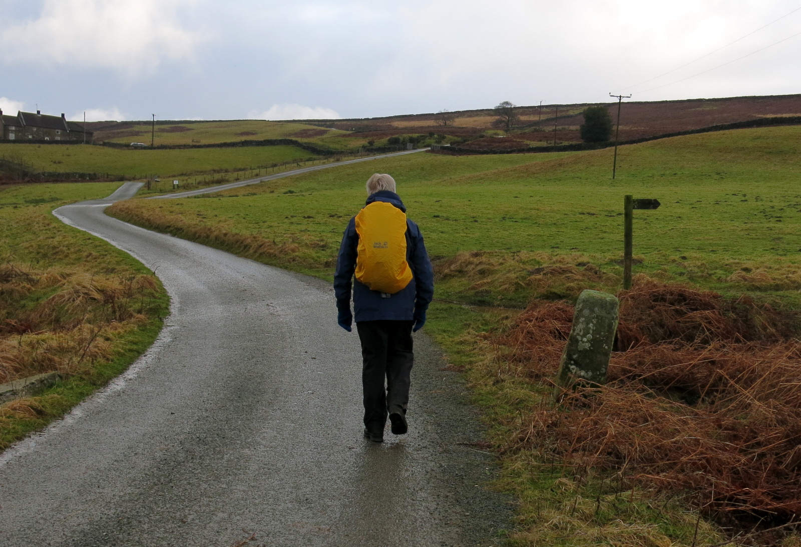
There is a half mile walk along John Breckon Road before taking a right hand turn onto the moor at an old green metal footpath sign. The path across the moor was running with water and very often we had to divert into heather to make headway.
We were now walking along the opposite side of Baysdale valley and parallel to our outward journey. Unfortunately the path on this side of the valley is not as good to walk as the old lime road, and progress was slow because of the conditions.
We passed a memorial cairn and plaque to 'Alan Clegg who loved these moors' and after a mile or so dropped down to the footbridge at Great Hograh Beck, where someone has placed a memorial bench.
 |
| Our path becomes a stream |
 |
| Dropping down to Great Hograh Beck... |
 |
| ... and a memorial bench |
 |
| Footbridge inscribed '1938' |
The bridge was built in 1938, according to an inscription and was the work of Rowland Close, of nearby Low House, which we would shortly pass by.
Just past the stone bridge we turned right onto a wide track and our progress speeded up after the difficulties of negotiating wet and muddy paths across the moor. We walked down hill and passed by the above mentioned farm called Low House where a mixed flock of ducks and hens were making a racket as they had just been fed. We then walked along the valley bottom to Baysdale Abbey. The original abbey was occupied by 9 or 10 nuns from 1190 to 1539. The building has been converted to holiday flats.
 |
| Approaching plantation at Low House Farm |
 |
| Low House Farm |
 |
| Ram and ewe at Low House farm |
Tom Scott Burns explains that in the middle ages land rents for Baysdale were paid with the heads of wolves, which were numerous in the area, and one can imagine this wild enclosed ravine in the 1300s, when cattle were over-wintered in the valley bottom. In fact, TSB explains, Baysdale is derived from Basdale meaning Cow Shed Valley.
 |
| Baysdale Beck near to Baysdale Abbey |
 |
| We find a strange offering... |
 |
| Recently shot |
 |
| Sheepdogs at Baysdale Abbey farm |
 |
| Bat box |
We were interested to see a bat box on one of the abbey buildings and then walked away from the buildings across a quaint stone bridge which is apparently the only substantial remnant of the original abbey.
 |
| Baysdale Abbey |
 |
| The old bridge |
 |
| Original bridge to abbey |
Once over the bridge we followed the road to a footpath sign where we turned right to climb steeply through fields, all the way to the dale top, at a height of 1050 feet, where we paused to admire the view back to the abbey and collect our breath. This is using the short cut shown on the map above as a dotted line opposite Baysdale Farm.
 |
| Turn off the road here to take short cut to the top |
 |
| Not sure what breed of sheep these are, possibly Dorsets. |
 |
| The short cut is a steep climb |
 |
| Nearly there.... |
This short cut cuts down the road walking but is very steep and we eventually rejoined the road we'd left and continued walking towards Kildale. After a few minutes walking on this road we saw a stone memorial to the crew of a second world war plane that had crashed on Kildale Moor; sadly the crew died from exposure before they could be rescued.
 |
| We reach tarmac again |
 |
| Tarmac and we're on The Cleveland Way all the way back to Kildale |
 |
| War memorial |
We followed the lane steadily down and eventually joined the Kildale road where we turned right towards the car. There is no pub in Kildale but a short drive took us to the Roal Oak at Great Ayton where we enjoyed a pint and discussed a good walk.
 |
| Battersby and beyond that, Battersby Junction |
 |
| Looking up to Kildale Crag |