Balk and Bagby from Sutton Village
7 miles Hot and sunny
We drove into Sutton-under-Whitestonecliffe on the A170 from the A19 and parked our cars in the Whitestonecliffe Inn Car Park. Tom Scott Burns tells us that hikers are welcome to use the inn's car park but sadly the pub is no longer in business and has a sign stating that it is for lease. The pub car park is huge and we could see no harm in parking there, hopefully it will re-open and we will repay with our custom.
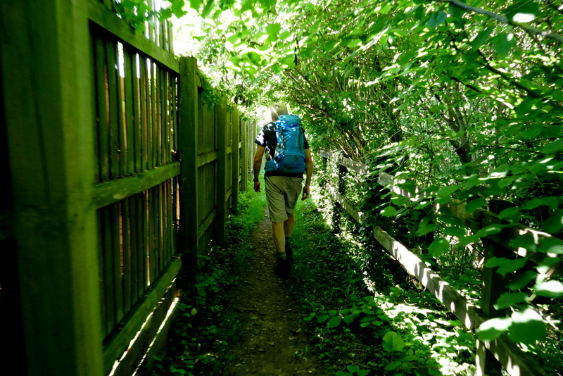
We walked from the pub and turned right onto the A170 which we followed through the village, spotting several interesting weather vanes.
This is a busy road and traffic whizzed past us as we crossed the bridge over Sutton Beck and turned left off the road and into a track at a footpath sign.


Thankful to leave the busy A1780 at a footpath sign on the right, we followed a track on tarmac then across fields to the town's sewage works. Keeping to the right of the sewage works we passed through more fields next to Sutton Beck, until we emerged beyond a static caravan park at the tiny hamlet of Balk.
TSB tells us that Balk originates in the Old English 'balca' or 'bank' and would have applied to the ridge of land between Balk Beck and Hood Beck.
We turned right onto the road and walked into the village.
We walked through Balk and admired its three storey mill, now renovated into housing, and opposite it, the old mill buildings which have been taken over by a furniture manufacturer.


The next bit of the walk became rather tricky. We could find no way-mark signs (most unusual!) and field enlargement appears to have swallowed up the footpath described by TSB. Perhaps a problem to be expected with Tom Scott Burns's walks is that paths are so little used that farmers feel entitled to plough them up. Continuing across these fields we found that the farmer had planted crops right up to the edge of the field, removing the footpath completely and making walking difficult.
We continued across fields relying on GPS tracks to show we were on official rights of way until reaching the large farm of Low Osgoodby Grange. Here we found way marks but directing us around the farm buildings in the opposite direction to TSB's map.
We stopped at the farm to buy free range eggs and chatted to the farmer's wife who told us that the new route was the one preferred by the farmers.
From Osgoodby Grange we followed the farm's track to the tarmac road where we turned left, heading back towards Balk. In the distance we could now see Whitestone Cliff.
Passing Mount Pleasant Farm we re-entered fields for a couple of miles, eventually taking us back to Sutton-under-Whitestonecliffe and the pub car park.
 |
Today's walk from The Walker's Guide to the Hambleton Hills |
 |
| View from the pub car park |
 |
| The Whitestonecliffe Inn in happier days |
This is a busy road and traffic whizzed past us as we crossed the bridge over Sutton Beck and turned left off the road and into a track at a footpath sign.


 |
| Bamber House - we wonder what the story is behind this deteriorating property on the High Street |
 |
| Walking through Sutton-under-Whitestonecliffe |
 |
| Sutton Hall, now holiday apartments |
 |
| Leaving the village |
 |
| Turn off the A170 at this gate |
Thankful to leave the busy A1780 at a footpath sign on the right, we followed a track on tarmac then across fields to the town's sewage works. Keeping to the right of the sewage works we passed through more fields next to Sutton Beck, until we emerged beyond a static caravan park at the tiny hamlet of Balk.
 |
| The cows are too hot to greet us |
 |
| It's just too hot to bother |
 |
 |
| The caravan park is still closed to the public |
 |
| A narrow track behind houses takes us into Balk |
TSB tells us that Balk originates in the Old English 'balca' or 'bank' and would have applied to the ridge of land between Balk Beck and Hood Beck.
We turned right onto the road and walked into the village.
 |
| Balk |
 |
| The Old Mill buildings |
 |
| Balk |
We remained on the road heading west until we reached the larger village of Bagby where we turned left onto a track near new housing just before entering the village. There is a sign but you would never spot it if you didn't know.
 |
| Weather vane at Bagby |
 |
| Turn left at this gravel track |
 |
| Spot the sign! |
 |
| Emerge into a bean field |
The gravel track leads to fields where we turned right to walk alongside the crops. As you see from the map above we now headed south along this track to the village of Thirkleby. We passed by another caravan park at Pond Wood and the grounds of Thirkleby Hall before emerging on to the road by the picturesque old school house.
 |
| A hot walk |
 |
| Hood Hill - we usually see it from the other side as we climb Sutton Brow |
 |
| Every bit of shade is used... |
 |
| Hot sheep |
 |
| The old school house at Thirkelby |
We walked through Great Thirkleby and came to the isolated church of All Saints' where we sat in shade on a memorial bench and enjoyed our coffee and scones.

 |
| All Saints from the road |
 |
| Built in 1722 in the Italian style |
 |
| Someone wants to share my scone |
 |
| The unusual style of All Saints' at Thirkleby |
We could admire the old building from the outside only as churches are still closed as part of the virus lockdown. After finishing our coffee we walked back to the road then crossed straight over to join a field path leading to a footbridge, then quickly on to the Little Thirkleby Road, where we turned left to walk parallel with the route we had followed into Thirkleby, this time to the right of Thirkleby Beck.
 |
| Thirkleby and the White Horse from our coffee stop |
 |
| Time to leave.. |

 |
| Keeping the flies off |
The next bit of the walk became rather tricky. We could find no way-mark signs (most unusual!) and field enlargement appears to have swallowed up the footpath described by TSB. Perhaps a problem to be expected with Tom Scott Burns's walks is that paths are so little used that farmers feel entitled to plough them up. Continuing across these fields we found that the farmer had planted crops right up to the edge of the field, removing the footpath completely and making walking difficult.
 |
| Leaving Thirkleby |
 |
| Walking parallel with the village |
 |
| Keeping the flies off (2) |
 |
| The White Horse on the hills opposite |
 |
| The heat gets to Clive. No waymarks here.. |
 |
| No paths either |
We stopped at the farm to buy free range eggs and chatted to the farmer's wife who told us that the new route was the one preferred by the farmers.
 |
| Low Osgoodby Grange |
 |
| "I'll have a dozen.." |
 |
| Looking back at Low Osgoodby Grange from the Bagby road |
From Osgoodby Grange we followed the farm's track to the tarmac road where we turned left, heading back towards Balk. In the distance we could now see Whitestone Cliff.
Passing Mount Pleasant Farm we re-entered fields for a couple of miles, eventually taking us back to Sutton-under-Whitestonecliffe and the pub car park.
 |
| Leave the Bagby road here, no sign again |
 |
| Whitestone Cliff |
 |
| No sign of a track but we're sure we are on the footpath |
 |
| Through the gate |
 |
| A waymark! |
 |
| Through the gate and straight over fields to ... |
 |
| ... Sutton-under-Whitestonecliffe |
 |
| Weather vane at Sutton Village |
Today's walk is level, easy walking but careful preparation of one's route is necessary, preferably with OS Map or GPS, as wayfinding is particularly difficult after Thirkleby.
 |
| Making friends in Sutton Village |