Bank Foot to Upper Baysdale and Burton Howe
11.3 miles Heavy Showers
Clive is holidaying in Spain so Carole agreed to walk with me for today's longer Tom Scott Burns walk which we haven't done for nearly three years.
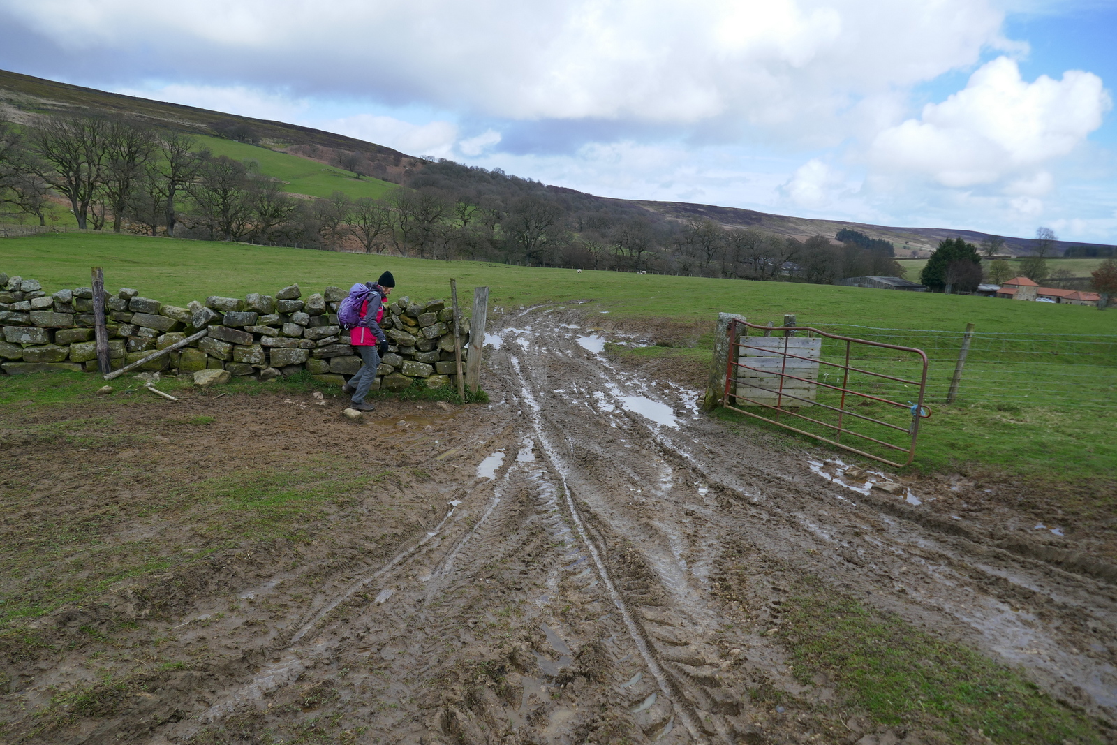
We parked at the road side near to Bank Foot Farm, which is approached from the unclassified road between Ingleby Greenhow and Battersby, and walked past the Grim Sheeper to climb to Turkey Nab.
 |
| Today's walk from The Walker's Guide to the Cleveland Hills |
 |
| The Grim Sheeper is looking a little weather-beaten |
 |
| Walking past Bank Foot Farm |
 |
| .. and stopping for a chat |
 |
| The cairn at Turkey Nab |
We walked past the farm and immediately started to climb the forestry path towards Turkey Nab.
The name Turkey Nab is believed to be a derivation of Thurkill, and Thurkill's hill road, which passes this point on its way to Stokesley from Kirbymoorside, is mentioned in the grant of land to Rievaulx Abbey. Nab is derived from Norse Nabbi meaning projecting peak and Turkey Nab is where the cairns are situated to the side of the rocky quarry cliff that is often used by climbers.
 |
| Left off the track and over the chain |
 |
| Crossing Battersby Moor |
 |
| Carole checks her GPS, a good idea as all moor tracks look the same |
After crossing the chain barrier we joined a smaller track leading across Ingleby Moor, crossing Black Beck about a mile further on before a slight climb to bear left onto Middle Head Road.
Shortly after crossing Black Beck we turned left at a junction and turned on to Middle Head Road. A short walk brought us to an interesting group of large boulders known as the Cheese Stones and we walked over to have a better view.
 |
| On Ingleby Moor |
 |
| Baysdale Moor ahead |
 |
| Red grouse |
 |
| Turn left here to follow the ridge above Baysdale |
 |
| Baysdale |
 |
| We arrive at the Cheese Stones |
The Cheese Stones are a group of sandstone boulders that look down into Baysdale Valley. We found some interesting graffitti including what appears to be a carving made by a father and later his son, separated by 24 years. Carole spotted some graffitti we hadn't seen before, from 1808 with the unusual name 'Olave Sanderson'.
 |
| The Cheese Stones |
 |
| Maurice H Close 1928 and below B Close 1952 |
 |
| A horned figure |
 |
| Carole jumping from stone to stone |
 |
| Maurice was very busy |
 |
| 1808 Olave Sanderson |
Here is a photo of Tom Scott Burns at the Cheese Stones on 15th November 2001. With many thanks to Don Burluraux.
 |
| Tom Scott Burns |
Continuing along the moor we walked past the remains of a medieval cross and soon looked down onto Baysdale and the imposing building of Baysdale Abbey. We walked through forestry and reached the sheep meadows that slope down to the abbey where we found a suitable soft spot to sit and enjoy our coffee and scones with a fine view and occasionally in the sun, which came and went.
 |
| Leave the Cheese Stones |
 |
| Approaching Grain Planting East |
 |
| Grain Planting East |
 |
| We emerge from the trees |
 |
| ... and decide it's time for coffee and scones |
We finished our coffee and walked down to the Abbey and its farm buildings.
Tom Scott Burns mentions that in the middle ages land rents for Baysdale were paid with the heads of wolves, which were numerous in the area, and it's easy to imagine how wild this enclosed ravine must have been in the 1300s, when cattle were over-wintered in the valley bottom.
TSB explains that Baysdale is derived from Basdale meaning Cow Shed Valley. The Abbey Farm has been renovated and is now marketed as holiday lets and we walked round the building, then followed the yellow way-marks uphill to Thorntree House.
 |
| Descending to Baysdale Abbey |
 |
| Muddy Boots |
 |
| The Abbey, now holiday lets |
 |
| Bat Box at Baysdale |
 |
| Climbing to Thorntree House |
 |
| Thorntree House Farm |
 |
| ... and residents watch us pass by |
We passed Thorntree House and climbed through a forestry plantation to reach the gate at Baysdale Moor and as TSB relates, "an ever-unfolding sea of moorland".
 |
| Steep climb to the moor and Carole pulls ahead.. |
 |
| GPS check at the moor gate |
 |
| Rain has made the tracks heavy going |
We followed the moorland track for about 1.5 miles and although our track turns right just before reaching an old stone shooting box, we decided to pop down to see it.
 |
| The old shooting box |
 |
| The date might suggest that Maurice H. Close has been here too! |
Back on our track we soon reached the old disused coal pits of Armouth Wath, ('ford at beck's clearing') pausing en route to don waterproofs as the first of several heavy showers began.
 |
| Looking across Stockdale from the shooting box |
 |
| Carole checks for trapped creatures in a shooting butt |
 |
| Baysdale Moor |
 |
| Wet but unbowed |
 |
| Dropping down to Armouth Wath |
 |
| Remains of miners' huts above Carole |
 |
| Black Hagg Beck |
Armouth Wath is a very bleak spot and life in the coal pits must have been hard. Excavation work has been done at the ruins of the four colliery buildings and revealed that the pits were 106' deep.
 |
| Rudimentary stone huts |
 |
| We return to the track |
We left following the colliers' track and a long climb brought us to the Bronze Age tumulus of Burton Howe.
 |
| Rainbow over Baysdale Moor |
 |
| Tumulus at Burton Howe |
 |
| Burton Howe |
There are several tumuli here, apparently dating from 4500 - 1400 BC, some still containing coffins and cremated remains.
Our path now follows the escarpment across the open land of Ingleby Moor, locally known as Siberia and devoid of interest until arriving at a well preserved standing stone near Tidy Brown Hill. We could make out the inscription 'Ingleby and Stoxley' on the front, ' Kirby and Helmsley 1757' on one side and 'Guis Boro' on the other.
Strangely, TSB doesn't mention this stone in his walk description.
 |
| Ingleby Plantation and Urra Moor in the background |
 |
| I strike a heroic posture |
 |
| Following the escarpment |
 |
| Standing stone |
 |
| Kirby and Helmsley 1757 |
 |
| Ingleby and Stoxley |
We now had a two mile walk along the escarpment with fine views, heather to our right and the villages of Cleveland below us to the left.
Alfred J Brown in his book Tramping in Yorkshire, says, "Even the longest ridge must come to an end, and suddenly the road twists, hesitates, and takes the plunge gloriously down Turkey Nab. The Cleveland County is full of 'Nabs' but Turkey Nab will take some beating."
Arriving at Turkey Nab we rejoined our outward path, this time descending back to Bank Foot Farm and our car.
 |
| Roseberry reappears on the horizon |
 |
| We rejoin the outward path at the chain |
 |
| ... and descend with Battersby Junction below |
 |
| Battersby Crag |
 |
| Off-piste as usual |
 |
| Farewell to the Grim Sheeper |
A short drive took us to the Royal Oak in Great Ayton where we enjoyed a pint and discussed this fine TSB walk.
 |
| "To The Grim Sheeper!" |