A Tour of Raisdale from Chop Gate
7 miles Warm and fairly sunny
We knew the heather would be in full bloom so we decided to do a moor walk today. We parked in the public car park at Chop
Gate Village Hall on the B1257 road, where a walking group of ladies were preparing for the off. "Teesside Trekkers? Where's the rest of your party?" said their leader. We explained that we weren't the Teesside Trekkers and compared walks, the ladies were doing the first part of our walk then our routes would separate. They continued to wait in the car park for stragglers and we started on our way immediately by climbing over a
stile at the rear of the car park, then following Raisdale Beck across
meadowland to Cock Flat Farm.
 |
| Today's walk from The Walker's Guide to the Cleveland Hills |
 |
| Looking over towards Chop Gate from Raisdale Beck |
 |
| The grass was long and very wet from last night's rain |
 |
| A helpful board over the mud |
We followed a nice assortment of field paths, little walked and wet, to Cock Flat Farm and
then High West Cote Farm. To our left we looked down on to Raisdale,
which TSB says means Reith's Valley. The last time we walked
along here in winter the paths were easy to walk as there was no bracken,
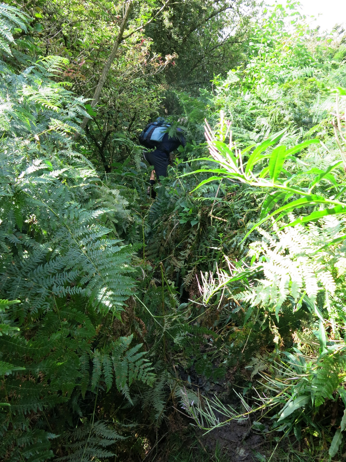
but today it was shoulder high and we had to be careful we didn't stand in any holes as we forced our way through it.
 |
| Clive pushes his way through the bracken |
 |
| The valley of Raisdale to our left |
 |
| Buzzards circle hopefully above us |
We passed by High West Cote Farm and dropped down to the road and Stone Intake Farm. TSB tells us that this section of road was mentioned in the 1160 Rievaulx Charters as the Red Road, possibly because of the red shale in the area. Just tarmac today and we followed it for a short distance and reached a sign for Raisdale Mill where we turned left off the road. The mill is now a private house but operated as a mill until the 1920s. We stopped to meet a couple of horses, one of which was a Shetland pony, and Clive shared an apple with them.
 |
| Looking over at High House and the walk to come |
 |
| High West Cote Farm |
 |
| A mysterious find in a dry stone wall |
 |
| We pass some cattle as we drop down to the road |
 |
| Weather-vane at Stone Intake Farm |
 |
| Stone Intake Farm |
 |
| Another weather-vane at Stone Intake Farm |
Just past the mill we entered a green lane and started our long ascent towards Barker's Crag.
Tom Scott Burns describes this green lane in the following words:
Just beyond the mill the walk pursues a path that veers right from the lane, then dramatically transforms into a most beautiful green lane which threads its way upwards to Barker's Ridge.
Since Tom wrote these words in the 1980s the green lane has been ruined by motor cycles and is now a badly rutted track. Last year we noticed that a tree had fallen across the lane completely blocking it to motor vehicles and today we saw that there were no new tyre tracks and we thought there was an improvement in the path, let's hope it isn't temporary.
 |
| Leaving the road just beyond Stone Intake Farm |
 |
| Buildings at Raisdale Mill |
 |
| "Any apples?" |
 |
| Friendly horses |
 |
| Clive shares his apple |
 |
| Starting up the 'green lane' |
 |
| Useful fallen tree |
Eventually the green lane led us to Barker's Ridge and the moor. We past High House and found a sheltered spot for our coffee and scones. sitting in the sun to look back at our outbound route from Chop Gate.
 |
| We wondered what these standing stones had been used for near to High House |
 |
| High House |
 |
| The view from our coffee stop |
 |
| Sometimes we sit and think and sometimes we just sit |
After coffee we started walking towards Scugdale Head and from this point on we were walking through the intoxicating smell of heather in bloom. TSB say that "it is a marvellous sight to see myriads of bees skimming across the pollen clad flowers" but Clive and I saw very few bees today, perhaps because of the heavy overnight rain. Who knows? As we climbed we came to a nice 'surprise view' of Scugdale, down to our right and Barker's Crag looked fine in the heather.
 |
| Barker's Crag |
 |
| Looking left from our path, to High House and beyond to Roseberry |
 |
| Surprise view of Scugdale |
The next couple of miles of trudging along a moorland track would normally have been a chore but today the heather made the walk exhilarating. Eventually our track dropped off left towards two small plantations and Head House, once derelict and now used as a store. We left the path to visit the old building, still unlocked and useful as a shelter in bad weather.
 |
| A layer of wool inside this shooting butt shows that sheep are using it as a shelter |
 |
| Head House |
 |
| Nicely restored on the outside... |
 |
| ... but the inside could do with a bit of work |
 |
| Grouse feed |
We walked on, past the conifer plantation and down to Arns Gill, almost hidden in bracken. We crossed the beck and walked up past the weathered old Rowan tree descibed in the '80s by TSB as "... a sorrowful looking rowan with wind shattered boughs - yet still growing - is seen by the side of Arns Gill." The last time we passed it in summer it had a good crop of red berries but this year there were none, however it still looks amazingly healthy for a fallen tree!
 |
| Arns Gill and the rowan tree |
Making our way out of the bracken we gained the moor and climbed through purple heather until we reached Cock Howe and its standing stone.
 |
| Climbing towards Cock Howe |
 |
| Exhilarating smell of heather in bloom |
 |
| Cock Howe |
From this point it was a steady descent down Trennet Bank towards Chop Gate. A lot of the hollow-ways formed over centuries by sledging turf down from the moor for fuel were full of bracken, so we kept to their tops as best we could, until we reached the car park and our car at Chop Gate Community Centre. By a happy chance this was situated very near to The Buck Inn and we sat in its beer garden to enjoy a pint and reflect on our walk.
 |
| Starting down Trennet Bank |
 |
| Chop Gate appears in the distance |
 |
| Hollow-way |
 |
| Steep descent to Chop Gate |
 |
| We keep above hollow-ways |
 |
| To short walks and long drinks! |