Coomb Hill and Dale Town from Hawnby
6 miles Fine and chilly
Tom Scott Burns suggests parking on the grass verge in front of the church at Hawnby but nowadays this carries a risk of getting bogged down so we parked at the village hall and walked back to the church, adding a mile to TSB's 5 mile walk description.
We walked along the tarmac road to reach All Saints Church which is practically invisible among trees until you are almost on top of it.
 |
| Today's walk from The Walker's Guide to the Hambleton Hills |
 |
| Clive feeds the Honesty Box at the Village Hall |
 |
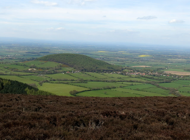
| Hawnby, bottom village |
 |
| We walk towards the church, hidden amongst trees, Coomb Hill ahead |
 |
| All Saints Church, Hawnby |
TSB explains that the church is basically a Norman structure, rebuilt in the late 14th century and restored in 1876 at a cost of £600, raised by subscription. It was unlocked so Clive and I went in for a look around and to our surprise found volunteers busy cleaning which made us conscious of our boots on the swept floor.
With Remembrance Day approaching we were particularly interested to see a newspaper cutting from 1924, showing the dedication of the war memorial window and another indicating the shocking number of men from Hawnby parish who were killed in WW1.
There is also a wreath to four German airmen who were killed in 1942 when their plane crashed on nearby Pepper Hill.
 |
| Altar window |
 |
| Tragedy: This window is dedicated to the three sons of William Hughes, the Rector of Hawnby, who were killed in action in 1917 and 1918 |
 |
| WWI window and wreath to German airmen |
 |
| 45 men! The tiny village must have suffered a loss in nearly every household |
 |
| 'All you who look upon this stone, Reflect how suddenly we were gone. Death does not always warning give, Therefore be careful how you live' |
We left the church and walked down to Church Bridge where, immediately after crossing we turned sharp left, then right at an Inn Way sign and began our climb to Coomb Hill.
 |
| Church Bridge |
 |
| We pause on Church Bridge... |
 |
| ... to look at the River Rye |
 |
| Turn off the road immediately after the bridge |
 |
| .. then right at the Inn Way sign |
 |
| Pheasants abound on this walk |
There were pheasants everywhere we looked and we were accompanied by their warning calls for the whole walk. As we climbed Coomb Hill we saw a male pheasant preening its feathers, just a few feet from the path. It made no attempt to fly away as I stopped and photographed it, until I walked off, then, posing over, it took to the air.
 |
| Hawnby Hill in the distance |
 |
| On Coomb Hill |
 |
| A spot of preening... |
 |
| Going through his autumn moult |
Having gained height we circumnavigated the hill, passing the ruins of two old buildings and dropping down to rejoin the same tarmac road we had left at Church Bridge.
 |
| The pheasant pen fence has been opened to allow the mature birds in and out |
 |
| Sun shining through larches on Coomb Hill |
 |
| Leaving the trees of Coomb Hill |
 |
| A wide path descends to... |
 |
| .. the Hawnby to Kepwick road |
We walked along the road to reach Arden Hall, passing the entrance to what TSB describes as 'the small but eerie ravine of Stoney Gill Hole'.
 |
| Stoney Gill Hole |
After Arden Hall the tarmac peters out and the road becomes a track that climbs steeply for three quarters of a mile until reaching a disused quarry overlooking Thorodale Lake.
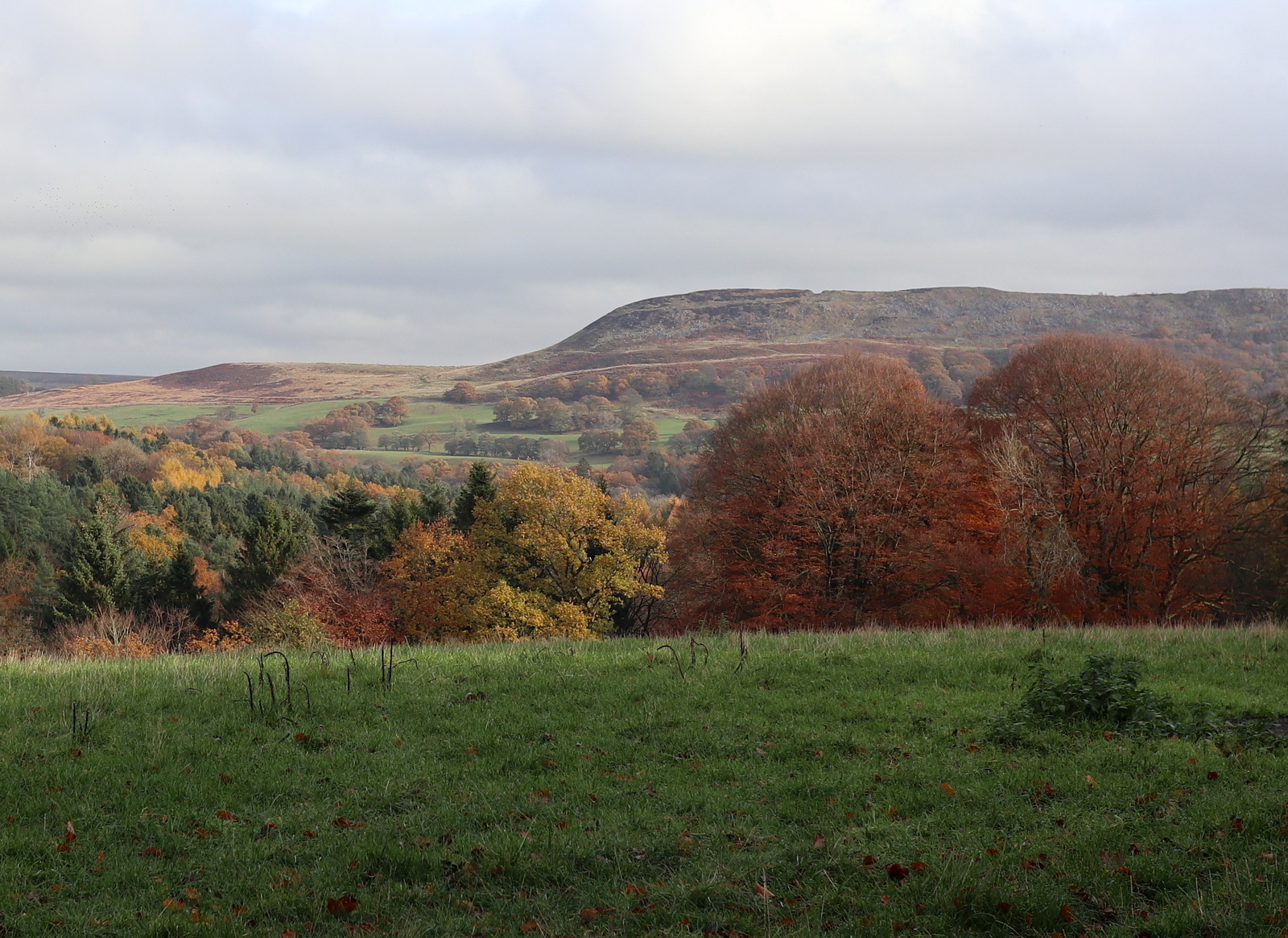
Soon after the quarry we reached the top of the hill and left the road to climb up the grass bank to Dale Town Common. We sat on the bank with a fine view down to Thorodale Lake and to the right Hawnby Hill, and enjoyed our coffee and scones.
 |
| Arden Hall rooftops from the road |
 |
| Hawnby Hill to the left of our road |
 |
| Arden Hall |
 |
| Thorodale Lake, TSB's 'wonderful view' now spoiled by saplings |
 |
| Climbing onto Dale Town Common... |
 |
| ... where we sat for coffee looking back down Thorodale |
After coffee we set off across Dale Town Common, which takes its name from the medieval lost village to the South East. There was a strong cold easterly wind blowing in our faces and we rapidly gained more height until we were looking down onto Hawnby and Easterside Hills.
At the first gate we came to a dyke that follows the line of a dry stone wall to the right, and we followed this wall. Apparently the dyke dates from the late Bronze Age, 900 - 600BC, and it is thought that it and other similar dykes were constructed to define the limits of farming settlements.
 |
| Setting off across Dale Town Common |
 |
| High Paradise in the distance to our right |
 |
| Leaving the common at a gate on our left |
Shortly after passing an old water tank we turned through a gate and walked across fields for a mile or so until we reached some old farm buildings where cattle were grazing. They had churned the path making progress difficult but showed no interest in us as we passed them by.
 |
| Too busy to acknowledge our presence |
 |
| Approaching the old farm sheds |
 |
| Cattle have chewed up the paths |
 |
| ... but watched placidly as we passed by |
Just past the old barn the path goes through an area of tumuli and TSB explains that before the moorland was enclosed there was a group of about 20 tumuli here, only about 7 or 8 now remain.
During the 1850s some excavation work was carried out and in one large mound, 40 - 50 feet diameter and 4 feet high, the skeleton of an Anglo Saxon lady of rank was found preserved in the limestone. At her head was a bronze bowl with three handles, round her waist a leather girdle inlaid with garnets and her hair was secured with gold and silver.
 |
| Remains of tumuli |
Our route now headed towards the perimeter of North Bank Wood before turning sharp left downhill at a sign just before Sunnybank Farm.
 |
| We had a clear view of Hawnby top village from North Bank Wood |
 |
| Approaching Sunnybank Farm |
 |
| The sign points to 'Alternative clean route for dog owners and walkers' We take it! |
There was now a steep and occasionally tricky descent back down to the River Rye. There is no path as such but we followed the yellow way-marks at field edges and crossed a couple of rickety stiles to drop down to the river.
As we entered a field with Dalicar Bridge over the river ahead of us we noticed an old shed and two elderly tractors which we have seen slowly deteriorate over the years. One of the tractors had been moved out of the shed and the other had a grass cutter attached, so both appeared to have been in use.
Further examination of the tractor in the shed showed that it was a petrol vehicle, and had just been fitted with new points and plugs. It's good to know these 1950 tractors are still in use.
 |
| We take the (non-existent) 'clean route' |
 |
| Follow the way-marks |
 |
| We reach the River Rye |
 |
| Fordson Diesel |
 |
| Built in 1952 by Ford at Dagenham |
 |
| Massey Ferguson petrol tractor with new plugs and coil |
 |
| Not playing but examining! |
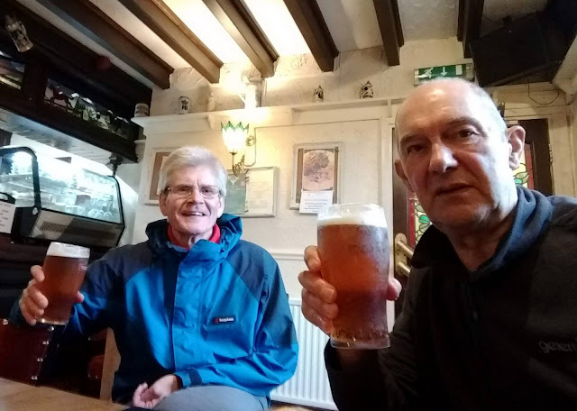
We crossed the bridge to reach the road and the end of our walk. The Inn at Hawby still has To Let signs on its walls so we drove to the Buck at Chop Gate to refresh ourselves and reflect on the day's walk.
 |
| Dalicar Bridge |
 |
| To Short Walks! |
We rarely do this walk as it is so short but it is still to be recommended at there is plenty to see.