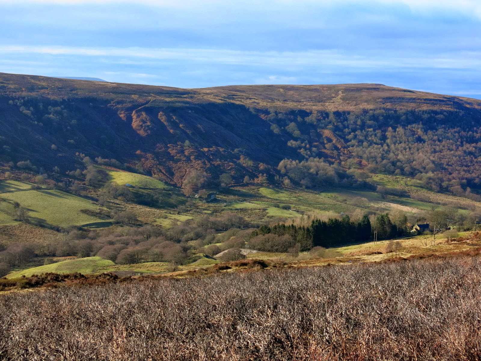
"There must be dales in Paradise
Which you and I will find.."

Thursday 27 February 2014


KILDALE TO BAYSDALE AND ITS LOST ABBEY


9 miles                                              Bright and fine


We parked in the lay-by in Kildale village and walked out of the village along the same road, towards Little Kildale.


Today's walk from The Walker's Guide to the Cleveland Hills

Tom Scott Burns informs us that Kildale is a village of great antiquity.  There are several 'Kildals' in Norway and the village was probably named by the Vikings.  It was called Childale in the Domesday Book.  Walking through the village we passed a beautiful display of snowdrops at the entrance to Kildale Hall and then turned right to walk up through Little Kildale where we stopped to chat to a couple of Shetland Ponies.  

Snowdrops at Kildale Hall

"Have you got any apples?"


We walked through Little Kildale Wood and came to Warren Farm where we turned right and headed  towards the moor.  We descended for a while, to cross the source of the River Leven and admired a fine brick chimney on our left.  TSB tells us that this is the remains of an ironstone mine that was operational between  1866 and 1874.  We continued past the mine and climbed steadily towards Kildale moor.

Old ironstone mine

Looking back towards Warren Farm and the old mine.

The Moor Gate


On reaching the moor our track continued straight ahead and we negotiated it with some difficulty, the overnight rain having made it more of a stream than a path.  After crossing the top of the moor we descended towards the valley of Baysdale, turning sharp left when we came to the ruins of an old stone barn. 

Descending into Baysdale

Turn left at the disused barn

Our path took us along Baysdale valley, walking parallel with Baysdale Beck for a mile and a half until we reached the road and dropped down to Hob Hole.  The beck was in full spate and we saw a car turn back rather than cross the water-splash where the sign was showing a depth of 1 foot.  We crossed the beck by the bridge and dropped down to sit out of the wind to enjoy our coffee and scones.

Hob Hole

Deep water!

Our view from our coffee stop

Hob Hole was supposed to be the haunt of a mischievous hobgoblin who taunted weary travellers and TSB reports a Canon Atkinson speaking of Padfoot, sometimes visible and sometimes not, padding quietly behind a traveller and then uttering a roar in his ear.  Fortunately our coffee stop was untroubled by Padfoot and feeling refreshed we continued walking uphill on the road from Hob Hole before turning first right into John Breckon Road.  After half a mile our path turned right off the road and returned us back along the opposite side of Baysdale Beck passing a memorial to Alan Clegg 'Who loved these moors'.  We arrived at a small stone footbridge over the beck and were surprised to see a wooden memorial seat.  It looked a little out of place and we wondered at the effort of getting it to this remote location.  The bridge was built in 1938, according to an inscription and was the work of Rowland Close, of nearby Low House.

John Breckon Road

Kildale Moor

Our path leaves John Breckon Road

Wet paths made difficult walking


Funny place for a park bench!

Just past the stone bridge we turned right onto a wide track and our progress speeded up after the difficulties of negotiating wet and muddy paths across the moor.  We walked down hill and passed by the above mentioned farm called Low House and then walked along the valley bottom to Baysdale Abbey.  The original abbey was occupied by 9 or 10 nuns from 1190 to 1539.  We were interested to see a bat box on one of the abbey buildings and then walked away from the buildings across a quaint stone bridge which is apparently the only substantial remnant of the original abbey.

Walking towards Low House Farm

Looking up from Low House farm to the old barn we had passed earlier

Baysdale Beck

Walking towards Baysdale Abbey

Sheep at Baysdale Abbey

Bat box!

Baysdale Abbey

Old bridge to Baysdale Abbey


We walked along the tarmac road from the abbey and then went right on a faint path across fields on a direct route uphill from the road, shown as a dotted line on the above map.  This cut down the road walking but was very steep and we eventually rejoined the road we'd left and continued walking towards Kildale.  After a few minutes walking on this road we saw a stone memorial to the crew of a second world war plane that had crashed on Kildale Moor; sadly the crew died from exposure before they could be rescued.  

Steep 'short cut'

Looking back to Baysdale Abbey

Memorial to WW2 plane crash


The walk along this road takes an hour and we found it quite wearying to walk on tarmac for so long at this stage of the hike.  Eventually Kildale Church came into view and we dropped down to the road and our car.  A very enjoyable walk with fine views.

Captain Cook's Monument and Roseberry Topping from the Kildale Road

A long walk on tarmac

Kildale


Wednesday 19 February 2014


Exploring Scugdale from Carlton Bank


7 miles                                       Fair, little wind


We parked in the Lords Stones Cafe car park and crossed back over the road to walk uphill on the old gliding club roadway.


Map of today's route from The Walker's Guide to the Cleveland Hills

Looking back towards the Lords Stones and Roseberry Topping from Gliding Club roadway

On reaching the top of the moor we turned left onto a footpath which leaves the roadway.  Until last year the view to the right was spoilt by the old Gliding Club but now no trace remains of the buildings and the moor stretches out on all sides.  The first feature of note is Stone Ruck to the left of our track, a pile of large rocks which looked very spooky in the mist the last time we walked here. Shortly afterwards we arrived at Brian's Pond to the right of the track.  In summer Clive and I have seen large numbers of dragonflies hovering here.


Carlton Moor

Stone Ruck

Brians Pond

From Brians Pond our route climbed steadily over Clough Gill Top to the moor rim where we suddenly had a fine view of Scugdale below us.  Tom Scott Burns tells us that Scugdale comes from the Danish 'skygger' meaning 'to overshadow'; so Scugdale would have meant 'the sheltered dale'.   We have walked this route several times but today's fine weather gave us our best views of the dale.  Our trail eventually led us to the rugged cliffs of Barker's Crags from where we looked down into Scugdale.


Clough Gill Top

Surprise view into Scugdale

The edge of Barker's Crags


We descended from Barker's Crags to the dale road and turned left to walk up to the head of the valley and High House.    This is an old farmhouse where TSB tells us lived a certain Harry Cooper who was reputed to be the tallest man in the world, standing at 8'6".  He joined Barnum's Circus in America and died in 1898 at the age of 41.  The farm was very quiet today with no sign of life as we walked past and turned right over a field stile and down the hillside to cross Scugdale Beck.   The slopes on the opposite side of the dale showed their mine workings in relief as the sun shone on them.  Alum and jet were mined here as well as iron ore.


Dale road through Scugdale

Jet mine workings show clearly on the hillside

High House

Outbuildings at High House

Looking down Scugdale from High House

When we arrived at the beck we found that storms had washed debris down the beck completely marooning the bridge which sat uselessly amongst a pile of silt and stones which had diverted the beck.  Fortunately it was passable without the bridge.


Walking downhill to Scugdale Beck

The bridge is no longer over water!

In need of a clean-out

Our route now followed the other side of the valley, crossing fields below the old alum workings.  There was no path and we picked our way through the boggy grass, occasionally seeing a yellow waymark.  This route is obviously little walked.  Just before we arrived at Holiday House, another old farm building, we stopped in a sheltered spot and enjoyed our coffee and scones in the sun while looking across at Scugdale Hall and Barker's Crags above it. 


Scugdale Hall from our coffee stop

Barker's Crags

Setting off again we were sorry to see that Holiday House appeared deserted and in poor repair.  The last time we walked here there were pet goats, sheep and fancy hens and a flag flew cheerfully above it.  Today there were no animals to be seen and disrepair everywhere we turned.  We wondered what could have happened. Leaving the farm we walked along the path to rejoin the dale road before turning right at a green metal footpath sign at Fog Close Farm.


Holiday House Farm

Fog Close Farm

After passing the farm buildings we made our way left, following yellow way-marks, steeply uphill onto Live Moor.  As we walked along the ridge we looked down into the little known valley of Snotterdale, where there is no road or path access.  

Looking down into Snotterdale, Scugdale in the distance

Climbing to Live Moor

Walking along Live Moor

Opposite a conifer plantation our path turned left across Carlton Moor where we eventually joined the Coast to Coast walk for the last few hundred yards to the trig point at 1338 feet.  From here we looked down on the steep stone path to Lords Stones and our car.


The old Gliding Club runway

Whorlton Hill from Carlton Moor

Trig Point above Carlton Bank