Two Days in the Lakes
 |
| A stretcher case at Styhead Tarn |
Day 1 Mellbreak from Loweswater
Day 2 Base Brown, Green Gable and Great Gable from Seathwaite
------------------------------------------------------------------------------------------------------------------------------------------------------------------------------------------------------------------------------------------------------------------------------------------------------------------------------------------------------------------------------
Hasty Bank, Cold Moor and Upper Bilsdale
8 miles Mixed weather
 |
| Today's walk from The Walker's Guideto the Cleveland Hills |
We parked at the top of Clay Bank and crossed the road to climb Hasty Bank. Instead of following the Cleveland Way route to the escarpment we branched left just after the gate, on to a small path above the farm track to Hasty Bank Farm. This winds its way upwards, eventually reaching the Old Quarry, shown on the map below.
 |
| Pheasants near the car park at Clay Bank |
 |
| Bluebells in abundance today |
 |
| Starting the climb |
 |
| Looking back towards Clay Bank |
 |
| A small path above Hasty Bank Farm |
There are two quarries to the side of this path and today we decided to look into the first of these, which we have not previously explored. We were surprised to see three nice bird carvings in the stone at the rear of the quarry, the model obviously being a curlew.
 |
| Approaching the first quarry |
 |
| A curlew |
It's hard to date these carvings, or to tell if they are contemporaneous, but they appear to be expertly done.
We moved on to the second quarry where Tom Scott Burns describes an ancient carving of a woman's head as 'the enigmatic face of a lady carved on a rock wall who gazes eternally down into Bilsdale'.
 |
| The Lady of Bilsdale |
Leaving the Lady we walked across the moor top to reach the Wainstones, where we picked our way carefully through the rocks before descending into Garfitts Gap and climbing onto Cold Moor.
TSB explains that the name Wainstones is believed to derive from the Saxon 'wanian' - to howl, and that the naming of the stones means 'stones of lamentation'.
 |
| Garfitt's Farm below |
 |
| We reach the Wainstones |
 |
| Descending from The Wainstones, our path to Cold Moor in the distance |
We walked along the summit of Cold Moor (1318') for 2.5 miles with fine views towards the Pennines in the west and Roseberry Topping and Easby Moor to the east.
 |
| We saw lots of grouse on the moor today |
 |
| Walking along Cold Moor |
 |
| Seave Green below |
Eventually we took a clear fork to the left, taking us gently down to the village of Chop Gate. This track is known as Cold Moor Lane and we passed through a gate where the path becomes a hollow lane. TSB says that it is possible that this passageway was established by prehistoric man and has continued in use throughout history to the present day.
 |
| Through the moor gate to Cold Moor Lane |
 |
| An anxious mother |
 |
| Lots of Spring flowers in Cold Moor Lane |
 |
| Cold Moor Lane is an ancient 'Hollow Lane' |
We soon reached Chop Gate where we emerged at the old Wesleyan Chapel that is almost hidden between houses.
TSB says the reason for the strange location of the chapel is that the landowner, Lord Feversham, was C of E and totally against a non-conformist church being established in the dale. However a local shop keeper sold the Methodists this plot of land and the chapel was built in 1858. It reportedly contains an interesting harmonium (pump organ) but its doors were firmly locked today. A couple of years ago the chapel was for sale but the sale does not seem to have taken place and the building and grounds appear to be deteriorating.
Only the front of the chapel is visible as it is hidden away between cottages but another view of the side of the building is accessible as you walk along the B1257.
 |
| Wesleyan Chapel |
 |
| A view from the B1257 road |
 |
| Cow weather vane in Chop Gate |
TSB says that the name Chop Gate is thought to be derived from the old Scandinavian term kaup meaning pedlar and with a number of pannier tracks converging on the village it must have been like a market place in times gone by.
Our break over, we wandered back to Baysdale Hall and re-joined TSB's route to begin the steep climb up to follow the alternative dotted path on the map above, going steeply uphill to reach Urra Moor.
 |
| Looking back to the red tiles of Bilsdale Hall |
 |
| We reach the moor gate |
 |
| The photographer is studiously ignored |
After pausing to admire the view and regain our breath we turned left and followed the ridge, with a succession of sweeping views of Bilsdale below us. As well as being on the ridge of the moor we also noticed we were walking alongside the remains of an earthworks. This earthworks stretches for 2.5 miles and its origin is forgotten, perhaps defensive, or it may have been an animal enclosure. It was known at one time as Cliff Dyke, and a couple of centuries ago as Cromwell's Lines.
TSB mentions two witches who inhabited Bilsdale's moors, Peg Humphreys and her companion Alice Wood, who was said to take the form of a cat or hare.
 |
| Looking across to The Wainstones and Garfitt's Gap |
 |
| Male grouse attracts attention with a good display! |
 |
| "I could do better!" |
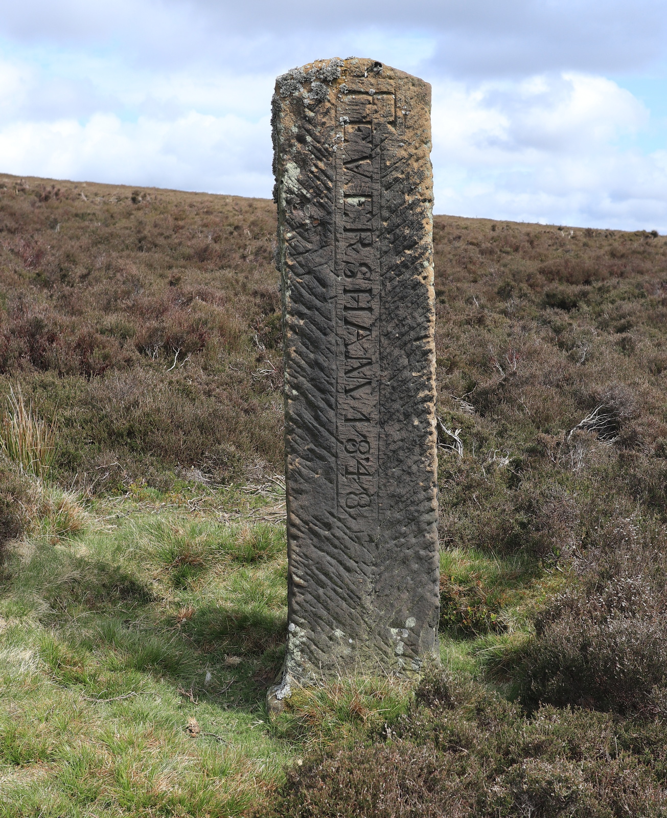
 |
| Feversham 1848 - boundary stone on our path |
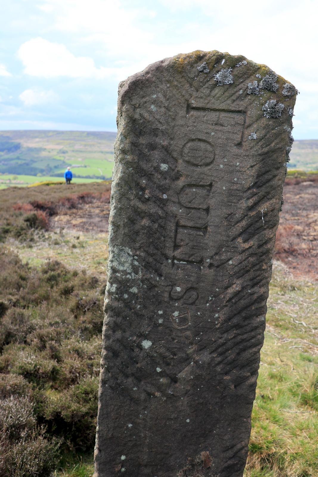
 |
| 'Foules' on the other side |
 |
| Walking alongside Maiden Spring |
 |
| 'Cromwell's Lines' - Earthworks along our route |
We followed the earthworks and eventually came to a little valley where we crossed a stream known as Maiden Spring, at 1300'. The track and surrounding ground were very boggy at this point.
Leaving the beck we continued to follow the earthworks until rejoining the Cleveland Way track on Carr Ridge. We turned left and walked steeply down to Haggs Gate to rejoin the main road for a few yards returning us to Clay Bank Car Park and the car.
 |
| Someone has lost an old friend! |
 |
| The final descent |