"There must be dales in Paradise
Which you and I will find.."

Thursday 21 August 2014


Boltby to Gormire Lake and Whitestone Cliff


7 miles                                    Cool and dry


With my heel apparently making a steady improvement we decided to try a longer walk from Tom Scott Burns' The Walker's Guide to the Hambleton Hills, and one which we hadn't tackled before.  We drove to Boltby after leaving the A19 at the Knayton turn-off and parked at the designated parking place shown on the map.


Today's walk from The Walker's Guide to the Hambleton Hills


We walked back into the village and turned sharply left into a lane signed Town Pasture Farm.  The lane was actually the farm track for Greendale Farm which we eventually reached and skirted around.  The track now became a green lane and led us to a farm called Tang Hall where we turned left across fields to walk across the nicely named Huggon Howl. 

Lane past Town Pasture Farm, Boltby

The lane turns into a farm track

The lane becomes an old coach road


Rounding a conical hill we dropped down to Tang Hall and continued to follow the old coach road towards Southwoods Hall, which we could see set among trees to our left.


Between Greendale Fram and Tang Hall

Tang Hall

Our path alongside Tang Hall


Southwoods Hall in the distance

We passed the gates of Southwoods Hall and walked along a nice path that led into trees and after a steady uphill climb, to the shore of Gormire Lake.  We were ready for a coffee by this point but saw that the next section of our walk led uphill from the lake-side to the top of Whitestone Cliff.  This climb was very steep, long and perhaps not best attempted after coffee and scones, so we decided to postpone our stop and go straight into the climb.  Our long ascent took us through a nature reserve, Garbutt Wood, and eventually we arrived at the top at Sutton Brow, where we came upon a perfectly situated bench.


The gates of Southwoods Hall

Path to Gormire Lake

Gormire Lake

The lake from our coffee stop

Two horses stood behind us throughout our break making hungry noises and before we left Clive fed them the remains of our fruit and shortcake biscuits.  As we left we thought we heard one of them mutter "cough sweet!" It certainly sounded like it - perhaps the word is getting around.  Our path now led along the top of the escarpment following the Cleveland Way with fabulous views in all directions.  Below us was the high lake of Gormire, which TSB tells us was once a glacial overflow that became blocked by a landslide. To the left was Whitestone Cliff and to the right Boltby Scar.  Our climb had been well worth it and our walk for the next couple of miles was both exhilarating and easy, on a flat good path.


Clive shares the fruit and shortcake biscuits

View towards the Gliding Station

Whitestone Cliff

Looking back towards Gormire from our path

As we followed the escarpment we saw Boltby down to our left but as we approached the ruins of an old barn the village disappeared behind trees for the rest of the walk.  On reaching the abandoned building we turned left and started our descent looking left at the bare cliff face of Boltby Scar.   We crossed the fields following  way signs in a zig-zag descent until we reached a gated bridge.  Crossing it we climbed steeply up another field, the track arriving conveniently at the road next to our car.  

The cliff path

We see Boltby below us

The remains of an ancient hill fort and the old barn where we leave the Cleveland Way

Looking back towards Boltby Scar as we descend
We decided this was an excellent walk that we would consider in all weathers as so much of it is on established paths.

Our path down, the trees in the middle of the photo hide my car

Uphill to the car


Thursday 14 August 2014

Limekiln House and the Drove Road from Kepwick


5.5 miles                               Fair and calm


Tom Scott Burns suggests that Kepwick is derived from the Scandinavian Kaeppi and Vik, so Kaeppivik which means a nook in the hills.  In Victorian times it was noted for its lime and sandstone quarries and a railway ran from Kepwick to kilns on the Yarm to Thirsk turnpike road.  We intended to park in the car park at the front of the Church Hall but we found it to be full, (more hikers?) so we parked at the roadside a little further into the village.


Today's walk from The Walker's Guide to the Hambleton Hills


We walked through Kepwick coming immediately to the gates of Kepwick Hall where we turned left, following the tarmac road across the remains of the old railway line and then climbing slowly past French Hill Wood to isolated Nab Farm.

Gates to Kepwick Hall
French Hill Wood on right and The Nab ahead on left

Hmm, looks like another of those walks...
Cattle restraint pen at Nab Farm

Leaving Nab Farm we left tarmac behind and could see our footpath crossing through a large field of cattle before heading up towards Kepwick Moor.  Despite the threatening signs we had passed the cattle were totally indifferent to us and we crossed a beck and came quickly to the ruins of an old limekiln.

Our path crosses the field and through the gap in the wall
Our passing is noted
Approaching old limekiln
Old limekiln chimney


We now followed a green path alongside a drystone wall with fine views all round.  We could see the old workings of Kepwick Quarry across to our right.  As we climbed we came upon a group of about 20 ramblers walking down towards us, no doubt the owners of the cars seen at Kepwick Church Hall.  A steady climb  brought us to the moor gate and the ruins of an old drovers' inn, Limekiln House, where we decided to enjoy our coffee and scones in the sun.  In The Walker's Guide to the Hambleton Hills is a photograph of Limekiln House showing ruined walls, but these have now disappeared.

Heather was at its best today

Green path on Kepwick Moor
Old workings of Kepwick Quarry
"Has it taken?" " Give it another few seconds..."

We were now on the old Hambleton Drove Road which TSB tells us was referred to as the 'regalis via' or King's Way' in a medieval document at Rievaulx, and which has probably been in use since prehistoric times.  We walked south along the Drove Road across Little Moor, steadily climbing to a height of 1200 feet. 


Hambleton Drove Road

Man or dog?  Memorial near Limekiln House

Looking back along the Drove Road

Eventually we reached the conifer plantation at Steeple Cross where we were going to turn right, leaving the Drove Road and heading onto a forestry path.  TSB tells us that Steeple Cross was referred to as Stepingecross in documents dated 1290 and was probably derived from the old English 'steapinga' - 'dweller on the slope', hence 'crossroads of the hill-dwellers'.  All round this area are Bronze Age earthworks.

Camouflage

Approaching Steeple Cross


Our path skirted a forestry plantation alongside Black Hill and then came to a fence which we had to cross to continue.  The last time we walked this route the fence had been made difficult to pass with barbed wire but we were pleased to see that the wire had been cut back to allow an easy passage.  Someone else must have been annoyed at this attempt to block a right of way!

Forestry path

Beautiful display of heather seen from forestry path

Wire cut back from our fence crossing

Our path became a sunken hollow as it crossed the flat plain of Pen Hill, then as we started to descend Atlay Bank rhododendrons grew thickly on either side for several hundreds of yards until the track levelled into a field where a gate took us onto Kepwick Village road.  We stopped to look at the church which was closely fenced all round and locked.  No room for a graveyard, we wondered if it was still used for services.  We passed the Church Hall with its now empty car park and arrived back at our car. A nice walk made even better by the scent and sight of masses of purple heather.

Looking down on Kepwick Hall
Sunken path

Rhododendrons on Atlay Bank

Kepwick Church


Thursday 7 August 2014


Kepwick and Cowesby from Over Silton

5.5 miles      hot and sunny


  After 5 months of nursing a sore heel at last I am fit enough to return to walking in the hills.  Nothing too demanding at first, but one of Tom Scott Burns' prettiest walks in the Hambleton Hills.


Today's walk from 'The Walker's Guide to the Hambleton Hills'


We approached Over Silton from the A19 and parked at the road side.  Tom Scott Burns tells us that the name Silton probably derives from Sal (as in Up-sal) which means a Hall or important place, and Ton which is Anglian for a place or town.  We headed east out of Silton and immediately looked for a field track turning right off the road.  We walked across a couple of fields following yellow markers, our track unused and invisible in the long grass, and soon came to the very neat Greystone Farm whose fields are full of Suffolk sheep and horses.  As we passed the farm buildings we saw an open barn full of rosettes and ribbons and stopped to admire them.  "That's just a few of 'em!" said a voice behind us and we turned to see the farmer, standing with a pint pot of tea in his hand.  He told us the prizes were mainly for his 'Suffolks' and represented an 'eck of a lot of work.' 


'Just a few of 'em!'

Suffolk sheep at Greystone Farm


Greystone Farm

Clive treats a horse to a Jakeman's Throat and Chest lozenge

We left the farmer and walked past several fields of Suffolk Sheep stopping to pat a friendly horse that Clive treated to a cough sweet and which it appeared to love.  We emerged from the fields where the road enters Nether Silton and made a left onto the road shortly followed by a right, back into more fields.   Several of the fields in today's walk were full of cattle and here, after reading a warning notice on the gate of a field we had to enter, we kept to the hedge-side while many cows and a large brown bull impassively watched us hurrying by.  We passed Hall Farm and walked through overgrown fields following a path thick with nettles and briers until we came to a footbridge.  The ponds shown above on Tom Scott Burns' map, which he says were man made, are no longer to be seen.


Drat, it's still early August

We walk quickly by....

First bridge of the day


Our overgrown footpath continued to a small stone bridge over what used to be a 3.5 mile narrow gauge railway, built in 1833, that brought limestone mined near Kepwick to kilns near to the Yarm and Thirsk turnpike road.    Another field traversed and we joined Peasland Lane which we followed for a mile into Cowesby.  Cowesby Church looked lovely in the sunshine and we sat on the step to enjoy our coffee and scones.


Overgrown paths of nettles

Cowesby Church hidden behind enormous yews

That step looks ideal for a coffee stop

Walking out of Cowesby

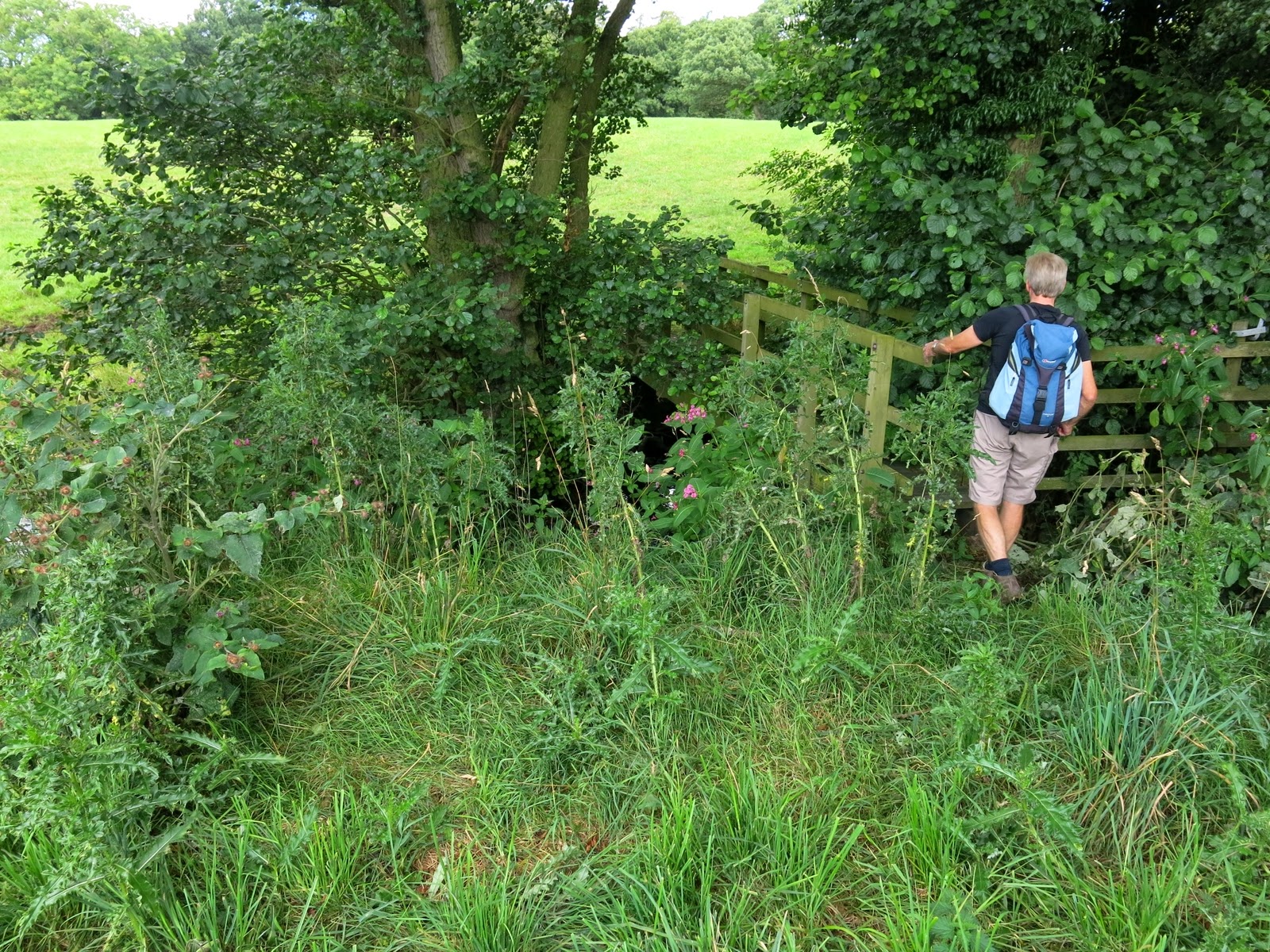
We walked through Cowesby past Home Farm and then followed a path bearing left along the western shoulder of Pen Hill.  This path was extremely overgrown and we had to fight our way through briers until the path suddenly dropped quickly down to the village of Kepwick.  We didn't enter the village, simply crossed the road and entered more fields, the second of which was full of cattle that rushed up to the fence to greet us.  We stood on one side of the stile and the cattle on the other in a Mexican Standoff.  Minutes passed with neither side moving until Clive stepped briskly over the stile waving his arms causing a sudden stampede with the cows 'high tailing' it to the other side of the field.  We walked back across the old railway line and down to a little used footbridge over Sorrow Beck which was covered in branches from adjacent trees. 


Walking up towards Pen Hill

Footpath at side of Pen Hill

Mexican Standoff

"Move 'em on!"

Clive fights his way onto bridge

We clear the bridge of branches

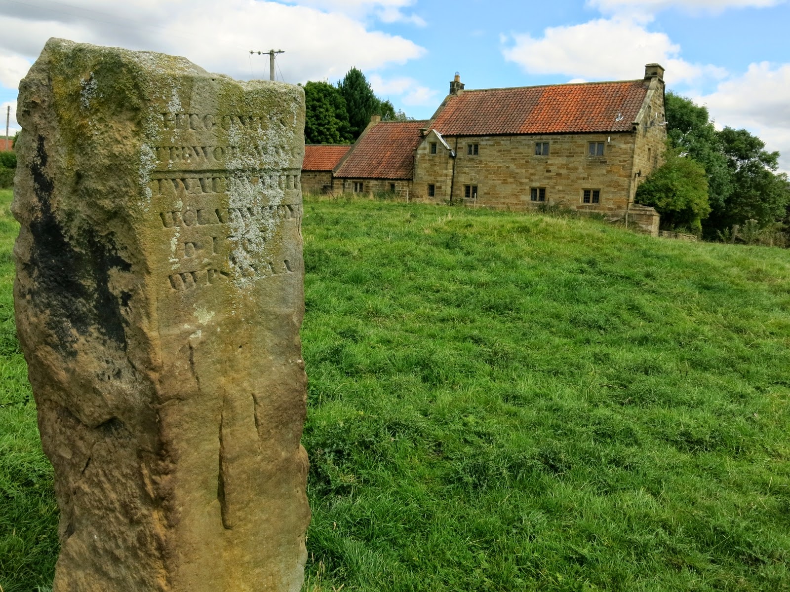
Our path led across more fields and returned us to the village of Nether Silton where we passed the Old Manor House and the large monolith erected long ago by Squire Hicks and on which is carved six rows of capital letters.  Each letter represents a word which spells the following inscription.

Here The Grand Old Manor House Stood
The Black Beams Were Oak, The Great Walls Were Good
The Walls At The East Wing Are Hidden Here
A Thatched Cottage Like A Barn Was Erected 
Year AD 1765
A Wide Porch Spans A Yard And Alcove


Young pheasants near Kepwick

Happy to be hiking again!

Clive admires the monolith at Nether Silton

See text above for translation

The Old Manor House standing behind the stone


We walked past the tidy church at Nether Silton and followed our path back into fields walking parallel to Greystone Farm, crossing Kirk Ings Lane to St Mary's Church, looking abandoned in the middle of a field quite some distance from the village of Over Silton, which it serves.  TSB tells us that the church has a Norman doorway and a 14th Century bellcote and the roof beams are old ship's timbers from the yards at Hartlepool.  Leaving the church we crossed the field to the road leading back into Over Silton and our car.


All Saints at Nether Silton

St Mary's at Over Silton

Leaving St Mary's and walking towards Over Silton