Bank Foot to Upper Baysdale
and Burton Howe
11 miles Sunny and warm
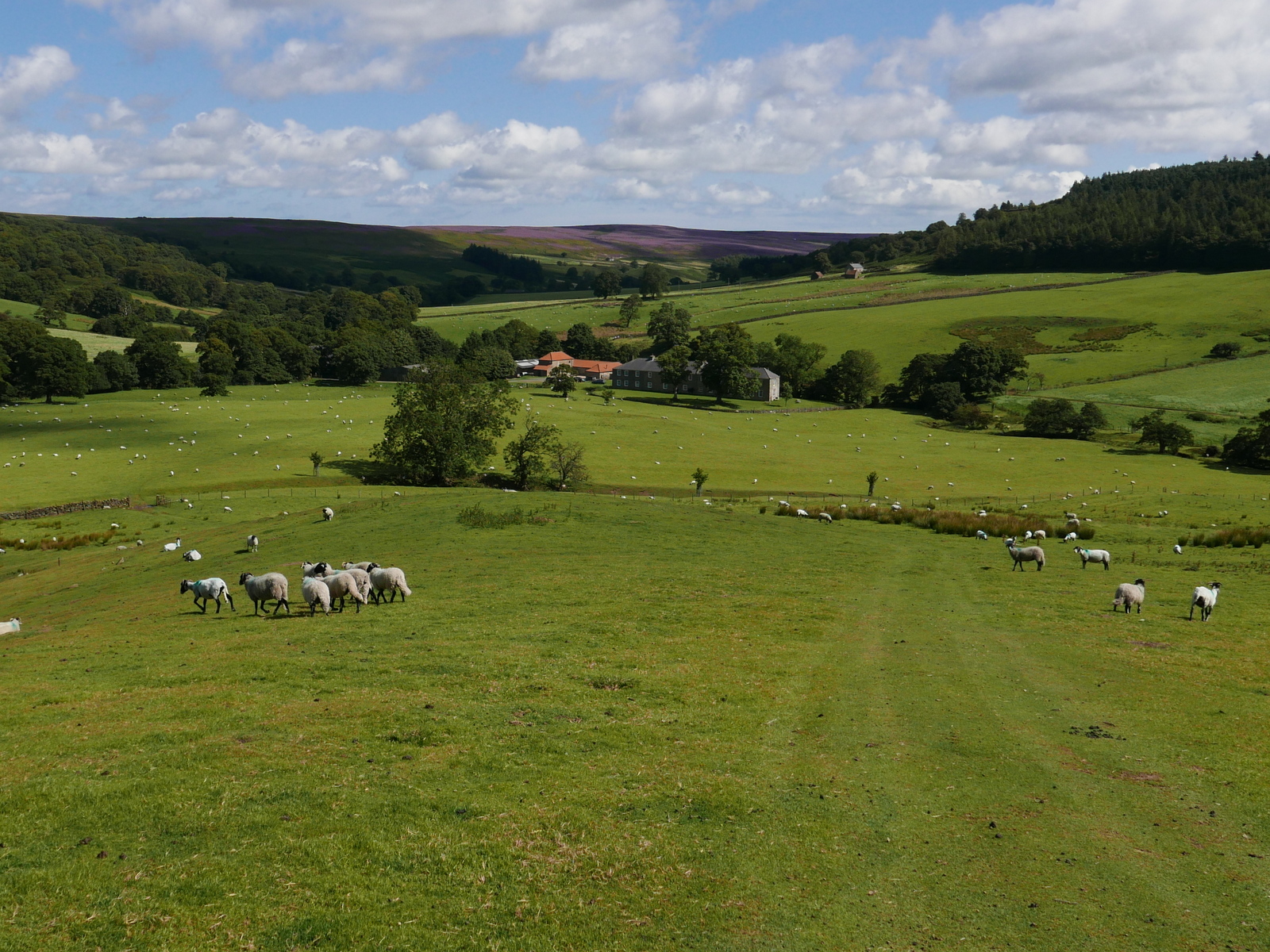
We decided on a longer walk today, taken from The Walker's Guide to the Cleveland Hills by Tom Scott Burns. We parked at the road side near to Bank Foot Farm, which is approached from the unclassified road between Ingleby Greenhow and Battersby.
Tom Scott Burns relates a grisly event that occurred here on 3rd October 1924. Frank Ward, who lived in one of the railway cottages on the incline, failed to return home after an evening of drinking at the Dudley Arms in Ingleby Greenhow. His daughter Hannah and a neighbour called Medd Carpenter made a search and followed a trail of blood to a haystack at Bank Foot where Frank's body was found partially concealed. Later that morning the police found Frank's best friend Jerry Dalton, who lived in a cottage near Bank Foot Farm, slumped in a ditch with self inflicted throat wounds. He was subsequently convicted of the murder of his friend and hanged for his crime.
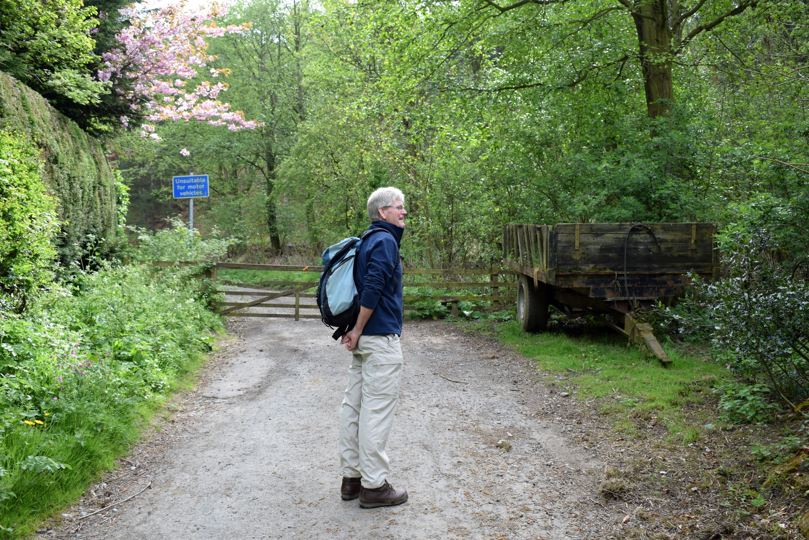
We walked past the farm and immediately started to climb the rutted forestry path towards Turkey Nab noticing a few signs warning against the use of unauthorised 'off road' vehicles.

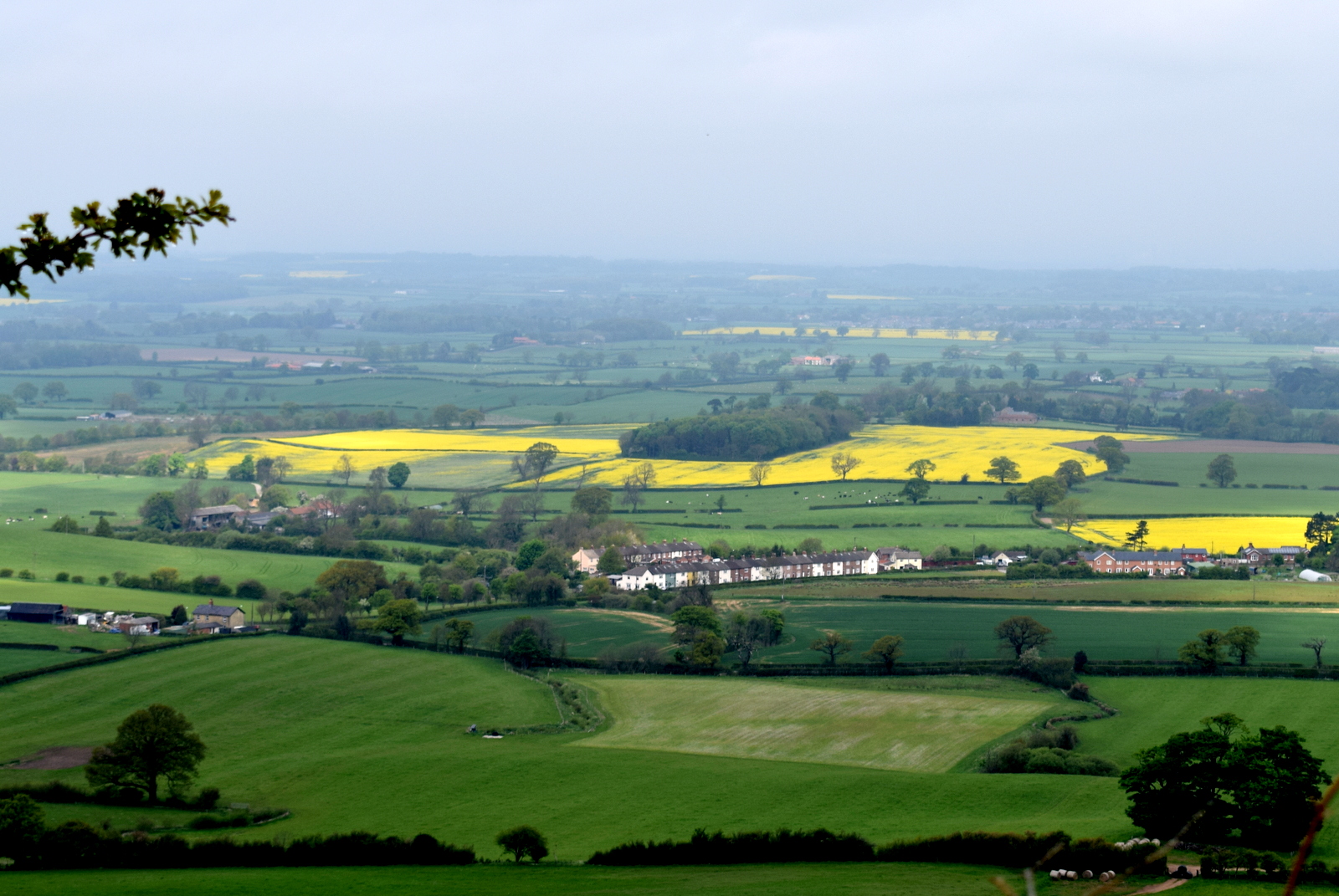
On reaching the top we paused to admire the view and get our breath back. There are fine views over Ingleby Greenhow and Battersby Junction and we picked out familiar land marks before passing a chain and following a moor path onto Ingleby Moor
 |
| Today's walk from The Walker's Guide to the Cleveland Hills |
 |
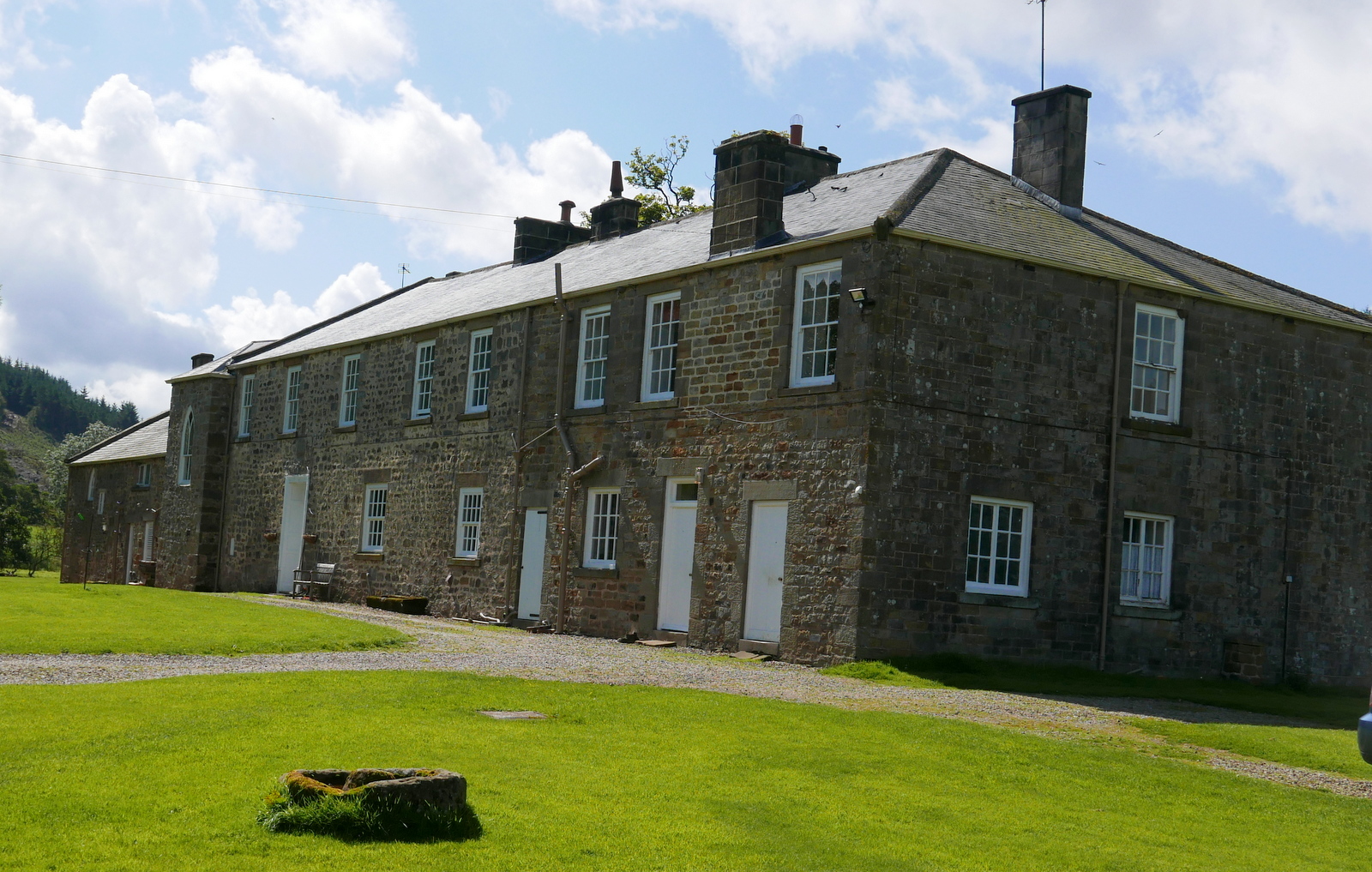
| Bank Foot Farm |
Tom Scott Burns relates a grisly event that occurred here on 3rd October 1924. Frank Ward, who lived in one of the railway cottages on the incline, failed to return home after an evening of drinking at the Dudley Arms in Ingleby Greenhow. His daughter Hannah and a neighbour called Medd Carpenter made a search and followed a trail of blood to a haystack at Bank Foot where Frank's body was found partially concealed. Later that morning the police found Frank's best friend Jerry Dalton, who lived in a cottage near Bank Foot Farm, slumped in a ditch with self inflicted throat wounds. He was subsequently convicted of the murder of his friend and hanged for his crime.
We walked past the farm and immediately started to climb the rutted forestry path towards Turkey Nab noticing a few signs warning against the use of unauthorised 'off road' vehicles.
 |
| Forestry track to Turkey Nab |

 |
| Old information board at Turkey Nab |
On reaching the top we paused to admire the view and get our breath back. There are fine views over Ingleby Greenhow and Battersby Junction and we picked out familiar land marks before passing a chain and following a moor path onto Ingleby Moor
 |
| Battersby Junction from Turkey Nab |
 |
| Step over the chain to follow the moor path |
 |
| The view east from Turkey Nab |
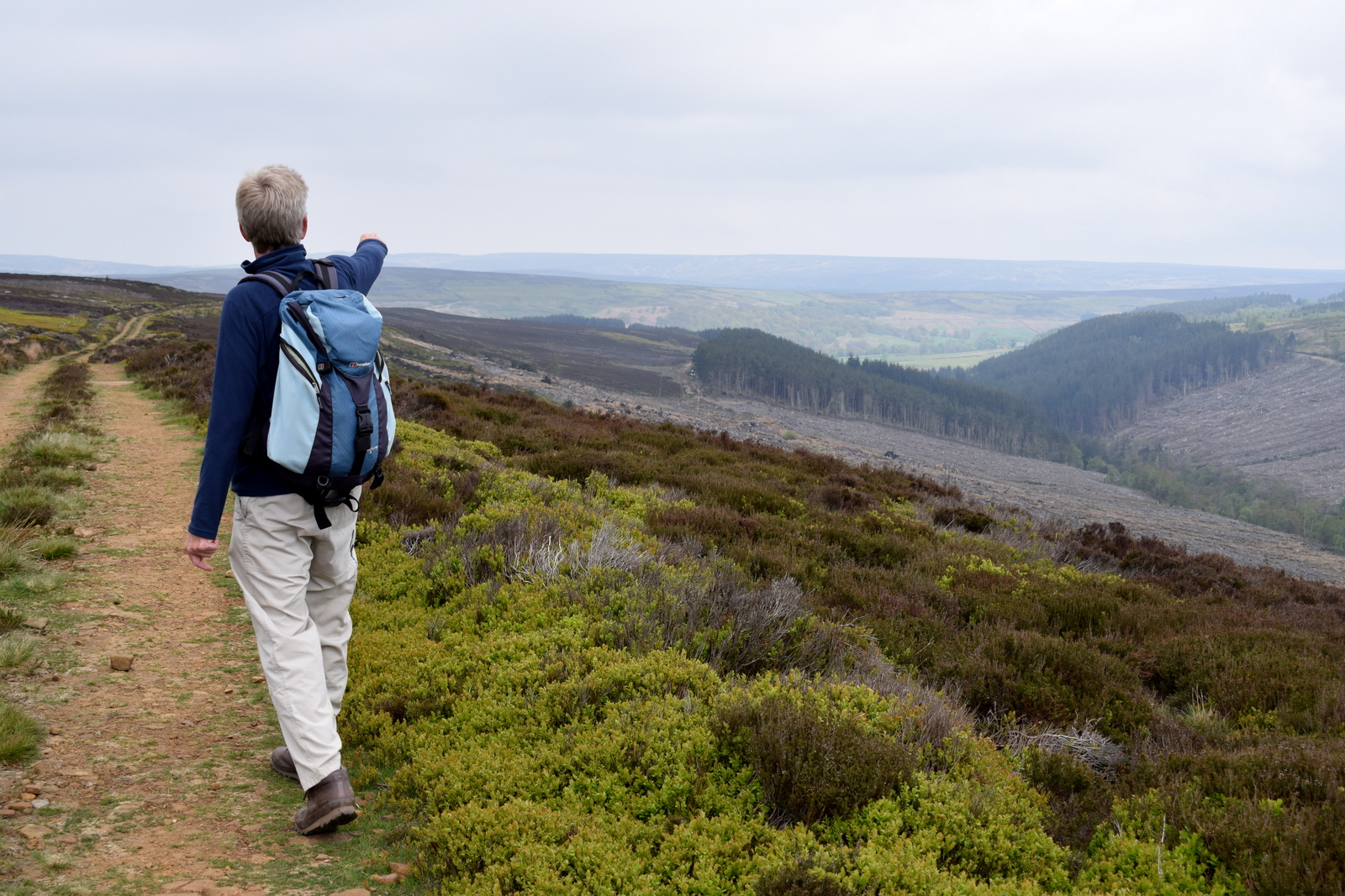
Just beyond the Nab we turned left onto a smaller track that leads across Ingleby Moor, crossing Black Beck about a mile further on before a slight climb to bear left onto Middle Head Road. The heather is now at its finest and there was a tremendously strong smell of pollen. Bees and other insects were everywhere but not interested in us.
 |
| Starting to cross Ingleby Moor |
 |
| Through walls of heather |
 |
| This year's display is the best we've seen |
 |
| Descending to Black Beck |
Shortly after crossing Black Beck we came to an interesting group of large boulders known as the Cheese Stones, a good vantage point for looking down into Baysdale. We walked over to have a better view.
 |
| The Cheese Stones |
 |
 |
| B Close has added his name to Maurice's in 1952 |
 |
| Looking towards Baysdale from the Cheese Stones |
 |
| More of Maurice's graffiti by the look of it, though neatly done! |
Continuing along the moor we came to the remains of a medieval cross and a little more walking found us looking down onto the imposing building of Baysdale Abbey Farm.

 |
| Remains of old cross |
 |
| Abbey Farm in the distance |
We walked down through to reach a gate into Intake Plantation and were soon walking through the trees to reach a fine view down to Baysdale Abbey. We found a comfortable mound of grass to sit on and enjoy our coffee and scones in the sun.
 |
| Intake Plantation |
 |
| A fine view to Baysdale Abbey and beyond |
 |
| Time for a coffee break |
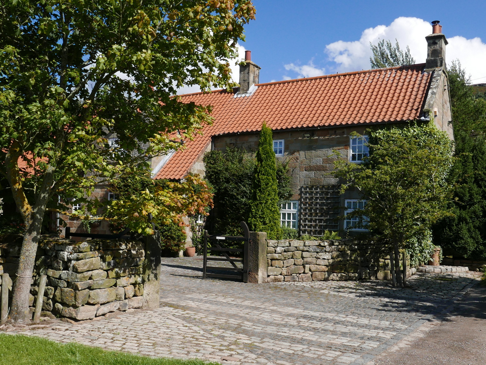
We finished our coffee and walked down to the Abbey and its farm buildings.
 |
| Baysdale Abbey, west side |
 |
| Baysdale Abbey, east side |
Tom Scott Burns explains that in the middle ages land rents for Baysdale were paid with the heads of wolves, which were numerous in the area, and one can imagine this wild enclosed ravine in the 1300s, when cattle were over-wintered in the valley bottom. In fact, TSB explains, Baysdale is derived from Basdale meaning Cow Shed Valley. The Abbey Farm has been renovated and is now marketed as holiday lets and we walked round the building, then followed the yellow way-marks uphill to Thorntree House.
 |
| Approaching Thorntree House |
 |
| Thorntree House |
We passed Thorntree House and climbed through the plantation to reach Baysdale Moor and as TSB relates, " an ever-unfolding sea of moorland". Purple heather was to be seen in every direction and the smell of its pollen was very heady. We followed the moorland track for about 1.5 miles, turning right just before reaching an old stone shooting box. Considering the season we saw very few grouse and wondered if there has been a problem with bird numbers this year.
 |
| A sea of purple heather in every direction |

 |
| Looking back towards Baysdale |
We walked on from the shooting box and our path eventually led us down through the old disused coal pits of Armouth Wath, ('ford at becks' meeting') and across Grain Beck.
Armouth Wath is a very bleak spot and life in the coal pits must have been hard. We had a look at what remained and the two becks the name refers to, Rowantree Beck and Black Hagg Beck. Excavation work has been done at the ruins of the four collier buildings and revealed that the pits were 106' deep.
We left following the colliers' track and a long climb brought us to the Bronze Age tumulus of Burton Howe.
There are several tumuli here, apparently dating from 4500 - 1400 BC, some still containing coffins and cremated remains.
 |
| Approaching Armouth Wath |
 |
| Armouth Wath |
 |
| Rowantree Beck at Armouth Wath |
Armouth Wath is a very bleak spot and life in the coal pits must have been hard. We had a look at what remained and the two becks the name refers to, Rowantree Beck and Black Hagg Beck. Excavation work has been done at the ruins of the four collier buildings and revealed that the pits were 106' deep.
We left following the colliers' track and a long climb brought us to the Bronze Age tumulus of Burton Howe.
 |
| Burton Howe |
 |
| Burton Howe tumulus |
 |
| Signs of mineral excavation looking from Burton Howe |
There are several tumuli here, apparently dating from 4500 - 1400 BC, some still containing coffins and cremated remains.
Our path now followed the escarpment across the open land of Ingleby Moor, locally known as Siberia, and devoid of interest until we came to a well preserved standing stone near Tidy Brown Hill. We could make out the inscription 'Ingleby and Stoxley' on the front, ' Kirby and Helmsley 1757' on one side and 'Guis Boro' on the other and we were pleased to see that tradition has been maintained and a few coins had been left under a loose top stone for the benefit of any needy person who happens by. Strangely, TSB doesn't mention this stone in his walk description.
 |
| Ingleby and Stoxley, and hand pointer |
 |
| Kirby and Helmsley 1757 |
 |
| Coins for the needy! |
We now had a two mile walk along the escarpment with fine views, purple heather to our right and the villages of Cleveland below us to the left. We were so immersed in this amazing view that it was some time before we we became aware of a rumbling noise and found ourselves slowly overhauled by a group of off road vehicles. They trundled past us and then as the going got tougher they slowed to a crawl and we trundled past them. In the end we saw the drivers get out of their vehicles to look at the enormous ruts and they were still standing there as we walked back down Turkey Nab. We think they would have to reverse quite a way before they could turn round. Ha!
 |
| Heather to our right... |
 |
| Ingleby Hall below |
 |
| A traffic jam on Turkey Nab |
 |
| We walk back down to Bank Foot |
Alfred J Brown in his book Tramping in Yorkshire, says, "Even the longest ridge must come to an end, and suddenly the road twists, hesitates, and takes the plunge gloriously down Turkey Nab. The Cleveland County is full of 'Nabs' but Turkey Nab will take some beating."
Back at Bank Foot we stopped to stroke a couple of horses and their foal who remained shyly behind its mother, before driving the short distance to Great Ayton and the Royal Oak for a cooling pint.
 |
| "Let's see your foal?" |
 |
| Re-assuring nuzzle |

 |