"There must be dales in Paradise
Which you and I will find.."
Showing posts with label "Noddle End". Show all posts

Friday 17 September 2021

Caydale and Noddle End from Murton


7.5 miles                           Sunny and warm


We drove to Murton Grange taking the Laskill turn-off from the B1257 Stokesley to Helmsley road and parked on the verge near to the white buildings of the Grange.


Today's walk from The Walker's Guide to the Hambleton Hills

Murton Grange


Tom Scott Burns explains that a 'grange' was a farmhouse attached to a religious order and Murton Grange once belonged to the monks of nearby Byland Abbey. 

We walked past the Grange and continued straight ahead until arriving at a fork, the main lane going on to Caydale Mill but we took the right fork down into the hidden valley of Caydale.  Tom Scott Burns tells us that at this spot the last wild cat in England was shot in 1840, by a Charles Harrison. 

Walking towards Caydale

Leave the lane by the right fork

.. and walk on towards the valley of Caydale

The sheltered valley of Caydale

We reached the bottom of the valley and crossed several streams of crystal clear water, known as 'rills'.  These are 
shown on the map above as Old Byland's Water Race and Limperdale Gill.  In the 1740s a Joseph Ford of Kirbymoorside perfected a system of tapping into springs and channeling water in open 'rills' some 12 inches wide.  Water was diverted by this method through Caydale from King Spring to the village of Old Byland and the straight rills remain.  

Caydale bottom

One of the 'rills'

We are distracted in Caydale by a buzzard being mobbed by crows

Another buzzard appears and the crows move off..


We crossed the valley floor and started up the other side.  Until a couple of years ago this climb was through trees but all vegetation has been removed and the area converted to rough grazing meadow.

A consequence of this clearing has been the removal of the old 'Captain's Seat' which is shown on the map above, and which we used to pass by, although in a dilapidated state. We would like to know who the Captain was and why he would sit at such a remote spot.

Leaving the climb and Caydale we crossed several fields to reach the tarmac of High Leir Lane where we turned right and walked through shimmering heat to pass Weathercote Farm with its novel 'cat and rat' weather vane.

Looking back across Caydale at Murton Grange on the horizon
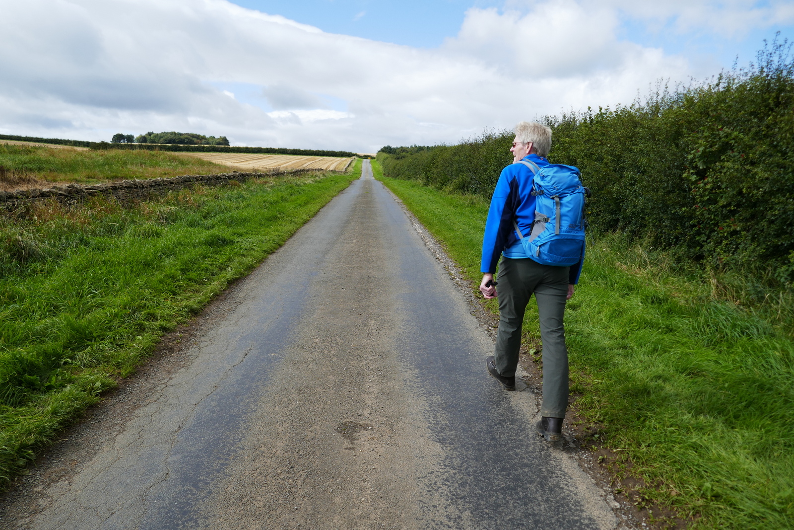
High Leir Lane

A collared dove acts as referee on the weather vane...

... at Weathercote Farm

After a mile we reached the junction with Cleveland Road which we crossed to follow field paths again, until reaching the high ridge of Boltby Scar.  We were ready for refreshment by this time and we followed the ridge to the old quarry workings where we sat with a magnificent view over Boltby and enjoyed our coffee and scones in a slight and very welcome breeze.

Pheasants lead us towards Boltby Scar.  Safe until October 1st!

We reach the ridge and the Cleveland Way and bear left

Boltby Village below


High Barn appears in the distance

Remains of old fort and quarry.... and coffee stop

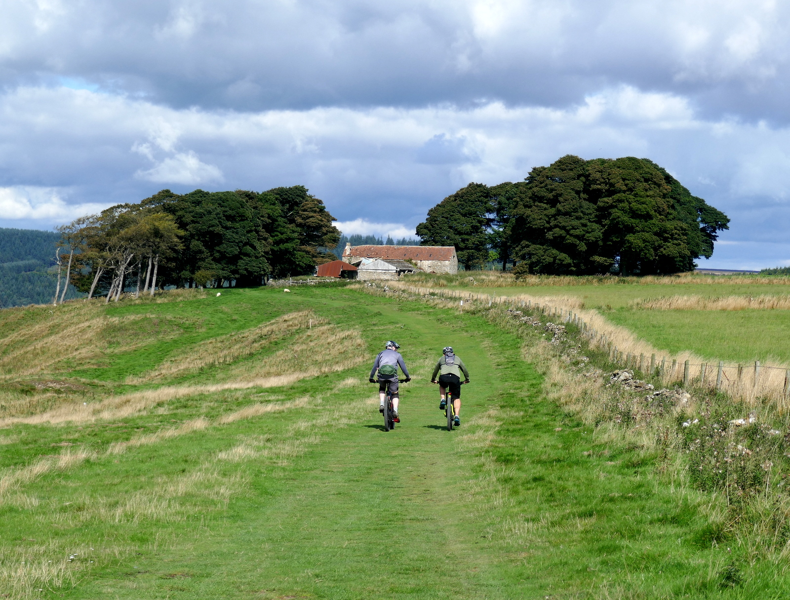
We set off and walked towards the Old Barn, walking straight past it following the Cleveland Way. 
We crossed Sneck Yate Bank Road, opening the gate for a couple of cyclists, and continued along a forest path to High Paradise Farm, which now has a tea room in the summer months.  Although it was nearly 30 minutes since we had our coffee break we showed amazing will power and walked on past walkers enjoying their coffee at the farm cafe, soon reaching the gate with the old drovers' road, Hambleton Road. 

Passing Old Barn


Low Paradise left and High Paradise Farm to the right


Entering Boltby Forest


High Paradise Farm and tearoom


Walking towards Hambleton Road

Crossing Hambleton Road towards Daletown Common

Daletown Common

Two of the sheep had red horns, we wondered what that signifies


At Hambleton Road we crossed straight over and walked onto Daletown Common where we continued for about two miles towards the old ruined barn at Noddle End.   As we walked we passed several freshly dead partridges and saw a large group of beaters being collected by transport on the road ahead.  Partridge season is 1st September to 1st February so they are 'fair game' at the moment.

Fresh partridge

Beaters being collected

The dogs must have missed these..


When we reached the barn we paused to enjoy a pleasant view into Gowerdale, before following the path down to reach the ruined farm of Gowerdale House.   Looking across towards Murton Bank we could see my car and a line of shooters' vehicles approaching it from Gowerdale, probably on their way for refreshments after the shoot.


Approaching Noddle End

The disused barn at Noddle End

My zoom lens shows the shooters approaching my white car


The path now leads steeply downhill to a single deserted farmstead, Gowerdale House. 

In his 'Round and About the North Yorkshire Moors, Vol. 2' Tom Scott Burns tells us that Gowerdale House is all that remains of a medieval village, called Dal in the Domesday Book, and Daile a century later. By 1433 there were 23 tenants recorded as living in Daletown but by 1569 in Humberston's Survey the entry was 'vocatum Dale Town'. Was the village wiped out by the Black Death?


Starting to descend into Gowerdale

Gowerdale House


Dozens of partridges take to the air 


We reach the bottom of the valley and Gowerdale House

A partridge watches us pass by Gowerdale House

The message, now hidden, says "Look around and Get Out!"


We passed the front of the house which has the bleak message, "Look around and get out!" painted on the front door, and then followed a rising path to reach Dale Town Farm.


Dale Town Farm

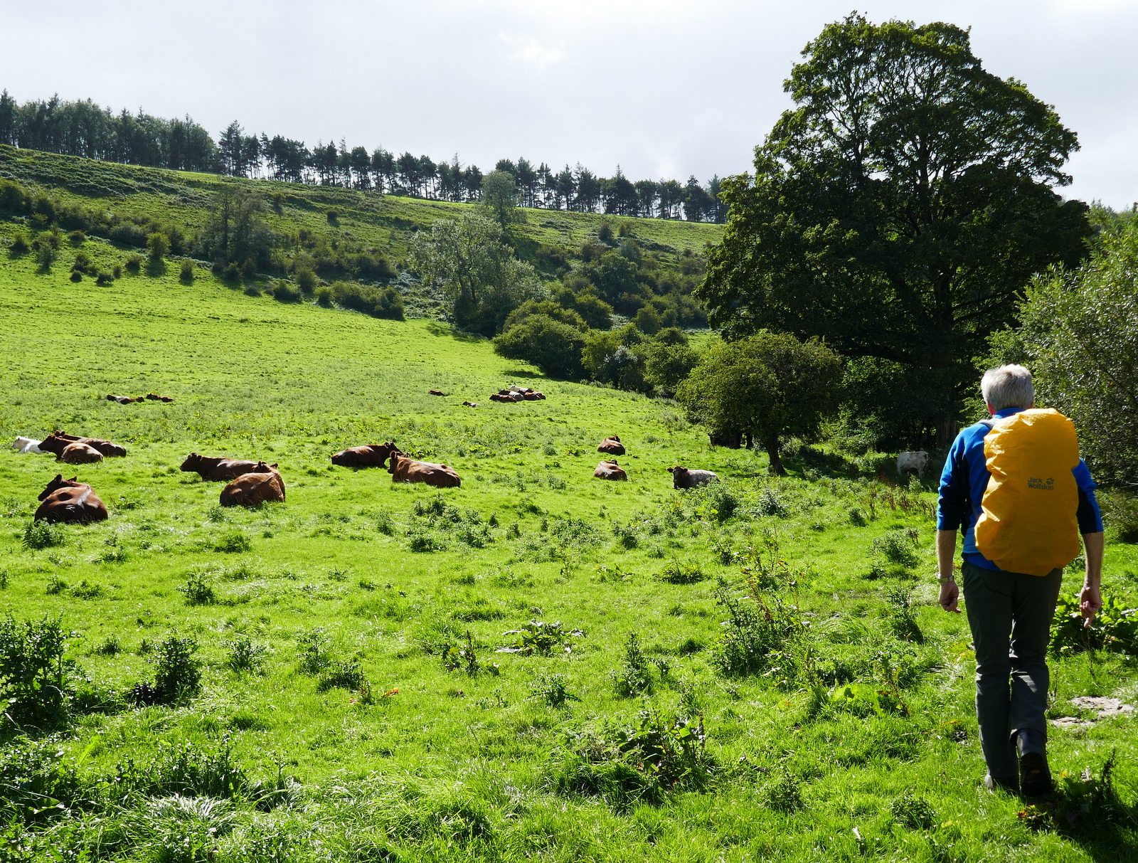
We turned right into a cow field just after passing the farm buildings and followed the faint path steeply uphill to the top of Peak Scar Top where we turned left to reach Murton Bank Road and the car.

Reaching the car we looked down on the village of Hawnby and its pub, The Owl.  We were soon seated in the pub garden enjoying a pint and discussing today's walk.

Climbing to Peak Scar Top

Hawnby below

Hawnby Hill and Easterside Hill from Murton Bank

A pleasant end to our walk at The Owl at Hawnby


Friday 4 September 2020

Caydale and Noddle End from Murton


7.5 miles                    Fine and breezy


Tom Scott Burns explains that a 'grange' is a farmhouse attached to a religious order and Murton Grange once belonged to the monks of nearby Byland Abbey.  Murton Grange is reached by taking the Laskill turn-off from the B1257 Stokesley to Helmsley road and parking on the grass verge at the top of Murton Bank.


Today's walk from The Walker's Guide to the Hambleton Hills

Looking down to Hawnby village from Murton Bank

Murton Grange

We walked past the Grange and continued straight ahead until arriving at a fork, the main lane going on to Caydale Mill but we took the right fork down into the hidden valley of Caydale.  Tom Scott Burns tells us that at this spot the last wild cat in England was shot in 1840, by a Charles Harrison. 

Walking towards Caydale

The valley of Caydale

Dropping down to the valley floor

We reached Caydale, taking the second footpath sign to drop down to the valley bottom.  Here there are several crystal clear waterways, shown on the map above as Old Byland's Water Race and Limperdale Gill.  In the 1740s a Joseph Ford of Kirbymoorside perfected a system of tapping into springs and channeling water in open 'rills' some 12 inches wide.  Water was diverted by this method through Caydale from King Spring to the village of Old Byland and the straight rills remain.

Crossing the rills in Cydale

Crystal clear water

We crossed the valley floor and started up the other side.  Until a couple of years ago this climb was through trees but all vegetation has been removed and the area converted to rough grazing meadow.

A consequence of this clearing has been the removal of the old 'Captain's Seat' which is shown on the map above, and which we used to pass by, although in a dilapidated state. Today we did find the remains of it lying near the path.  Who the Captain was and why he was seated there is lost in time.

Climbing out of Caydale

Remains of the Captain's Seat


Looking back across Caydale to Murton Grange

Leaving the climb and Caydale we crossed several sheep fields.  A mass of crows took to the air as we approached and we saw that they had been about to dine on a dead sheep.

A sad sight


We soon reached the tarmac of High Leir Lane where we turned right and followed the lane to pass Weathercote Farm with its novel 'cat and rat' weather vane.


Approaching Weathercote Farm

Cat and rat


A mile or two on tarmac

Eventually we reached the junction with Cleveland Road which we crossed to follow field paths for another half mile until reaching the high ridge of Boltby Scar and turning right onto the Cleveland Way.


Approaching Boltby Scar

Turn right towards Sneck Yate

Straight ahead lies the village of Boltby

The path now follows the Cleveland Way along Boltby Scar, passing the old quarry workings and the ruins of High Barn before briefly crossing the tarmac of Sneck Yate Bank. Here we entered Boltby plantation and we walked along forest paths to pass Low Paradise Farm and then climbed to reach High Paradise Farm.

Looking past the old workings towards the old barn

Passing the ruins of the old barn

Low Paradise Farm below and High Paradise above

Into the woods...

Pleasant walk through the trees

The dreaded virus has closed the tea room for now but the enterprising owners have provided a 'chuck wagon' where hot and cold snacks can be purchased.  There was quite a throng here as walkers and mountain bikers had converged at the farm. Standing by the chuck wagon the owner told us of her plans to open a marquee with a flame pit in the next three weeks. After much consideration Clive had pizza and I succumbed to home made chocolate cake and we took our purchases to sit at picnic tables outside the old cafe.

Looking back from Low Paradise

High Paradise Farm

Residents at High Paradise


Chuck wagon at High Paradise

Pizza!

The Nail Game


Refreshed, we rejoined the track to walk past the farm to reach Sneck Gate and the old Drovers' Road, which we crossed into Daletown Common.  This area has been given over to pheasant rearing and hundreds of the young birds have recently been released to toughen up for the shooting season, which for pheasants begins on 1st October.  As we followed the two mile walk towards the barn at Noddle End pheasants ran ahead of us or took to the air as we passed their cover. 


Daletown Common

Plenty of flowering heather

Young pheasants


We are surprised as noisy birds take to the air when we pass by

Squawk!

The birds trot ahead of us across towards Noddle End

The old barn at Noddle End

When we reached the barn we paused to enjoy a pleasant view into Gowerdale, before following the path down to reach the ruined farm of Gowerdale House.

In his 'Round and About the North Yorkshire Moors, Vol. 2' Tom Scott Burns tells us that Gowerdale House is all that remains of a medieval village, called Dal in the Domesday Book, and Daile a century later. By 1433 there were 23 tenants recorded as living in Daletown but by 1569 in Humberston's Survey the entry was 'vocatum Dale Town'. Was the village wiped out by the Black Death?


Passing Noddle End

Looking down into Gowerdale

Gowerdale House


We need to cross the stream to pass Gowerdale House

"Look around and Get Out"

We passed the front of the house which has the bleak message, "Look around and get out!" painted on the front door, and then followed a rising path to reach Dale Town Farm.

Dale Town Farm

We turned right into a cow field just after passing the farm buildings and followed a very faint path past the dozing cattle, eventually turning left along Peak Scar Top and soon reaching Murton Bank Road and the cars.


Follow the hedge line upwards

Lurking, waiting to pounce..

Looking back, Easterside Hill in the distance

Gaining height and Hawnby comes into view

Nearly at the top..

Leaving Gowerdale behind

A short drive took us to Chop Gate where we sat outside the Buck with a pint and discussed today's excellent walk.

Debrief!