"There must be dales in Paradise
Which you and I will find.."

Friday, 18 January 2019


Stonegrave and Caulkleys Bank from Nunnington


7 miles                              Wintry showers


We approached Nunnington on the B1257 from Helmsley and parked in a lay-by opposite Nunnington Hall, next to the river.


Today's walk from The Walker's Guide to the Hambleton Hills

We walked back over the bridge and set off on the most southerly of the walks in Tom Scott Burns' The Walker's Guide to the Hambleton Hills.


Tom Scott Burns explains that the name Nunnington is derived from the old English personal name Nunna rather than from the Saxon nunnery that once stood where the hall now stands.

We walked through the village admiring the neat streets, laid out in a grid formation with all the houses decorated in the same dark green and cream paintwork.

Nunnington

The Old School House


Nunnington Studios

'Percy'

Walking here in 2017 we paused to admire the above weather vane at Nunnington Studios and were told that it was a memorial to a much loved dog, a spaniel called Percy.  Apparently the spaniel was a real character who led a very independent life, doing exactly what he pleased. The weather vane of Percy was made to order and is life sized.  At the other end of the village is a small copse of trees named after the dog and known as Percy's Plantation.


Walking through Nunnington

Bridge Cottage

At the end of the village we followed a footpath sign just beyond Bridge Cottage directing us through a gate and onto a field path running alongside the River Rye.  After about a mile we crossed a small bridge over a tributary and immediately turned left to follow a faint path through fields.

Past the cottage and through the gate...

.. to follow the river for a mile or so

Clive checks a rickety bridge

This one is beyond checking!

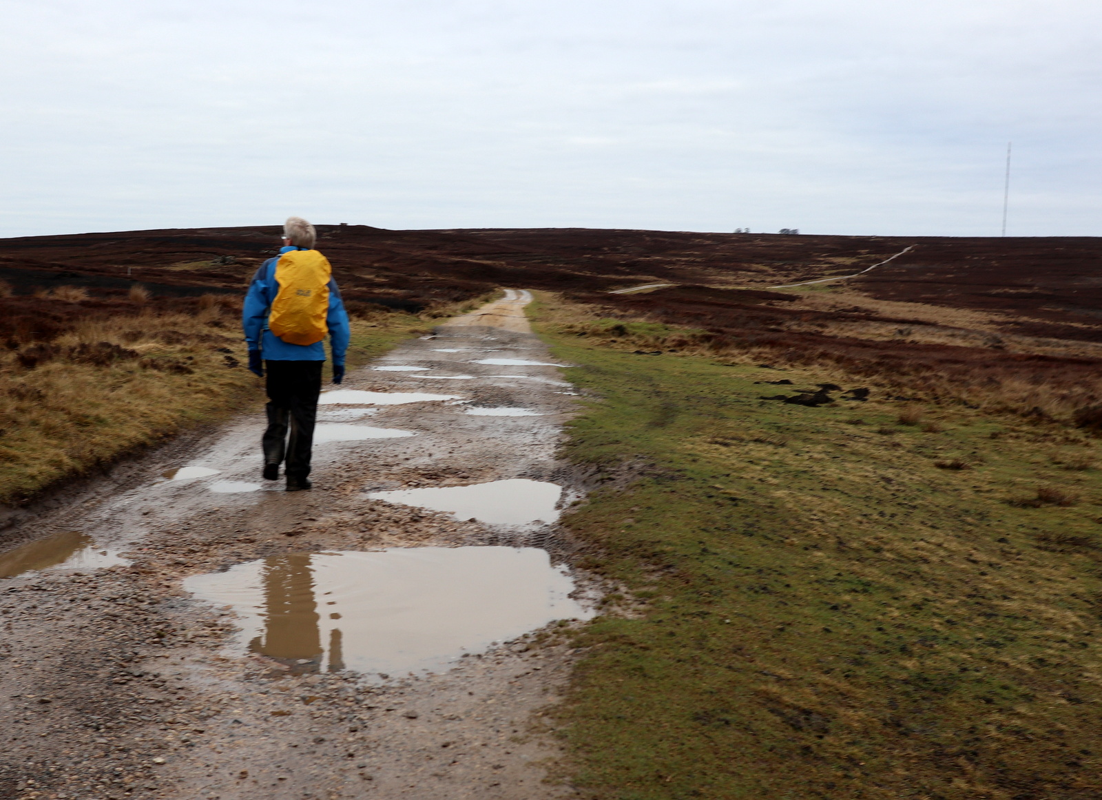
Turn left to follow a faint path

As we followed the field path snow started to fall and as we reached and turned left onto a farm track known as High Moor Lane, it began to fall heavier.


A hide at Low Moor Plantation

Snow starts to fall

We turn left to ?

High Moor Lane

We crossed a tarmac lane before continuing through fields to reach the B1257, where we emerged just above the village of Stonegrave, home of England's smallest minster.


We reach the B1257 and see the minster

Stonegrave Minster, founded around 757AD

TSB says that Stonegrave is derived from steinn-gryfia meaning a 'stone cleft', and there were important quarries of building stone here in the Middle Ages.

We turned off the busy road and walked past an Elizabethan manor house to reach the tiny and ancient Stonegrave Minster which was mentioned in an eighth century letter from Pope Paul to Eadbert, king of Northumbria.

It started to snow heavily as we arrived so we moved a bench into the minster porch to sit, warm and cosy, with our coffee, watching the snow fall outside the door.

Passing by the Elizabethan Manor 

Stonegrave Minster

We watch the weather worsen


After drinking our coffee we had a look around the minster and I was particularly impressed by a Celtic cross dating from the 8th or 9th century. 

Celtic Cross


Side window

Altar window


The Thorntons


Eventually it was time to step out into the snow once more and we found the gravestones illegible in the snow, so after returning the bench to its proper spot, we crossed the Malton road and joined a grassy path which veers left from the road to climb Caulkleys Bank.

Time to go

Norman head

Stonegrave Minster

We give up trying to read the epitaphs

Climbing Caulkleys Bank
The name Caulkleys is a corruption of 'Chalk Lands' and in The Walker's Guide to the Hambleton Hills one reads that the terrain here consists mainly of rich deposits of reef limestones and detritus known as Coral Rag, all pointing to the marine origins of this hillside.

Reaching the top of Caulkleys Bank we walked along the grassy ridge and after passing Caulkleys Wood we had fine views in all directions.   We were pleased that the grassy track which had all but been destroyed in 2017 by horse and bike traffic, was returned to its proper state.

Thatched cottage at Stonegrave

Climbing Caulkleys Bank

Walking alongside Caulkleys Wood

A lonely pine catches the sun


The grassy track appears to have recovered
We followed the ridge walk for about 2.5 miles, at its highest  point it is marked by a prig point.  TSB says that no less than 22 towns, villages and hamlets and sixteen churches can be seen from here.

Good job we know the way..

Trig Point...

.. and memorial bench

Starting to descend
Eventually our path began to lose height and we reached the houses of the tiny hamlet of West Ness.

Clive and I had been looking forward to inspecting the produce of a little cake stand we found at West Ness Hall Farm last visit but were disappointed today to see that it was no longer in operation.

Entering West Ness

Rams at West Ness Hall Farm

"Where's the cake stall??"

Old chapel at West Ness


Just past a Wesleyan chapel built in 1836, the path leaves the road and rejoins the River Rye.  We walked alongside the peaceful river for about 1.5 miles and reached Mill Farm.  

TSB says there has been a mill here since Domesday and the present mill dates from 1875.  Until 1950 the mill race powered a generator providing electricity for Nunnington Hall.


Geese share the sheep field

Approaching Mill Farm


The old Mill buildings

The mill race
Continuing alongside the river we reached Nunington Hall, where the screeching of peacocks could be heard. The Hall was owned by Sir Thomas Parr in the sixteenth century so it's possible that Catherine Parr, Henry VIII's last wife, played in the village as a child.

Following the river

Nunnington Hall

Hall cottages

Hall and farm buildings

Southdown sheep at Nunnington Hall

Pheasant weather vane at Nunnington Hall
We crossed the bridge and returned to the car.  Sadly the village pub, The Royal Oak, has closed its doors to business and a trip further afield would be necessary should one want post-walk refreshment.


Saturday, 12 January 2019


Ladhill Gill and Bumper Castle from Fangdale Beck


7.5 miles                           Grey sky, dry and cool


We turned off the B1257 Bilsdale Road and drove past an old green telephone kiosk to the village of Fangdale Beck where we parked at the roadside.  Tom Scott Burns tells us that Fangdale comes from the personal Scandinavian name Fangi or Fangulf, giving 'Fangi's Valley'.   Leaving the car we crossed the beck by the little bridge and walked past the old Wesleyan Chapel, now converted into a private house.


Today's walk from The Walker's Guide to the Cleveland Hills

Unusual telephone box at Fangdale Beck - see story below

Fangdale Beck


Old Wensleyan Chapel, now a house

The green telephone box at Fangdale Beck was installed in the 1930s and was green at the request of Lord Feversham, who wanted it to blend in with its surroundings. In 1992 a battle was fought over this when British Telecom, without any consultation, removed it and installed one of the new 'shower cubicle' type boxes, without realising they had removed a Grade II listed building.  To the delight of the locals they were fined £3000 and ordered to restore the original.


We crossed the bridge next to the old Chapel and followed the tarmac lane around to a farm with a sign above the door inscribed Malkin Bower. (Matilda's or Maude's dwelling)  We continued straight past the farm with the tarmac changing to a grassy track.

Looking back at Fangdale Beck

Looking across Bilsdale to St John's Church

Malkin Bower

Dog weather vane at Malkin Bower


Passing Malkin Bower

Once past the farm the tarmac vanished and our track became a muddy path which we followed along the valley of Bilsdale, parallel to the road below us.  The path dropped down to the River Seph becoming wetter and muddier before climbing gently up to Helm House.  


Mist in the valley


Helm House


Leaving Helm House we continued on a very muddy path across sheep fields before arriving at Benhill Bank Plantation where the track climbs steadily up to reach the moor gate.

Benhill Bank Plantation in the distance

Benhill Bank Plantation


"You lot have made it a right mess!"

The ground finally became less muddy as we climbed through the conifer plantation.   At the top of the bank we turned right onto a tarmac road to Wethercote Farm, which we left, bearing left, after a couple of hundred yards.  We now walked across fields, our path completely undetectable apart from the occasional yellow waymark. 

Join the road towards Weathercote Farm at Low Ewe Farm...

... and climb uphill

Heading for the moor gate

The last gate took us to the moor edge where the path becomes more distinct, leading from the moor gate.  Looking down to our right we saw the ruins of Bumper Castle behind a grove of trees.  TSB tells us that the castle was once part of the estate of the Duke of Buckingham and also that the monks of Rievaulx once wrought iron on Bumper Moor.


The ruins of Bumper Castle.  For a fuller report on the castle see our last visit in November 2017

We walked parallel to the valley bottom along an old cart track until we reached a line of telegraph poles.  Here we met another track leading straight down to Ladhill Gill.  Reaching the stream we sat on some convenient rocks near the bridge and enjoyed our coffee, sheltered from the breeze.  

Following the cart track parallel to the stream


Easterside Hill comes into view ahead

Walking down to Ladhill Gill, Sportsmans Hall on the hill ahead

Yellow right of way mark on the boulder indicates position of bridge across Ladhill Gill

We sit to enjoy our coffee near the bridge

We crossed the bridge and climbed steeply up the opposite side of the valley, turning left to join a track that led us above Sportsmans Hall.  TSB suggests that this name probably has something to do with Bumper Castle and the Duke's sporting pastimes.


Slippery bridge

Ladhill Gill

Way-mark down!


We climb up from the stream..

.. to pass behind Sportsmans Hall

"Excuse me but we're coming through"

We walked towards the Hawnby road and turned right along a vehicle access track at the moor gate.   The track divides twice and on each occasion we took the right fork, heading towards Bilsdale mast.


Turn right at this sign to follow a shooter's path

We have come across a few of these painted stones recently

Across the moor towards Bilsdale Mast

Eventually our path struck off faintly across the moor.  We lost sight of the track occasionally but it didn't matter, we knew we had to head east to cross the upper reaches of Ladhill Gill, where it joins with Wetherhouse Beck.  Here the route is indicated by a row of wooden stakes showing the location of some shooting butts. 

This part of the walk is a bit hit and miss, the moor track being either non-existent or overgrown and very boggy, but eventually we reached the shooting butts and we turned left to follow their line.

We follow the line of shooting butts 


Turn right before this fence...

... and follow the fence line

At the end of the shooting butts we came to a fence which we followed uphill to reach the top of the moor and a sandy shooter's track.  We then followed the shooters' track along the ridge of the moor until we came to poles, indicating more shooting butts.  The top of these poles have been painted white and we followed their line downhill towards Bilsdale.


Follow the poles!

It was at this point in 2016 I had the good fortune to have my camera out and ready when some grouse took to the air, providing me with one of my favourite photos.


A lucky shot in 2016


We passed a rounded hillock and then bore right between two plantations.   We went through the moor gate and by some old quarries and then descended via the usual hollow way to emerge at Malkin Bower where we turned left to return to Fangdale and our car.

Back into Bilsdale

Following a hollow lane..

.. back to Fangdale

Arriving at Fangdale
Having time to spare we decided to pay a quick call to nearby St John's Church, which is just opposite the Fangdale turn off on the B1257.  The church was built in the 1890s and so has little history, but it was unlocked and we were free to look around.


St John's Church, Bilsdale


Altar window at St John's Church