Ladhill Gill and Bumper Castle from Fangdale Beck
7.5 miles Fine and warm
We turned off the B1257 Bilsdale Road at the Fangdale sign and drove past a green telephone kiosk just past the junction, and parked in the village at the roadside.
 |
| Today's walk from The Walker's Guide to the Cleveland Hills |
 |
| Fangdale's unusual telephone box, still in working order |
 |
| We parked at the roadside next to these houses |
The unusual green telephone box was installed in the 1930s and was green at the request of Lord Feversham, who wanted it to blend in with its surroundings. In 1992 a battle was fought over this when British Telecom, without any consultation, removed it and installed one of the new 'shower cubicle' type boxes, not realising they had removed a Grade II listed building. To the delight of the locals they were fined £3000 and ordered to restore the original.
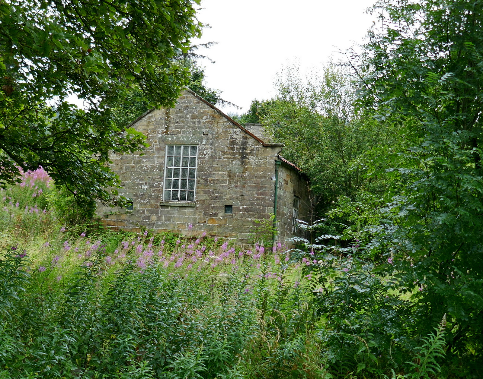
We crossed the beck by a small bridge and walked past the chapel, now converted to a house. Tom Scott Burns tells us that Fangdale comes from the personal Scandinavian name Fangi or Fangulf, meaning 'Fangi's Valley'.
 |
| Converted chapel |
 |
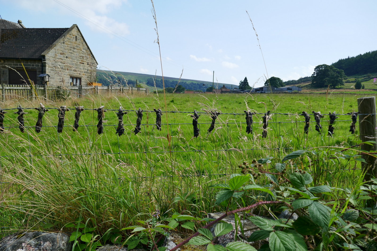
| Clive notices some grisly totems |
As we left the village we noticed a row of dead moles strung on the fence. We spoke to a molecatcher a couple of years ago and he told us how they were paid per mole caught and had to provide evidence of their catch to get paid. This resulted in the tradition of stringing the moles.
 |
| A grisly tradition |
Leaving the moles behind, a walk along the farm track brought us to a farm called Malkin Bower, which means Matilda's or Maud's Dwelling. We continued straight past the farm with the tarmac changing to a grass track.
 |
| Looking back to Fangdale |
 |
| Malkin Bower |
 |
| Continue straight along the farm track |
 |
| .. with the valley of Bilsdale to the left |
We followed the path along the valley of Bilsdale, parallel to the road below us. The track drops down to the River Seph before gently climbing up to Helm House, where mechanical repairs are carried out to farm vehicles, as well as it being a working farm.
 |
| Helm House |
 |
| Continue past Helm House |
 |
| "Mind your feet!" |
 |
| Little frogs on the move |
 |
| Well camouflaged |
Leaving Helm House we continued across sheep fields before arriving at Benhill Bank Plantation where the track climbs steadily up to reach the moor gate.
 |
| Clive is careful not to stand on frogs |
 |
| Benfield Bank Plantation |
At the top of the bank we turned right onto a tarmac road which leads to Wethercote Farm, but here we turned left to leave through a gate after a couple of hundred yards. We now walked uphill across meadow fields, the path completely undetectable apart from the occasional yellow waymark.
 |
| Tarmac for 100 yards |
 |
| Then back in fields |
 |
| Easterside Hill appears to the left |
 |
| "One last field" |
The last gate took us to the moor where the path becomes less distinct, almost disappearing as it leads from the moor gate. Looking down to our right we saw the ruins of Bumper Castle behind a grove of trees. TSB tells us that the castle was once part of the estate of the Duke of Buckingham and also that the monks of Rievaulx at one time wrought iron on Bumper Moor. We crossed the heather to join an old cart track that leads to the ruin.
 |
| We reach the moor |
 |
| At first there is a path of sorts |
 |
| ... but it soon disappears in heather. We head towards the gate. |
 |
| Looking down to Bumper Castle from the moor gate |
There appears to be fire damage and the building is in an unsafe condition. We looked around and before heading back to our track.
I have previously made an internet search about Bumper Castle, which found this:
For a farm house Bumper Castle was well built with a slate roof which would have to have been imported into the dale. There's a date on the gable of 1722. It is said that in the 18c the 3rd Duke of Rutland and the Marquis of Granby stayed here for the shooting. So the house may have been built as a shooting lodge.
From the Hawnby parish register in 1794 William Douglas, Bumper Castle, batchelor, 74, was buried "when there was the greatest depth of snow ever known in memory". In 1801 Samuel Tiplady was christened, son of Samuel (gamekeeper) and Dillery Tiplady, Bumper Castle. In 1811 William Mansell, gamekeeper to the Duke of Rutland, died at Bumper Castle aged 38.
From the mid 19c it seems to have been used as a farm. According to the 1851 census Richard Hilbert was farming 127 acres here. In 1881 and 91 Thomas Wrathall was resident. In 1920 Mrs. Clark, widow of Noah Clark was paying £25 rent.
Clive and I have seen a brass memorial plaque to William Mansell set into the floor of Hawnby Church and it would appear that he was staying at Bumper Castle at the time of his death. It would be interesting to know exactly what befell him.
TSB reports in The Walker's Guide to the Cleveland Hills that Bumper Castle was owned by George Villiers, the notorious second Duke of Buckingham, who, when he died in 1687, had squandered £50,000 a year and had become an outcast from society. There is no record of him actually visiting the building however.
We rejoined our original path eventually turning right to go down towards Ladhill Gill Beck. We usually do this walk in the winter months and have our coffee near the beck where we are sheltered by trees, but summer undergrowth has covered the rocks where we sit so we continued over the bridge. Climbing towards Sportsman's Lodge we stopped at some convenient flat rocks where we drank our coffee with a fine view back over Ladhill Gill.
 |
| Leaving Bumper Castle |
 |
| Sportsmans Lodge |
 |
| Walking down to Ladhill Gill Beck, Sportsmans Lodge beyond |
 |
| "We can't stop here!" |
 |
| Crossing Ladhill Gill |
 |
| We didn't know we were on St Aelred's Pilgrim Trail |
We saw some new signs informing us that we were on St Aelred's Pilgrim Trail. This is a new 41 mile walk starting and ending in Helmsley.https://www.saintaelredspilgrimtrail.com/
 |
| Easterside Hill and the roof of Sportsmans Lodge from our coffee stop |
 |
| Coffee with a view |
Finishing our coffee we climbed steeply up the side of the valley, turning left to join a track that leads above Sportsmans Hall. TSB suggests that this name probably has something to do with Bumper Castle and the Duke's sporting pastimes.
We walked towards the Hawnby road and turned right along Sunley Slack, a vehicle access track at the moor gate. The track divides twice and on each occasion we took the right fork, heading towards the new Bilsdale mast.
 |
| Hawnby Hill |
 |
| Walking to Moorgate from the Sportsmans Lodge |
 |
| Turn right towards Sunley Slack |
 |
| The heat gets to Clive |
 |
| Keep bearing right |
 |
| Workers strimming to give access to the shooting butts, soon be the 12th! |
We gradually descended past some old workings to reach Weatherhouse Beck and here we left the sandy track and headed off on a faint track through the heather. We lost sight of the track occasionally but it didn't matter, we knew we had to head east to cross the upper reaches of Ladhill Gill where it joins with Wetherhouse Beck and we followed a line of very basic shooting shelters.
 |
| Keep right |
 |
| Old workings |
 |
| Dropping down to Wetherhouse Beck |
 |
| Take path to left just before the beck |
 |
| ... and follow a line of shooting stands |
This part of the walk is a bit hit and miss, the moor track being either non-existent or overgrown and very boggy. We turned right on reaching a wall and walked on, eventually reaching a sandy track where we turned right to follow it along Shaw Side.
We soon came to a line of poles marking shooting butts which we followed left, down towards the trees of Helm House Wood. This is the dotted line going east off Shaw Side on the map above.
 |
| Where's the path?? |
 |
| The new Bilsdale mast |
 |
| On Shaw Side |
 |
| Down to Helm Wood |
We went through the moor gate and by some old quarries and then descended via the usual hollow way to emerge at Malkin Bower where we turned left to return to Fangdale.
 |
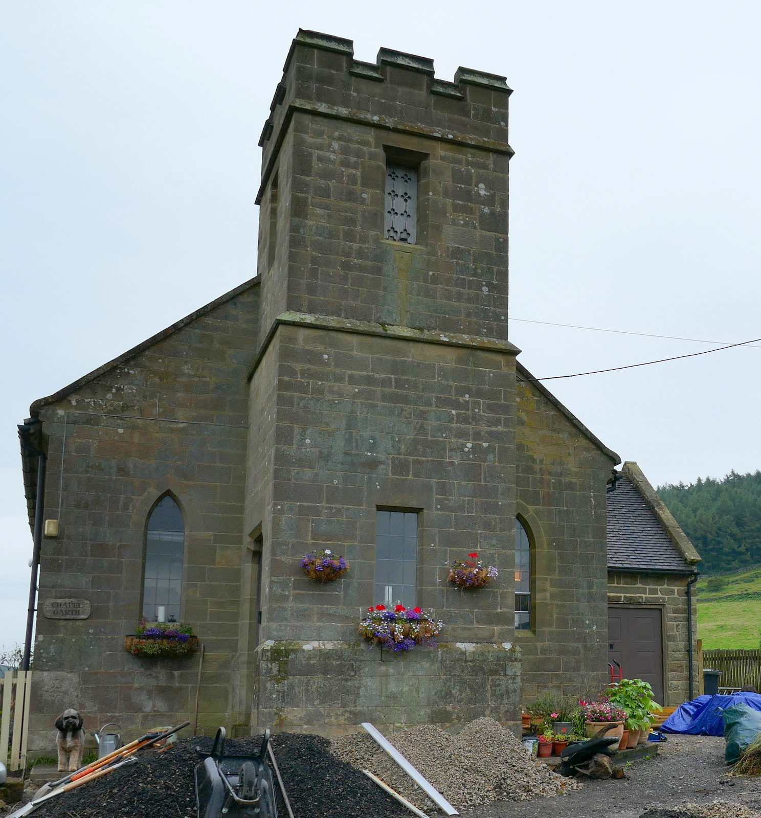
| The old village hall |
This is a good walk but needs a close eye on the OS map or I will send our GPS track on request.
 |
| I bump into Lawrence of Arabia in Carlton. Cheers! |