Rievaulx Abbey and Caydale from Murton
8.5 miles Warm and mostly sunny
We left the B1257 Stokesley to Helmsley
Road at the Hawnby turn off and parked at the
roadside near to Murton Grange.
 |
| Today's walk from The Walker's Guide to the Hambleton Hills |
Tom Scott Burns explains in his 'Walker's Guide to the Hambleton Hills' that the township of Murton was given to Byland Abbey by Hugh Malebisse in the 12th century. A grange was constructed by lay brothers and was basically a well run farm with a small chapel.
We walked past the neat white buildings of the grange and after a short distance turned into Ox Pasture Lane which we followed to the top of
Deep Gill Wood. Ahead of us trotted dozens of young pheasants, determined not to take to the air, until a dog running alongside some horse riders ran towards them barking.
 |
| Ox Pasture Lane |
 |
| We have company along the lane |
 |
| Leaving Ox Pasture Lane to walk along the edge of Deep Gill Wood |
 |
| We emerge onto meadows |
Our path ran alongside the wood for some time before
reaching fields which we crossed to reach an old disused barn before
descending to Barnclose Farm.
 |
| Approaching the old barn |
 |
| Clive goes for a look around |
 |
| Descending to Barnclose Farm |
We walked through the farm and then had a steady climb on the road to reach
Tylas Farm, which TSB tells us that the monks of Old Byland built as a
grange and tile house, hence its name. We passed the farm and continued
along the road to Oxen Dale until reaching a gate and
way-mark on our left where we turned off the road and gradually
descended to the River Rye.
 |
| The road to Tylas Farm |
 |
| Our turn off is almost hidden by bracken |
 |
| Walking through Oxendale |
Our path now led through the valley of Oxendale, the River Rye to our left. We followed a pleasant grass track until we reached the river and our path became a boardwalk over areas that obviously suffer from flooding.
 |
| The River Rye from our path |
 |
| Looking back at an old sign to Hawnby |
We emerged onto tarmac and almost immediately crossed the river at Bow Bridge, originally built by the Cistercian monks of Rievaulx.
A short walk on the road brought us to a
sign pointing to our path across fields to Rievaulx Abbey. We left the
road at a wooden Inn Way sign and soon the abbey came into sight. Our route followed the traces
of the old canal that the monks had built in the 11th century to carry
stone for the abbey from the nearby Penny Piece Quarry, so named
because quarrymen were apparently paid a penny a day. The river was dammed here and water diverted into the canal.
As we walked through fields towards the Abbey we were rewarded with a fine view of the ruins, Tom Scott Burns says that Rievaulx Abbey is undoubtedly a place to walk to, rather than from.
 |
| Remains of the old canal |
 |
| Leaving the road near Bow Bridge |
 |
| Walking towards Rievaulx Abbey |
We soon arrived at the village and the road and decided to leave our route for a while to visit the church of St Mary's which could be seen uphill to our left.
Apparently the church was originally a 'slipper chapel' to the abbey, a place where pilgrims would remove their shoes and put on soft slippers or socks to enter the holy buildings. It was renovated early this century.
We found the church unlocked and entered to find a neat, well kept building with a fine altar window.
 |
| The Church of St Mary's, Rievaulx |
 |
| Hen weather-vane |
 |
| Looking from the door towards the altar |
 |
| The altar window |
 |
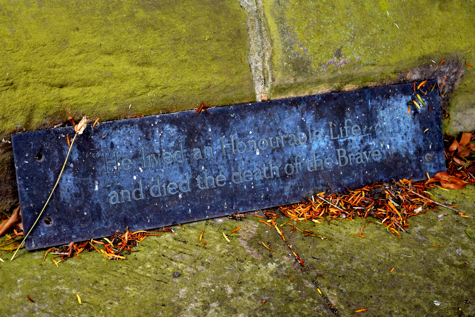
| Window commemorating the Earl of Feversham, who died at the Somme |
Just outside the church is a heavy wooden cross erected to the memory of the Earl of Feversham and inside we found the following explanation for its presence.
 |
| The cross, made from wood recovered from the Somme battlefield |
 |
| Memorial on the cross to the Earl of Feversham |
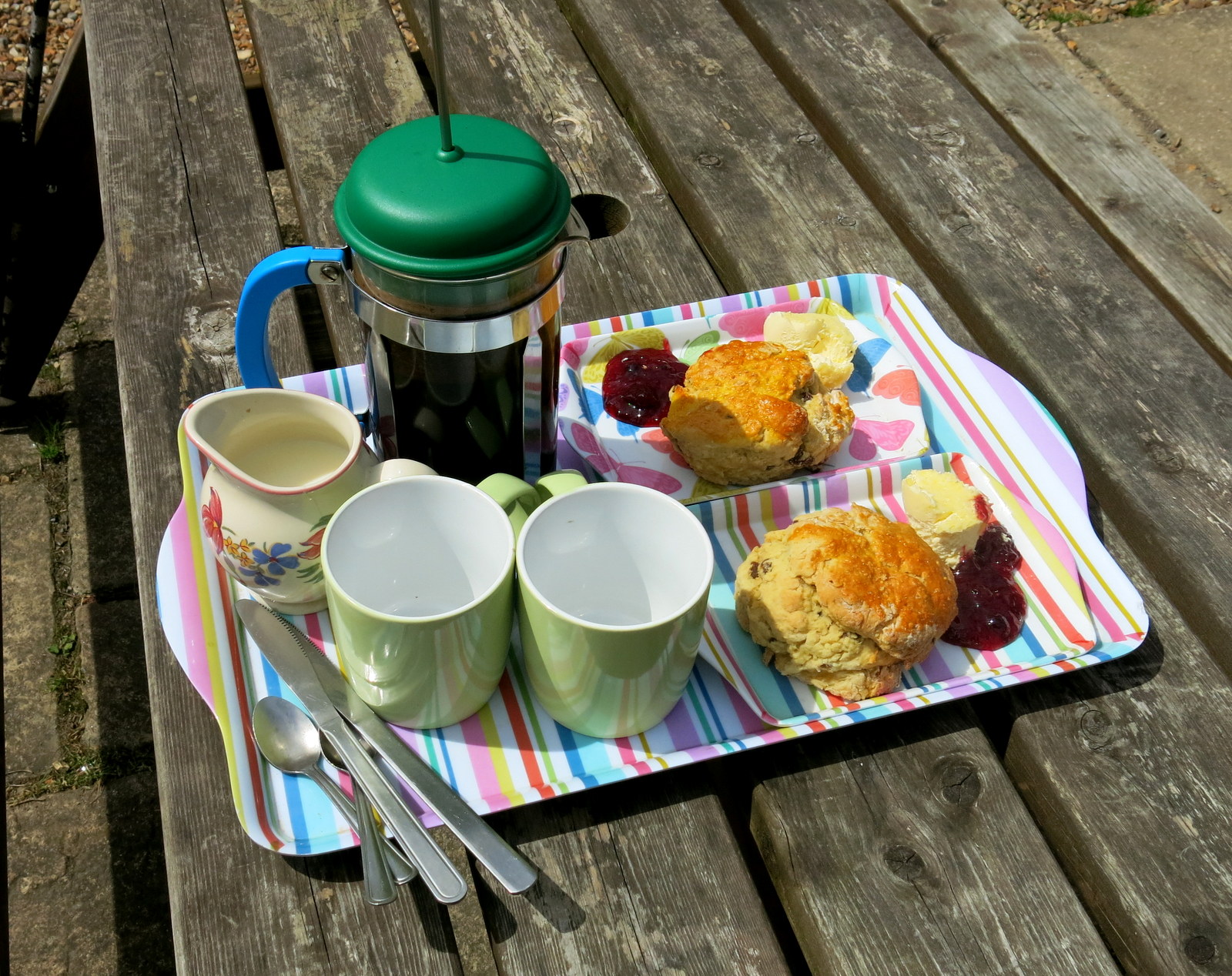
We retraced our steps downhill and came to a bench where we sat and enjoyed our coffee and scones, looking down on to the village.
Refreshed, we walked down to view the abbey from the road as we walked towards Rievaulx Bridge.
TSB tells how Wordsworth's sister,
Dorothy, who, like us, arrived here during a July afternoon, described
how she "could have stayed in this solemn, quiet spot till evening
without a thought of moving, but William was waiting for me."
The Abbey sits in a natural amphitheatre
which was granted to the Cistercian monks by the Lord of Helmsley and
building began in 1132. Because of the Abbey's site between a hill and
the River Rye the church faces North - South instead of the usual East -
West. By 1200 there were 140 monks and 500 lay brothers but like
nearby Byland Abbey, it was suppressed in 1538.
 |
| Walking through Rievaulx |
 |
| Rievaulx Bridge |
We crossed the bridge and followed the road to pretty Ashberry Farm where our path turned behind the building and immediately started to climb Ashberry Hill. As on previous visits our view was not the magnificent one enjoyed by TSB in the days before it was spoiled by new growth, however at one point a gap in the trees gave us a view of one of the Ionic Temples built above the abbey by a local squire in 1758.
 |
| Old York North Riding sign near Ashberry Farm |
 |
| Ashberry Farm |
 |
| Tuscan style temple above the Abbey |
We followed the wooded path through
Lambert Hagg Wood and left the wood on the same road that
we had followed on the way out, past Tylas Farm. This time we left
the road before the farm, turning left to climb onto Birk Bank on the
other side of the valley.
 |
| Walking back through Oxendale |
 |
| Looking towards Tylas Farm |
 |
| We saw tiny frogs crossing our road |
 |
| The trees of Birk Bank |
A mile of walking along this woodland
track took us to Caydale Mill below us, and just beyond we reached the
road and a ford where we washed the mud from our boots. Cars on this route
drive through 100 yards of water, but walkers cross by a bridge and
avoid getting wet feet.
A long steep climb up this road took us back to
Murton Grange and our car. A short drive later we were relaxing in the Buck at Chop Gate where we discussed an enjoyable walk over a pint of Ruby Red ale.
 |
| Washing boots in the ford |
 |
| Murton Grange |
|
|
|
|