Hawnby, Easterside Hill
and Shaken Bridge
7.5 miles Wintry showers and windy
We approached Hawnby from the B1257 Stokesley to Helmsley Road and drove to the lower houses of Hawnby Bridge. Tom Scott Burns explains that the village of Hawnby is divided into an upper and lower part because in the 1750s a zealous landlord turned out all the Methodists from their houses. They had lived in what we now think of as the top village. They moved a short distance away where they built some small houses and a Wesleyan Chapel, completed in 1770, now the lower village.
We parked behind this Chapel on the newly re-surfaced car park where parking is freely available for about a dozen cars.
 |
| Today's walk from The Walker's Guide to the Hambleton Hills |
 |
| New surface on car park |
 |
| Parking is free but... |
 |
| Lower Hawnby |
After leaving the car park we turned right and walked past the village shop and cafe to the junction, which we crossed to walk through a gate into fields which were very wet and muddy.
 |
| Leave the road at the gate |
 |
| Heavy going today |
 |
| Crossing Ladhill Beck |
After crossing the beck we walked slowly uphill to reach Ellers Wood and then Easterside Farm where we joined the Hawnby road for a hundred yards before turning right at a signpost, over a stile and into fields.
 |
| The first of many snow showers |
 |
| Five minutes later the sun is out |
 |
| Looking at Hawnby Hill to our left |
We followed the trail under the shadow of Easterside Hill until we dropped down to follow the farm track for High Banniscue Farm. When we reached the farm we turned left to walk along a faint track to reach an old ruined building shown as Crows Nest on the OS map. We turned right at these ruins to pass through the moor gate and followed a path through heather to skirt Pepper Hill and Easterside Hill.
 |
| High Banniscue Farm |
 |
| Crows Nest ruin |
 |
| The moor gate next to Crows Nest |
 |
| Heather track alongside Pepper Hill |
 |
| Approaching Easterside Hill |
We walked along the east side of Easterside Hill looking over at the valley of Bilsdale and then dropped down to join the Hawnby road. In a hundred yards or so we turned right off the Hawnby road at a footpath sign, to re-enter boggy fields.
Cattle are now inside for winter but their presence is not forgotten. Their hooves have made these fields a quagmire and we had difficulty making progress. We dropped down to the ruins of Grimes Holme and found that the old buildings (and our coffee stop!) had been used as a cattle shelter. We carried on past the building and eventually stopped at an old dry stone wall where we sat to enjoy our coffee and scones.
 |
| Ruin shown as Timber Holme on the OS map |
 |
| Dropping towards Grime Holme for coffee |
 |
| We keep to the fence line |
 |
| We arrive at Grime Holme and cancel coffee |
 |
| Negotiating slurry by the gate |
 |
| We sit on these old wall stones for our break |
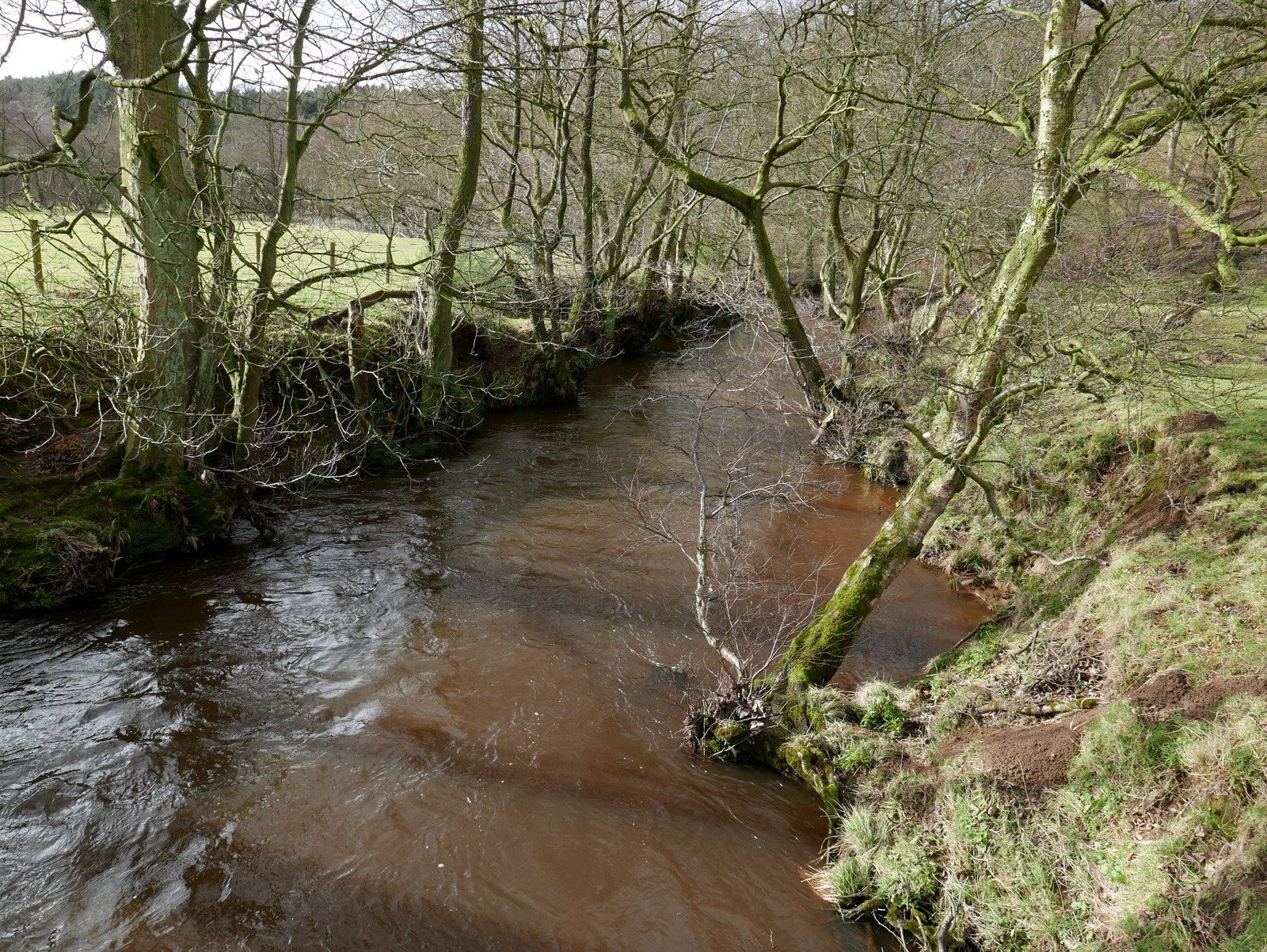
Refreshed we continued downhill and crossed the River Seph at a footbridge and dropped down to join a tarmac lane at Fair Hill Farm. We turned left and followed the tarmac lane down to Broadway Foot Farm. The last time we passed by in 2016 builders were hard at work at Broadway Foot, rebuilding after a disastrous fire. The work appears to be almost finished and although there is still a site office there was no sign of any activity. I was pleased to see they had retained the old Bull and Dog weather vane from the old house.
 |
| The River Seph was higher than we have seen it in the past |
 |
| Looking downstream from the bridge |
 |
| Fair Hill Farm |
 |
| A pleasant tarmac lane |
 |
| Snowdrops near Broadway Foot |
 |
| Nearly finished at Broadway Foot |
 |
| Weather vane at Broadway Foot Farm |
We continued past Broadway Foot and followed the tarmac lane down to a point where the River Seph and the River Rye converge, near to Shaken Bridge.
Tom Scott Burns tells us that the name Shaken Bridge derives from the Old English 'sceacre' meaning robber, so 'Robbers' Bridge'.
We crossed the bridge and followed the road for a hundred yards before turning left at a signpost for Shaken Bridge Farm.
 |
| Shaken Bridge |
 |
| Turn left into Shaken Bridge Farm |
We followed the track past the farm and uphill towards East Ley Wood where we saw a few sheep, one or two with lambs. We noticed one sheep apparently dead on its side but noticing it twitch we went over to find it rigged, that is, unable to get back onto its feet. Clive rolled it upright but it collapsed again so righting it once more, he held onto its back for several minutes to allow it to get its balance again. After a prolonged 'wee' which it must have been desperate to do, it eventually moved its feet and appeared steady.
Clive left go and within a moment it began eating, apparently none the worse. We wondered how long it had been lying there.
 |
| Is it a dead 'un? |
 |
| Clive notices it twitch its leg |
 |
| ... and rolls it upright |
 |
| A prolonged 'wee' |
 |
| A couple of minutes steadying the sheep |
 |
| ... and its back to normal |
A check on google shows this is a common occurrence with sheep, especially at this time of year when they are heavy with lambs.
https://theworkingsheepdog.com/you-can-save-a-sheeps-life/
We resumed our climb towards East Ley Wood where we turned right and walked past an old barn. At the first gate we took the left fork but at the second we went through the gate into East Ley Woods. We were surprised to see that some old signs bearing a rough sketch of a hiker on the gateposts are still present. We have often wondered who put these signs here and why.
 |
| Looking over Bilsdale |
 |
| A telephoto view of Broadway Foot new buildings |
 |
| A lamb wisely gets shelter from the biting wind |
 |
| Looking back at Easterside Hill and Broadway Foot Farm middle right |
 |
| East Ley Woods |
 |
| All the gates along here carry this leather patch. We wonder at its history? |
 |
| Passing by old ruined barn |
We meandered along this path for about 1.75 miles, first alongside and then in East Ley Woods, before eventually exiting at Murton Bank top.
 |
| Walking alongside East Ley Woods |
 |
| Dale Town Farm below left |
 |
| Tarmac back to Hawnby |
We turned right here, onto the tarmac road and descended steeply with fine views over to our left, first of Dale Town and then the twin settlements of Hawnby.
We crossed the bridge and walked back into Hawnby to reach our car before driving up to Upper Hawnby to see if some grim news (that the Inn at Hawnby had closed to business) was accurate. Sadly it was and we had to drive on to The Buck at Chop Gate for a restorative pint.
 |
| From the road we see both Upper and Lower Hawnby |
 |
| The bridge over the River Rye at Hawnby |
 |
| Entering the village to finish our walk |


