Old Byland to Nettledale and Scawton
7.5 miles Changeable
In The Walker's Guide to the Hambleton Hills, Tom Scott Burns describes this walk as embodying all the charm of Ryedale as it passes through the villages of Old Byland, Scawton and Cold Kirby.
We approached Old Byland from the B1257 Bilsdale road via Rievaulx village and parked in the village, at the roadside close to the green.
 |
| Today's walk from The Walker's Guide to the Hambleton Hills |
TSB goes on to relate that in 1143 the Norman Baron Roger de Mowbray granted land in Ryedale to some wandering monks from Furnace Abbey in Lancashire. They moved about the dale for a few years before finally settling on a site they called Bellalanda, or Byland.
 |
| Old Rectory as we enter Scawton |
 |
| We pass by St Mary's Church |
 |
| ... and its image opposite |
 |
| Fir trees weather vane |
 |
| Houses opposite our coffee stop |
After finishing our coffee we decided to look in on St Mary's Church, which was unlocked and welcomes visitors.
The church was built by the Cistercians of Byland Abbey, 'owing to the divers perils and fatigue which the parishioners underwent in coming from Scawton to Byland.'
 |
| Altar and to the left the 'sink' mentioned in the text above |
 |
| Looking back from the altar |
In the porch is an interesting memorial to five Free French Airmen who were killed nearby in WW2.
 |
| To scan it should definitely read 'to yonder happy shore' |
 |
'Bright angels beckon me away, then mother dry that tear, I go from thou to endless day, Say would'st thou keep me hear (sic) I know thou would'st not mourning then, thy daughter's early doom, Thy loss is her infinite gain ,
She lives beyond the tomb' |
Leaving the church we returned to the village green and crossed the grass to an overgrown path behind the village telephone box. The box isn't operational and is in poor repair. Being curious to discover why it has a wooden door we googled for further information and discovered it to be an early K6 model which always had a teak wood door.
 |
| The K6 with its wooden door |
 |
| Our path runs by the side of the telephone box |
It would appear that this next section of today's walk is not being used by other walkers and the fields show no sign of tracks. There are waymarks on field boundaries and we aimed for these as we crossed several sheep fields.
 |
| We cross several sheep fields |
We kept to our path by using the yellow way-marks posted on field boundaries until we descended back into Flassen Dale, which has been recently deforested.
On reaching the valley floor we turned left onto a broad path then almost immediately right to climb up the other side of the dale.
We now crossed more fields to reach the village of Cold Kirby.
 |
| Flassen Dale |
 |
| Up the other side |
 |
| Cold Kirby |
In Cold Kirby, almost the first building we encountered was the Church of St Michael, which Tom Scott Burns explains was rebuilt in the 1800s. It originally dated back to the 12th century when the parish was administered by the Order of Knights Templar. It has an unusual purple ceiling, which seems to continue the purple theme of the stained glass windows.
 |
| St Michaels, Cold Kirby |
 |
| Altar window |
 |
| Side window |
We looked into the village briefly and then followed the Cleveland Way sign to rejoin our path for the steady descent back to Nettle Dale.
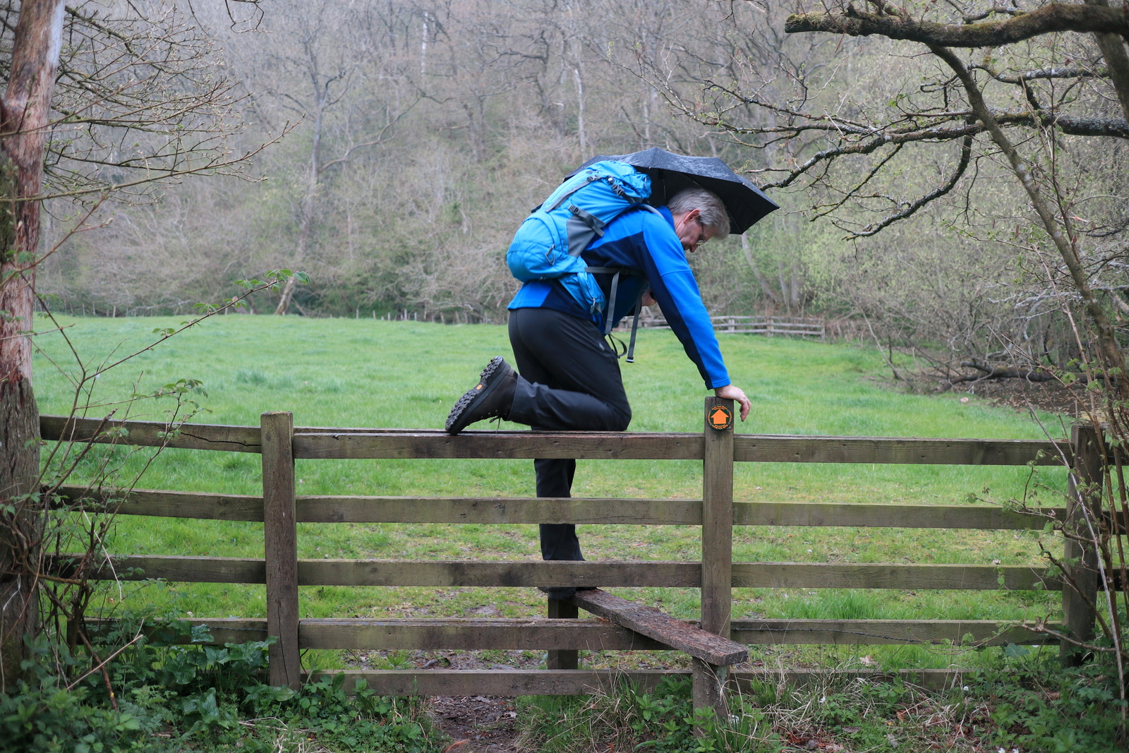
The sky grew steadily darker and we heard rumbles of thunder. As we entered Nettledale the storm broke and I quickly scrambled into waterproofs, a nuisance for just the last half hour of the walk.
 |
| We hear thunder... |
 |
| Descending into Nettledale |
At Nettle Dale we parted from the Cleveland Way as we reached the lakes, turning left into a field and crossing to a gated bridge over a stream. We now had a steep climb out of Nettle Dale through Calister Wood, until we reached fields on the other side.
The rain lashed down as we followed our path across these field boundaries back to Old Byland, first descending and crossing Low Gill's woods once again.
 |
| Walking field boundaries |
 |
| Old Byland appears in the distance |
 |
| Ample Bosom.com always makes us chuckle |
 |
| The storm passes Old Byland |