8 miles Fine and dry
Boris has finally allowed us to meet and walk with someone from another household thus freeing Clive and I to drive (in separate cars) to Clay Bank Car Park for a 'socially distanced' Tom Scott Burns walk.
 |
| Today's walk from The Walker's Guide to the Cleveland Hills |
We parked at the top of Clay Bank and crossed the road to climb Hasty Bank. Instead of following the Cleveland Way route to the escarpment we branched left just after the gate, on to a small path above the farm track to Hasty Bank Farm. This winds its way upwards, eventually reaching the Old Quarry, shown on the map above.
 |
| "Hey, two metres if you don't mind!" |
 |
| Climbing Hasty Bank towards the Old Quarry |
 |
| Looking back towards the car park |
 |
| The Old Quarry |
 |
| ... and The Lady of Bilsdale |
 |
| The Lady's view of Bilsdale |
Tom Scott Burns describes the ancient carving of a woman's head as 'the enigmatic face of a lady carved on a rock wall who gazes eternally down into Bilsdale'.
Leaving the Lady we followed the moor path which eventually leads to the Wainstones, but were amused to come across a large strangely shaped rock which had obviously reminded someone of a head (dinosaur?), so they have added an eye and teeth. This doesn't look freshly done and we must have passed it many times without noticing.
 |
| Following the moor path |
 |
| A strange head? |
We picked our way carefully through the rocks of the Wainstones before descending into Garfitts Gap and climbing onto Cold Moor.
TSB explains that the name Wainstones is believed to derive from the Saxon 'wanian' - to howl, and that the naming of the stones means 'stones of lamentation'.
 |
| Approaching The Wainstones |
 |
| Picking a route through the rocks |
 |
| Climbing Cold Moor |
We walked along the summit of Cold Moor (1318') for 2.5 miles with fine views towards the Pennines in the west and Roseberry Topping and Easby Moor to the east.
 |
| Cold Moor ridge walk |
 |
| Starting to descend |
 |
| Bilsdale Hall and Seave Green below |
Eventually we took a clear fork to the left, taking us gently down to the village of Chop Gate. This track is known as Cold Moor Lane and we passed through a gate where the path becomes a hollow lane. TSB says that it is possible that this passageway was established by prehistoric man and has continued in use throughout history to the present day.
 |
| A pheasant notes our passing by |
 |
| The gate to Cold Moor Lane |
 |
| A hollow lane |
Hollow lanes are ancient pathways which have been hollowed out over time, very often where peat or turf was dragged down from the moor on sledges. Below is a photograph of Thomas Leckenby of Mount House Farm Bilsdale, leading his sledge of turves off Urra Moor in the early 1930s. The strips of cut turf were dried in heaps called 'rooks' and were used as fuel and for building walls.
 |
| Thomas Leckenby on Urra Moor, from 'Round and About the North Yorkshire Moors' |
I have recently got hold of Round and About the North Yorkshire Moors by Tom Scott Burns and Martin Rigg, Volumes 1 and 2. The books are out of print but I got them from Ebay for about £5 each and they are full of local history and photographs such as the above.
Cold Moor Lane led us to Chop Gate where we emerged at the old Wesleyan Chapel that is almost hidden between houses.
 |
| Emerging at Chop Gate alongside the Wesleyan Chapel |
 |
| The old chapel now appears deserted |
TSB says the reason for the strange location of the chapel is that the landowner, Lord Feversham, was C of E and totally against a non-conformist church being established in the dale. However a local shop keeper sold the Methodists this plot of land and the chapel was built in 1858. It reportedly contains an interesting harmonium (pump organ) but its doors were firmly locked today and the building appears empty. A couple of years ago the chapel was for sale but the sale does not seem to have taken place and the building and grounds appear to be deteriorating.
TSB says that the name Chop Gate is thought to be derived from the old Scandinavian term kaup meaning pedlar and with a number of pannier tracks converging on the village it must have been like a market place in times gone by.
 |
| Seave Green |
 |
| We follow the B1257 to a turning.. |
 |
| ... into Seave Green |
 |
| Approaching Bilsdale Hall |
We turned left into the B1257 and walked along to Seave Green whose name is thought to derive from its owner back in 1301, Nicholas del Seves. Here we crossed the road to the tarmac track to Bilsdale Hall, where we turned left away from TSB's map, in order to walk to St Hilda's Church just a couple of hundred yards away, this being a good spot to pause for coffee and scones.
 |
| Recently re-roofed St Hilda's church |
 |
| Coffee and scones at St Hilda's |
 |
| "Scones?" |
St Hilda's is on the site of an ancient church and was rebuilt in 1851 in the shape and style of the original church.
There were plenty of bluebells in the churchyard, although past their best, and we enjoyed our coffee with fine views of the Bilsdale valley. Unfortunately the church was locked but there were several old gravestones to decipher before moving on.
 |
| This was in the porch, perhaps to frighten off swallows and housemartins from nesting there |
 |
| A Perpetuate, very neatly inscribed but difficult to decipher |
 |
| "Sleep blest creature in thy urn, Our sobs and tears cannot wake thee, Weel stay untill it be our turn" |

Our break over, we wandered back to Baysdale Hall and re-joined TSB's route to begin the steep climb up to follow the alternative dotted path on the map above, going steeply uphill to reach Urra Moor.
 |
| Bluebells behind Bilsdale Hall |
 |
| Climbing onto Urra Moor |
 |
| Looking back to Bilsdale Hall |
 |
| Moor gate |
After pausing to admire the view and regain our breath we turned left and followed the ridge north for a couple of miles, with a succession of sweeping views of Bilsdale below. As well as being on the ridge of the moor we noticed we were walking alongside the remains of an earthworks, shown clearly on TSB's map above. This earthworks stretches for 2.5 miles and its origin is forgotten, perhaps defensive, or it might have been an animal enclosure. It was known at one time as Cliff Dyke, and a couple of centuries ago as Cromwell's Lines.
 |
| On Urra Moor |
 |
| The earthworks is to our left |
TSB mentions two witches who inhabited Bilsdale's moors, Peg Humphreys and her companion Alice Wood, who was said to take the form of a cat or hare.
We followed the earthworks and eventually came to a little valley where we crossed a stream known as Maiden Spring, at 1300'. The track and surrounding ground were very boggy at this point even though there has been little rain for weeks.
 |
| Arriving at Maiden Spring and picking the best route across boggy ground |
 |
| Maiden Spring, the Wainstones in the distance |
Leaving the beck we continued to follow the earthworks until rejoining the Cleveland Way track on Carr Ridge. We were interested to see a large boundary stone not mentioned by TSB, with 'Feversham 1848' on one side and 'Foulis' on the other.
 |
| Boundary stone |
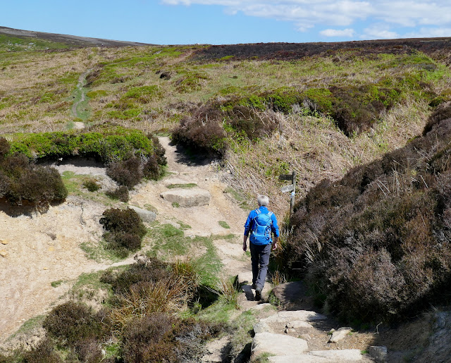
We continued along Carr Ridge before turning sharp left and walking steeply down to Haggs Gate where we rejoined the main road for a few yards to return to Clay Bank Car Park.
 |
| The houses of Urra below |
 |
| Descending to Haggs Gate |
 |
| Social Distancing at Haggs Gate |