Ladhill Gill and Bumper Castle from Fangdale Beck
7.5 miles Grey sky, dry and cool
Tom Scott Burns tells us that Fangdale comes from the personal Scandinavian name Fangi or Fangulf, giving 'Fangi's Valley'. Leaving the car we crossed the beck by the little bridge and walked past the old Wesleyan Chapel, now converted into a private house.
We followed the tarmac lane around to a farm with an old wooden sign above the door inscribed Malkin Bower (Matilda's or Maude's dwelling), continuing straight past the farm with the tarmac changing to a grassy track.

Clive and I have seen a brass memorial plaque to william Mansell set into the floor of Hawnby Church and it would appear that he was staying at Bumper Castle at the time of his death. It would be interesting to know what befell him.


We gradually descended past some old workings to reach Weatherhouse Beck and here we left the sandy track and headed off on a faint track through the heather. We lost sight of the track occasionally but it didn't matter, we knew we had to head east to cross the upper reaches of Ladhill Gill where it joins with Wetherhouse Beck and we followed a line of very basic shooting shelters.

At the end of the shooting butts we came to a fence which we followed uphill to reach the top of the moor and another sandy track. We then followed this track south along the ridge of the moor for a few hundred yards until we came to poles, indicating more shooting butts. The top of these poles have been painted white and we followed their line downhill towards Bilsdale, this is the dotted line going east off Shaw Side on the map above.
We turned off the B1257 Bilsdale Road at the Fangdale sign and drove past a green telephone kiosk just past the junction. This unusual green telephone box was installed in the 1930s and was green at the request of Lord Feversham, who wanted it to blend in with its surroundings. In 1992 a battle was fought over this when British Telecom, without any consultation, removed it and installed one of the new 'shower cubicle' type boxes, not realising they had removed a Grade II listed building. To the delight of the locals they were fined £3000 and ordered to restore the original.
We drove into the village and parked our cars at the side of the road opposite the old school house.
 |
| Today's walk from The Walker's Guide to the Cleveland Hills |
 |
| Fangdale Telephone Box |
Tom Scott Burns tells us that Fangdale comes from the personal Scandinavian name Fangi or Fangulf, giving 'Fangi's Valley'. Leaving the car we crossed the beck by the little bridge and walked past the old Wesleyan Chapel, now converted into a private house.
 |
| House in Fangdale |
 |
| Cross Fangdale Beck... |
 |
| ... and pass the converted chapel, now a house |
We followed the tarmac lane around to a farm with an old wooden sign above the door inscribed Malkin Bower (Matilda's or Maude's dwelling), continuing straight past the farm with the tarmac changing to a grassy track.
 |
| Looking back at Fangdale |
 |
| Approaching Malkin Bower |
 |
| Malkin Bower |

 |
| Weather vane at Malkin Bower |
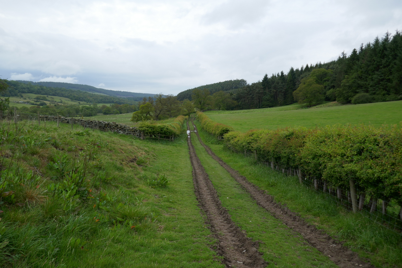
Once past the farm the tarmac vanishes and the track becomes a dirt path which we followed along the valley of Bilsdale, parallel to the road below us. The path drops down to the River Seph and became wetter and muddier before climbing gently up to Helm House.
 |
| Leaving the tarmac behind |
 |
 |
| Walking along Bilsdale, the B1257 over to the left |
 |
| Helm House, also a working garage |
 |
| Old tractor at Helm House |
Leaving Helm House we crossed sheep fields before arriving at Benhill Bank Plantation where the track climbs steadily past the trees to reach the moor gate.
 |
 |
| Approaching Benhill Bank Plantation |
 |
| Crossing sheep fields |
 |
| Up through the plantation |
At the top of the bank we turned right onto a tarmac road which leads to Wethercote Farm, but which we turned left to leave after a couple of hundred yards. We now walked across meadow fields, the path completely undetectable apart from the occasional yellow waymark. As we walked we were accompanied by curlews and noisy oyster catchers. We were obviously too near their broods. We paused to watch them in the adjacent field and were sorry to see one limping badly. As it flew off we saw it had something hanging from its foot; let's hope whatever it was fell off shortly after.
 |
| Leaving the farm road ... |
 |
| Our path invisible in the long grass |
 |
| Curlew |
 |
| Oyster Catcher |
 |
| The bird on the right has something caught on its left leg... |
 |
| ... which trails behind as it flys |
The last gate took us to the moor edge where the path becomes more distinct, leading from the moor gate. Looking down to our right we saw the ruins of Bumper Castle behind a grove of trees. TSB tells us that the castle was once part of the estate of the Duke of Buckingham and also that the monks of Rievaulx once wrought iron on Bumper Moor. We crossed the heather to join an old cart track that leads to the ruin.
 |
| Easterside Hill to our left |
 |
| Crossing the top of the moor |
 |
| Dropping down towards Bumper Castle |
 |
| Approaching the ruin |
There appears to be fire damage and the building is in an unsafe condition. We looked around and headed back to our track. I was interested to find out more about the ruin's original purpose and later made an internet search, which found this:
For a farm house Bumper Castle was well built with a slate roof which would have to have been imported into the dale. There's a date on the gable of 1722. It is said that in the 18c the 3rd Duke of Rutland and the Marquis of Granby stayed here for the shooting. So the house may have been built as a shooting lodge.
From the Hawnby parish register in 1794 William Douglas, Bumper Castle, batchelor, 74, was buried "when there was the greatest depth of snow ever known in memory". In 1801 Samuel Tiplady was christened, son of Samuel (gamekeeper) and Dillery Tiplady, Bumper Castle. In 1811 William Mansell, gamekeeper to the Duke of Rutland, died at Bumper Castle aged 38.
From the Hawnby parish register in 1794 William Douglas, Bumper Castle, batchelor, 74, was buried "when there was the greatest depth of snow ever known in memory". In 1801 Samuel Tiplady was christened, son of Samuel (gamekeeper) and Dillery Tiplady, Bumper Castle. In 1811 William Mansell, gamekeeper to the Duke of Rutland, died at Bumper Castle aged 38.
From the mid 19c it seems to have been used as a farm. According to the 1851 census Richard Hilbert was farming 127 acres here. In 1881 and 91 Thomas Wrathall was resident. In 1920 Mrs. Clark, widow of Noah Clark was paying £25 rent.
TSB reports in The Walker's Guide to the Cleveland Hills that Bumper Castle was owned by George Villiers, the notorious second Duke of Buckingham, who, when he died in 1687, had squandered £50,000 a year and had become an outcast from society. There is no record of him actually visiting the building however.
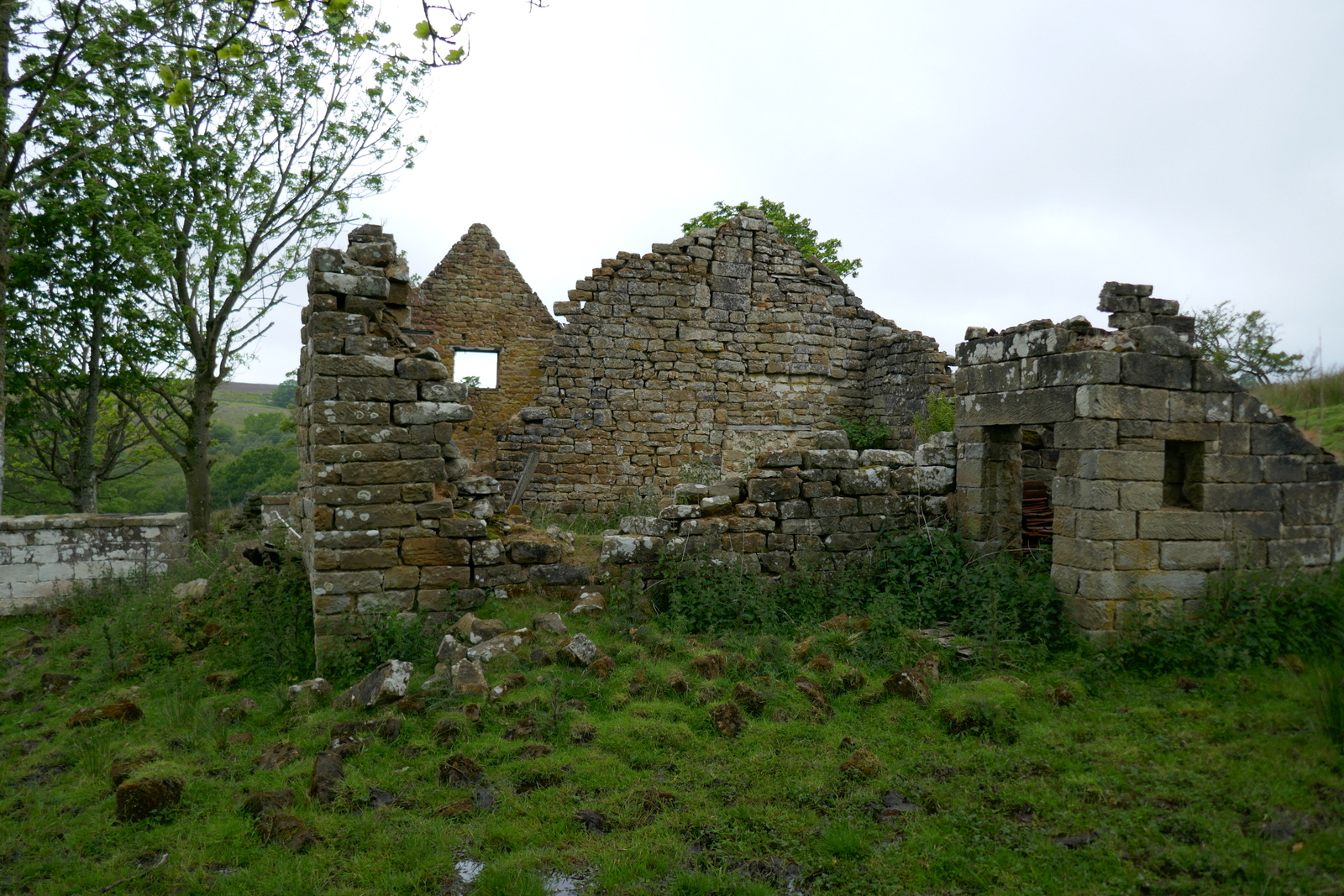 |
| Bumper Castle |


Satisfied that we had seen all there is to see at Bumper Castle we set off along a muddy track to eventually rejoin our original path, which we followed down to Ladhill Gill Beck.
 |
| A curlew runs off as we approach |
 |
| Sportsmans Hall on the hill opposite |

 |
| Walking down to Ladhill Gill |
 |
 |
| We sit by Ladhill Gill to enjoy our coffee |
Reaching the stream we sat on some convenient rocks near the bridge and enjoyed our coffee and scones, sheltered from the breeze.
 |
| Ladhill Gill from our coffee spot |
We crossed the bridge and climbed steeply up the opposite side of the valley, turning left to join a track that led us above Sportsmans Hall. TSB suggests that this name probably has something to do with Bumper Castle and the Duke's sporting pastimes.
 |
| Over Ladhill Gill |
 |
| Looking back as we climb towards Sportsmans Hall |
We walked towards the Hawnby road and turned right along a vehicle access track at the moor gate. The track divides twice and on each occasion we took the right fork, heading towards Bilsdale mast which was obscured from view in today's misty weather.
 |
| A bit bleak for June |

 |
| Keep bearing right at each junction |
 |
| Following the line of shooting stands |
 |
| Weatherhouse Beck |
 |
| Keep going until the wall is reached |
 |
| Someone had lots of blue paint to spare |
 |
| Blue sheep make a slightly surreal scene |
This part of the walk is a bit hit and miss, the moor track being either non-existent or overgrown and very boggy. We turned right at the wall and walked on, eventually reaching a line of new shooting butts which we followed.
We always check these new shooting butts as they have no egress for any small animal which may fall in. As usual we saw dead toads and mice that had been trapped, but nothing we could rescue.
 |
| Temporary water trough from our dry Spring, half a plastic container weighed down with rocks and filled with water |
 |
| Follow the shooting butts towards the trees |
 |
| Clive can get out.. |
 |
| .. but mice and frogs can't |

 |
| The trees of Helm House Wood |
 |
| We start to descend |
 |
| Throught the gate to a hollow lane |
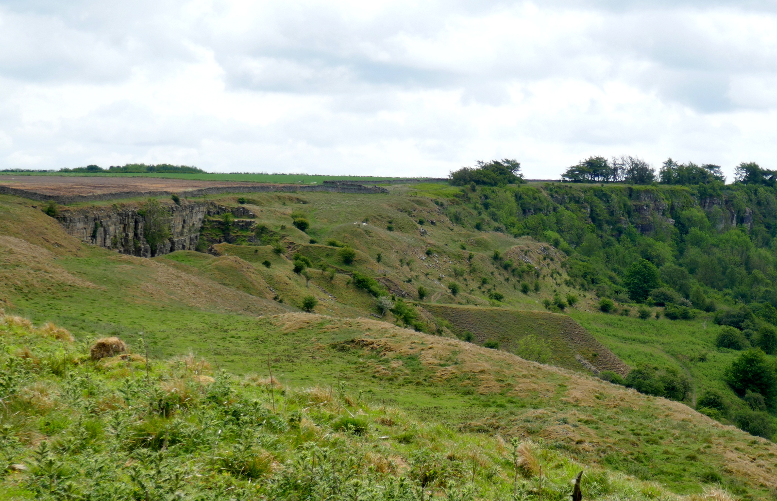
We went through the moor gate and by some old quarries and then descended via the usual hollow way to emerge at Malkin Bower where we turned left to return to Fangdale.
 |
| Quarry workings |
 |
| Hollow Way |
 |
| Fangdale |
 |
| Malkin Bower |
 |
| Residents at Malkin Bower |
We crossed the bridge to Fangdale and were wondering if an empty house, falling into disrepair, was the village hall when a passing local couple was able to inform us that it was, indeed, the hall and prior to that had been the village school. They explained that the ownership of the old building was complicated, it having been left to the residents of Fangdale, and so sadly could not easily be sold for renovation.
 |
| The old village hall |
This only left the return to our cars after enjoying one of our favourite Tom Scott Burns walks.


