7 miles Fine and cold
We approached Nunnington on the B1257 from Helmsley and parked in a lay-by opposite Nunnington Hall, next to the river.
 |
| Today's walk from The Walker's Guide to the Hambleton Hills |
We walked over the bridge and set off on the most southerly of the walks in Tom Scott Burns' The Walker's Guide to the Hambleton Hills. It was a fine day but we walked straight into a chilly breeze and coats were needed.
Tom Scott Burns explains that the name Nunnington is derived from the old English personal name Nunna rather than from the Saxon nunnery that once stood where the hall now stands.
We walked through the village admiring the neat streets, laid out in a grid formation, until we reached the last house where we left the road to continue straight ahead along a path next to the river.
 |
| The Old School House |
 |
| Percy's weather vane on the studio roof (see below) |
 |
| The boxes were full of paperbacks and DVDs, free to a good home |
 |
| Clive checks out the rustic goods |
 |
| The village streets run off to our left |
 |
| Eventually we leave the road and continue by the river |
As we passed Nunnington studios we paused to admire the weather vane which we were once told is a life sized memorial to a much loved dog, a spaniel called Percy. Apparently the spaniel was a real character who led a very independent life, doing exactly what he pleased. At the other end of the village is a small copse of trees named after the dog and known as Percy's Plantation.
Leaving Nunnington at Bridge Cottage we walked for about a mile alongside the river until we crossed a small bridge over a beck. Here we turned sharp left and walked away from the river into fields.
 |
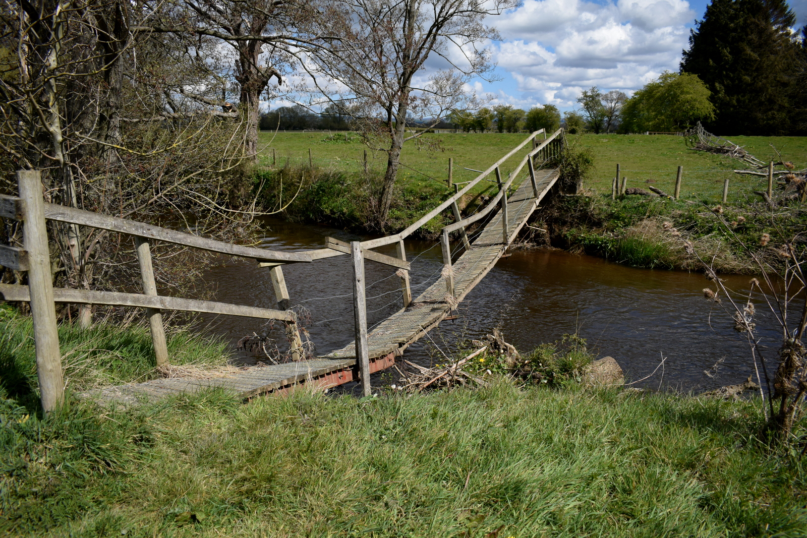
| The river needs some management |
 |
| ... as so do some of the bridges |
 |
Field paths towards Stonegrave
|
 |
| We turn away from the river |
We followed the field path, known as High Moor Lane, crossing a tarmac lane before continuing on through fields to reach the B1257, where we emerged just above the village of Stonegrave, home of England's smallest minster.
 |
| We are impressed by a fine display of Cowslips on High Moor Lane |
 |
| Entering Stonegrave |
 |
| We cross fields to take the back door route to the Minster |
TSB explains that Stonegrave is derived from steinn-gryfia meaning a 'stone cleft', and there were important quarries of building stone here in the Middle Ages.
We entered the churchyard by a stile and crossed to the Minster where we took advantage of a bench to enjoy our coffee and scones, before exploring the old building.
 |
| Views of Stonegrave Minster |
 |
| Finely carved stone medieval heads are seen all round the building |
 |
| Stonegrave Minster |
 |
| A Celtic Cross just inside the entrance |
 |
| Side window |
 |
| Altar window |
Leaving the Minster we walked past the old manor house and crossed back over the Malton road to join a grassy path that veers left from the road to climb Caulkleys Bank. Here we saw a fine display of bluebells in Caulkleys Wood.
The name Caulkleys is a corruption of 'Chalk Lands' and in The Walker's Guide to the Hambleton Hills one reads that the terrain here consists mainly of rich deposits of reef limestones and detritus known as Coral Rag, all pointing to the marine origins of this hillside.
 |
| Clive admires the old Manor and tries to identify the magnificent espaliered tree |
 |
| Climbing Caulkleys Bank |
 |
| Bluebells in Caulkleys Wood |
 |
| The roofs of Stonegrave below |
Reaching the top of Caulkleys Bank we walked along the grassy ridge and after passing Caulkleys Wood we had fine views in all directions.
We followed the ridge walk for about 2.5 miles, at its highest point it is marked by a trig point. TSB says that no less than 22 towns, villages and hamlets and sixteen churches can be seen from here.
 |
| Alongside Caulkleys Wood |
 |
| The Trig Point |
Eventually our path began to lose height and we reached the houses of the tiny hamlet of West Ness, where we passed an old Wesleyan Chapel, long disused, and a freshly painted telephone box, still working and in service!
 |
| Old Chapel dated 1836 |
 |
| Good grief, it's working! |
 |
| Leaving the road at West Ness |
Just past a Wesleyan chapel built in 1836, the path leaves the road and rejoins the River Rye. As we walked we saw a movement next to a fencepole and on examination saw a mouse looking up at us. Perhaps a family but we didn't want to disturb it further.
 |
| Walking along the river bank |
 |
| What's that down there?! |
 |
| We can see you! |
We walked alongside the peaceful river for about 1.5 miles towards Mill Farm, disturbed only by a low flying helicopter which we presumed to be checking power cables.
 |
| Freshly sown potato crops make a nice pattern |
We soon reached Mill Farm, where TSB says there has been a mill since Domesday, the present one dating from 1875. Until 1950 the mill race powered a generator providing electricity for Nunnington Hall but it's looking a bit untidy today with flotsam and jetsam caught on the race.
 |
| Mill Farm |
 |
| The Old Mill |
 |
| Unused now, except by pigeons |
 |
| Trees stuck on the Mill Race |
Continuing alongside the river we reached Nunington Hall, where the screeching of peacocks could be heard. The Hall was owned by Sir Thomas Parr in the sixteenth century so it's possible that Catherine Parr, Henry VIII's last wife, played in the village as a child.
 |
| Sheep at Mill Farm |
 |
| The rear gates of Nunnington Hall |
 |
| Views of Nunnington Hall |
We crossed the bridge and returned to the cars. Sadly the village pub, The Royal Oak, has closed its doors to business, so a short drive was required to reach the rather bijou bar of Helmsley Brewery where we sat in the sun and discussed today's walk.
 |
| To TSB! |