A Tour of Raisdale from Chop Gate
7 miles Sunny with cold wind
We parked at Chop Gate Community Centre on the B1257 where there is space for many cars.
After booting up we climbed over a stile at the rear of the car park and followed a faint trail next to Raisdale Beck, across wet meadowland towards Cock Flat Farm.
 |
| Today's walk from The Walker's Guide to the Cleveland Hills |
 |
| Walking alongside Raisdale Beck |
 |
| Crossing tarmac just below Cock Flat Farm |
 |
| Some wet paths and fields today |
 |
| Cock Flat Farm |
The path stays well below Cock Flat Farm, which Tom Scott Burns says comes from Kyrkflat, denoting Church field. Fields close to the farm were crowded with heavily pregnant ewes probably brought down from the hills.
Our path wandered through several fields climbing above Raisdale (Reith's Valley, an old Norse personal name) and would make pleasant walking if it were a bit drier underfoot. As it was we slipped and slid quite a lot until we reached High West Cote Farm, where we had a splendid view west towards Raisdale Mill and the moorland col of Barker's Ridge.
 |
| Pregnant ewe at Cock Flat Farm |
 |
| Following field tracks above Raisdale |

 |
| Low West Cote Farm |
After High West Cote we dropped down to reach a tarmac lane just before well ordered Stone Intake Farm and immediately after passing the farm buildings we climbed a stile on our left and descended through a field to Raisdale Road.

 |
| Field tracks through Raisdale |
 |
| High West Cote Farm |
 |
| Fine views towards Barker's Ridge, top left |
 |
| Stone Intake Farm |
 |
| Troubled by cats at Stone Intake? |
 | |
| Weather vane at Stone Intake Farm |
 |
| Weather vane at Stone Intake Farm |
TSB notes that this section of Raisdale Road is referred to in the 1160 Rievaulx Charters as the 'Red Road', perhaps derived from the red shale in this area.
Leaving the field we turned right into Raisdale Road and followed it for a couple of hundred yards until we turned into the entrance of Raisdale Mill on our left.
We walked down to the old mill buildings, originally built by John Garbutt in 1849. These ceased operating in the 1920s.
 |
| The 'Red Road' or Raisdale Road |
 |
| Mill Buildings |

 |
| Raisdale Mill |
 |
| John Garbutt 1849 |
We turned left immediately after Raisdale Mill and entered what TSB describes as 'a most beautiful green lane which threads its way upwards to Barker's Ridge'. Sadly since Tom wrote his book in the 1980s motor cycles have pretty much ruined the green lane and it is badly rutted and difficult to negotiate.
We reached the top and Barker's Ridge, with the rocky outcrop of Barker's Crag to our right. We followed the ridge to pass by High House and continued climbing until we came to a gate on our left. Here we entered the gate and settled down behind a stone wall to enjoy our coffee and scones in the lea of the wall, with a fine view back of our walk so far.
 |
| The Green Lane - note the 'no motorcycles' sign |

 |
| The green lane becomes a 'hollow lane' |
 |
| Passing by High House Farm |
 |
| Up to Barker's Ridge |
 |
| Looking back at High House Farm |
 |
| Looking down to Raisdale from our coffee stop |
After coffee we resumed our walk along Barker's Ridge towards the head of Scugdale. We were now walking into a strong south westerly wind and talking became difficult.
The last time we did this walk, in Summer 2015, the heather was blooming and the bees were droning but in today's conditions it was all we could do to keep on our feet.
 |
| Climbing Barker's Ridge |
 |
| Barker's Crag |
 |
| 2.5 miles of moor track |
 |
| A 'surprise view' into Scugdale |
This stretch of the walk was not very interesting, other than a surprise view into Scugdale, and we trudged along the moor path into the wind for about 2.5 miles, until we came to a small copse of forestry trees.
 |
| A jet trainer zooms up Scugdale |
 |
| No dogs? |
 |
| A shower approaches |
Here we came to a junction where we turned left and walked down to Head House, no longer the ruin described by TSB. Considerable care has been taken to restore parts of Head House but it is still work in progress. We found it unlocked and entered for a look round just as a shower arrived.
 |
| Approaching isolated Head House |
 |
| A couple of years ago we found this as a ruin... |
 |
| ... but someone has been to trouble and expense |
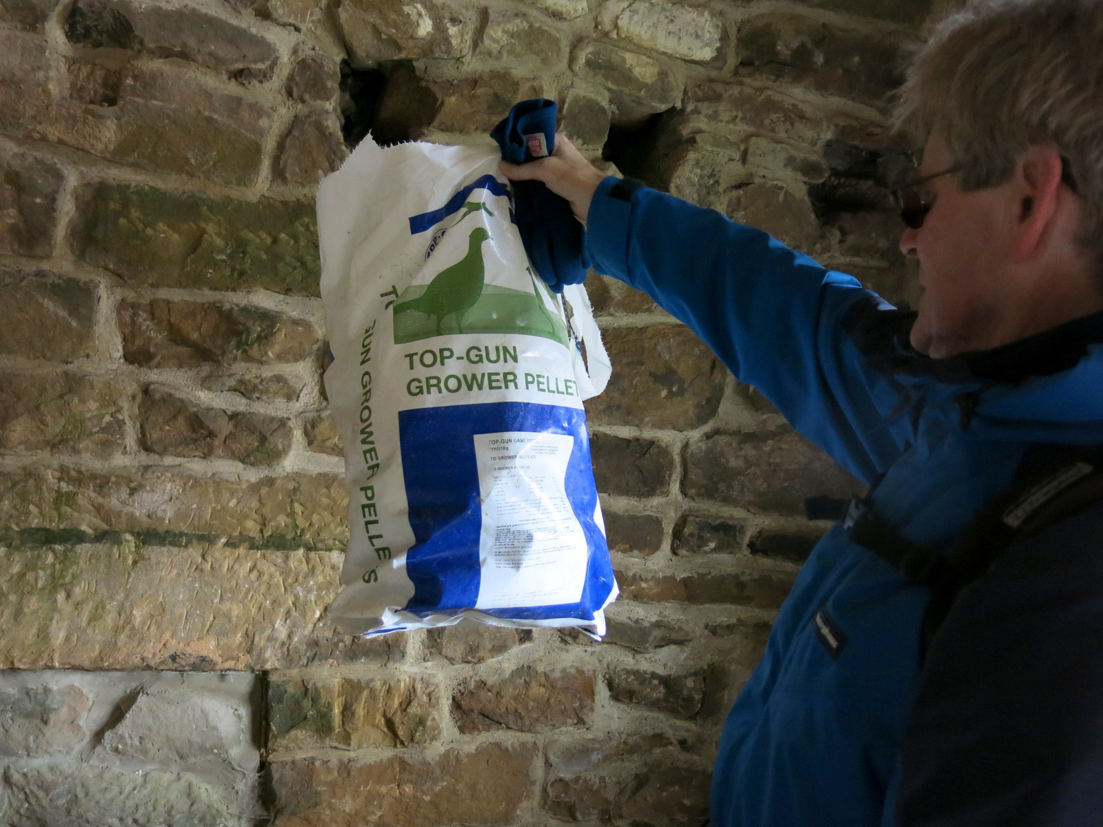 |
| A dry place to store feed |
 |
| Still work to be done |
 |
| The view from Head House |
We left Head House and soon came to Arnsgill, but just before the stream we saw a strange contraption behind the wall which appeared to be a solar panel joined by cable to a black box some yards away. An examination of the label on the black box provided a surpising explanation, it was an earthquake detector! You don't see many of those on a walk on the moors.

 |
| Solar panel near Head House |
 |
| Hmm, what does that do? |
 |
| The surprising answer |
We dropped down to Arns Gill and crossed the stream with a jump. The path took us to an ancient rowan tree, fallen but still alive and described in the '80s as 'weathered' by TSB.
 |
| The weathered rowan |
 |
| Clive puts up a grouse |
 |
| Someone has suffered an expensive loss |
A long climb up Trennet Bank took us to a memorial stone and a fine view down to Chop Gate. A number of hollow-ways descend Trennet Bank to Chop Gate, which TSB says were worn over many centuries by sledging turf from the moor tops for fuel.
 |
| Climbing Trennets Bank |
 |
| Memorial stone at top of Trennets Bank |
 |
| Chop Gate appears in the distance |
 |
| Chop Gate |
 |
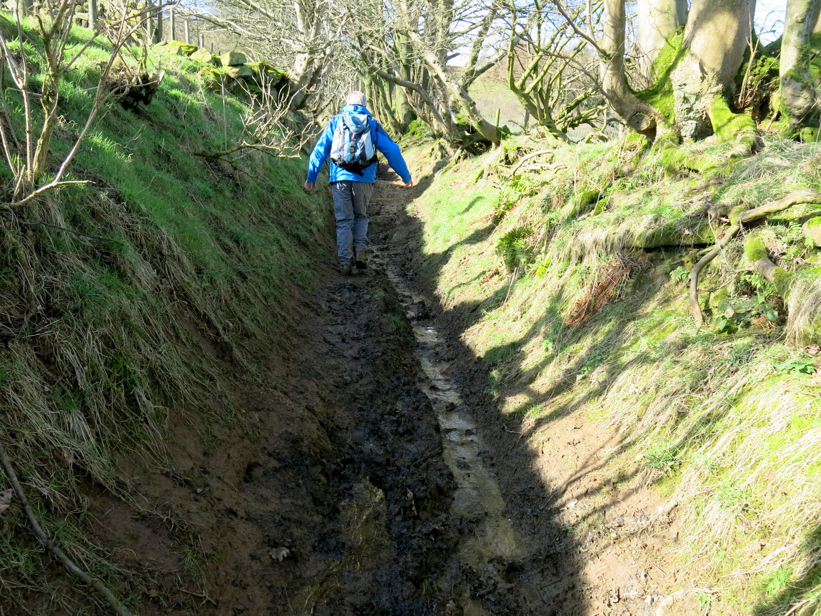
| Hollow-way |
We used the hollow-ways where possible and walked along their tops when they became too wet and muddy.
These turf tracks led us directly to the car park below, crossing Raisdale Beck by a wooden bridge, and we were soon discussing the day's walk over a pint of Timothy Taylors Landlord.
 |
| Chop Gate from our descent |
 |
| Hollow-way |
 |
| Stayed above this one |
 |
| Community Centre and car park below |