The lost village of Pinchinthorpe from Newton
7 miles Grey and cold
Clive is away so today I am supervised by my wife on this pleasant and undemanding walk that we last did a couple of years ago.
We parked in the lay-by at Newton under Roseberry and walked through the village past the King's Head pub to the pay and display car park at the other end of the village. Our track leaves the main road just before the car park and goes directly towards Roseberry Topping, which dominates the skyline.
 |
| Today's walk from The Walker's Guide to the Cleveland Hills |
 |
| Roseberry Topping from the car park |
The track to Roseberry Topping has been resurfaced since we last walked it and is much improved.
We followed the path up to Roseberry Common then left towards Bousdale Hill. Keeping left we walked towards a conifer wood in the distance. This is Hanging Stone Wood and we turned left into a field just as we reached it.
 |
| Good new surface on what was once a very muddy track |
 |
| Walking towards Hanging Stone Wood |
 |
| Looking back towards Newton under Roseberry |
 |
| We turn left away from the Topping |
 |
| Bousdale Hill |
 |
| New memorial bench |
 |
| Nearing Hanging Stone Wood |
We turned left before reaching Bousdale Hill and walked along a broad footpath until we came to a gate on our left, which we passed through fields.
Walking across a couple of fields led us to Bousdale Farm and we went by the front of the buildings which appear unoccupied while renovations are being carried out. These renovations seem to be long term and little has changed since spring of 2016 when we last passed by.
Tom Scott Burns explains that Bousdale Farm was built to house Sir Joseph Pease's thoroughbred hunters. There was no water supply so Pease introduced a syphon system using a huge boiler which had done service in the first steamship that berthed in the Tees.
The old stables are an interesting design and it looks as if they are also being converted, perhaps into holiday homes.
 |
| Indistinct footpath across fields |
 |
| Hanging Stone Woods |
 |
| There will be changes at Bousdale Farm |
 |
| The old stable block |
 |
| Large stable block undergoing major works |
 |
| Leaving the farm across fields |
After the farm the path crosses a field before following the field edge until a forestry track is reached. This gently descends to meet the old disused railway track to Pinchinthorpe station.
 |
| Guisborough over to our right |
 |
| Through the gate into Pinchinthorpe Woods |
 |
| Activity Trail for kids in Pinchinthorpe Woods |
 |
| Lots of wood carvings to see |
 |
| ... and some unusual sights among the trees |
 |
| We meet a strange man in the woods... (only kidding Graham!) |
Pinchinthorpe is an old village and TSB relates that the Domesday Book says Ulchil possessed a manor of 3 carucates, which is the amount of land that could be ploughed in a year using one team, between 60 and 180 acres depending on soil quality, at Torpe. The village's present name comes from the Norman family name of Pinciun who held the land in the 12th century.
We stopped at the cafe here for coffee and scones.
 |
| Pinchinthorpe Station |
 |
| Pirate leads Carole into the cafe |
Warmed through and fully refreshed we set off once more along the disused railway track that once took trains from Middlesbrough to Guisborough. We passed by the old station and as we walked along the track had a fine view to Roseberry Topping on our left.

 |
| The Codhill Kibble |
 |
| Old station building |
 |
| Newer station buildings |
A straight walk for two miles brought us to the end of the old railway walkway and we turned left up some steps into fields.
Now to our right was the Middlesbrough to Whitby railway line and to our left the buildings of Spite Hall Farm. TSB says that this farm was well named because it was built by a younger son to obstruct the view of his elder brother who had inherited Pinchinthorpe Hall, across the fields.
We walked parallel to the railway for a couple of fields before following a diagonal path across a field to reach a bridge over Nunthorpe Stell.
 |
| The old railway track from Pinchinthorpe to Nunthorpe |
 |
| Turn left at the sign into fields |
 |
| A diagonal path across a field... |
 |
| ... to a bridge over Nunthorpe Stell |
 |
| Nunthorpe Stell |
The word Stell is used locally to describe man made ditches used to drain marshy ground and an internet search finds it probably has Saxon roots:
North German: topographic name for someone who lived near a marsh, from an old dialect word stel ‘bog’, where the land was built up on mudflats (behind the dyke) for cattle grazing.
After crossing the bridge we made our way over a field to Snow Hall Farm. TSB thinks this unusual name might relate to Ann Snowdon who lived there in the 1890s.
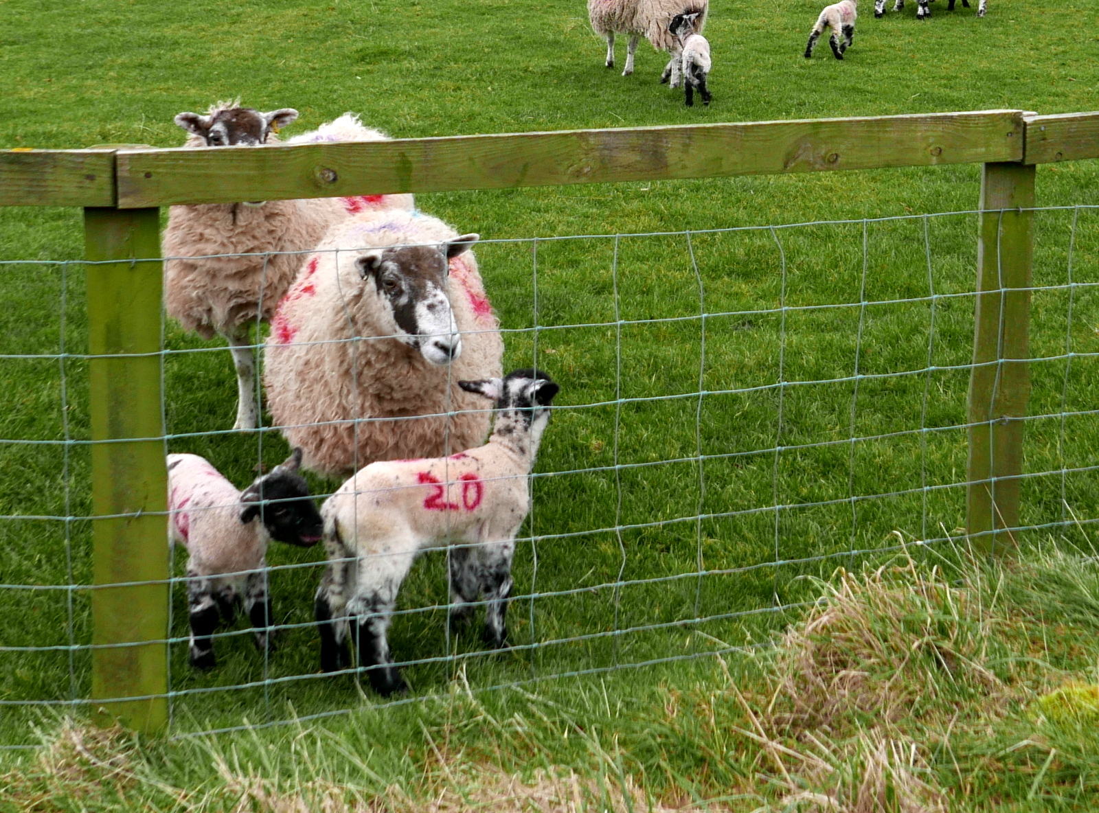
Approaching the farm we were surprised and delighted to see our first lambs of the year.
 |
| Snow Hall Farm |
 |
| January lambs |
 |
| Pond at Snow Hall Farm |
The lane quickly leads from Snow Hall Farm to Newton and the ancient St Oswald's Church. We had a look around the walls of this interesting old building and admired the Anglo-Saxon carved stone set in the tower of the church showing a dragon and some sort of quadruped. Tom Scott Burns says that this stone was actually described in an eleventh century book called 'Bestiaries'.
TSB notes that until the dissolution of the monasteries this church was run by the monks at Whitby but was made a parish in 1539.
There were some ancient gravestones, some too old to read but we were disappointed to find the church locked.
 |
| Newton under Roseberry |
 |
| St Oswald's Church, Newton |
 |
| Ancient stone coffin |
 |
| Saxon Carving (see below) |
 |
| Owl box at Newton under Roseberry |
Leaving the church we turned left at the road to walk back to the lay by and our car.


No comments:
Post a Comment