Balk and Bagby from Sutton Village
7 miles Sun and showers
This is a level, easy walk that we thought we would re-visit as we haven't done it for a couple of years. The second half of the walk has few way marks, so keeping an eye on the map is recommended.
We drove from the A19 along the A170 into Sutton-under-Whitestonecliffe and parked in the Whitestonecliffe Inn Car Park. Tom Scott Burns tells us that hikers are welcome to use the inn's car park and twenty five years later the present innkeeper confirmed that is still the case. We promised we would be in for a pint after the walk.
 |
| Today's walk from The Walker's Guide to the Hambleton Hills |
 |
| The Whitestonecliffe Inn |
 |
| View from the car park of the Whitestonecliffe Inn |
We walked from the pub and turned right onto the A170 which we followed through the village, spotting several interesting weather vanes.
 |
| Weather vanes in Sutton-under-Whitestonecliffe |
This is a busy road and care must be taken after the pavement peters out. We crossed the bridge over Sutton Beck and quickly turned left at a sign, leaving the traffic behind.
Our route led us straight across a field to a stile alongside the town's sewage works, then on through more fields next to Sutton Beck, until it emerged beyond a static caravan park at the tiny hamlet of Balk.
 |
| Leaving the A170 behind |
 |
| .. to walk through tranquil fields |
 |
| We reach a caravan park |
 |
| Narrow path into Balk |
TSB tells us that Balk originates in the Old English 'balca' or 'bank' and would have applied to the ridge of land between Balk Beck and Hood Beck.
We walkied into Balk and admired its three storey mill, now renovated into housing, and opposite it the old mill buildings which have been taken over by a furniture manufacturer.
 |
| Balk |
 |
| The Old Mill at Balk |

We joined the road at Balk and remained on it, heading west until we reached the larger village of Bagby where we turned left onto a track near new housing just before we entered the village. This track would be easy to miss as the sign has been obscured by undergrowth.
 |
| Turn into track just past the high fence |
 |
| Obscured sign! |
We headed south along this track, towards Thirkleby. We passed by another caravan park and the grounds of Thirkleby Hall before emerging on to the road at Thirkleby, by the picturesque old school house whose clock was accurate to the minute.
 |
| Back into fields |
 |
| A cool spot |
 |
| Glider and tow plane drift overhead |
 |
| The old school house at Thirkleby |
 |
| Dahlias in Thirkleby |
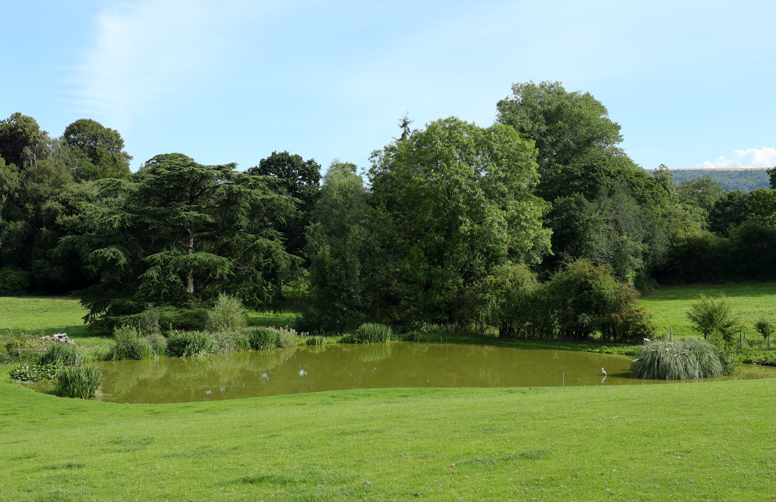
We walked out of the village and came to the church of All Saints which is situated outside the village at the end of a narrow lane. We decided it was now time for our coffee and scones and chose the most comfortable looking of several benches placed around the church, to relax for our break.
 |
| Our first view of isolated All Saints Church |
 |
| Walking down the narrow church lane |
 |
| All Saints, Thirkleby |
 |
| The view of All Saints from our bench |
Replete, we walked over to the church and found it open.
All Saints is nicely kept and interesting to walk round. It was bigger than one would expect for the size of the village, with fine stained glass windows picturing St George and St Martin. We left the building and went into the graveyard where the eroded inscriptions on some of the gravestones reminded us of how fragile life was for our ancestors.
 |
| Looking towards the altar |
 |
| Looking back towards the organ and rear of church |
 |
| Altar window |
 |
| Side window |
 |
| "Weep not dear friend, my course was run. It was the Lord, His will be done. In love she lived, in peace she died. Her life was asked, but God denied" |
Leaving the church we walked back to the road then crossed straight over to join a field path leading to a footbridge, then quickly on to the Little Thirkleby Road, where we turned left to walk parallel with the route we had followed into Thirkleby, this time to the right of Thirkleby Beck.
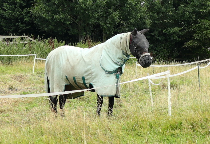
We saw a couple of horses in a field and were amused to see one of them in a mask that must have made eating very difficult. Was it to stop the horse eating or to protect it from flies?
 |
| Looking towards the White Horse of Kilburn from our coffee stop |
 |
| Walking through an orchard |
 |
| Looking fed up |
 |
| Towards the back of Thirkleby |
The next bit of the walk became rather tricky as there are no way-marks to be seen. We wondered if they have been removed by someone hostile to walkers? We walked along field edges using the map and our memories to ensure we stayed on footpaths. I would be happy to supply my GPS track on request.
 |
| No way marks and no paths |
 |
| Clive follows the faint track through the undergrowth |
 |
| A decent field margin to follow |
 |
| Walking towards Low Osgoodby Grange |
We reached the large farm of Low Osgoodby Grange and from Osgoodby Grange we followed the farm's track to the tarmac road where we turned left, heading back towards Balk. In the distance we could now see Whitestone Cliff.
 |
| Our path goes through an orchard at Low Osgoodby |
 |
| We reach tarmac next to this sign |
 |
| A sudden heavy shower causes jackets to be donned |
 |
| Turning off the tarmac at Mount Pleasant Lane |
 |
| Whitestone Cliff appears in the distance |
We walked past Balk Wood Farm and reached the metaled lane that leads to the A170 and Sutton village.
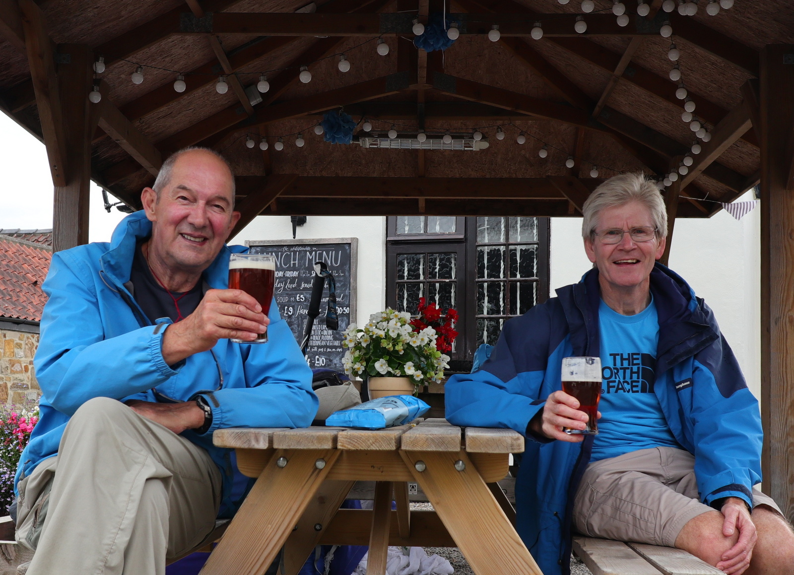
Our walk over, we paused only to collect a couple of pints from the bar at the Whitestonecliffe Inn, to fulfill our parking bargain.
 |
The end of the walk
|


No comments:
Post a Comment