The Hanging Stone and High Cliff from Gribdale Gate
8 miles Cold and wet
We've had heavy rain from Storm Dennis this week and field paths are sure to be sodden and boggy so we decided to do this moors walk where the ground should be better underfoot.
 |
| Today's walk from The Walker's Guide to the Cleveland Hills |
In The Walker's Guide to the Cleveland Hills, Tom Scott Burns relates a curious belief from a 19th century book called 'Customs of the North Riding' which states, 'Anyone who dares to stand near Gribdale Gate on New Year's Eve at midnight will see an old man pass through and then vanish'. But it's now late February and there are already other cars parked at Gribdale Gate and we changed into our boots as the rain lashed down. Leaving the car we followed the footpath steeply uphill onto Great Ayton Moor.
After reaching the moor the footpath follows a dry stone wall with views over to Roseberry Topping through the rain. We came to a gate at Newton Moor but turned right just before it. Tom Scott Burns mentions that this is the site of a chambered cairn, part of a complex Neolithic burial site dating from the Bronze Age, roughly 2300 - 800BC, a time when these moors were covered with mixed forest and woodland clearance was beginning to take place. By the Iron Age the site was treeless and cultivation was in progress. Following the Iron Age, heather had spread across the moor replacing farmland, so the moors have in fact looked much as they do now since that time.
We followed the distinct path through the remains of a conifer wood which TSB describes as 'a corridor of trees rinsed with the scent of pine.' No more, I'm afraid those trees have gone.
The path eventually led us to a surprise view of Hanging Stone, which is a massive block of sandstone that TSB believes may have been part of an old quarry. We needed to pick our steps with care as we descended past the stone as the heavy rain was now starting to make the path slippery.
The track falls steeply from the Hanging Stone and is treacherously slippery, so we took our time descending through the trees to briefly join a connecting track through Hutton Lowcross Woods, then turning left to again descend to reach Hutton village road. Turning right along the road we entered Hutton village, which was built as a model village during ironstone mining of the 1850s. At the end of the village our track climbed towards Bold Venture Gill.
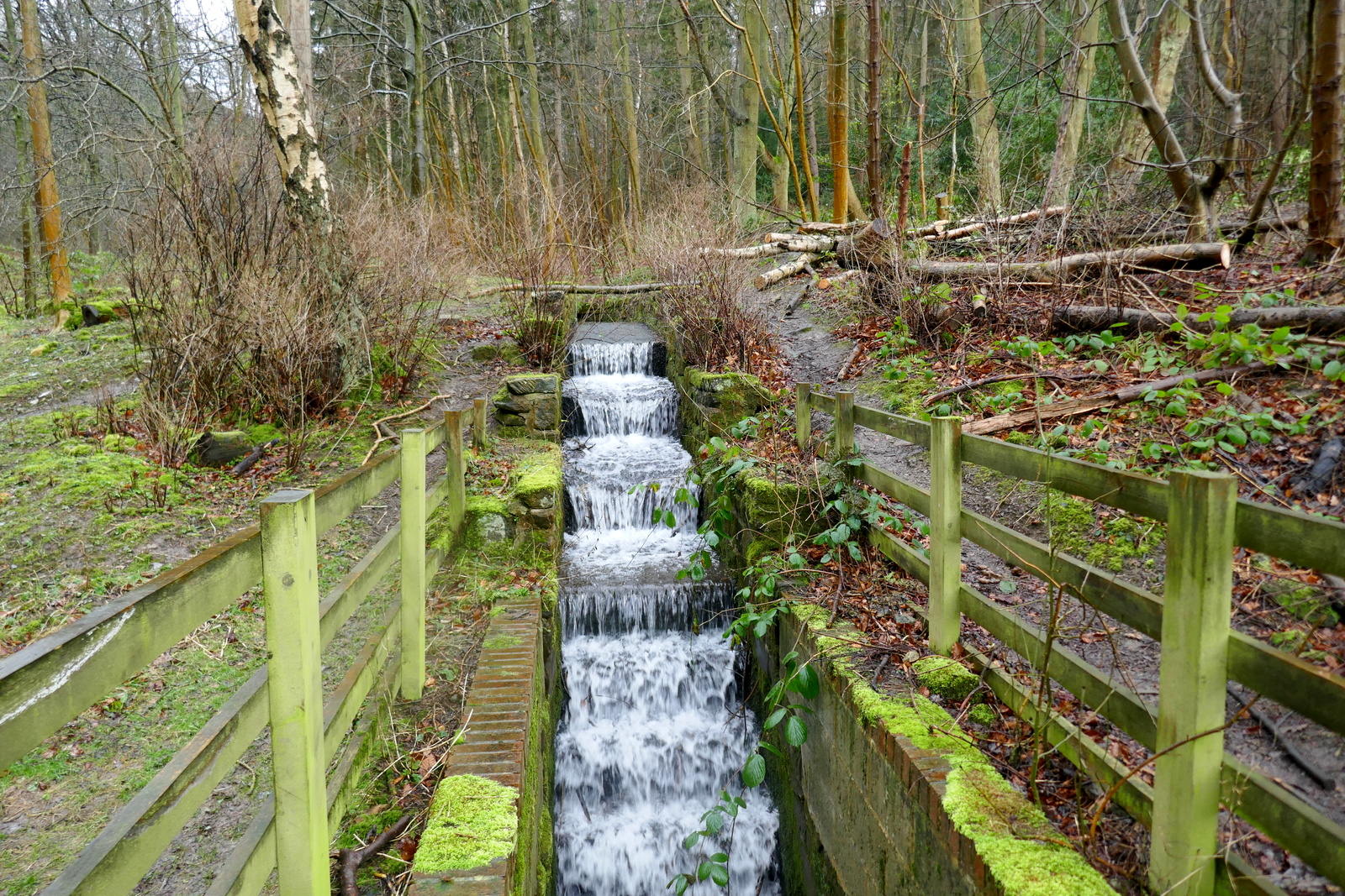
We stayed on this track ignoring all turn-offs and noted recent forestry work. No longer are there 'endless rows of conifers' as described in 'The Walker's Guide to the Cleveland Hills'. A convenient bench near to the nab was too exposed to the strong westerly wind for our coffee stop so we continued under the nab on to Guisborough Moor. We followed our path alongside a dry stone wall and came to a well placed bench, out of the wind if not the rain. Hot coffee and scones were very welcome. As we ate the weather brightened and the rain stopped.
 |
| Straight out of the car and straight uphill |
 |
| A bit of dolomite makes the path easier |
After reaching the moor the footpath follows a dry stone wall with views over to Roseberry Topping through the rain. We came to a gate at Newton Moor but turned right just before it. Tom Scott Burns mentions that this is the site of a chambered cairn, part of a complex Neolithic burial site dating from the Bronze Age, roughly 2300 - 800BC, a time when these moors were covered with mixed forest and woodland clearance was beginning to take place. By the Iron Age the site was treeless and cultivation was in progress. Following the Iron Age, heather had spread across the moor replacing farmland, so the moors have in fact looked much as they do now since that time.
 |
| Roseberry from Great Ayton Moor |
 |
| A corridor of trees no more |
We followed the distinct path through the remains of a conifer wood which TSB describes as 'a corridor of trees rinsed with the scent of pine.' No more, I'm afraid those trees have gone.
The path eventually led us to a surprise view of Hanging Stone, which is a massive block of sandstone that TSB believes may have been part of an old quarry. We needed to pick our steps with care as we descended past the stone as the heavy rain was now starting to make the path slippery.
 |
| Walking through some self seeded spruce brings us to... |
 |
| ...Hanging Stone and its view of Guisborough |
 |
| We climb aboard for a better view |
 |
| Looking over to High Cliff from Hanging Stone |
 |
| A slippery descent |
The track falls steeply from the Hanging Stone and is treacherously slippery, so we took our time descending through the trees to briefly join a connecting track through Hutton Lowcross Woods, then turning left to again descend to reach Hutton village road. Turning right along the road we entered Hutton village, which was built as a model village during ironstone mining of the 1850s. At the end of the village our track climbed towards Bold Venture Gill.
 |
| Hutton Lowcross Woods |
 |
| Slippery when wet! |
 |
| In 2015 we admire this 1973 Rover V8 in Hutton Village |
 |
| We are surprised to see the same car today, still obviously in daily use! |
 |
| Once these were miners' cottages but now smart private homes |
 |
| Eco Home as we leave Hutton Village |
 |
| Bold Venture Gill disappears into a culvert |
We stayed on this track ignoring all turn-offs and noted recent forestry work. No longer are there 'endless rows of conifers' as described in 'The Walker's Guide to the Cleveland Hills'. A convenient bench near to the nab was too exposed to the strong westerly wind for our coffee stop so we continued under the nab on to Guisborough Moor. We followed our path alongside a dry stone wall and came to a well placed bench, out of the wind if not the rain. Hot coffee and scones were very welcome. As we ate the weather brightened and the rain stopped.
 |
| A steady climb to High Cliff |
 |
| High Cliff appears ahead |
 |
| Following the moor path below High Cliff |
 |
| A bench! Time for coffee. |
 |
| Scones in the rain |
Our walk now led us on to the open moor where we looked down to High Cliff Farm. We then strode across Codhill Heights, 'Cod' being derived from the Viking word 'Keld', which means 'spring'. As we crossed the moor rain flurries stung our faces as we walked into the strong wind. On our left we looked down into Sleddale which is apparently derived from the old English 'slaed', a wide flat valley. Soon isolated Sleddale Farm came into view, looking a bleak place in today's weather.
 |
| High Cliff Farm |
 |
| Clive points out the way ahead |
 |
| Codhill Heights |
 |
| Moors resident |
 |
| Heather has been burnt off alongside our path |
 |
| Sleddale |
 |
| Sleddale Farm with new pond under construction |
We joined a tarmac road that serves as the access road to Sleddale Farm. After a while we came to a T junction with Percy Cross Rigg rd and turned right into it, enjoying views in all directions. The rain had stopped and a watery sun was occasionally breaking through the clouds.
We came to a small fenced area which is the site of several Iron Age huts that were excavated in the 1960s. We were pleased to see that dense heather which had previously covered the huts had been cut back, giving a much better idea of the layout of the huts.

We came to a small fenced area which is the site of several Iron Age huts that were excavated in the 1960s. We were pleased to see that dense heather which had previously covered the huts had been cut back, giving a much better idea of the layout of the huts.
 |
| Percy Cross Rigg |
 |
| 'I don't know where to start!' |

 |
| Hut circle remains |
 |
| Hut circles |
We walked along Percy Cross Rigg, once a prehistoric track connecting settlements at Eston Moor, Great Ayton Moor and the Crown End Settlement in Westerdale, until we reached a gate and information board at Percy Cross Rigg. Here there is a meeting of paths that is actually the junction of four parishes, Guisborough, Kildale, Great Ayton and Hutton Lowcross, although there is no sign to that effect. However, we did notice a sign declaring the area a Site of Special Scientific Interest and saw that someone had obscured the word 'Motorcycles' from the prohibitions listed on the sign. This junction is where we turned left from Percy Cross Rigg to cut across the moor on a green path with Lonsdale Bowl to our left. Looking at the map of the walk (above), you will see that this took us alongside Lonsdale Plantation. The trees shown on the map have also been felled, but in this case with the advantage that there is now a fine view to be had into Lonsdale Bowl.
 |
| Looking across at High Cliff from Percy Cross Rigg |
 |
| The moors are a Site of Special Scientific Interest |
 |
| Lonsdale Bowl |
 |
| Captain Cook's Monument in the distance |
We followed our path across Great Ayton Moor for the final leg of our walk, dropping down from the moor to retun to the car at Gribdale Gate. A short drive took us to the Royal Oak at Great Ayton where we discussed today's winter walk over a pint.
No comments:
Post a Comment