Hasty Bank, Cold Moor and Upper Bilsdale
8 miles Fine and mostly dry
We parked at Clay Bank Car Park and crossed the road to climb Hasty Bank. Instead of following the Cleveland Way route to the escarpment we branched left just after the gate, on to a small path above the farm track to Hasty Bank Farm. This winds its way upwards, eventually reaching the Old Quarry, shown on the map below, where we would pay our respects to the Lady of Bilsdale.
As we climbed we could see a herd of belted galloway cattle in the bracken above and we wondered if they were on our path - it turned out they had been, but had blundered uphill and wouldn't cause us any problem.
 |
| Today's walk from The Walker's Guide to the Cleveland Hills |
 |
| Belties! |
 |
| Bracken! |
 |
| Looking down into Bilsdale from our climb |
 |
| "Make a note - not to be walked in August!" |
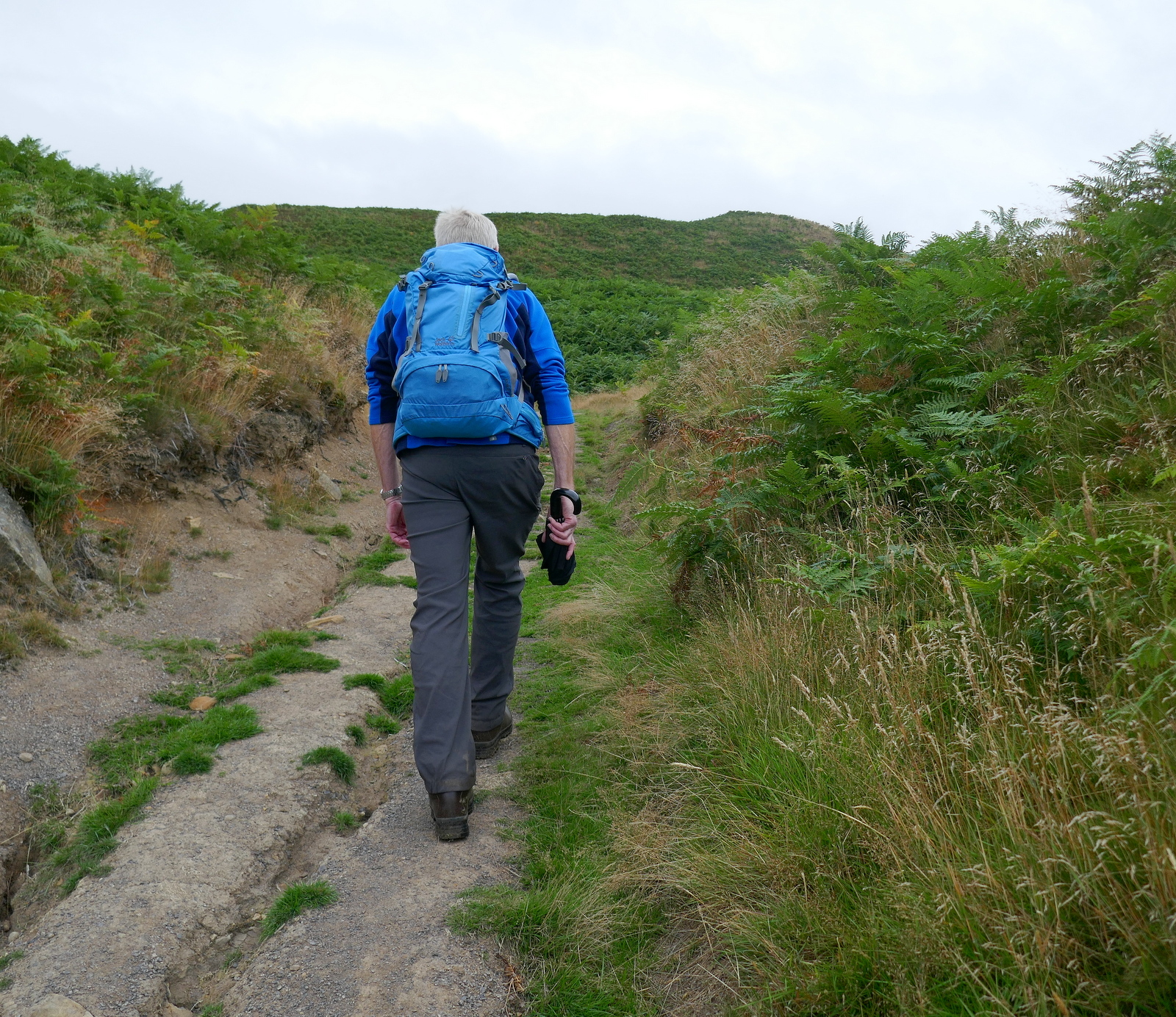
What did cause us a problem was bracken. Our path, which was uneven and littered with stones, was almost entirely covered by bracken making the ascent of Hasty Bank somewhat tricky.
Eventually we reached the quarry, at the same time as the belted galloways, and saw the Lady Of Bilsdale gazing down at us.
Tom Scott Burns describes the ancient carving of a woman's head as 'the enigmatic face of a lady carved on a rock wall who gazes eternally down into Bilsdale', and reflects that it was probably carved by a quarry worker long ago.
 |
| The Lady of Bilsdale |
Leaving the Lady we followed the moor path which leads through more bracken, along the side of Cold Moor to reach the Wainstones.
TSB explains that the name Wainstones is believed to derive from the Saxon 'wanian' - to howl, and that the naming of the stones means 'stones of lamentation'. He mentions that his favourite graffitti to be found on the Wainstones is 'RO WOOING TD 1712' but we have yet to come across it.
 |
| A slow path through the bracken |
 |
| Beak Hills Farm below us |
 |
| We arrive at the Wainstones |
 |
| Clive checks the graffiti |
We descended from the Wainstones and then climbed on to Cold Moor. Once on its summit we turned left to walk along the ridge of Cold Moor (1318') for 2.5 miles with fine views towards the Pennines in the west and Roseberry Topping and Easby Moor to the east.
 |
| The red roof of Bilsdale Hall below |
 |
| Cold Moor Lane... |
 |
| ... a hollow lane |
Hollow lanes are ancient pathways which have been hollowed out over time, very often where peat or turf was repeatedly dragged down from the moor on sledges. Below is a photograph of Thomas Leckenby of Mount House Farm Bilsdale, leading his sledge of turves off Urra Moor in the early 1930s. The strips of cut turf were dried in heaps called 'rooks' and were used as fuel and for building walls.
| Thomas Leckenby on Urra Moor, from 'Round and About the North Yorkshire Moors' by Tom Scott Burns |
Cold Moor Lane led us to Chop Gate where we emerged at the old Wesleyan Chapel that is almost hidden between houses.
 |
| Weather vane at Chop Gate |
 |
| Approaching the rear of the Wesleyan Chapel |
 |
| The front has had a modern letterbox added to the door |
TSB says the reason for the strange location of the chapel is that the landowner, Lord Feversham, was C of E and totally against a non-conformist church being established in the dale. However a local shop keeper sold the Methodists this plot of land and the chapel was built in 1858. It reportedly contains an interesting harmonium (pump organ) but its doors were firmly locked today and the building appears empty. A couple of years ago the chapel was for sale but the sale does not seem to have taken place and the building and grounds appear to be deteriorating.
TSB says that the name Chop Gate is thought to be derived from the old Scandinavian term kaup meaning pedlar and with a number of pannier tracks converging on the village it must have been like a market place in times gone by.
 |
| Approaching Seave Green |
 |
| Seave Green Farm |
 |
| Rose Cottage, Seave Green |
 |
| Recently re-roofed Bilsdale Hall |
We turned left into the B1257 and walked along to Seave Green whose name is thought to derive from its owner back in 1301, Nicholas del Seves. Here we crossed the road to the tarmac track to Bilsdale Hall, where we turned left away from TSB's map, in order to walk to St Hilda's Church just a couple of hundred yards away, this being a good spot to pause for coffee and scones.
 |
| St Hilda's Church |
 |
| A new bench makes for a comfortable coffee break. The plastic sheeting had been hung in an attempt to keep out nesting swallows |
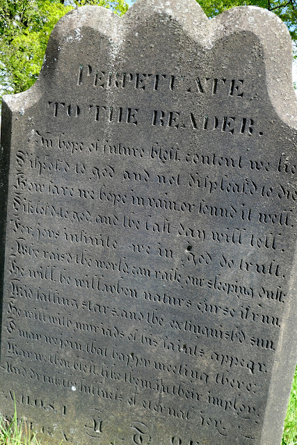
St Hilda's is on the site of an ancient church and was rebuilt in 1851 in the shape and style of the original church. We enjoyed our coffee with fine views of the Bilsdale valley. Unfortunately the church was locked but there were several old gravestones to decipher before moving on.
 |
| A perpetuate |
 |
| "Sleep blest creature in thy urn, Our sobs and tears cannot wake thee, Weel stay untill it be our turn" |
Our break over, we wandered back to Baysdale Hall and re-joined TSB's route to begin the steep climb up to follow the alternative dotted path on the map above, going steeply uphill to reach Urra Moor at Medd Crag.
 |
| Looking back down to Bilsdale Hall |
 |
| Old store house |
 |
| Through the moor gate |
 |
| ... and up to the top |
 |
| ... of Medd Crag |
After pausing to admire the view and regain our breath we turned left and followed the ridge north for a couple of miles, with a succession of sweeping views of Bilsdale below. As well as being on the ridge of the moor we noticed we were walking alongside the remains of an earthworks, shown clearly on TSB's map above. This earthworks stretches for 2.5 miles and its origin is forgotten, perhaps defensive, or it might have been an animal enclosure. It was known at one time as Cliff Dyke, and a couple of centuries ago as Cromwell's Lines.
 |
| A wet bit |
 |
| Urra Farm and Mount House Farm below |
TSB mentions two witches who inhabited Bilsdale's moors, Peg Humphreys and her companion Alice Wood, who was said to take the form of a cat or hare.
We followed the earthworks and eventually came to a little valley where we crossed a stream known as Maiden Spring, at 1300'. The track and surrounding ground were very boggy at this point even though there has been little rain for weeks.
 |
| Stone slabs across the marshy ground near Maiden Spring |
 |
| Maiden Spring to our left |
Leaving the beck we continued to follow the earthworks until rejoining the Cleveland Way track on Carr Ridge. We were interested to see a large boundary stone not mentioned by TSB, with 'Feversham 1848' on one side and 'Foulis' on the other.
We continued along Carr Ridge before turning sharp left and walking steeply down to Haggs Gate where we rejoined the main road for a few yards to return to Clay Bank Car Park.
 |
| On Carr Ridge |
 |
| Descending to Haggs Gate |
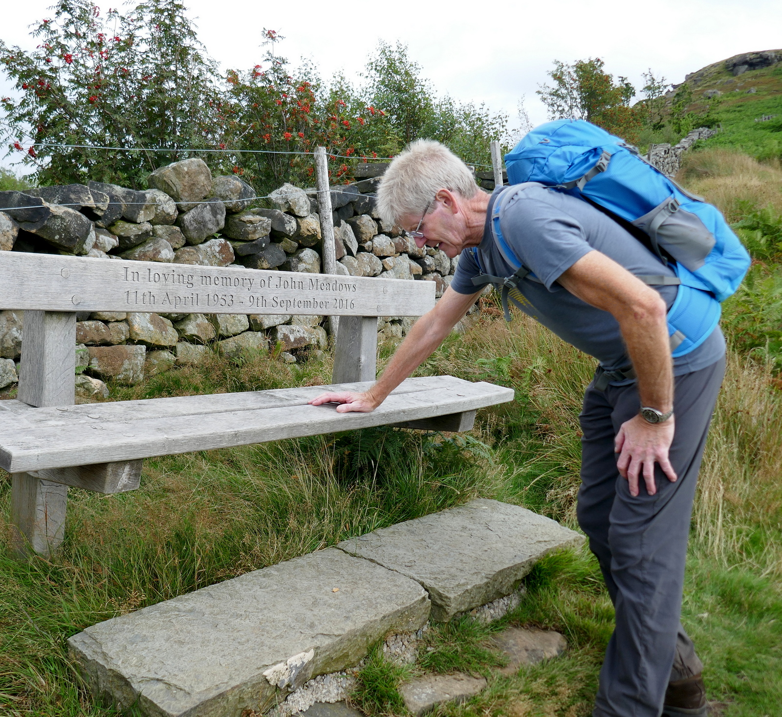
On the way down Clive was interested to see a memorial bench to a man he used to work with and who, he was surprised to discover, shared his date of birth.
A short drive took us to Lordstones where we de-briefed over a pint or two.
 |
| "To Peg Humphries!" |


No comments:
Post a Comment