Old Byland to Nettledale and Scawton
8 miles Overcast, some drizzle
In The Walker's Guide to the Hambleton Hills, Tom Scott Burns describes this walk as embodying all the charm of Ryedale as it passes through the villages of Old Byland, Scawton and Cold Kirby.
 |
| Today's walk from The Walker's Guide to the Hambleton Hills |
We approached Old Byland from the B1257 Bilsdale road via Rievaulx village and parked our cars in the village, at the roadside close to the green.
TSB relates that in 1143 the Norman Baron Roger de Mowbray granted land in Ryedale to some wandering monks from Furnace Abbey in Lancashire. They moved about the dale for a few years before finally settling on a site they called Bellalanda, or Byland.
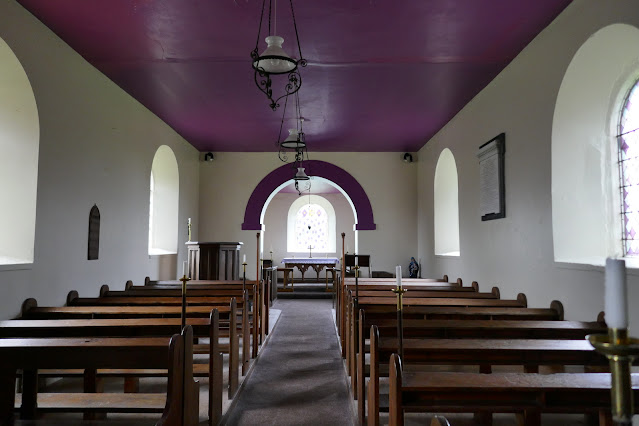
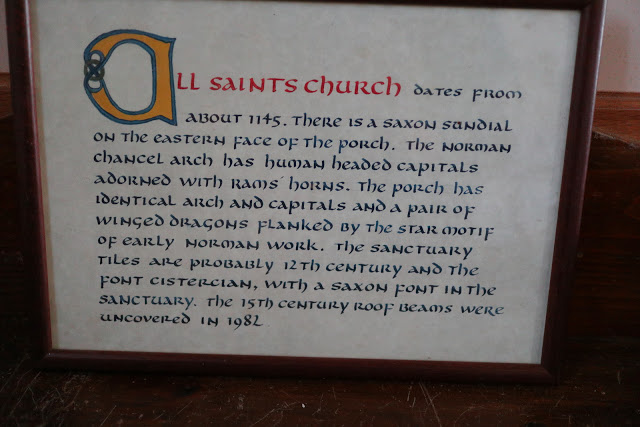
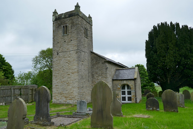
We walked through the pretty village and saw the C12th Church of All Saints almost hidden from view behind houses in the north west corner of the village. The church was unlocked so we went inside for a look around.
 |
| Old Byland |
 |
| The church is hidden behind these houses |
 |
| Weather vane in Old Byland |
 |
| C12th Church of All Saints |
 |
| Grasscutters in the graveyard |
 |
| 'The winter of afflection is past, The storm of affliction is o'er, The struggle is ended at last, And sorrow and death are no more' Cheerful epitaph at All Saints |
 |
| C15th timbered ceiling |
 |
| Saxon font |
 |
| Looking to the rear of the church |
 |
| Early Norman dragon |
 |
| Norman head |
The church is very interesting to browse but it was time to get walking and we emerged into a fine drizzle to walk through the village. Just as we exited Old Byland we turned left through a gate into the woods of Low Gill. The track here is very overgrown and slippery with a dangerous drop of 100' or so to the right. We proceeded with a great deal of caution until we dropped down to Ashberry Pasture.
 |
| Enormous sycamore on the village green |
 |
| Houses in Old Byland |
 |
| Old Byland Hall |
 |
| Turn off the road here |
 |
| ... and enter Low Gill Wood |
 |
| The path is slippery in places with a steep drop to the right |
 |
| We reach Ashberry Pasture |
Ashberry Pasture is a wild-flower sanctuary maintained by the Yorkshire Wildlife Trust and is a lovely unspoilt valley to walk through, almost 2 miles without a road or buildings.
Eventually we emerged onto the Rievaulx to Old Byland road just below Ashberry Hill and followed it to a junction next to picturesque Ashberry Farm.
 |
| Can't decide what these yellow hedgerow flowers are, a type of dandelion? |
 |
| Hagg Hall |
 |
| We join the Cleveland Way |
 |
| The first lake |
 |
| The second lake |
Just past the third lake we reached a footbridge and Cleveland Way sign on our right. We turned left here and walked uphill into Spring Wood where a steady half mile climb took us to tarmac and the road into Scawton.
 |
| Through the gate ... |
 |
| .. and a long climb alongside Spring Wood |
 |
| A strong smell of aniseed as we pass Sweet Cicely |
 |
| Vicarage Farm, Scawton |
 |
| Cottages in Scawton |
The wind was blowing too strongly to sit on the village green bench so we entered the churchyard and sat on the grass behind the wall to enjoy our coffee and scones.
Replete, we explored the church which was open to the public.
The church was built by the Cistercians of Byland Abbey, 'owing to the divers perils and fatigue which the parishioners underwent in coming from Scawton to Byland.'
Leaving the church we returned to the village green and crossed the grass to an overgrown path behind the village telephone box. The box isn't operational and is in poor repair. A couple of years ago, being curious to discover why the box has a wooden door we googled for further information and discovered it to be an early K6 model which always had a teak wood door. It is a shame the village hasn't made arrangements for cleaning and painting the box.
 |
| Our path runs left between the phone box and the green footpath sign |
It would appear that the next section of today's walk is not being used by other walkers and the fields show no sign of tracks. There are waymarks on field boundaries and we aimed for these as we crossed several sheep fields.
We kept to the path by using the yellow way-marks posted on field boundaries until we descended back into Flassen Dale, which has been recently deforested. On reaching the bottom we turned left onto a broad path then almost immediately climbed steeply up the other side of the dale.
 |
| Busy sheep fields |
 |
| Descending into Flassen Dale |
 |
| ... and straight up the other side! |
We now crossed more fields to reach the village of Cold Kirby where almost the first building one encounters is the Church of St Michael, which Tom Scott Burns explains was rebuilt in the 1800s. It originally dated back to the 12th century when the parish was administered by the Order of Knights Templar. It was unlocked so we entered the building to find an unusual purple colour scheme.


No comments:
Post a Comment