Rievaulx Abbey and Caydale from Murton
9.7 miles Fine and dry
Leaving the B1257 Stokesley to Helmsley Road at the Hawnby turn off we parked by the roadside near to the buildings of Murton Grange, overlooking the village of Hawnby below.
 |
| Today's walk from The Walker's Guide to the Hambleton Hills |
 |
| Murton Grange |
Tom Scott Burns explains in his 'Walker's Guide to the Hambleton Hills' that the township of Murton was given to Byland Abbey by Hugh Malebisse in the 12th century. A grange was constructed by lay brothers and was basically a well organised farm with a small chapel.
Just past the Grange we turned into Ox Pasture Lane to walk along a muddy track alongside Deep Gill Wood. We followed this lane for nearly two miles, eventually leaving the woods at a farm gate and crossing fields to an old barn. |
| Mole traps left on the gate at Ox Pasture Lane |
 |
| Clive demonstrates how they work |
 |
| Turning in to Ox Pasture Lane |
 |
| Deep Gill Wood |
 |
| Partridges lead us through the wood |
 |
| Follow the track for two miles |
 |
| We pass cattle en route to... |
 |
| ... the Old Barn |
 |
| It's had some repairs to keep out the weather since we saw it last |
We passed to the left of the barn then through a gate to descend to Barnclose Farm, where the path goes through the farm yard before turning right onto the farm track.
 |
| Bear right through the gate.. |
 |
| ... and descend to Barnclose Farm |
Leaving Barnclose Farm we had a steady climb on tarmac to reach Tylas Farm, today almost hidden from view by foliage, and which TSB tells us was built by the monks of Old Byland as a grange and tile house, hence its name.
We passed Tylas Farm and continued along the tarmac lane to Oxendale until reaching a gate on our left, where we turned off the road to gradually descend to the River Rye.
 |
| Through the gate |
 |
| .. and into Oxendale |
 |
| Boardwalk alongside the River Rye |
The path now leads through the valley of Oxendale, the River Rye on the left. We followed a pleasant grassy track until we reached the river and our path became a boardwalk over areas that obviously suffer from flooding.
We emerged onto tarmac and almost immediately crossed the river at Bow Bridge, originally built by the Cistercian monks of Rievaulx. A short walk on the road brought us to a sign pointing to our path across fields to Rievaulx Abbey. We left the road at a wooden Inn Way sign and soon the Abbey came into sight.
 |
| Bow Bridge |
 |
| Turn off road at Inn Way sign |
 |
| Also now sporting the new blue St Aelred's Way sign |
 |
| Remains of the canal built by monks |
 |
| Rievaulx Abbey comes into view |
Our route across the fields follows the traces of the old canal built by monks in the 11th century to carry stone for the Abbey from the nearby Penny Piece Quarry, so named because quarrymen were apparently paid a penny a day. The river was dammed here and water diverted into the canal.
As we walked through fields towards the abbey we were rewarded with a fine view of the ruins. Tom Scott Burns says that Rievaulx Abbey is undoubtedly a place to walk to, rather than from. He explains the name Rievaulx is from old French for Valley of the Rye. Under its third abbot, Aelred (to whom the walk signposted earlier refers), the monastery had 640 men dependent on its Cistercian order.
 |
| We approach the Abbey ruins |
 |
| Coffee break |
We walked uphill through the village and stopped at a public bench to refresh ourselves with coffee and scones, before resuming the climb to reach the Slipper Chapel of St Mary's. This was a place where pilgrims would remove their shoes and put on soft slippers or socks to enter the holy buildings of the Abbey. It was renovated early in the twentieth century.
We found the church unlocked and entered to find a neat, well kept building with a fine altar window.
 |
| St Mary's Church |
 |
| The new St Aelred's Trail opens next month |
 |
| Towards the altar |
 |
| Towards the rear |
 |
| Altar window |
 |
| The house opposite the church has an interesting sundial |
 |
| 'The shadow shows/demonstrates the light' |
We set off once more, down through the village and past the Abbey ruins to Rievaulx Bridge. TSB tells how Wordsworth's sister, Dorothy, who, arriving here during a July afternoon, described how she "could have stayed in this solemn, quiet spot till evening without a thought of moving, but William was waiting for me."
TSB explains that the Abbey sits in a natural amphitheatre which was granted to the Cistercian monks by the Lord of Helmsley, and building began in 1132. Because of the Abbey's site between a hill and the River Rye the church faces North - South instead of the usual East - West. By 1200 there were 140 monks and 500 lay brothers but like nearby Byland Abbey, it was suppressed in 1538.
 |
| House with character in Rievaulx |
 |
| Recently renovated Abbey Cottage and side view of the abbey ruins |
 |
| Village house |
 |
| Views of the Abbey |
We walked past the Visitors' Centre to reach Rievaulx Bridge which we crossed, following the road to pretty Ashberry Farm. Here the path turns behind the building and immediately starts to climb Ashberry Hill.
 |
| Climbing behind Ashberry Farm |
 |
| Memorial seat near Ashberry Farm |
 |
| View from the seat |
 |
| Folly - Ionic Temple above Rievaulx Abbey |
We left the wood on the same road that we had followed on our outward route, past Tylas Farm. We left the road just before reaching the farm, turning left onto a rough track that runs along Birk Bank.
 |
| Leaving the road just before Tylas Farm |
 |
| .. and follow the track |
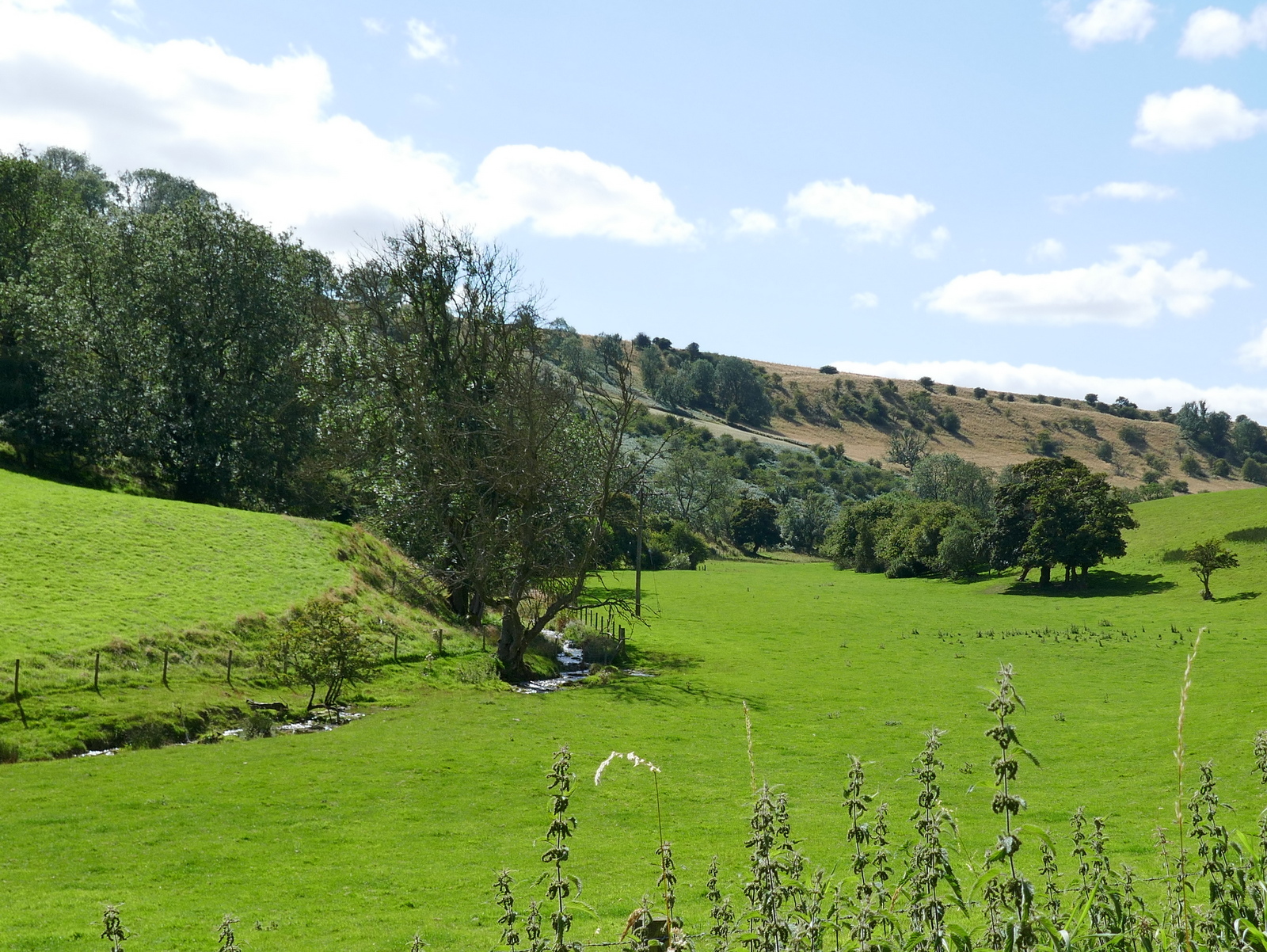
The path meanders in and out of trees from about the midway point of Birk Bank until, after about 2.5 miles it finally reaches Caydale Mill, almost unseen in the trees below.
 |
| New sapling growth has made the path difficult |
 |
| Eventually the track opens out near to Caydale Mill |
 |
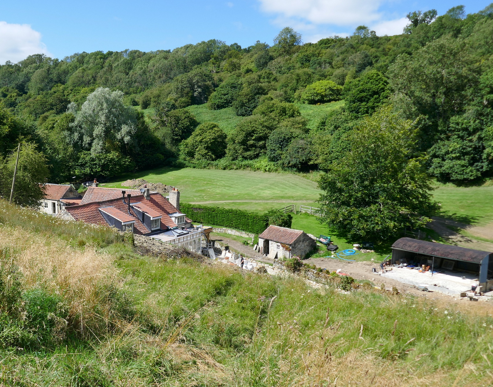
| Major works going on at Caydale Mill |
Just beyond the mill we reached the road and a ford where we washed the mud from our boots.
Cars using this lane must drive through 100 yards of water, but walkers cross by a bridge and can avoid getting wet feet, rejoining the road at the other side of the ford.
We passed by the entrance to the mill which has become a site entrance for the time being, and immediately began the long steep climb out of Caydale.
 |
| The road becomes a ford |
 |
| Entrance to Caydale Mill |
 |
| Looking along Caydale |
 |
| We begin the climb |
 |
| A red kite flies hopefully above |
The lane becomes a very steep (1:4) climb for about half a mile, before eventually levelling out. After nine miles of walking this final climb is a test for the legs! Eventually the buildings of Murton Grange appeared in the distance and we reached the end of our walk.
 |
| We pass three fine bulls near Murton Grange |
 |
| We reach the end of our walk |
Murton is just above the village of Hawnby and a few minutes later we could be found sitting in the grounds of The Owl to discuss today's walk over a well earned pint of beer.
 |
| Cheers! |


No comments:
Post a Comment