Eston Hills Circular from Flatts Lane
5.5 miles Sunny, cold and still
This short walk of Tom Scott Burns is a local one so has the advantage of being a suitable choice for my daily exercise session during lockdown. It's also nearly 6 years since I walked it.
We appoached Flatts Lane via the A171 and parked in the public car park that is built on the site of the old Normanby Brick and Tile Company, which was established in 1883.
Today's walk from The Walker's Guide to the Cleveland Hills
Car Park at Flatts Lane
From the car park we walked along the field to a stile which took us on to Flatts Lane, emerging opposite Rose Cottage. A perilous 100 yard walk up Flatts Lane as cars zoomed past brought us to a footpath on the left side of the road and we crossed here to enter Ten Acre Bank and immediately left civilisation behind. Tom Scott Burns reports that Flatts Lane was metalled across the Eston Hills to the Guisborough road by the local authorities in the days of the depression. Evidence of ironstone working is all around the area, worked by Bell Bros until 1889 when the Cargo Fleet Iron Company took over. There was a weekly extraction of 3,000 tons of ore from the surrounding hills.
Nanook of the North is ready for the off!
Only 100 yards but this is a busy road with no pavements
Cross at the sign and straight into...
... the trees of Ten Acre Bank
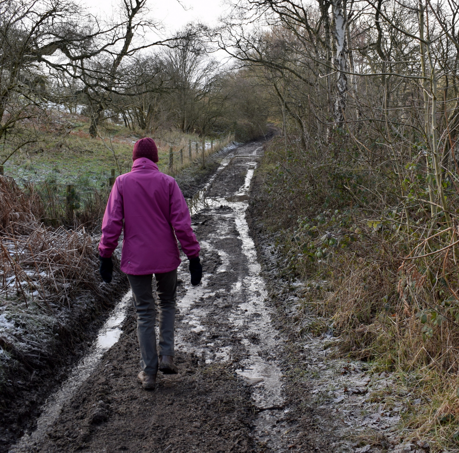
A short climb brought us to a T junction where we turned right and followed a pleasant path below Ten Acre Bank. The path was frozen solid but it was obvious that its normal state would have been very muddy indeed.
Our path was parallel to Flatts Lane until we turned left over a stile and into a meadow which led to Mill Farm and then Claphams Wood. This was a lovely path and we were surprised that it was so little walked and in fact we didn't see another soul until we reached the Nab monument. It was difficult to believe that we were not far above the main Guisborough road.
Walking parallel to Flatts Lane
Cross the stile and into fields
A pleasant path
View over to Roseberry to our right
Mill Farm
A steady climb alongside the wood on little walked paths, thick with brambles, brought us to Moordale Bog, which was frozen so felt firm underfoot. TSB tells us that here, hidden among the undergrowth, is the ruins of Upsall Pit, run by Bolckow, Vaughan and Co from 1866 and then Dorman Long and Co until 1945. The shaft was 564 feet deep and in all 63 million tons of iron ore were extracted from these hills between 1850 and 1949.
Walk downhill to Mill Farm to cross the stile
The way-mark is down
Sometimes just in the wood...
... and sometimes just outside the trees
Carole stops to admire the view
The view!
We see the transmitter masts for the first time
The track would be difficult in places if not frozen
A small community lived here in the now forgotten village of Barnaby and provisions for the village were brought via the underground mine railway. TSB says that the foundations of two rows of cottages can still be seen, as can the capped well. We found the well but not the foundations. Also demolished were a chapel and a schoolroom built in 1871.
The trees of Clapham Wood
This well is all that remains visible of Barnaby Village
Another climb took us onto Wilton Moor where we came to a convenient bench with a magnificent view across to Roseberry Topping, an ideal place to sit in the sun and enjoy our coffee and scones.
More mine remains, these stone posts have metal plates inset
Coffee with a view
The view from our bench
Our path headed north west across Eston Moor where TSB says early man built barrows and left flint tools dating from 6000 to 2000 BC, until we reached a cluster of transmitter masts. We walked on towards the Eston Nab Monument where we paused and read the bronze inscription.
We pass by the transmitter masts...
... to reach the beacon at Eston Nab
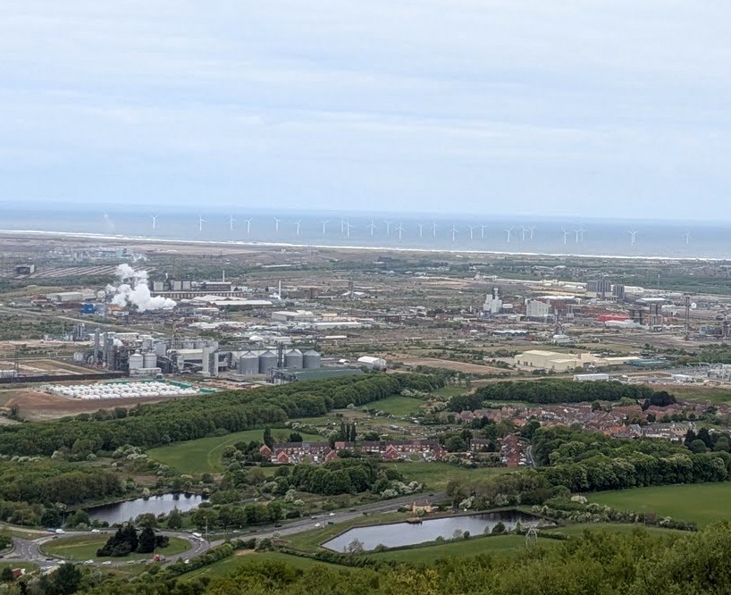
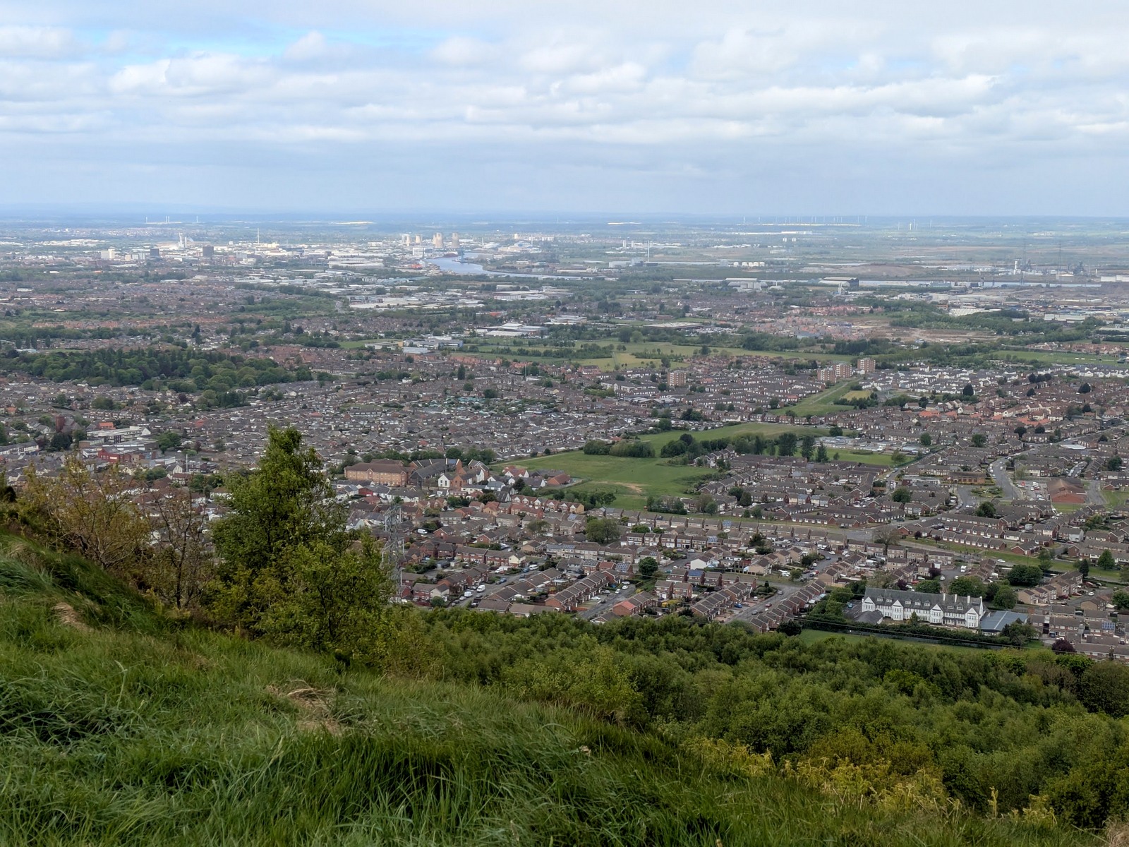
At this spot a beacon tower was constructed in 1808 during the Napoleonic Wars. After 1815 it was used as a house and from 1884 was the home of a David Helm and his wife until 1933, when the body of 80 year old Mr Helm, who had outlived his wife by a year, was carried by horse drawn cart down for burial at Wilton churchyard. In 1956 it was finally demolished and the present monument was built by ICI, using the stone from the original beacon. We stood and enjoyed an amazing panoramic view of Teesside and beyond from the Nab.
Views from Eston Nab
The yellow block is the nuclear power station
The houses of Eston below
The area around the monument was once an Iron Age hill fort dating from 550 BC. TSB says that it probably served as a refuge for surrounding settlements and calcined bones have been found at the site which prove that cannibalism took place, possibly when ancient warriors were besieged on the nab.
The flag in memory of Lee Rigby, the murdered soldier
We followed the path along the escarpment where someone has erected a flag in memory of Lee Rigby, the murdered soldier, and here we met our first people of the day. We continued along the path to pass by Carr Pond.
We walk along the ridge
Carr Pond
TSB informs us that during the last war a Junkers Ju88A aeroplane crashed here on 30th March 1941 after being shot down by a Spitfire from 41 Squadron. All four crew died and during the war another three aircraft crashed on these moors, including a Spitfire which crashed near to the Junkers site.
We begin descending towards Flatts Lane
Flatts Lane Hospital, once a teacher training college
We now started the descent back towards Flatts Lane and our car. We agreed that it had been an interesting walk with great views in the clear weather, and it was good to get an unfamiliar view of the familiar places and industrial landscapes so close to our homes.
A short walk but a good one!