The Drove Road and Windygill Ridge from Boltby
7 miles Warm and dry
We drove through Boltby and parked at a hard shoulder on the right hand side of the road, shown by 'P' on the map below. After booting up we walked uphill along the same road, away from the village, until turning left at a footpath sign into a farm track to Lunshaw House Farm.
 |
| Today's walk from The Walker's Guide to the Hambleton Hills |
 |
| Bear left uphill |
Before reaching the farm we crossed a stile on the right to follow a field path signposted Low Paradise. The field was very dry and only thistles seemed to be thriving.
 |
| Turn right into the field at the sign |
 |
| .... and follow the faint path across the field |
The path eventually drops down into woods before crossing Lunshaw Beck via stone slabs. We then started a mile long ascent which TSB correctly describes as a 'muscular climb'. This climb first passes Low Paradise farm, then Oak Beck cottage before continuing to climb all the way to High Paradise Farm.
 |
| The path eventually drops down to Lunshaw Beck |
 |
| Slabs across an almost dry Lunshaw Beck |
 |
| Climbing to Low Paradise Farm |
 |
| Low Paradise Farm |
 |
| A contented couple |
After Low Paradise we continued the steep climb to eventually reach High Paradise Farm and its tea room.
 |
| Looking back at our ascent |
 |
| High Paradise Farm |
 |
| "Don't mind if we do!" |
Here we decided to stop for coffee and refreshments and I was easily persuaded to try a raspberry scone. "The raspberries were picked in the forest this morning", we were told with a wink.
 |
| Bijou High Paradise Cafe |
 |
| Raspberry scones and coffee |
 |
| Female chaffinch shares my scone |
After finishing our coffee we left the farm cafe and walked towards Sneck Gate and the moor. Passing through the gate we were now on the Hambleton Drove Road, which we followed left for 1.5 miles, soon reaching forest. To our right was Daletown Common Moor.
 |
| Leaving High Paradise |
 |
| "Boo!" Daletown Common is to our right |
We walked on through the trees for some time and then, just before reaching the ruins of Steeple Cross (first mentioned in 1246 but no longer a cross, now just a 2 feet high piece of stone) we turned left to enter the plantation's trees.
 |
| Through the trees on Boltby Moor |
 |
| Red Admiral. Lots of butterflies in this warm dry weather |
 |
| Reaching the gate at Steeple Cross - turn left |
 |
| .... and enter the trees of Boltby Forest |
 |
| Steeple Cross remains |
We walked along Windygill Ridge through the trees of Boltby Forest for a mile or so until we came to an area of felling, and here we saw the remains of Friar's Cross. This old monument stands on the route of an ancient track leading from Kepwick to join with the Hambleton Drove Road.
 |
| Almost immediately we come to a fork, bear right |
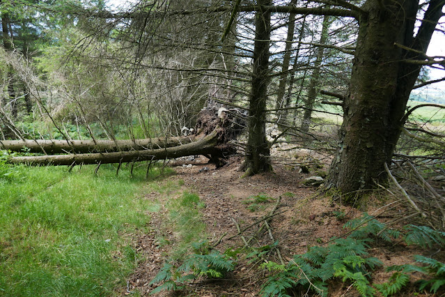 |
| ... and follow a path along the forest edge. We come to a fallen tree |
 |
| It is easily circled. Clive examines the conifer's shallow root system |
 |
| Friar's Cross |
 |
| Easily spotted nowadays, thanks to felling |
We emerged onto a ridge path overlooking Cowesby village. Ahead of us was the Vale of Mowbray and to the right, Black Hambleton and we could see the hummock of Seta Pike, our next destination, about a mile ahead.
Just after passing Seta Pike the path turns left to descend on a steep forestry path. Even in this dry weather the track was wet and boggy in places and the steep descents were slippery making progress slow. The path eventually levels out and we picked our way through Gurtof Wood, looking down on Gurtof Beck running below us. Here the track became very difficult with fallen trees and branches and it was necessary to divert up and down to pass the worst bits. The path, although just visible, does not appear to be getting walked.
 |
| On Windygill Ridge |
 |
| Follow the ridge walk |
 |
| Cowesby village below |
 |
| We nearly missed the sign to the left |
 |
| Taking us into little walked Gurtof Wood |
 |
| Many obstructions on the path needed negotiating |
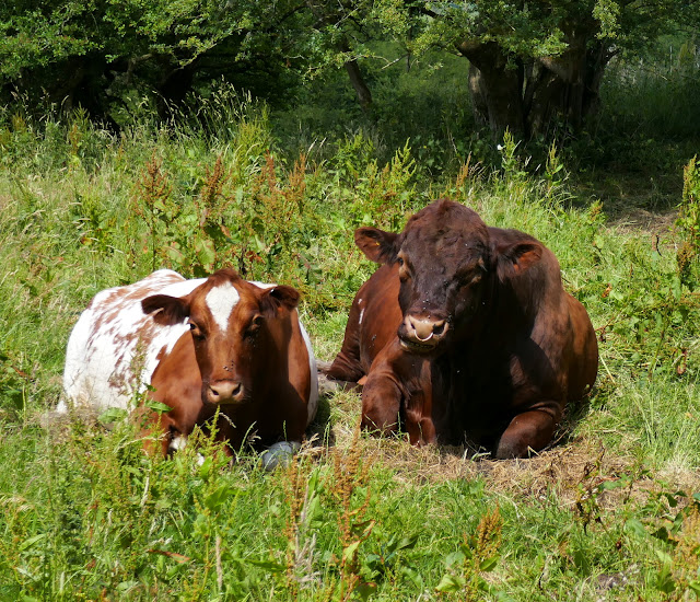
We came to an area where felling had taken place and soon after this entered fields once more.
 |
| We pass a field of Belted Galloways |
 |
| Quite a few calves among them |
 |
| ... and a bull |
 |
| Hide |
 |
| Looking more impressive on site than on photo, an English Elm, now rarely seen as a mature tree |
 |
| We arrive in Boltby |
We walked back through Boltby and passed by Holy Trinity Church where we paused to look around.
 |
| Boltby Trekking Centre, once the Johnstone Arms |
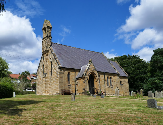 |
| Holy Trinity Church |
 |
| Looking towards the altar |
 |
| Altar window |
The churchyard seems to contain only fairly recent graves and a further look at our guidebook 'The Walker's Guide to the Hambleton Hills' explains why: apparently it was the custom until Victorian times to carry the dead from Boltby and Kirby Knowle for burial at Felixkirk, "swathed in linen and uncoffined." It would be interesting to know the reason for this practice but unfortunately the book does not give one. Strange, when they had perfectly good churches in both Boltby and Kirby Knowle.
We continued through the village, crossing the old pack horse bridge and climbed steeply up the hill, heading towards the car and a well earned pint.
 |
| A flagon of foaming ale at the end of the walk |


