Newton-under-Roseberry to
Old Nunthorpe
7 miles Cold and bright
Frozen roads this morning persuaded us not to stray too far today so we decided do a walk from Newton-under-Roseberry.
Just outside the village is a lay-by with free parking and we walked back through Newton passing the King's Head pub.
 |
| Today's walk from The Walker's Guide to the Cleveland Hills |
 |
| Roseberry from the car park |
 |
| The Old Village Hall, now a house |
In his walker's guide Tom Scott Burns informs us that the King's Head dates back to 1796 and was run by an old woman known as 'Old Gag Mally Wright' who started a fair in the village and was a 'handy body' who acted as midwife and also laid out the dead. Locals said she 'tied up t' jaws of t' dying afore tha wur deead'.
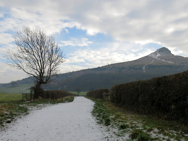
We turned into the lane to Roseberry Topping which today was frozen so that we progressed without getting the usual dirty boots and soon reached the lower slopes of the Teesside 'mini-Matterhorn'.
 |
| Roseberry Lane |
TSB also recounts the story of a Northumbrian princess who had been warned by an astrologer that her son Oswy would be drowned on a certain day. To avoid this she took the child to the summit of Roseberry Topping where he would surely be safe from that fate. While she slept the child wandered off and fell down a well, situated on the north eastern slope of Roseberry, so fulfilling the prophecy, which led the princess to kill herself. Mother and child were buried together and 'Os by his mother lay' and so the village of Osmotherly gained its name.
The name Roseberry has puzzled many historians. In 1119 it was Outhenesbergh, Osenburgh in 1424 and Roseberye in 1657. The hill was mined for iron ore between 1880 and 1926 and in 1912 the mining caused a landslip that gave the hill its distinctive shape. We carefully climbed the hill's icy steps and then turned west to walk down to the folly built on its western slope.
 |
| Icy stones made the path tricky |
 |
| Walking alongside Newton Wood... |
 |
| The summer house, Wilson's Folly, comes into view |
We walked down from the hut to Newton Wood where we descended through trees to reach Quarry Lane, which if we turned left would take us to Cliff Rigg Quarry, where whinstone was mined until the last century. We turned right, however, and walked down to turn right again into the Ayton to Guisborough Road. We had to walk along this busy road for about a quarter of a mile until we could turn left into a lane alongside some buildings used by Cleveland Mountain Rescue.
 |
| A walker summits Roseberry! |
 |
| Walking through Newton Wood |
 |
| We cross the Middlesbrough to Whitby Line |
 |
| We join the A172 and walk East to reach... |
 |
| ... the gates of Cleveland Mountain Rescue |
We walked along this lane which runs parallel to the old rail bed to Langbaurgh Quarry. We passed by the old workings of Nunthorpe Quarries where signs warned us of mine shafts and unstable ground.
These quarries, Cliff Rigg, Langbaurgh and Nunthorpe, are all set on a ridge of whinstone that runs down to Quarry Hill Farm, and are all now disused. We emerged from the trees that surround the old Nunthorpe Quarry to find ourselves walking briefly among the out-buildings of The Whinstone View Hotel, before crossing a stell by a small bridge into fields, where our track followed the field line.
 |
| Texel Rams are not known for their beauty! |
 |
| Sheep approach hoping we have brought food |
 |
| Suffolk Rams |
 |
| Passing by old mine shafts |
 |
| We reach the Wainstones Hotel |
 |
| Crossing Main Stell |
 |
| Ready for coffee |
By now we were ready for coffee and a stile made a useful seat for us both. We sipped our coffee looking over to a misty Great Ayton.
 |
| Coffee time |
 |
| Our view towards Ayton |
As so often with TSB walks there was little sign of a path and our route could only be told by looking for yellow way-marks.
Eventually we walked alongside the imposing Quarry Hill Farm building where a couple of very old tractors rot in a field, apparently abandoned to the elements. I forgot to photograph them today but they are Case tractors, one a three wheeler and the other with steel wheels. Both look like museum pieces but sadly have deteriorated since the below photo taken in 2016.
 |
| Quarry Hill Farm |
 |
| Statue at Quarry Hill Farm |
 |
| Case Tractors |
Leaving the tractors we crossed the A179 and walked over a field to some stables where we petted a couple of tame sheep, and then to the road which runs through Old Nunthorpe. The original name of the village was Torp which was amended to Nunthorpe in the early 12th century in honour of a Cistercian Nunnery. In 1231 the nunnery moved to Baysdale.
We walked past the old Hall, now a residential home, and turned into a footpath alongside Hall Farm which has been unoccupied for the last two years. The farm is apparently owned by Middlesbrough Council who are attempting to sell it. Passing through the old farm buildings we paused to admire the family history mural painted by the last occupants of the farm.
 |
| Crossing fields to Old Nunthorpe |
 |
| Pet sheep |
 |
| Walking through the village |
 |
| Nunthorpe Hall |
 |
| Hall Farm |
 |
| Weather vane at Hall Farm |
 |
| Mural at Hall Farm |
After the farm buildings we re-crossed the A179 and entered fields to join a farm track to Morton Carr Farm. TSB reports that Carr is a Norse word for a marshy piece of land, and these lowland meadows which are drained by numerous stells are certainly marshy. We passed by Morton Carr Farm and turned right at its outbuildings and walked across fields towards Eastfield Farm.
 |
| Good ground for walking! |
 |
| St Mary's Church in the distance |
 |
| Approaching the new farm building |
 |
| The old Morton Carr Farm building |
 |
| Cattle in for winter |
 |
| Time to scratch a head or two |
Our path passed the front of Eastfields Farm and we were amused to see a pair of gargoyles on the roof. Past Eastfields Farm are wet-lands and bird life is prolific among the hedgerows.
We spotted a hare lying low in a field but I couldn't get a close shot of him. Likewise a female sparrow hawk who moved on ahead of us, always just too far for my camera.
 |
| Eastfields Farm |
 |
| Weather vane at Eastfields |
 |
| Hedge sparrow |
 |
| Hare lying low |
 |
| One of several large lakes |
 |
| Female sparrow hawk |
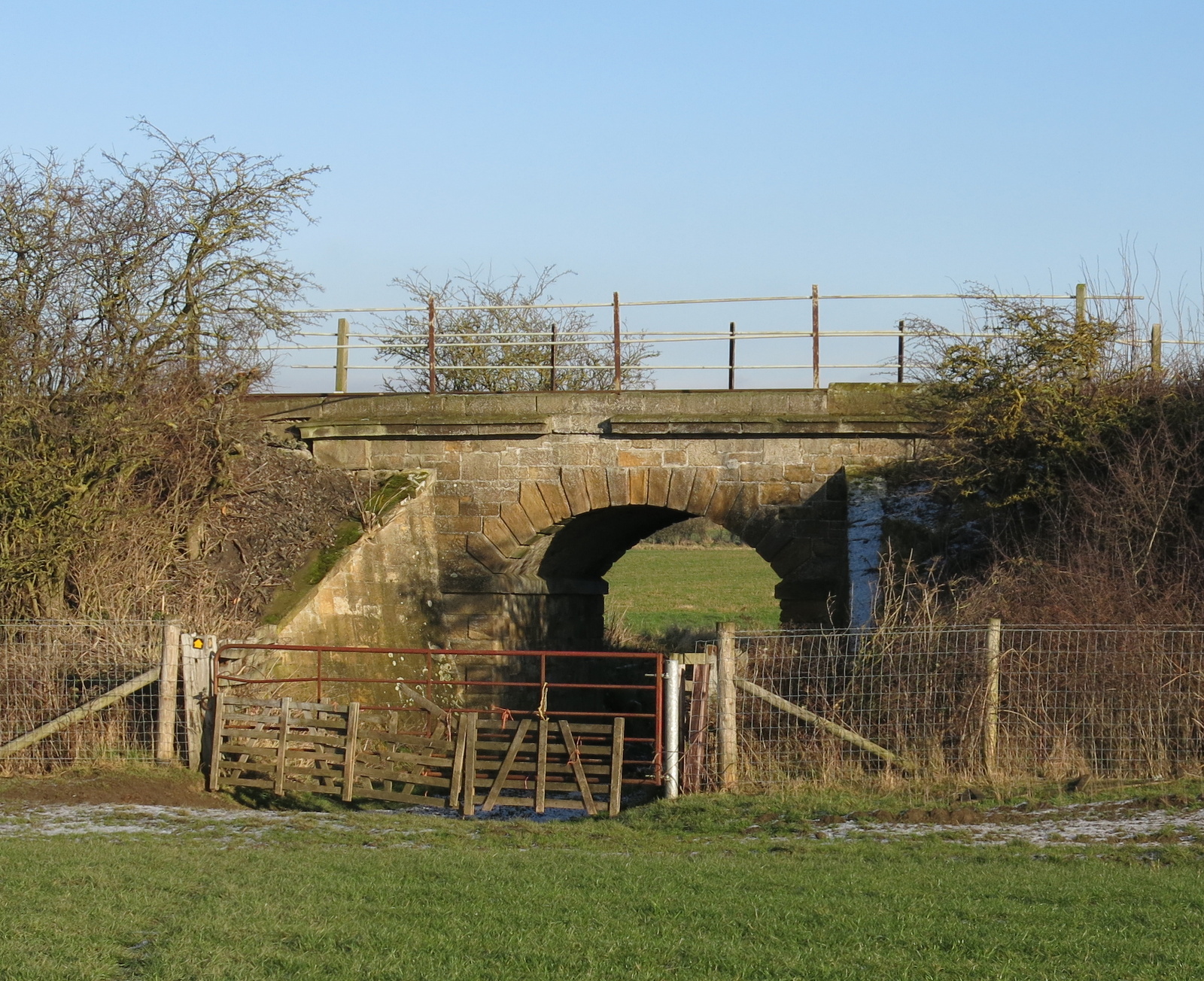
We went across more fields until we reached the Middlesbrough to Whitby line where our path ran under a stone bridge holding the line.
 |
| Middlesbrough to Whitby line |
Walking over several more fields brought us to stepping stones over Main Stell and the outskirts of Newton-under-Roseberry. We walked through the green where to the left is St Oswald's Church, unfortunately locked today, as it always seems to be when we call by.
 |
| Newton-under- Roseberry |
 |
| St Oswalds |
 |
| Saxon carving |
 |
| Old stone coffin |
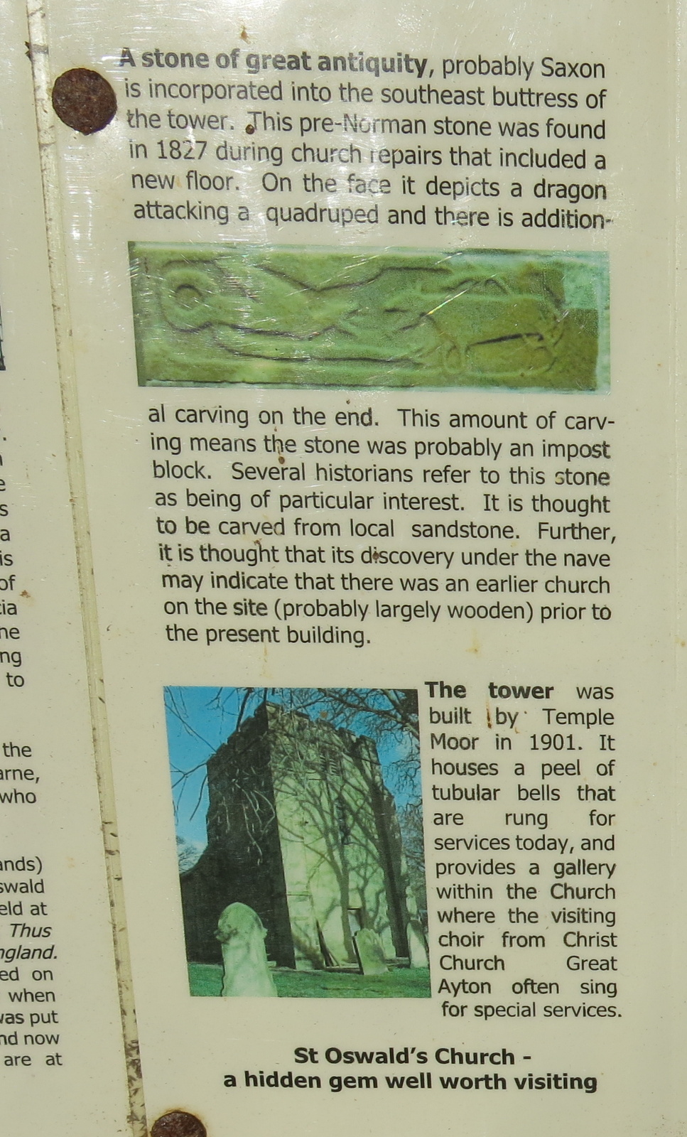
This ancient church has an Anglo-Saxon carved stone set in the tower of the church showing a dragon and some sort of quadruped. Tom Scott Burns says that this stone was actually described in an eleventh century book called 'Bestiaries'. It's interesting to think of what the carver must have looked like and what this area would have been like at that time.
 |
| Interesting WW2 grave |
A few more steps took us to the Guisborough to Great Ayton road and we turned left to walk back to the car, enjoying a last look at Roseberry Topping in the afternoon sun.