The Rosedale Railway and Botton Head from Ingleby Greenhow
8.5 miles Sunny but cool
We parked in Ingleby Greenhow in the
overflow car park for the Dudley Arms and walked back to the main road,
in the direction of Kildale. Our route left the road alongside a newly built house and crossed meadows where sheep fussed with new lambs.
 |
| Today's walk from The Walker's Guide to the Cleveland Hills |
 |
| Walking behind houses as we leave the Kildale road |
 |
| Looking back at Ingleby Greenhow |
 |
| Across several meadows |
 |
| .. and through fields with new lambs |
 |
| I'm sorry but you're lying on our path |
We soon reached Bank Foot Farm, situated under Turkey Nab which is probably derived from the old personal name Thorlkil. Tom Scott Burns says in the Walker's Guide that in 1729 William Parkin was hung from gallows mounted on Turkey Nab for murdering his brother-in-law at Great Broughton, but our plan was to find Mary Ross's Seat, described by TSB as being at grid reference 594055. The last time we did this walk, in February 2014, we walked along the old railway track from Bank Foot and cut upwards through the trees, eventually having to double back to the forest track to find the seat. This time we approached the problem more sensibly and walked straight past the old railway track and up through Bank Foot Farm until we saw the forest track on our right. We followed it until we came to the seat, carved from natural stone and with the words 'Lady Mary Ross 1837' engraved on it. TSB explains that Lady Ross's daughter married Sir William Foulis of Ingleby Manor and the seat was built on one of her favourite walks which she used when visiting her daughter, long before the forestry commission planted conifers.
 |
| Cockerel and hens at Bank Foot Farm |
 |
| Entering the forest track... |
 |
| ...which was muddy and difficult to negotiate |
 |
| We spot Lady Ross's seat from the track |
 |
| Lady Mary Ross 1837 |
 |
| Clive inspects Lady Ross's seat |
|
Rather than fight our way back down to the old railway track we remained on the forest track until we reached the bottom of the incline railway, which we followed steadily uphill, pausing to admire old graffiti of a man in a stove pipe hat and a bird, probably carvings made by a bored miner. It is a long, straight, steep climb and on reaching the top of the incline we rested, sitting in the sun with a spectacular view across to Clay Bank. We enjoyed our coffee and scones here, looking down onto Shepherds Close Farm and what would be our descent from the moor top.
 |
| Joining the Incline from the forest track |
 |
| Looking across at old mine workings from the Incline |
 |
| Old graffiti of man in hat and bird |
 |
| Spectacular coffee stop |
 |
| Looking over at Clay Bank |
 |
| Looking back down the Incline |
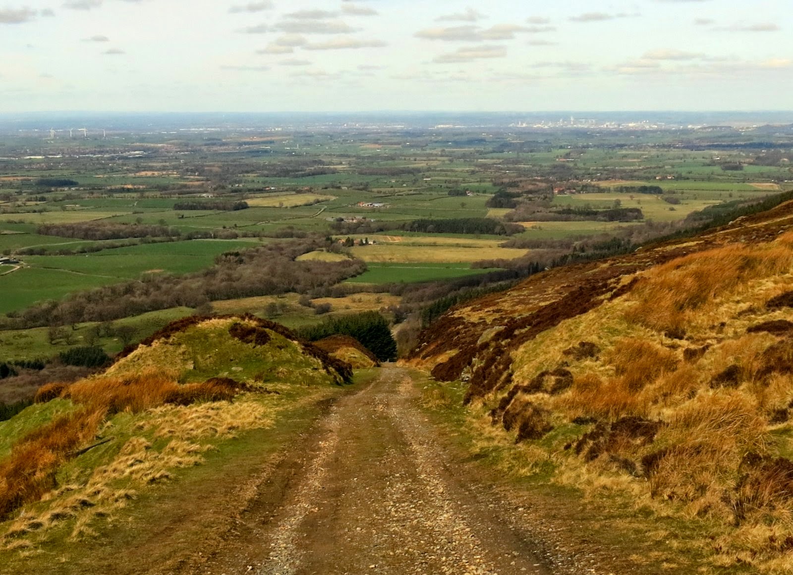
We set off to follow the old railway line, which once ran from this point to Rosedale Bank Top 11 miles away, pausing to take a look at the huge stone blocks and bits of old iron work that once were part of the drum house which was dismantled in 1941. We walked along the moor top and came to a memorial bench at the windiest spot. A marvellous view but there can't be many days when it's warm enough to sit there.
 |
| The old railway track to Rosedale |
 |
| Seat with a view |
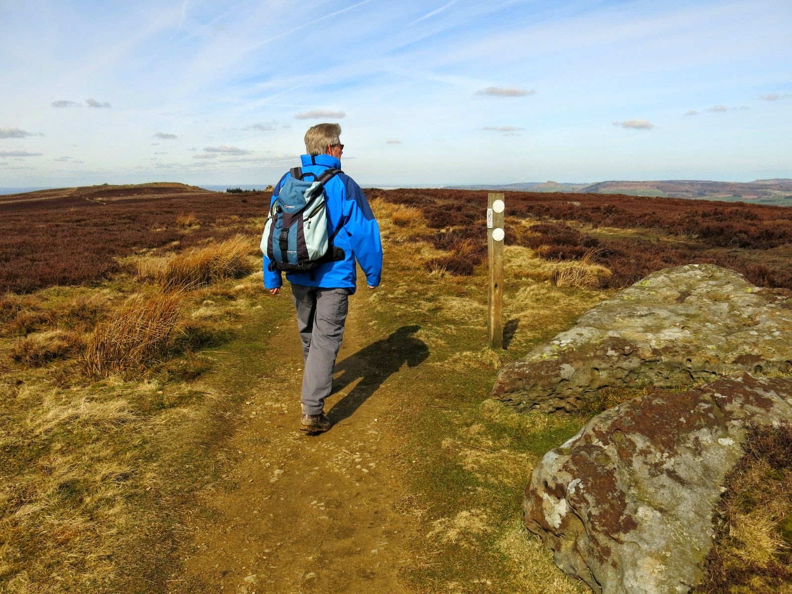
We continued across Greenhow Moor and came to a junction where the acorn on the signpost showed that we were joining the Cleveland Way. We walked along the Cleveland Way, which follows a wide moor track for about 2 miles. On the way we passed two interesting old boundary posts, the first being The Face Stone, which is mentioned in a 1642 document for the Helmsley Estate. The second is The Hand Stone, displaying an engraved hand (now very eroded) dating from 1711. Behind the Hand Stone is the trig point at Botton How, which is actually located on a Bronze Age burial mound and at 1490 feet is the highest point of the North Yorkshire Moors.
 |
| Ancient spooky smile .... and The Face Stone! |
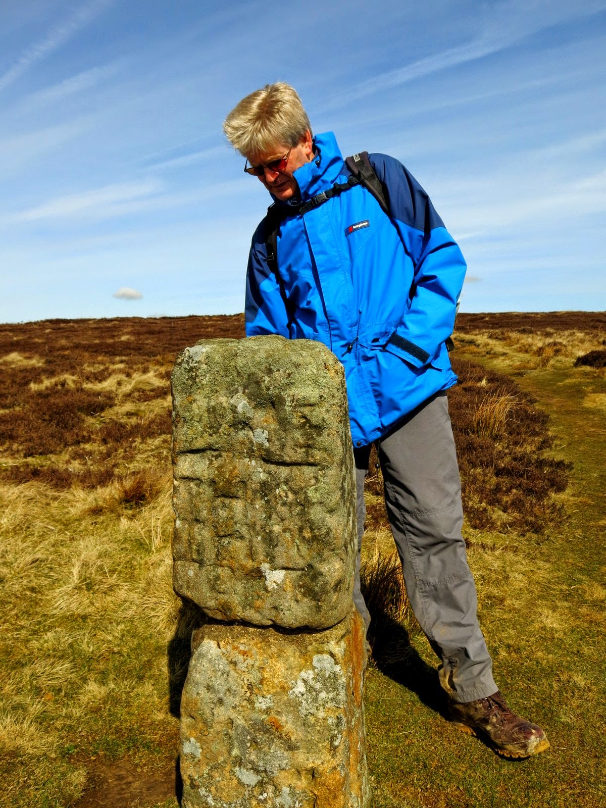 |
| Clive examines the Hand Stone |
 |
| Trig Point on Botton Head |
We walked back to the wide path and
carried on across Urra Moor, which according to TSB derives from
the Old English 'horh' meaning 'filth'! Eventually we came to a
signpost where we left the Cleveland Way and bore right on an indistinct path which dropped
off the moor down Jackson's Bank and into Greenhow Plantation.
 |
| Spring plumage on grouse |
 |
| We turn right towards Jackson's Bank |
 |
| Starting down Jackson's Bank |
 |
| Entering Greenhow Plantation |
As we walked across Greenhow Botton following the farm service road we were surprised to see an old 4 engined plane flying slowly through the valley ahead of us. How did he get permission to fly so low, we wondered? We passed Midnight Farm to our left and then Woods Farm to our right before turning off the track at Low Farm, where we chuckled once more at the farm's 'stone circle.'
 |
| Greenhow Botton |
 |
| Whoa, what's that?! |
 |
| Shire horse weathervane at Low Farm |
 |
| 'Stone Circle' at Low Farm |
Our path turned left just before the farm
buildings, into fields which we crossed one after another, following an unseen
right of way by aiming for the yellow right of way signs on each field
boundary. Our path eventually reached the bridge over Ingleby Beck and we crossed into the churchyard of St Andrew's beyond it. The church was unlocked and we enjoyed a browse around the ancient building. TSB says that the original church was granted to the abbots of Whitby in 1143 by Adam de Ingelby and still retains traces of Norman work. We liked the pigs carved onto stone pillars near the altar and the fine stained glass window.
 |
| Crossing Ingleby Beck |
 |
| St Andrew's Church, Ingleby Greenhow |
 |
| Sarcophagus in St Andrew's |
 |
| A disapproving face notes Clive's donation |
 |
| Pigs or boars on pillars |
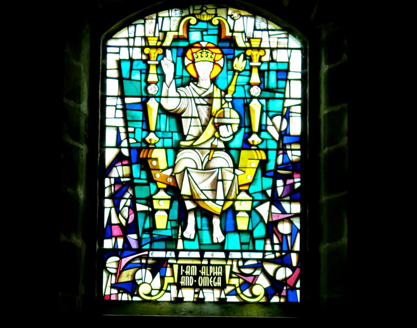 |
| Altar window |
 |
| Attractive church of St Andrew's |
Leaving the church we found that we had
parked very close to the Dudley Arms Hotel - what a surprise - so we popped inside to enjoy a
pint and discuss today's fine walk.
 |
| The Dudley Arms, Ingleby Greenhow |


