Helmsley to Harome and Sproxton
10 miles Fine and mainly sunny
We paused on Newton Grange Lane for our coffee break and sat in the sun with a fine view over West Newton Grange Farm and Seamer Great Wood.
We retraced our steps through the village to Sproxton Hall Farm where we turned left across fields past Low Parks Farm, our path eventually reaching an arched bridge over the River Rye. We didn't cross the bridge however, turning left instead to follow the river upstream.
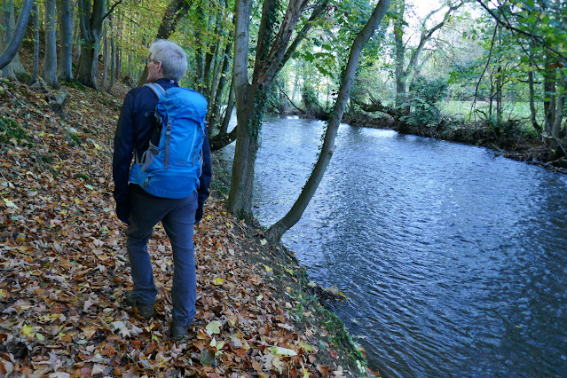
We now walked back alongside the opposite bank from our outward journey, at first through sheep fields but later, for the last half mile or so, along an increasingly tricky river bank. Our path was covered with fallen leaves but still slippery and at times too close to the water for comfort. The river bank had been washed away at frequent intervals and the path was far more difficult than we remembered from previous visits.
Eventually we passed though a gate and into a sheep field which we crossed to reach the road at the bridge in Helmsley. Just before we left the field we saw a notice informing us that the path we had taken has been closed because of erosion. Unfortunately there was no similar notice near the arch bridge where we joined the path. It looks as though in future we will have to cross the arch bridge and return to Helmsley via Sawmill Lane.
A fine Autumn day for one of our favourite walks. We parked at the side of the road where it enters Helmsley and walked down through the market place and just before Rye Bridge veered left into Ryegate, then right into Sawmill Lane. There are signs here for the Ebor Way, which we follow for a while.
 |
| Today's walk from The Walker's Guide to the Hambleton Hills |
 |
| Helmsley |
 |
| Passing the entrance to Helmsley Castle |
 |
| Entering Sawmill Lane |
Sawmill Lane took us past an industrial estate and then, following a new sign for the Ebor Way, we walked into fields leaving the town behind.
We were soon walking alongside the River Rye; on reaching the sewerage works the path becomes a very narrow space between the fence and the river.
We walked alongside the River Rye until we reached an oxbow where we left the river by turning under an old railway bridge that was once part of the York to Pickering railway, closed by Beeching in 1964. We crossed a sheep field to the road which we followed for a mile to reach Harome.
 |
| We follow the river |
 |
| Yesterday's Storm Claudio appears to have brought this tree down across the new gate |
 |
| We reach the oxbow |
 |
| We leave the river to go under the railway bridge |
 |
| On the Harome road |
Entering Harome we were interested to see work is progressing well on the Star Inn which was damaged by fire last year. Walls were being rendered and a thatcher was hard at work.
In the garden opposite a giant Buddha watched the work enigmatically.
 |
| Work at The Star |
 |
| New thatch |
 |
| Big Buddha |
Passing the Star we entered Harome where we saw that morning coffee was being served at The Pheasant and we decided to pause for a while.
 |
| "Shall we?" |
 |
| "Yes" |
 |
| Our view of Harome duck pond from the patio |
 |
| The Pheasant |
Reluctantly we left The Pheasant and walked through picturesque Harome, past the duckpond and some interesting cottages including Harome Mill and Aby Green Farm We soon reached Hall Lane passing by the old railway cottages, now private houses.
Hall Lane becomes a farm track and returns to the river once more.
We walked alongside the River Rye and then crossed it by a footbridge a short distance from Hall Lane end. A little further and we joined Lack Lane which leads to East Newton Hall and Loschy Farm.
We were filled with admiration for the dry stone walling at East Newton Hall. To the left of the building, on a hill, is Loschy Wood and TSB relates that long ago a dragon lived on Loschy Hill and terrorised the villagers. A local man called Peter Loschy had a special suit of armour made covered with sharp blades and went with his dog to confront the dragon. It wrapped itself around Peter and the blades sliced it so portions of the dragon fell to the ground. The pieces tried to reassemble the dragon so the trusty dog carried the segments of dragon and buried them on the hill. Peter stooped to praise his dog which licked him on the face, but as the dragon's blood was poisonous he and the dog both fell down dead. They were buried at Nunnington Church, the dog at Peter's feet. TSB says unbelievers can visit the church and see for themselves!
Just past Losky Farm there is a footpath sign pointing across fields where a path is clearly deliniated and we took this, soon reaching the busy B1257.
This next stretch is the worst part of today's walk. We had to follow the grass verge of the busy road for about a mile, passing by Leysthorpe Hall and Birch Hall Farm. This is not a very pleasant experience.
Eventually, opposite a sign pointing to Oswaldkirk village, we turned right into a farm lane and started to descend in the general direction of Sproxton; the footpath sign telling us we were now back on the Ebor Way.
 |
| Cross the stile... |
 |
| .. and walk disgonally across the field |
 |
| Leysthorpe Hall |
 |
| B1257 for 1 mile |
 |
| Turn right off the B1257 |
 |
| .. and enter the peace of Newton Grange Lane |
We paused on Newton Grange Lane for our coffee break and sat in the sun with a fine view over West Newton Grange Farm and Seamer Great Wood.
 |
| We disturbed a flock of fieldfares eating berries |
 |
| Seamer Little Wood from our coffee spot |
 |
| Seamer Great Wood and West Newton Grange |
We now followed a series of winding field paths until we entered Sproxton after passing the farm called Sproxton Hall. At the end of the village we reached the B1257 again and the old church of St Chads. Unfortunately the church is not usually left open for visitors but photos of the inside of the church can be seen on this earlier blog of the walk when we did find it unlocked.
 |
| Sproxton Hall Farm |
 |
| Sproxton Village Hall on the outskirts of the village is a WWII Nissan hut |
 |
| Weather vane at Sproxton |
 |
| The tiny church of St Chads |
We retraced our steps through the village to Sproxton Hall Farm where we turned left across fields past Low Parks Farm, our path eventually reaching an arched bridge over the River Rye. We didn't cross the bridge however, turning left instead to follow the river upstream.
 |
| Low Parks Farm |
 |
| Great Ness Wood to our right |
 |
| Arch bridge over the River Rye |
We now walked back alongside the opposite bank from our outward journey, at first through sheep fields but later, for the last half mile or so, along an increasingly tricky river bank. Our path was covered with fallen leaves but still slippery and at times too close to the water for comfort. The river bank had been washed away at frequent intervals and the path was far more difficult than we remembered from previous visits.
 |
| The oxbow from the other bank |
 |
| An easy path alongside the river |
 |
| ... becomes increasingly tricky |
 |
| The path is more difficult than it appears here and is very close to the river |
 |
| Great care needed on this section |
Eventually we passed though a gate and into a sheep field which we crossed to reach the road at the bridge in Helmsley. Just before we left the field we saw a notice informing us that the path we had taken has been closed because of erosion. Unfortunately there was no similar notice near the arch bridge where we joined the path. It looks as though in future we will have to cross the arch bridge and return to Helmsley via Sawmill Lane.
We crossed the bridge to enter Helmsley, where fortuitously almost the first building one encounters is Helmsley Brewery.
We were soon sitting snugly in their beer garden discussing today's interesting walk over a well earned pint of Yorkshire Legend bitter.


