The Drove Road and Windygill Ridge from Boltby
7 miles Cool and showery
We drove through Boltby and parked at a hard shoulder on the right hand side of the road, shown by 'P' on the map below. After booting up we walked uphill along the same road, away from the village, until turning left at a footpath sign into a farm track to Lunshaw House Farm.
 |
| Today's walk from The Walker's Guide to the Hambleton Hills |
 |
| Bluebells on Lunshaw Bank |
 |
| Turn left up Lunshaw Bank |
Before reaching the farm we crossed a stile on the right to follow a field path signposted Low Paradise. Like last year, this field had a herd of Belted Galloways cattle who appear to have used the footpath to move around the field. This path which already has a difficult camber is now rutted with hoof marks and we found it easier to walk to the side of the path.
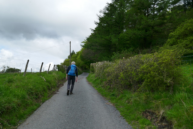
The path eventually drops down into woods before crossing Lunshaw Beck via stone slabs. We then started a mile long ascent which TSB correctly describes as a 'muscular climb'. This climb first passes Low Paradise farm, then Oak Beck cottage before continuing to climb all the way to High Paradise Farm.
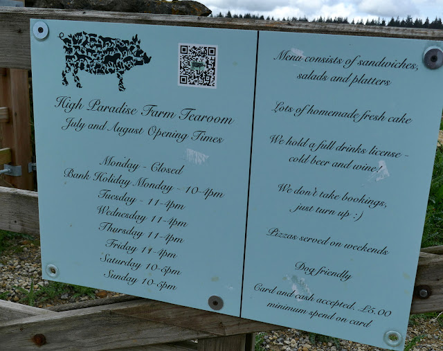
We approached High Paradise Farm and seeing that its tea room was open for business we spent a pleasant interlude here with coffee and blueberry scones.
 |
| Fresh tree felling at Windygill Ridge |
 |
| Rain approaches Cowesby below us |
Ahead of us was the Vale of Mowbray and to the right, Black Hambleton and we could see the hummock of Seta Pike, our next destination about a mile ahead.
Just after passing Seta Pike the path turns left to descend on a steep forestry path. The track was wet and boggy and the steep descents were slippery making progress slow. The path eventually levels out and we picked our way through Gurtof Wood, looking down on Gurtof Beck running below us. Here the track became very boggy and it was necessary to divert up and down to pass the worst bits.
 |
| Descending through Gurtof Wood |
 |
| Small tracks |
 |
| Boggy tracks |
 |
| Clive diverts past the worst bits |
 |
| An old milk churn in Gurtof Wood |
 |
| Unusual growth in Gurtof Wood |
We came to an area where felling had just taken place on our last visit and soon after this entered fields once more.
 |
| Passing last year's felling |
 |
| Right at the sign brings us to.. |
 |
| Fields once more |
We then walked through fields using way-marks on the field boundaries as guides until joining a wide track. We followed this to a green lane, which, after passing by a smallholding with sheep and a horse, led us to Boltby.
 |
| Follow the green lane to Boltby |
 |
| The riding school used to be the Johnstone Arms |
 |
| Boltby |
 |
| Boltby Scar above the village |
We stopped to look in the Holy Trinity Church which was unlocked and open to visitors.
 |
| Holy Trinity Church Boltby |
 |
| Towards the altar |
 |
| Altar window |
 |
| A penitent at the rear of the church |
The churchyard seems to contain only fairly recent graves and a further look at our guidebook 'The Walker's Guide to the Hambleton Hills' explained why: apparently it was the custom until Victorian times to carry the dead from Boltby and Kirby Knowle for burial at Felixkirk, "swathed in linen and uncoffined." It would be interesting to know the reason for this practice but unfortunately the book does not give one. Strange, when they had perfectly good churches in Boltby and Kirby Knowle. This local practice gave rise to the strange tale of the lost corpse at nearby Turton Beckstead. Tom Scott Burns relates a strange event that apparently happened here. In the 1860s some mourners were carrying a body from Kirby Knowle to Felixkirk for burial. The bearers set down the coffin to rest briefly at this spot, but on raising it up again it felt much lighter and they discovered that the corpse had disappeared. The empty coffin was buried and the site at Beckstead Wood became known as Lost Corpse End.
We continued our walk through Boltby and climbed to the car park to finish our walk just in time, as the persistent drizzle turned much heavier.
 |
| The last climb of the day |
 |
| A hiker's reward |


