"There must be dales in Paradise
Which you and I will find.."

Friday 14 February 2014

 Abandoned Walk

Drove to Hawnby intending to walk via Coombe Hill but standing water on paths and fields made the walk impossible.  Returned to Lords Stone and walked on to tops in bitter wind before abandoning and returning to Lords Stone for a pot of tea and a bacon sandwich.

Walking up to Falconer's Seat

Clive at Falconer's Seat

Thursday 6 February 2014


The Rosedale Railway and Botton Head from Ingleby Greenhow


8.5 miles                                       Cool,  wet underfoot


We parked in Ingleby Greenhow in the overflow car park for the Dudley Arms and walked back to the main road, in the direction of Kildale.  Our route turned right off the road into a narrow path between houses which soon exited onto a very muddy path across fields.


Today's walk from The Walker's Guide to the Cleveland Hills

Leaving the main road

Difficult paths

Field paths to Bank Foot

Our path took us across waterlogged fields via rights of way that seemed little used, until we reached Bank Foot where we turned right onto the old railway track.  Tom Scott Burns tells us that the old railway was completed in 1861 and leads to the foot of the incline bank where the trains were loaded with ironstone.  The incline reaches a maximum gradient of 1 in 5 and a brake drum house is situated at the top.  Three empty wagons were hauled by steel ropes as three loaded wagons descended, an operation which took 3 minutes at a speed of 20mph, regulated by the drum house.    Today we decided to leave the old railway track after a couple of hundred yards because we wanted to find a seat mentioned by TSB and marked on the above map as Lady Mary Ross Seat.  We climbed steeply up through the Battersby Plantation until we came to an old forestry track running parallel to the railway track.  Unfortunately water was draining from the woods onto the mud track and it was a quagmire.   We staggered along, slipping and sliding until we came upon Lady Ross's Seat, a crude stone chair engraved with the words 'Lady Mary Ross 1837'.  Little is known about her other than that she was married to the Earl of Kildale and had a daughter who married Sir William Foulis of Ingleby Manor.  The seat is believed to have been constructed here as it was the route of one of Lady Mary's favourite walks.  We were pleased to have found the seat and it made our muddy detour worthwhile.


We saw more of these crow totems - do they really work?

Clive examines Lady Mary's seat

Lady Mary Ross 1837
Forestry track adjacent to the seat


We had gained some height and were reluctant to make our way back to the old railway track so we continued along the forestry track, at one point my boot going deeply into a boggy bit, leaving me with a wet foot for the rest of the walk.  After approximately 2.5 miles the muddy track joined the old railway incline about a quarter of the way up and we turned onto a firmer surface for the steep climb uphill.  We were deeply in conversation as we climbed and unfortunately forgot to photograph the old carving of a man wearing a stove pipe hat with a bird in front of his face, believed to be graffiti dating back to the building of the railway.  It's situated where the incline cuts through a rock face about two thirds of the way up the incline. 

Picture taken last year

When we finally reached the top of the incline we were ready for coffee and scones and sat with our backs to the side of the incline, sheltered from the wind and looking back down the path we had climbed.

Climbing the incline

Looking back from our coffee stop

From bank top looking over at quarry workings

The line was officially closed on 13th June 1929 and now makes a nice 11 mile path to Farndale, Westerdale and Rosedale.    We continued to follow the railway track until we reached a turn to the right, where we saw the familiar acorn of the Coast to Coast Walk which we joined for a while.  This wide fire break track led us gently upwards to Round Hill where two ancient boundary standing stones are located, one with an engraving of a face and the other showing a hand.  We turned off the track at the Hand Stone to walk to the bronze age burial mound and its Ordnance Survey trig point, the highest spot on the North York Moors at 1490 feet.

Walking towards Botton Head


The Face Stone
Hand stone

Trig Point on Burial Mound

Ordnance Survey Trig Point at Botton Head


We walked back to the wide path and continued walking across Urra Moor, which according to TSB derives from the Old English 'horh' meaning 'filth'!  Eventually we came to a signpost and an indistinct path right which we followed to quickly drop off the moor down Jacksons Bank and into Greenhow Plantation.  


Urra Moor, Clay Bank and Wainstones in the distance

Dropping down from Urra Moor

Jacksons Bank

Once we left the moor track we were once again walking through mud and we were glad when we reached the lane down Greenhow Bottoms.   Over to the right we could see the incline railway and ahead of us Roseberry Topping appeared in the distance.  When we reached Low Farm we turned right, following a footpath sign, into Low Farm where we were amused by a small stone circle, an ancient monument - not!  Our path turned left before the farm buildings into fields which we crossed, one after another, on an unseen right of way, aiming for the yellow right of way signs at the field boundaries.  The fields were completely saturated and we squelched across them leaving deep footprints. 

Greenhow Bottoms

'Stone Circle' and incline path top left

Not a well used path

We were pleased when our path reached a bridge over Ingleby Beck and we saw the old church of St Andrews behind it.  We looked round the outside of the church but decided that our boots were too bad to enter the building, although it was unlocked.  The church was built in 1143 and rebuilt in 1741 at the parishioners' expense. 

Waterlogged fields


The bridge to St Andrews Church

We were interested to see a gravestone to the Chief Constable of Tynemouth, Tom Blackburn, who had held office between 1920 and 1946, obviously not promoted from the ranks.  What had brought him to Ingleby Greenhow, we wondered. 

St Andrews Church, Ingleby Greenhow

Tom Blackburn, Chief Constable of Tynemouth

A short walk back uphill returned us to the overflow car park and our car.


Thursday 30 January 2014


Nether and Over Silton to Oakdale Reservoir via Thimbleby  Plantation


7 miles                                       Dry, Cold and Grey


We started our walk from the car park at the junction of Hambleton Street and the Hawnby Road, which was already full with cars belonging to a group of beaters who were assembling on the other side of the road, their red flags tucked under their arms.   The sound of guns accompanied us throughout the whole walk.


Today's walk from The Walker's Guide to the Cleveland Hills

Leaving the car we walked along Hambleton Street, which crosses Thimbleby Moor along the right shoulder of Black Hambleton, and passed through a gate giving access to the conifer plantation.  Our path, known as Moor Lane, took us steadily downhill for about 2.5 miles through conifers and with little of interest until we saw the ruins of a lime kiln and later, near Rose Cottage, an ancient drinking trough.


Passing through Moor Gate, Black Hambleton in the distance

Moor Lane

Old Lime Kiln
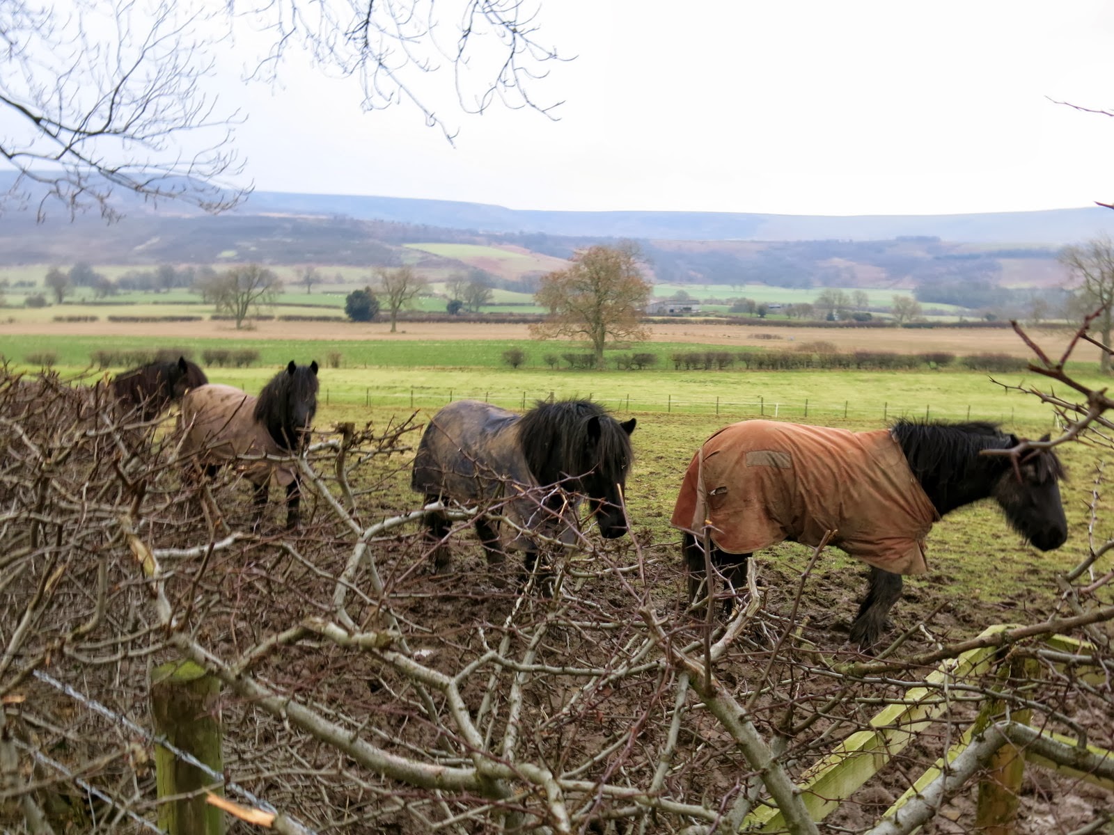
Some ponies walk with us hoping for apples

Rose Cottage

Old drinking trough, water still trickling from its spout

Moor Lane eventually ended at a T junction where we turned right and walked into the pretty village of Nether Silton.  We soon spotted the stone monolith which we discussed in an earlier blog post.  (See Walk 15th August 2013)  We looked at the chapel of All Saints, a medieval church which Tom Scott Burns tells us was rebuilt in 1812 at a cost of £450 raised by subscription and whose alter rails are made from the wood of HMS Dreadnought of Lord Nelson's navy.


Entering Nether Silton

Old Manor Stone monolith


All Saints at Nether Silton


Our path left the road opposite the church, as if into a private garden, through a white gate at the side of the old Post Office.  There is no way sign on the gate.  The path is a pleasant track through several fields but each gate was approached through thick mud because of recent rain.  We soon reached the unusual ancient church of St Mary, standing in a secluded field with no approaching paths and whose Jubilee bench made an ideal resting place while we enjoyed our coffee and scones.  I have described the church in earlier blogs but this time we were pleased to find an epitaph which TSB refers to and which I photographed.


'Hidden' path to Over Silton

Field paths to Over Silton

St Mary's, Over Silton

"All of you who come my grave to see - Prepare yourselves to follow me - Repent in time, no more delay - For youth and Age will soon decay - Life is uncertain, death is sure - Sin is the wound but Christ the cure"

Evidence of a picnic at the Jubilee Bench

Feeling much refreshed we walked across the fields away from the isolated church and towards the village of Over Silton.    Here we turned right and walked beyond the houses to a left turn where our path left the road and climbed steeply into Crabtree Bank Plantation. The next 2.5 miles were through conifers, sometimes on wide forestry tracks and sometimes on narrow footpaths but always very muddy and difficult to negotiate.  We climbed steeply for the first mile then our path levelled out for a mile before dropping sharply through Big Wood towards Oakdale.


View from our coffee stop

Looking back at isolated St Mary's Church

Striding out towards Over Silton

Difficult paths all the way through the plantations

As we walked through the appropriately named Big Wood we saw a couple of strange hides below us; were they for the shooters whose guns had been banging away all through our walk, or birdwatchers?  Whoever used them had gone to considerable trouble and expense as they stood at least 30 feet high.  Soon we could see down through gaps in the trees to Osmotherley, far below us .  


A Hide?

Another hide

Climbing through Crabtree Plantation

Trying to negotiate a tricky bit

The descent through the woods to Oakdale Reservoir was very slippery and we hung on to saplings as we slid downwards until we reached a bridge across the stream that runs between the upper and lower reservoirs.


Looking down from Big Wood towards Osmotherley

Clive decides I should get in front of the lens for a change

We saw a lot of new signs warning walkers to keep to the right of way

Awkward descent towards Oakdale Reservoirs

Bridge between reservoirs

As we approached the upper reservoir we joined the stone path of the Cleveland Way, which would lead us back to where our car was parked.  We stopped to admire the old reservoir and a gamekeeper on a quad bike zoomed up followed by several 4 x 4s carrying a shooting party and dogs.  The shooting party got out of their vans, all very smartly dressed in tweeds and flat caps with their guns still in leather cases.  We quickly left them at the reservoir and started the steep climb back to Hawnby Road and our car.  We stopped at the top of the hill to look back at the reservoir just as the first shots were fired.


Looking back at Big Wood

The gamekeeper arrives

... followed by the shooting party

Looking back to Upper Reservoir