"There must be dales in Paradise
Which you and I will find.."

Monday 24 November 2014


A Birthday Weekend in the Lakes

   Day 1              Dove Crag  and The Priest Hole

 Day 2                          Gowbarrow Fell             


Birthday party in the Priest Hole!

Wednesday 19 November 2014


The Drove Road and Windygill Ridge from Boltby


7 miles                           Grey with heavy showers


We left the A19 at the Knayton turn-off and drove through Boltby village and up the steep hill at the east side of the village to a small car park at the side of the road.


Today's walk from The Walker's Guide to the Hambleton Hills

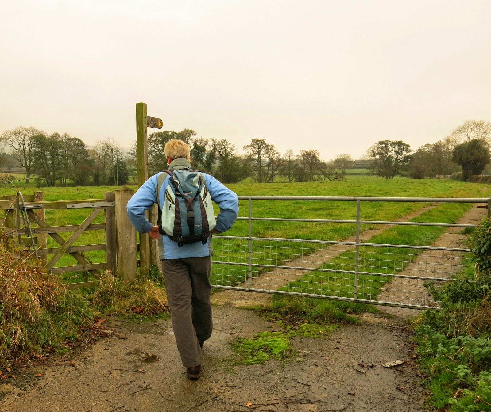
Leaving the car we continued east for 100 yards before bearing left to follow the farm path to Lunshaw House Farm.  Before reaching the farm we crossed a stile to follow a field path signposted Low Paradise.    Sheep had used our small path and made it very muddy pushing us onto the sloping wet grass and we slipped and slid our way down to Lunshaw Beck.


Lunshaw House farm track

Looking over the Vale of Mowbray towards Low Paradise

We leave the farm track

Crossing Lunshaw Beck

Our field track now climbed steeply, first to Low Paradise Farm and then on to High Paradise Farm.  The last time we walked this path, a little over a year ago, we were beset by hounds as we approached a bungalow above Low Paradise and we wondered if they were still around.  They were and seeing us approach began howling and barking but fortunately from the other side of a fence.  The owner peered out of the window and shouted at the dogs to no avail and they continued to bark as we climbed towards High Paradise Farm.  We were impressed by both neat and tidy farms.  


Below Low Paradise Farm

Low Paradise Farm

Who let the dogs out?!

Approaching High Paradise

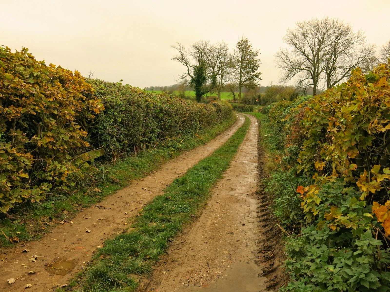
Tom Scott Burns describes the climb to High Paradise Farm as 'muscular' and we wouldn't argue with that description.  Finally on level ground we walked past the farm buildings and shortly came to the Old Drove Road at Sneck Gate, where we turned left to follow the green drove road, which is also a stretch of the Cleveland Way.  After about a mile on the old highway we came to Steeple Cross, or what's left of it, where we got down behind a stone wall and enjoyed our coffee and scones.  Steeple Cross was mentioned in 1246 but it is now just a 2 feet high piece of stone.  We sat for 15 minutes and in that time a cyclist and two sets of walkers passed by, all stopping to chat.  A busy spot considering we never saw anyone else throughout the whole walk.   As we finished the last of our coffee the heavens opened and I quickly donned my waterproofs while Clive unfurled his umbrella.   We turned left off the Drove Road through a gate and walked along a forestry path.


Old Drove Road, Boltby Moor to the left and Dale Town Common to the right

Leaving the Drove Road

Walking towards Gallow Hill

We walked through the forestry plantation and emerged at Gallow Hill, which in better weather would give us a nice view towards Cowesby village.  We turned left at Gallow Hill and followed the broad path to Windygill Ridge, all the time rain falling like stair rods.  To the left of our path was a forestry plantation and ahead a fine vista across the Vale of Mowbray and to the right Black Hambleton and the hummock of Seta Pike.  Suddenly the sky brightened and we looked down on a double rainbow, the nearest appearing very bright.

Lashing down!

Rainbow at Windygill Ridge

Just after passing Seta Pike our path turned left down a steep forestry path.  The track was very faint and also very boggy; the steep descents proved very slippery and progress was slow.   The path levelled out and we picked our way through Gurtof Wood, looking down on Gurtof Beck which ran below us.  Eventually we reached a gate leading out of the trees into wet meadows.


Steep descent!

Gurtof Wood

Totally unnecessary bridge

Out of the woods at last!

Our faint path crossed several meadows, all made very boggy by the rain until we came to a wide track through fields of maize, standing a good 7' tall.  We were surprised to see this growing here as a crop and wondered when it would be harvested and whether it would be animal feed or sold for human consumption.   The rooftops of Boltby now appeared below and the track led us alongside a field containing two rams, one of which must have been a pet as it came over to be fussed.  Clive can never resist feeding animals and the ram was treated first to an apple and then a rich tea biscuit, which it appeared to find more enjoyable.


Maize

Large fields of maize

'The Sheep Whisperer'

Apple's OK...

But biscuit's better...!

Our path exited at the west end of Boltby village and we turned left to walk along the road.  Set back from the road is Holy Trinity Church and finding it unlocked we entered for a look around.  The church is in very good repair and as TSB says that the church was first erected in 1409 and was continuously in use until it was rebuilt in 1859 we were surprised to see that the churchyard only seemed to contain fairly recent graves.  A further look at our guidebook The Walker's Guide to the Hambleton Hills explained why: apparently it was the custom until Victorian times to carry the dead from Boltby for burial at Felixkirk, "swathed in linen and uncoffined."  Unfortunately the book does not say why this happened!


Holy Trinity Church, Boltby


Altar windows, Holy Trinity Church


We continued to walk along the main street past the old stone footbridge over Gurton Beck before climbing steeply out of the village to the hard standing where we had left the car.


Old packhorse bridge over Gurton Beck

Boltby

Looking down to Hesketh Hall from our car park

Thursday 13 November 2014


Balk and Bagby from Sutton Village


7 miles                   Grey, dry and cool


We drove into Sutton-under-Whitestoneclife on the A170 from the A19.  Tom Scott Burns suggests that Whitestone Cliffe Inn in the village is a good parking place, but as his book was written 25 years ago Clive checked with the present innkeeper who said hikers were still always welcome to use his car park.  We walked from the pub car park and turned right into the A170 and followed it through the village until we turned at a wooden footpath with a sign pointing us south across the fields.


Today's walk from The Walker's Guide to the Hambleton Hills

We parked in the Whitestone Cliffe Inn Car Park

Walking out of the village along the A170

We leave the road and turn into fields


As is often the case with TSB's walks the footpaths today were hardly used and as neither of us had walked in this part of the Hambleton Hills before we had to pay close attention to our maps.  The vehicle track quickly turned into a field path alongside the town's sewage works, then on through more fields adjacent to Sutton Beck until it emerged beyond a static caravan park at the tiny hamlet of Balk.  TSB tells us that Balk originates in the Old English 'balca' or 'bank' and would have applied to the ridge of land between Balk Beck and Hood Beck.


Strolling past the sewage works


Crossing Sutton Beck

Entering Balk

We walked into Balk and were impressed by the renovated three-storey mill and opposite it, a furniture manufacturer occupying the old mill buildings.


The old mill

Old mill buildings now used for furniture manufacture

We joined the road at Balk and remained on it, heading west until we reached the larger village of Bagby.  Although our route turned off just before the village we couldn't resist a look around and continued to walk along the high street.   There is an interesting mixture of very old and very new housing but the new building gives an impression of the houses being crowded, we thought.   We retraced our steps to the field path just before Bagby and headed south once more, towards Thirkleby.  We passed by another caravan park and the grounds of  Thirkleby Hall before emerging on to the road at Thirkleby, by the old school whose clock was accurate to the minute.


We pass our track to look around Bagby


Leaving Bagby

Most paths today were well signed

The old schoolhouse at Thirkleby, whose clock tells us it's coffee time!

We walked through Thirkleby to the isolated church of All Saints where we settled down to enjoy our coffee and scones before looking round the church, which was unlocked.  The church was bigger than one would expect for the size of the village, with fine stained glass windows picturing St George and St Martin, and had interesting 17th century inscriptions on the walls.


All Saints Church at Thirkleby

The altar at All Saints Church


Leaving the church we walked back to the road then crossed straight over to join a field path leading to a footbridge then quickly to the Little Thirkleby Road where we turned left to walk parallel with the route we had followed into Thirkleby, this time to the right of Thirkleby Beck.  


Leaving Thirkleby

Walking north, parallel with Thirkleby village, through which we had just walked southwards

Double stile and bridge

We catch a glimpse of the White Horse at Kilburn

The next bit of the walk became rather tricky.  We could find no way-mark signs (most unusual!) and field enlargement appeared to have swallowed up the footpath as described by TSB.  Using the GPS to keep exactly on the track we marched across the arable field through which shoots were just starting to appear.  Perhaps a problem to be expected with Tom Scott Burns's walks is that paths are so little used that farmers feel entitled to plough them up.  Continuing across these fields we found that the farmer had ploughed right up to the edge of the field removing the footpath completely and making walking difficult.  At this point we were surprised to come across an old vehicle in the ditch, how had it got to this point and when?  Clive climbed down to examine it and checking the engine plate found it to be a Standard 10 from the 1950s.  We continued across fields relying on the GPS to show we were on official rights of way until we reached the large farm of Low Osgoodby Grange.


What's happened to the footpath?

How did that get there??

The engine plate shows Standard 10

Low Osgoodby Grange

Some residents of Low Osgoodby Grange

Field paths were muddy at times

Following the old field boundary.  This is a footpath according to the map!

Funny place for a gate.  We wonder what is planned for this field
From Osgoodby Grange we followed the farm's track to the tarmac road where we turned left, heading back towards Balk.   In the distance we could now see Whitestone Cliff.


Whitestone Cliff

Just before reaching the tiny village we turned right and followed our track, now clearly way-marked, across fields until we reached the road at Sutton-under-Whitestonecliffe, which we followed back to the inn and our car.  It seemed only proper to reward the landlord for his hospitality by giving him our custom and we discussed the walk over a pint of Black Sheep bitter.  Today's walk was very level, easy walking but mainly across fields, which would have been difficult to cross if the ground was any wetter.  


Approaching Sutton-under-Whitestonecliffe

Clive feeding an apple to the sheep

Portrait of the hiker enjoying his reward, the artist reflected in the mirror