Tripsdale to Bransdale from Chop Gate
12.5 miles Hot and sunny
The weather forecast was for sun and little wind so we decided it was time we tackled one of Tom Scott Burns's longer walks. We parked at the village hall car park in Chop Gate and walked south along the B1257 until we saw a footpath sign indicating William Beck Farm where we turned off the road.
 |
| Today's walk from The Walker's Guide to the Cleveland Hills |
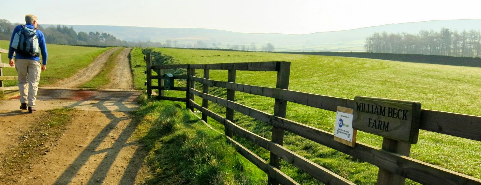 |
| Leaving the road |
A pleasant walk along the farm track brought us to William Beck Farm, long established according to TSB, who informs us that in 1160 it was named Willelmesbec. The footpath bears right at the farm building and then climbs steeply to the moor gate. Pressing straight on we soon dropped down Black Intake into the uninhabited and hidden dale of Tripsdale. On the 12th February 1943, during World War 2, a Wellington Bomber returning to Croft after being hit over Holland crashed on Black Intake, killing all six crew and bits of wire and metal are still to be seen scattered in the heather.
 |
| Moor gate |
 |
| Looking back at William Beck Farm and Chop Gate |
 |
| Access track down Black Intake |
Ahead of us we could see the ugly scar of the shooters' track up the other side of Tripsdale heading towards Bransdale but first we thought we would divert to look at the Ship Stone, so called because the front of the stone looks like the prow of a ship. We reached the beck and turned right for a hundred yards or so and found the Ship Stone which looks insignificant as one approaches but is enormous from the other side. On the stone is a Latin inscription which translates as "All things are full of the Creator. John Hart, a man of Bilsdale 1849".
 |
| Following Tripsdale Beck |
 |
| The Ship Stone doesn't look much from this side |
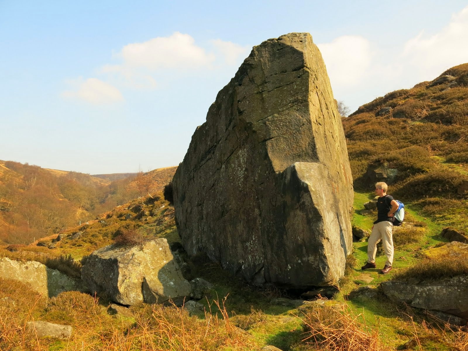 |
| Clive examines the inscription |
 |
| 'All things are full of the Creator' - John Hart a man of Bilsdale 1849 |
We walked back towards the bulldozed shooters' track passing the ruins of a dwelling which TSB explains was the home of an old cobbler who used to sell clogs and shoes outside the Fox and Hounds Inn at Seave Green on Sundays, as the congregation came down from Urra Church. There were numerous traps set around this building but nothing had been caught.
 |
| Trap near ruins of cobbler's hut |
 |
| Cobbler's hut. Traps set on each of the wooden poles |
 |
| Looking back along Tripsdale from the Cobbler's Hut |
|
|
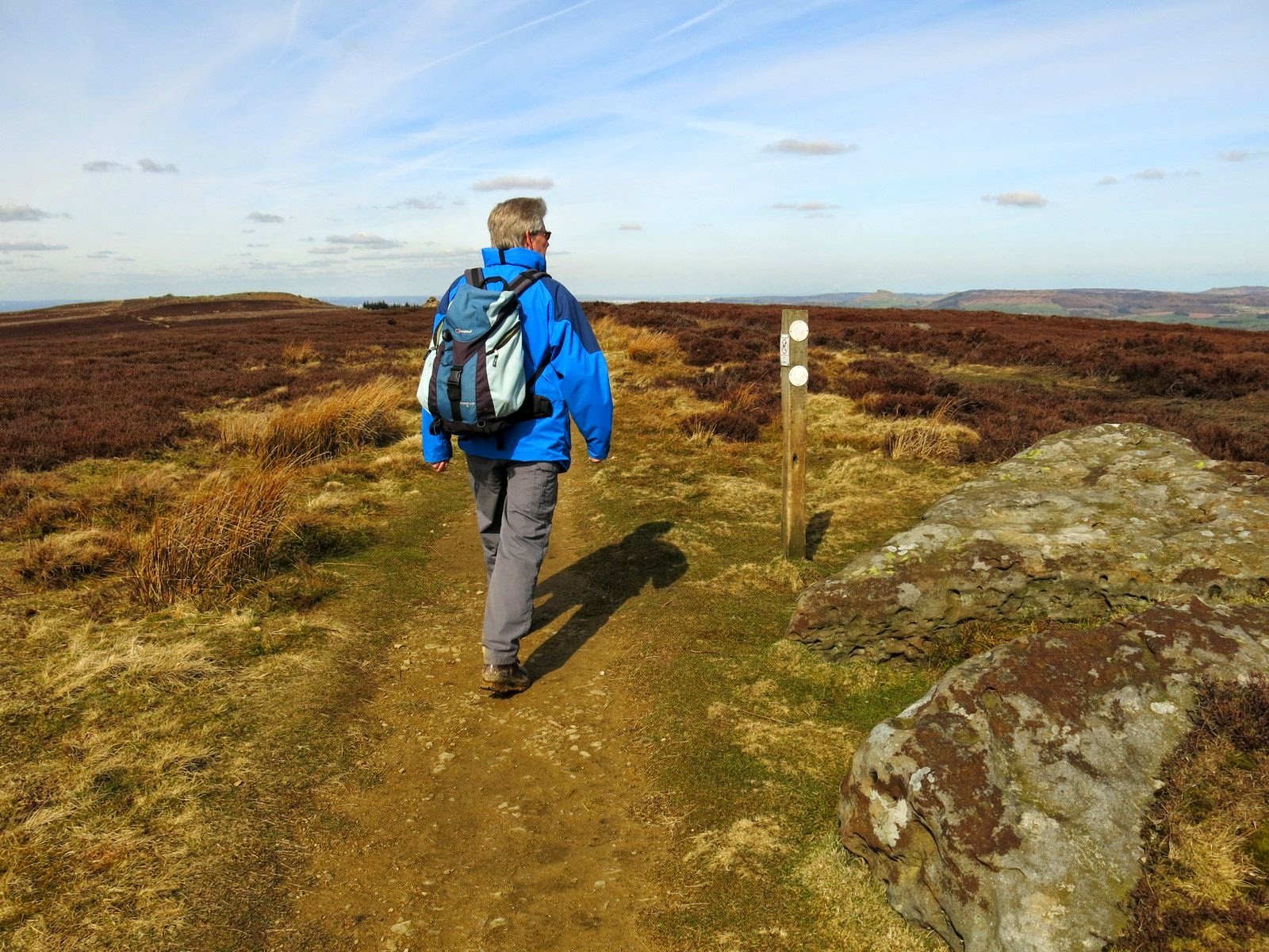
We climbed out of Tripsdale onto Hagg Moor, a 'hagg' being a wood or coppice grown on broken ground, and then crossed Todd Intake Moor. After walking for about a mile we came to two huts on the right hand side. In the mid-90s I took shelter in one of these huts in a storm and found Tom Scott Burns had left leaflets on the table, advertising his Walker's Guides, intended to be picked up by passing hikers. Nothing so interesting today however, but we decided it was time for a little something as we had been walking for a couple of hours.
 |
| Hagg House Moor |
 |
| Huts |
 |
| House martin's nest and fire break shovels |
 |
| Sheep's skull doesn't frighten us off |
 |
| Coffee break |
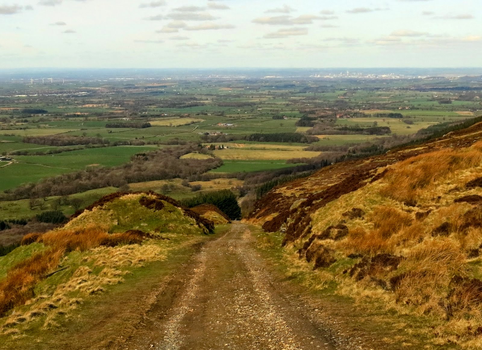
We continued along the moor track for another mile or so and came to the remains of Stump Cross and, shortly after, the almost hidden turn off to Bransdale. We would have missed this without the GPS., but once descending the track there was a reassuring cairn every hundred yards or so, to prove it wasn't just a sheep track. We soon came to a fine view down into Bransdale.
 |
| The remains of Stump Cross |
 |
| Watching us pass |
 |
| The GPS says turn left here! |
 |
| A track soon appears |
 |
| Looking down into Bransdale |
The track led us down into Bransdale, crossing a small road, and to Colt House Farm, which is marked as Bransdale Castle on old maps. From the farm we followed way marks across several fields and descended to reach an old sun dial above Bransdale Mill. This seemed an excellent spot for lunch with fine views in all directions.
 |
| Descending to Colt House Farm |
 |
| Farm residents watch us pass |
 |
| Bransdale Lodge |
 |
| Sun Dial and old mill below |
 |
| Inscription on sun dial warns us we'd better get on with lunch |
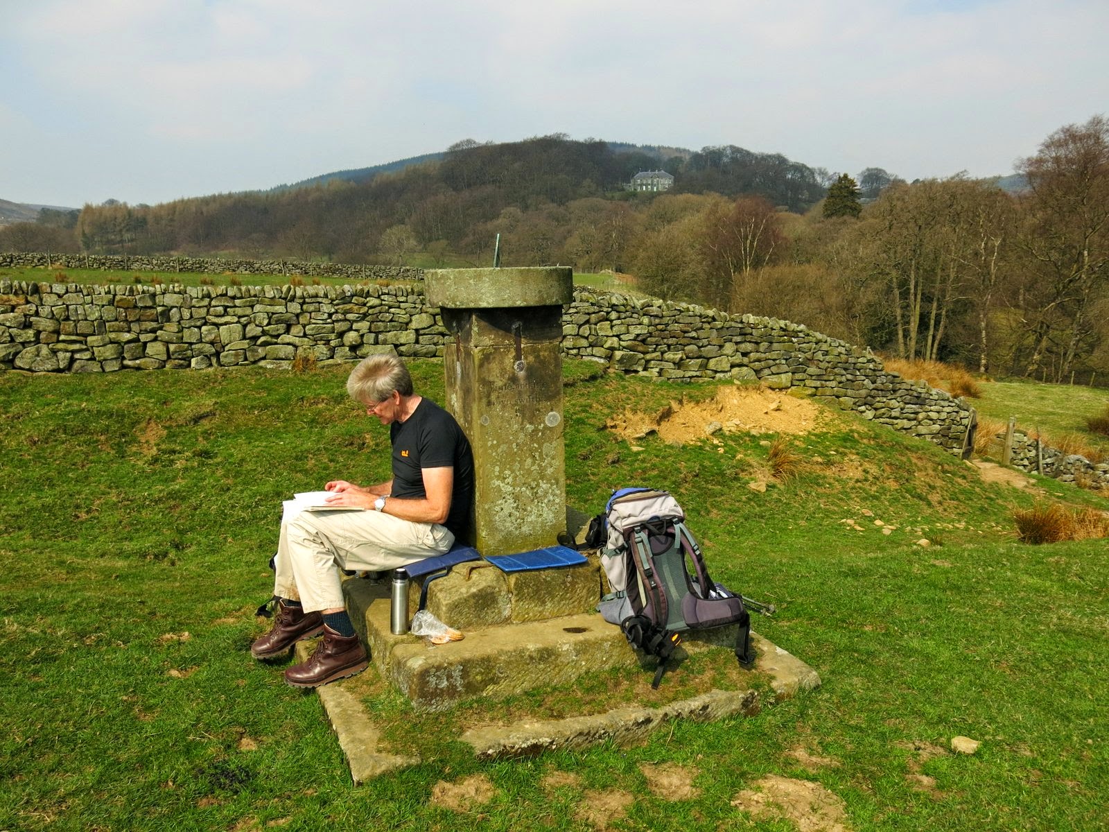 |
| Clive checks Tom Scott Burns' walk notes |
Lunch over, we walked down to look round the old mill, which appeared to completely deserted today. On the front of the building was an inscription stating that it had been rebuilt in 1842 and the wall ties 'W' and 'S' stand for William Strickland who rebuilt the mill after moving from Farndale. Round the back we saw a Greek inscription which was apparently the work of Strickland's son, who became curate at Ingleby Greenhow and is responsible for a number of inscriptions in the area. TSB says that this one means, "Rejoice evermore Pray without ceasing. In everything give thanks."
 |
| The Old Mill |
 |
| Rebuilt 1842 |
 |
| Hebrew and Greek! See text above |
 |
| Looking back at the mill as we climb out of Bransdale |
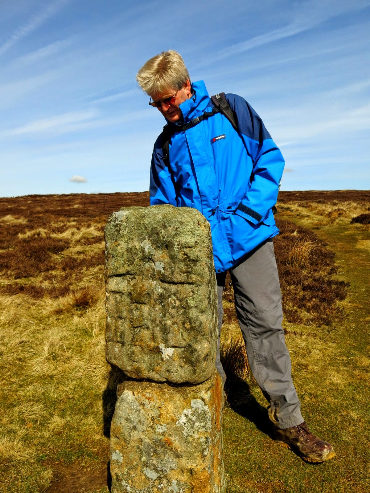
A steep climb out of the dale brought us first to Cow Sike Farm and then up alongside a conifer plantation, to eventually join the ancient roadway of Rudland Rigg, which runs from Kirby Moorside to Turkey Nab above Ingleby Greenhow. On the right of the roadway we came to a large standing stone which TSB says was 'erected by primitive hands'. This is known as the Cammon Stone, derived from the celtic 'cam' meaning 'bank stone'. A Hebrew inscription translates as "Hallelujah", almost certainly the work of Emmanuel Strickland from Bransdale Mill!
 |
| Walking up to Rudland Rigg |
 |
| Rudland Rigg |
 |
| The Cammon Stone |
 |
| Hallelujah |