Wass to Cockerdale and Byland Abbey
7 miles Cold and bright
We parked by the Village Hall at Wass where there is ample parking and an honesty box. We walked back to the crossroads and turned left up the lane then walked steadily uphill out of the village.
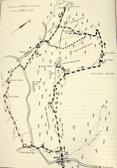 |
| Today's map from The Walker's Guide to the Hambleton Hills |
 |
| Stone from Byland Abbey was used in many houses in Wass |
 |
| The Wombwell Arms, Wass |
 |
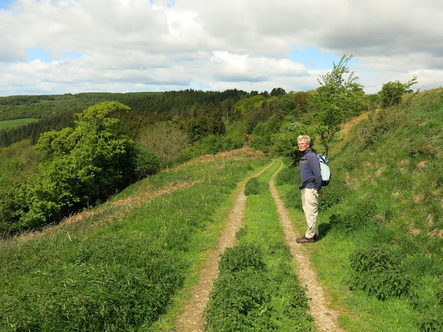
| Uphill, out of Wass |
|
|
Tom Scott Burns says in The Walker's Guide to the Hambleton Hills, that Wass is taken from the Middle English word wathes and means 'fords', there being two such crossings in the village. We walked into woods, to the right, Blind Side Gill and to the left, Abbey Bank Noddle, admiring the masses of bluebells and other wild flowers. This was a steady climb which suddenly got steeper as we followed our path to the ridge of Snever Scar. TB says that a reward for this is the view over the Vale of York but unfortunately trees have grown which now obscure that view.
 |
| Towards the Observatory |
 |
| We found this strange offering along the way |
 |
| Thank you, but who was the message for? |
 |
| Abbey Bank Noddle |
 |
| Climb to Snevers Scar |
Our path led along the ridge, frustratingly our view was always spoilt by tree cover, then descended from the ridge until we reached a gate with a track making its way left uphill. There were no signs, but a friendly dog walker had warned us that we should take the left here if we wanted to see the observatory, so we made our way back up to the top of Snever Scar and the stone folly known as The Observatory came into view.
 |
| Approaching The Observatory |
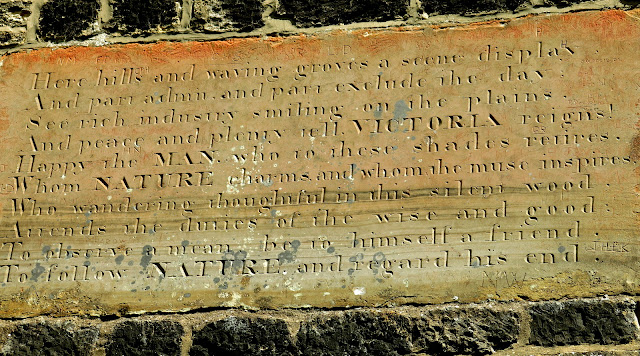 |
| Here hills and waving groves a scene display, And part admit and part exclude the day, See rich industry smiling on the plains, And peace and planty yell VICTORIA reigns!, Happy the MAN who to these shades retires, Whom nature charms and whom the muse inspires, Who wandering thoughtful in this silent wood, Attends the duties of the wise and good, To observe a mean, be in himself a friend, To follow NATURE and regard his end |
 |
| John Wormald in the first year of the reign of Queen Victoria, caused this observatory to be built |
|
 |
| The Observatory |
 |
| Our best view |
The Observatory was padlocked which was a shame as climbing it would have put us above the frustrating ground cover that spoiled what would have been a magnificent view. We retraced our steps back to the gate and turned left to walk along field paths. According to TSB this was the scene of the Battle of Byland in 1322, when King Edward II was defeated by Robert de Brus of Scotland. The King only escaped 'by the very pity of Christ' leaving behind in his flight the royal treasure and the crown jewels. Our path led us past Cam farm and Cam House before reaching Cockerdale Wood. As we passed through the wood we went left from the forest track onto a small path that descended steeply through the wood perimeter where we saw Cockerdale Farm standing in the centre of a large meadow.
 |
| Returning to the gate after The Observatory |
 |
| Once the scene of the Battle of Byland |
 |
| Cam House |
 |
| View from Cam House |
 |
| Towards Cockerdale Woods |
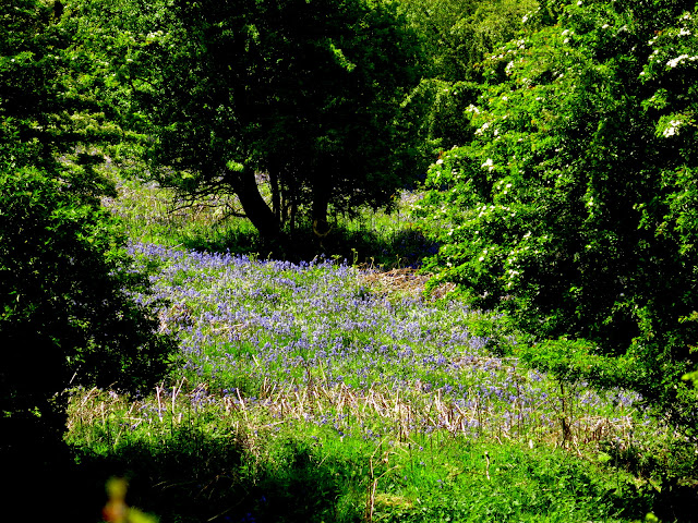 |
| Woods full of bluebells |
 |
| Follow the path to Cockerdale Farm |
 |
| Steep descent through Cockerdale Wood |
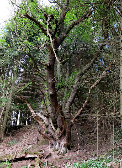 |
| Enormous oak, trunk must have measured 20 feet |
Leaving the wood we came to a gate and a dead pheasant. The bird was recently killed and appeared to have a broken neck, we wondered if it had flown into the gate accidently. There were no other injuries to be seen.
 |
| A mysterious death |
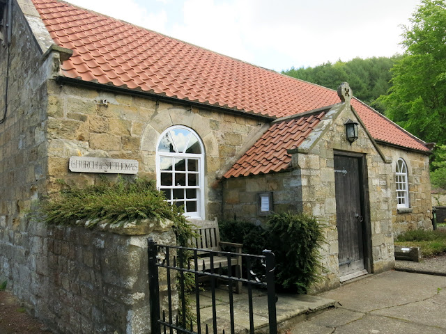
We passed the farm and once again climbed steeply uphill to meet a lane. Our walk should go left here but TSB suggests detouring right to a little chapel, and this is what we did. He did not mention however, that the lane is exceedingly steep and we soon forgot the cold wind as we puffed uphill. The chapel was a charming spot apparently built as a dedication to three pupils from Ampleforth College who were killed in WW2. Next to the chapel was a low wall where we sat in the sun, sheltered from the cold wind and enjoyed coffee and scones.
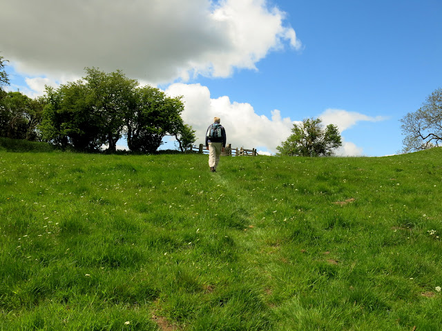 |
| Climbing past Cockerdale Farm |
 |
| We join a lane to the small chapel |
 |
| The small wall provided a nice coffee stop |
 |
| Carvings above the chapel door |
 |
| History of the chapel's builder |
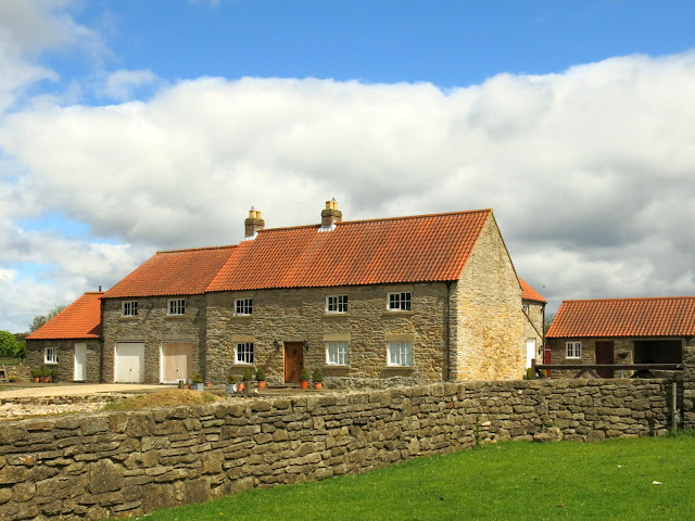
The chapel was padlocked so we retraced our steps, finding the going much easier downhill and we carried on to join a tarmac road for a hundred yards before turning left past the impressive building of Oldstead Hall, built by John Wormald who also constructed The Observatory. We followed a field path and rejoined the tarmac. At the side of the road was a metal trailer and a sheepdog made friendly noises from inside. There was no sign of the farmer but it looked as if preparations were in hand to move nearby sheep. A short stretch on tarmac and we turned left towards the imposing building of Oldstead Grange.
 |
| Walking downhill from the Chapel |
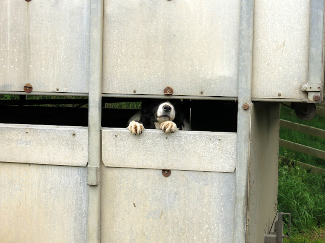 |
| "Come and see me!" |
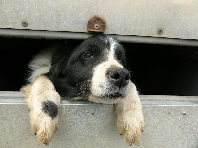 |
| Friendly sheepdog |
 |
| Weathervane near Oldstead |
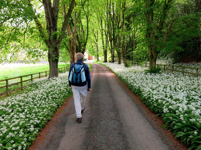 |
| Wild garlic as we approach Oldstead Grange |
 |
| Oldstead Grange |
Continuing past the Grange we followed yellow waymarks across field paths passing by a farm called Cam Heads where we noticed mill stones built into the wall, then following our path across field after field until we reached the ruins of Byland Abbey.
 |
| Emerging onto fields after Oldstead Grange |
 |
| Wildflowers at the side of the meadows |
 |
| The blue flowers of linseed crops |
 |
| Cam Heads and mill wheels built into wall |
 |
| The farm cat watches disapprovingly as we pass |
As I mentioned in previous walks in this area, thirteen monks detached themselves from Furnace Abbey in Lancashire and after a series of temporary abodes over 44 years the brethren built themselves a small cell near to Old Byland. They moved from here and in 1147 migrated to a spot near Oldstead, where they built a small church, cloisters and accommodation. After 30 years the Abbot decided to leave for another spot and selected the place where the ruins now stand, in Byland. They used local stone from quarries at Wass and 'moved in' on 31st October 1177.
 |
| Sign at Cam Heads |
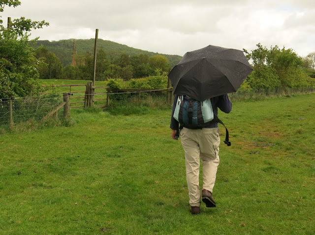 |
| A cloudburst as the ruins of the Abbey appear ahead |
 |
| Spitfire weathervane at Byland |
Tom Scott Burns says that the architecture of Byland Abbey remains a perfect example of Cistercian planning on a grand scale and Clive and I were surprised at the extensive development. TSB explains that the church, itself 330 feet long, was fringed by chapels and columns, only traces of which remain.
 |
| Byland Abbey |
When the Abbey was dismantled in 1540 after the supression of the monasteries by Henry VIII, it housed twenty five monks beside the Abbot. An interesting webpage about the monastery, showing a reconstruction of how it would have looked in its heyday is here.
We walked past the Abbey before rejoining a field path back to Wass, where, the weather having faired up again, we sat outside the Wombwell Arms and enjoyed a pint of Black Sheep. A nice end to a nice walk.
 |
| A stork near Byland Abbey |
 |
| Wildflowers at Wass |
|
 |
| We enjoy a pint outside the Wombwell Arms |


