Hawnby, Easterside Hill and Shaken Bridge
7.5 miles Dry and Bright
We approached Hawnby from the B1257
Stokesley to Helmsley Road and drove to the lower houses of Hawnby
Bridge. Tom Scott Burns explains that the
village of Hawnby is divided into an upper and lower part because in the 1750s a zealous landlord turned
out all the Methodists from their houses. They had lived in what we now
think of as the top village. They moved a short distance
away where they built some small houses and a Wesleyan Chapel, completed
in 1770, now the lower village.
We parked behind this Chapel where parking is freely available for about a
dozen cars.
 |
| Today's walk from The Walker's Guide to the Hambleton Hills |
 |
| Parking free... but... |
 |
| Cottage near village hall |
After leaving the car park we turned right and walked past the village shop and cafe to the junction, which we crossed to walk straight into fields which were very wet and muddy.
 |
| Straight across the road and through that gate.. |
 |
| ... into fields |
 |
| Crossing Ladhill Beck |
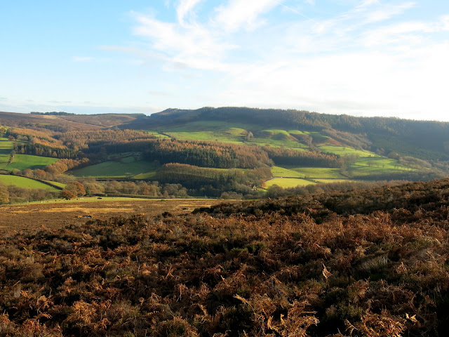
After crossing the beck we walked slowly uphill to reach Ellers Wood and then Easterside Farm where we joined the Hawnby road for a hundred yards before turning right at a signpost, over a stile and into fields.
 |
| Looking back at Hawnby from Ellers Wood |
 |
| Easterside Hill |
 |
| Muddy trail at High Banniscue Farm |
We followed the trail under the shadow of Easterside Hill until we dropped down to follow the farm track for High Banniscue Farm. When we reached the farm we turned left to head to a way-marked gate then turned right to walk along the field with Pepper Hill and Easterside Hill over to our right.
 |
| Looking left over to Hawnby Hill |
 |
| Through the water and through the moor gate |
Passing through the moor gate we followed a track to our right round the end of Pepper Hill and then back towards the other side of Easterside Hill. On this eastern side of Pepper Hill is the site where a German Dornier crashed during the last war, killing its four air crew. A memorial window to the airmen can be seen in Hawnby Church.
 |
| Heather track under Pepper Hill |
 |
| Looking left towards the B1257 |
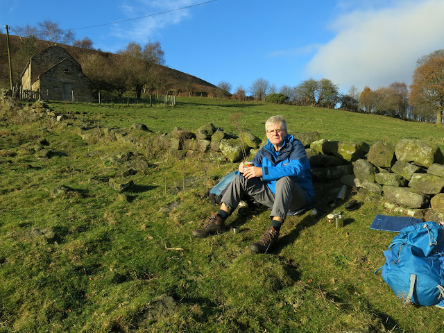
We re-crossed the Hawnby road and walked towards the ruins of Grimes Holme where we have previously stopped to have our coffee. Today, however, the sun was shining and there was no wind so we decided to have our scones facing the sun with our backs against a stone wall, looking down to Grimes Holme. Just as we sat down we were buzzed by a solitary fighter jet.
 |
| Slippery wooden steps down to the road |
 |
| Turn right again at the stile |
 |
| We nearly spill our coffee |
 |
| Coffee and scones in the sun |
 |
| The ruins of Grimes Holme |
After a leisurely break we walked down to Grimes Holme and found the path to be very muddy. Passing by the ruins we crossed the River Seph at a footbridge and dropped down to join tarmac at Fair Hill Farm.
 |
| Heavy going at Grimes Holme |
 |
| Clive spots the footbridge.... |
 |
| .... over the River Seph |
 |
| Joining the tarmac at Fair Hill Farm |
We turned left and followed the tarmac lane down to Broadway Foot Farm, which has been a ruin for several years following a fire. Builders were hard at work and no doubt on our next visit the building will be occupied.
 |
| Looking back at Easterside Hill |
 |
| Two types of native pheasant, the Cookit (left - more sporting for shooting) ) and the traditional bird |
 |
| Builders at Broadway Foot Farm |
 |
| Old pan tile roof at Broadway Foot Farm |
 |
| The weather vane is still in place at Broadway Foot |
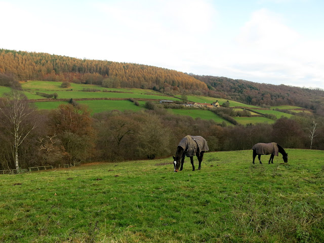
We continued past Broadway Foot after chatting to a roofer about the development, and followed the tarmac lane down to where the River Seph and the River Rye converge, near to Shaken Bridge.
Tom Scott Burns tells us that the name Shaken Bridge derives from the Old English 'sceacre' meaning robber, so 'Robbers Bridge'.
We crossed the bridge and followed the road for a hundred yards before turning left at a signpost for Shaken Bridge Farm.
 |
| Shaken Bridge |
 |
| Looking upstream |
 |
| Looking downstream |
 |
| Turn left for Shaken Bridge Farm |
We followed the track past the farm and uphill to East Ley Wood where we turned right and walked past an old barn. At the first gate we took the left fork but at the second we went through the gate into East Ley Woods.
 |
| Back to Shaken Bridge |
 |
| Horses at Shaken Bridge Farm |
 |
| Climbing to East Ley Wood |
 |
| Old High Barn |
We were surprised to see that some old leather signs on the gateposts, bearing a rough sketch of a hiker were still present. We have often wondered who put these signs here and why.
 |
| Left at the first gate |
 |
| Through the next... |
 |
| Sign on gate |
 |
| Fungus in East Ley Wood |
We meandered along this path for about 1.75 miles, eventually exiting at Murton Bank top.
We turned right here, onto the tarmac road and descended steeply with fine views over to our left, first of Dale Town and then the twin settlements of Hawnby.
 |
| Dale Town |
 |
| Steep downhill |
 |
| Hawnby Hill and Hawnby |
As we passed the entrance to Dale Town Farm some chickens were scratching at the verge sides. One took a fancy to Clive and amused us by walking at his side until we reached its boundary near to Hawnby Bridge where it turned back.
 |
| 'Wild' hens |
 |
| Clive and his walking companion |
 |
| Easterside Hill in the distance |
We crossed the bridge and walked back into Hawnby to reach our car.
 |
| Entering Hawnby |


