"There must be dales in Paradise
Which you and I will find.."

Friday 25 August 2017


The Rosedale Railway and Botton Head from Ingleby Greenhow


 8.5 miles                                Mainly fine and cool


Tom Scott Burns notes in his Walker's Guide to the Cleveland Hills, that the name Ingleby has been written in various ways over the years including Angleby, Engelbi, Yngleby and Yngylby. During the reign of William II (1087-1100) Guy de Baliol was granted the barony of Ingleby and it remained in his family until the 13th century.

We parked in Ingleby Greenhow in the overflow car park for the Dudley Arms and walked back to the main road, in the direction of Kildale.  Our route left the road alongside a newly built house and we followed an overgrown path onto meadows.  


Today's walk from The Walker's Guide to the Cleveland Hills


Turn off road between houses...

... into track between houses

... leading to fields


Apart from the moorland trails our paths today were little walked and overgrown in most places. We crossed a field with sheep, adjacent to Ingleby Manor and then several meadows, to arrive at Bank Foot Farm situated under Turkey Nab, which is probably derived from the old personal name Thorlkil.  Tom Scott Burns says in his Walker's Guide that in 1729 William Parkin was hung from gallows mounted on Turkey Nab for murdering his brother-in-law at Great Broughton.


Ingleby Manor


Arriving at Bank Top Farm

 
We joined the bed of the old railway track at Bank Foot and turned right to walk towards the incline bottom. After a couple of miles we passed by some old railway cottages and reached the stiff gradient of the old incline railway.  


Old railway track from Bank Foot

Old railway cottages

I spot a 'new' blacksmith weather vane but can't get a clear shot!

Bear left for the Incline


Tom Scott Burns tells us that the old railway was completed in 1861 and leads to the foot of the incline bank where the trains were loaded with ironstone.  The incline reaches a maximum gradient of 1 in 5 and a brake drum house was situated at the top.  Three empty wagons were hauled by steel ropes as three loaded wagons descended, an operation which took 3 minutes at a speed of 20mph, regulated by the drum house.    


Mine workings from the Incline

Gate near the top of the Incline

The graffiti is between the gate and the top on the left as you climb

Looking back down the Incline

Our passing is noted


We climbed steadily and passed by some old graffiti of a man wearing a stovepipe hat with a bird in front of his face.  TSB suggests that this is a satirical caricature carved by a railway navvy in a moment of inactivity.  


Old drum house ruins
Greenhow Moor

Well situated bench

Ideal for a coffee stop

Our view from the bench

Reaching the top we looked at the remains of the drum house and then continued along the old railway line until we came to a bench looking down into Greenhow Botton.  This seemed an ideal spot for coffee and scones, and so it was.


Resuming, we turned right off the old railway, which officially closed on 13th June 1929 and now makes a nice 11 mile path to Farndale, Westerdale and Rosedale and joined a trail to Cockayne Head and Botton Head, which is also part of the Cleveland Way.  As we walked this trail we came to two old boundary posts, the first known as The Face Stone is mentioned in a 1642 document for the Helmsley Estate, and the second showing a carved hand near to Round Hill dates from 1711.  Near the Hand Stone is the trig point at Botton Howe which is located on a Bronze Age burial mound at 1490 feet, the highest point on the North York Moors.


Face stone


Old trig point

Hand stone

New advice board

We walked back to the wide path and continued walking across Urra Moor, which according to TSB derives from the Old English 'horh' meaning 'filth'!   

We noticed a partridge walking slowly towards us along the path. It seemed unhurt although short in the tail feather department, and after eyeing us beadily continued along its way.

Seemingly unafraid


We heard a quad bike behind us and it stopped alongside, the driver obviously wanting a chat.  He told us he was looking for sheep that had dodged shearing and had a pen of 17 further along, where he was now going.  He showed us his electric shears and his hand shears which he had in a case on the front of the quad.  In answer to our questions he pointed out the boundaries of his land (he was a Bransdale man) and the area covered by the neighbouring shepherd, ( a Baysdale man) but said they crossed each other's land all the time as the sheep knew no boundaries.

We admired his dogs and he told us that the one standing in front of the quad was 5 years old and bought from Ripon, its sire being worth a thousand guineas, and that he had bred the other, which was now 9 years old.


Looking towards Clay Bank

Well met, the shepherd stops for a chat


Looking across at our walk up! 

Eventually we came to a signpost and an indistinct path right that we followed to quickly drop off the moor down Jackson's Bank and into Greenhow Plantation. 


Turn right to Jackson's Bank

Descending Jackson's Bank

Forestry work going on today


We reached the lane down Greenhow Bottoms and over to the right we could see the incline railway while ahead of us Roseberry Topping appeared in the distance.  A mile or so further on the tarmac lane and we reached Low Farm where we stopped to feed an apple to a horse.

Texel Ram


We turned right, following a footpath sign into Low Farm where we admired their 'ancient' stone circle and appropriate weather vane.

'Ancient' stone circle at Low Farm

Weather vane at Low Farm

Our path turned left before the farm buildings into fields which we crossed, one after another, on an unseen right of way, aiming for the yellow right of way signs at the field boundaries.

After a mile of field walking our path veered right into bushes and descended on a slippery paved trod to reach the bridge over Ingleby Beck, and next to the bridge, the old church of St Andrews. 


No apparent path but yellow way marks on fences

Descending old trod to Ingleby Beck

Over the bridge..

.. to St Andrew's Church

The church was unlocked so we entered and had a look around.  The original church was granted to the Bishops of Whitby in 1143 by Adam de Ingleby and still retains traces of Norman work, we liked a nice pig effigy on one pillar.  Apparently the church was rebuilt at the parishioners' expense in 1741.


St Andrew's Church

Altar window

Looking to the rear of the church

There are two recumbent effigies, one of
   a knight  (probably C15)...

.... and the other, a priest (Willimus Wrelton, incumbent c.1300)


Original Norman carvings.. a caricature?

.. a dog?

.. a boar or pig
.. a dragon or serpent?
St Andrew's Church, Ingleby Greenhow


We both agree that this walk of TSB's is very enjoyable, with a bit of everything; hills, moors, farms and woods and deserves to be walked more frequently to prevent many of the paths falling into disuse.


Friday 18 August 2017


Bank Foot to Upper Baysdale 

and Burton Howe


11 miles                                         Sunny and warm


We decided on a longer walk today, taken from The Walker's Guide to the Cleveland Hills by Tom Scott Burns.  We parked at the road side near to Bank Foot Farm, which is approached from the unclassified road between Ingleby Greenhow and Battersby.


Today's walk from The Walker's Guide to the Cleveland Hills


Bank Foot Farm

Tom Scott Burns relates a grisly event that occurred here on 3rd October 1924.  Frank Ward, who lived in one of the railway cottages on the incline, failed to return home after an evening of drinking at the Dudley Arms in Ingleby Greenhow.  His daughter Hannah and a neighbour called Medd Carpenter made a search and followed a trail of blood to a haystack at Bank Foot where Frank's body was found partially concealed.  Later that morning the police found Frank's best friend Jerry Dalton, who lived in a cottage near Bank Foot Farm, slumped in a ditch with self inflicted throat wounds.  He was subsequently convicted of the murder of his friend and hanged for his crime. 


We walked past the farm and immediately started to climb the rutted forestry path towards Turkey Nab noticing a few signs warning against the use of unauthorised 'off road' vehicles.


Forestry track to Turkey Nab


Old information board at Turkey Nab


On reaching the top we paused to admire the view and get our breath back.  There are fine views over Ingleby Greenhow and Battersby Junction and we picked out familiar land marks before passing a chain and following a moor path onto Ingleby Moor


Battersby Junction from Turkey Nab

Step over the chain to follow the moor path
The view east from Turkey Nab

Just beyond the Nab we turned left onto a smaller track that leads across Ingleby Moor, crossing Black Beck about a mile further on before a slight climb to bear left onto Middle Head Road.   The heather is now at its finest and there was a tremendously strong smell of pollen.  Bees and other insects were everywhere but not interested in us.

Starting to cross Ingleby Moor

Through walls of heather

This year's display is the best we've seen

Descending to Black Beck 

Shortly after crossing Black Beck we came to an interesting group of large boulders known as the Cheese Stones, a good vantage point for looking down into Baysdale.  We walked over to have a better view. 

The Cheese Stones


 B Close has added his name to Maurice's in 1952

Looking towards Baysdale from the Cheese Stones

More of Maurice's graffiti by the look of it, though neatly done!

Continuing along the moor we came to the remains of a medieval cross and a little more walking found us looking down onto the imposing building of Baysdale Abbey Farm.  


Remains of old cross
Abbey Farm in the distance

We walked down through to reach a gate into Intake Plantation and were soon walking through the trees to reach a fine view down to Baysdale Abbey.  We found a comfortable mound of grass to sit on and enjoy our coffee and scones in the sun.

 
Intake Plantation

A fine view to Baysdale Abbey and beyond

Time for a coffee break

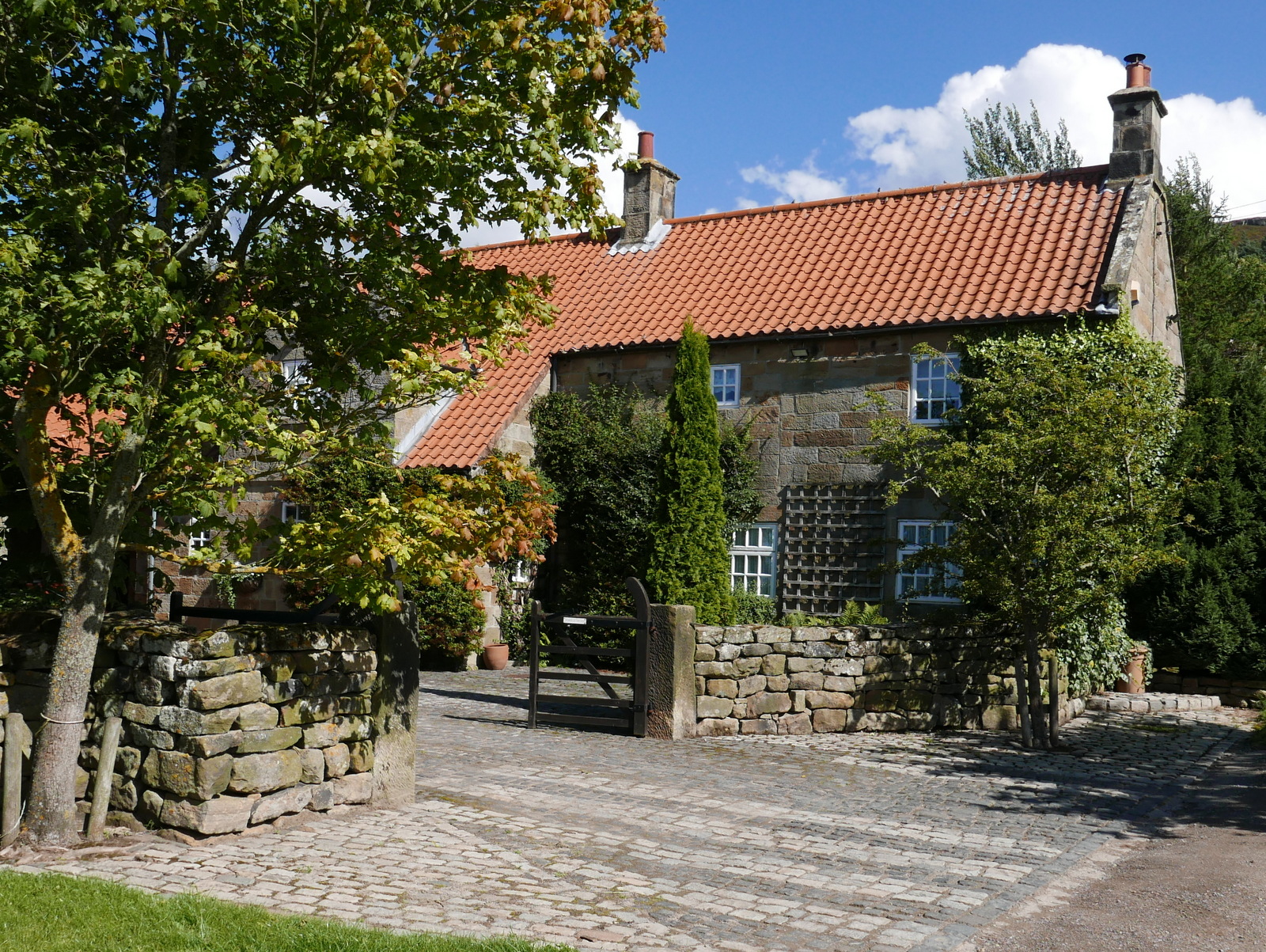
We finished our coffee and walked down to the Abbey and its farm buildings. 

Baysdale Abbey, west side

Baysdale Abbey, east side

Tom Scott Burns explains that in the middle ages land rents for Baysdale were paid with the heads of wolves, which were numerous in the area, and one can imagine this wild enclosed ravine in the 1300s, when cattle were over-wintered in the valley bottom.  In fact, TSB explains, Baysdale is derived from Basdale meaning Cow Shed Valley.  The Abbey Farm has been renovated and is now marketed as holiday lets and we walked round the building, then followed the yellow way-marks uphill to Thorntree House.

Approaching Thorntree House

Thorntree House

We passed Thorntree House and climbed through the plantation to reach Baysdale Moor and as TSB relates, " an ever-unfolding sea of moorland".  Purple heather was to be seen in every direction and the smell of its pollen was very heady.  We followed the moorland track for about 1.5 miles, turning right just before reaching an old stone shooting box.  Considering the season we saw very few grouse and wondered if there has been a problem with bird numbers this year.


A sea of purple heather in every direction


Looking back towards Baysdale

We walked on from the shooting box and our path eventually led us down through the old disused coal pits of Armouth Wath, ('ford at becks' meeting') and across Grain Beck.  


Approaching Armouth Wath

Armouth Wath

Rowantree Beck at Armouth Wath

Armouth Wath is a very bleak spot and life in the coal pits must have been hard.  We had a look at what remained and the two becks the name refers to, Rowantree Beck and Black Hagg Beck.  Excavation work has been done at the ruins of the four collier buildings and revealed that the pits were 106' deep.

We left following the colliers' track and a long climb brought us to the Bronze Age tumulus of Burton Howe.


Burton Howe

Burton Howe tumulus

Signs of mineral excavation looking from Burton Howe

There are several tumuli here, apparently dating from 4500 - 1400 BC, some still containing coffins and cremated remains. 


Our path now followed the escarpment across the open land of Ingleby Moor, locally known as Siberia, and devoid of interest until we came to a well preserved standing stone near Tidy Brown Hill.  We could make out the inscription 'Ingleby and Stoxley' on the front, ' Kirby and Helmsley 1757' on one side and 'Guis Boro' on the other and we were pleased to see that tradition has been maintained and a few coins had been left under a loose top stone for the benefit of any needy person who happens by.  Strangely, TSB doesn't mention this stone in his walk description.

Ingleby and Stoxley, and hand pointer

Kirby and Helmsley 1757

Coins for the needy!

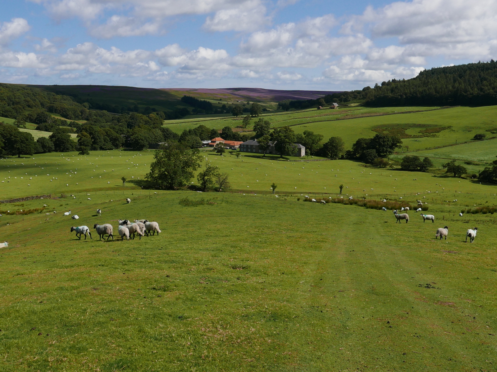
We now had a two mile walk along the escarpment with fine views, purple heather to our right and the villages of Cleveland below us to the left.  We were so immersed in this amazing view that it was some time before we we became aware of a rumbling noise and found ourselves slowly overhauled by a group of off road vehicles. They trundled past us and then as the going got tougher they slowed to a crawl and we trundled past them.  In the end we saw the drivers get out of their vehicles to look at the enormous ruts and they were still standing there as we walked back down Turkey Nab. We think they would have to reverse quite a way before they could turn round. Ha!

Heather to our right...

Ingleby Hall below

A traffic jam on Turkey Nab

We walk back down to Bank Foot

Alfred J Brown in his book Tramping in Yorkshire, says, "Even the longest ridge must come to an end, and suddenly the road twists, hesitates, and takes the plunge gloriously down Turkey Nab. The Cleveland County is full of 'Nabs' but Turkey Nab will take some beating."

Back at Bank Foot we stopped to stroke a couple of horses and their foal who remained shyly behind its mother, before driving the short distance to Great Ayton and the Royal Oak for a cooling pint.

"Let's see your foal?"

Re-assuring nuzzle