"There must be dales in Paradise
Which you and I will find.."

Saturday 4 November 2017


Slingsby Castle and Fryton from Hovingham


10.5 miles                   Grey, cool and still


Tom Scott Burns says in The Walker's Guide to the Hambleton Hills that this route of woodland paths, open lanes, and the villages of Hovingham and Slingsby, with its ruined castle, will calm the most distraught mind.  We would agree except for a confusing forestry trail in the last couple of miles.

This is the second time we've walked today's route.  The first time was in the heat of summer but we thought it would be worth re-visiting as there should be a fine display of autumn colours.  

We drove to Hovingham via Helmsley along the B1257 and pulled in to the village hall to be met with a sign warning against parking there today as the market would be setting up after 12 noon.  We backed out and left the car at the roadside, where there is unrestricted parking.


Today's walk from The Walker's Guide to the Hambleton Hills

We parked next to Hovingham Hall which TSB says was given to Roger de Mowbray by William the Conqueror and came to the Worsley family in 1563, with the present Hall dating from 1745.  


Hovingham Hall

Next to the hall is the Church of All Saints and we decided to look inside before starting our walk.  The church has retained its Anglo Saxon tower and a Saxon doorway. The stained glass windows show scenes from Revelations.  It was unlocked and we looked around but didn't take as long as usual as we had a long walk ahead of us.


The Church of All Saints

Looking towards the altar


A piece of a Saxon cross suspended before the altar

Serpent detail on Saxon cross

Norman feature

Modern window

We walked past the large stone gateway to the Hall upon which is the inscription, "virtus in actione consistit" (virtue consists in action) and then swung right just beyond the Worsley Arms Hotel and followed the road for a short distance before entering fields and then following a small stream parallel with the road.

We could now see the rear of the Hall and passed an attractive bridge and waterfall feature which must have been built to be viewed from the Hall.


Rear view of Hovingham Hall

Following a faint path across fields...

... brings us to an ornate bridge

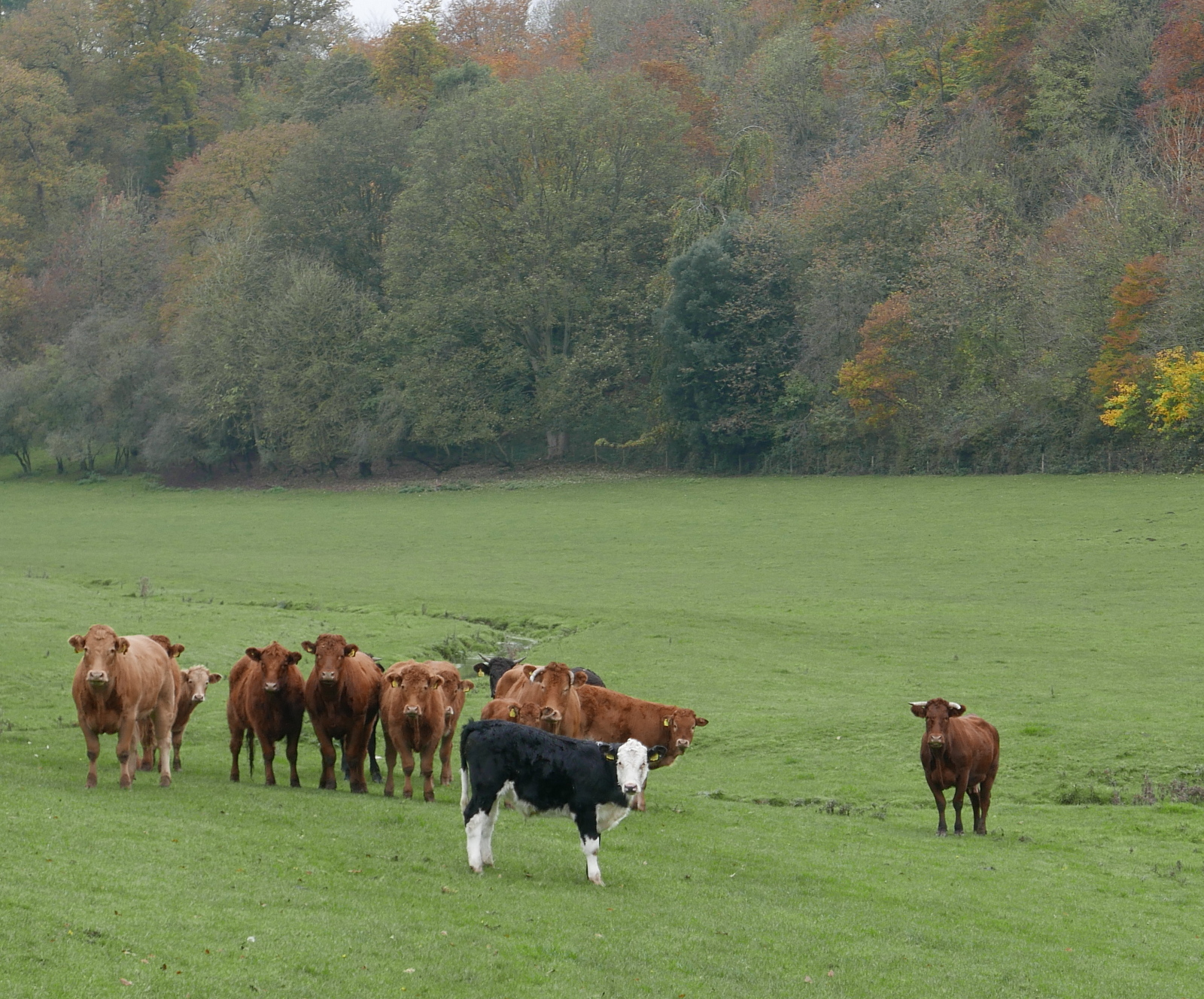
We continued past the bridge and our field path became increasingly boggy, made worse by cattle hooves.  Passing by the skittish beasts we rejoined the road for a short time and turned left into Mill Wood, our path now following the course of a stream before rejoining the road near to Hovingham Lodge.


Autumn finery

Turning off the road into Mill Wood
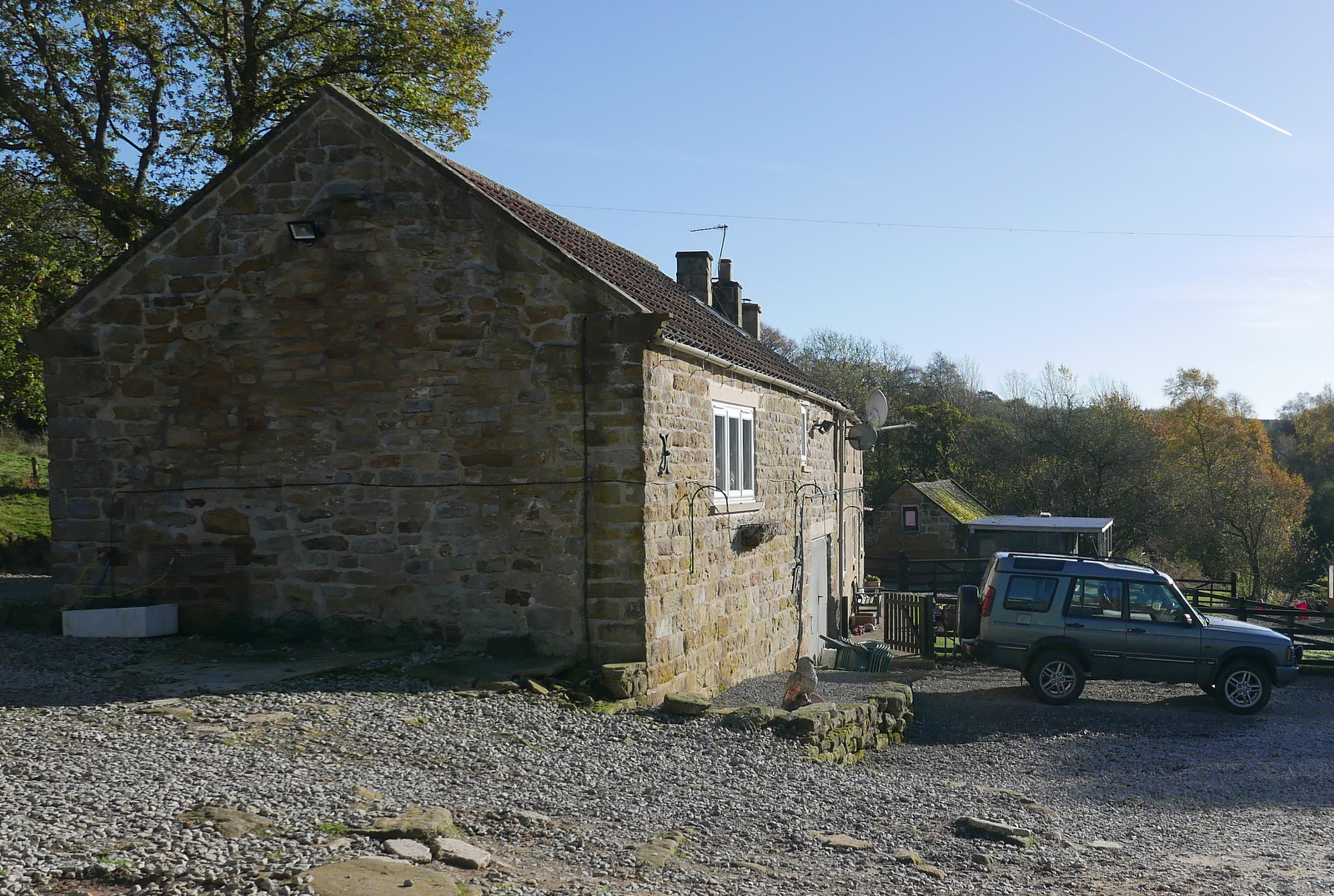
Thwaites Cottage

The track took us passed Thwaites Cottage and then Hovingham Lodge before joining field paths towards Airyholme Farm, whose sign proudly proclaimed it to be the Home of the Flitwick Flock.
As we approached the farm we saw some pet sheep in a field who, on seeing us, charged across to meet us at the fence, obviously expecting tidbits.


We are spotted...

... and the rush begins

Hopeful and hungry

Just after the farm we passed by a large fish pond and decided a fallen gatepost would made a good seat where we could enjoy our coffee and scones.   

Refreshed we continued our path, now alongside Fryton Moor plantations.


We are diverted around the farm buildings

Turn right onto the Centenary Way

Looking back through poppies to Airyholme Farm

A nice spot to enjoy our coffee and scones

Ho, ho!

Walking towards Fryton Moor Plantations

Eventually we reached Bank Lane and a long gentle descent to Slingsby.   We walked through the pretty village to the Methodist church and a brightly coloured Maypole, where TSB reports Plough Monday sword dancers cavorted and the Slingsby Temperance Society held a great demonstration in 1851.


Across fields to Slingsby

Weather vane in Slingsby

Slingsby Methodist Church

Maypole in front of the village school

We continued through the village to reach the ruins of Slingsby Castle, which is only visible from the neighbouring road.  It was built by Sir Ralph Hastings in 1343 and enlarged by his grandson Lord William Hastings, who was beheaded for treason in 1483. 

View from the road of Slingsby Castle

We walked away from the castle to turn left into field paths at Castle Farm, and walked to the hamlet of Fryton.  There is little to see in Fryton and we turned left into Fryton Lane for a long and slow climb up to the woodlands of Fryton Moor.


Fryton


There was something of interest in Fryton, a HGV weather vane!

Walking up to Fryton Moor

Millennium bench and plaque

The plaque celebrates the finding of a 4000 year old skeleton in a nearby burial henge

On reaching the trees we turned right and our path led us through trees for a mile and a half.  Towards the end of this stretch the path is easily missed because of recent forestry work and concentration is needed.  We lost a bit of time back-tracking before turning north to join the straight path that took us back to Hovingham.


Turn right to follow the Centenary Way to Hovingham

Forestry work makes the going tough
Care needed here to keep to the right path

Back on tarmac and Hovingham in sight


Quite a long walk today and we were glad that The Worsley Arms Hotel welcomes hikers, however grubby.  We sat in front of the fire in the Cricketers Bar with a couple of pints of Black Sheep and discussed today's walk.


The Worsley Arms

We veer into the Cricketers Bar

The hiker's reward


Sunday 29 October 2017


Hazel Head to Arnsgill and Cow Ridge


 7 miles                       Fine and sunny


We approached Hazel Head Car Park via a 6 mile drive along the unclassified road from Osmotherley and after driving past the ford at Blow Gill ('ravine with the dark ford') we parked at Hazel Head car park.

After donning our boots we returned along the road, back to Blow Gill where we admired the waterfall and an old lime kiln at the side of the road before climbing back up the road to the entrance to Street Gate Farm.


Today's walk from The Walker's Guide to the Cleveland Hills

Blow Gill
Waterfall at Blow Gill
Roadside lime kiln

Tom Scott Burns explains that a number of farmers in the region had their own lime kilns for burning lime, which was used for lime washing walls and dressing the land, a custom going back to Roman times. The lime neutralises the acid in the moorland soil allowing more varied crops to be grown.  We had passed another well preserved lime kiln in the car a mile or so further back and we would shortly pass yet another on our path.  These high farms would have used the lime to reclaim moorland.

The farm track led past Street Gate Farm and into South Wood.  Even though it was very sunny today the path was very overgrown and wet.  This is an old lane and TSB tells how these lanes were used by tinkers and pedlars who became very numerous in the Middle Ages.  These travelling salesmen not only sold their goods but were also responsible for circulating news and delivering letters between settlements.


A sad notice on the farm gate
Turn into Street Gate Farm


We arrive at Street Gate Farm

Our green path will shortly become muddy and boggy


The track led us past another farm, Hagg House, where our arrival was heralded by a deafening cacophony of barking from a pen of spaniels. 

We continued along the wet lane until we reached Birk Wood Farm where we turned right and climbed steeply to reach a tarmac lane.  


Hagg House Farm

The green lane has been made boggy by cattle


We pass an enormous ants nest

Across a meadow....

.... to reach Birk Wood Farm

We crossed the tarmac road and passed by a new gate to start a steep climb to reach the moor.  On our left we saw another lime kiln and shortly after the moor track turns to the left and down to Hill End Farm.  At this left turn we continued straight ahead on an indistinct path through the heather.

Cross the tarmac and through a new gate

Good walking with the moor to our right

Snilesworth to the left


We continue straight on through the heather, Hill End Farm ahead

Leaving the heather we joined a distinct shooters' track which dropped down to the little footbridge over Arns Gill.  On crossing the bridge we found a sea of mud and the next 100 feet were tricky to cross, before climbing briskly through some cattle, past the farm and to the moor above.


Bridge over Arns Gill

Descending into the mire!

Hill End Farm


Hill End Farm has its own lime kiln

Our climb took us to the top of Arnsgill Ridge and we followed a shooters' track through the moor gate towards a small plantation of conifers.  Just before we reached them we came to a large flat stone which would make a fine seat and table and decided to stop for coffee and scones.

Through the moor gate to .... coffee and scones

Eventually we resumed our walk and followed the path for a couple of miles before coming to a fork.  Here we turned right to drop down to Head House, an abandoned farm which is now used by the keepers for storage of bird food and the like. A couple of our walks converge on Head House and over the last five years we have seen it change from an abandoned ruin, as it was in TSB's day, to a renovated weather proof building; the work being carried out presumably by the North York Moors authority.

Approaching isolated Head House

Never locked and useful to hikers in bad weather


Head House could still do with a bit of interior decoration

Arns Gill near Head House

Looking back to Head House from Arns Gill

We re-crossed Arns Gill and climbed to Cow Ridge passing a couple of shepherds on quads, with their dogs jumping on and off the vehicles.  Then we came to a party of beaters, waiting patiently to begin their work.  On Cow Ridge we came to another group and it was obvious they were going to head down towards Arns Gill, and the guns would be waiting on the other side of the stream.

We strode out along the moor path for a couple of miles and soon found we were walking to the sound of guns.


Shepherds

Beaters waiting to 'go over the top'

Clive strides out across Cow Ridge

We notice a stoat trap

Bilsdale Mast


We came to a cairn which marks the location of Iron Howe.  TSB points out that all along this stretch are well preserved field boundaries and over 300 cairns dating from 2300 to 800 BC.  Although they don't show well in the photographs they are in fact very noticeable as you walk along this stretch of the path.


Cairn at Iron Howe

Many dwelling remains along here


We started to walk from Iron Howe downhill back towards Blow Gill.  Over to the left there are fine views of Hawnby Hill and Easterside Hill.  


We followed our path past the strangely named Scotland Farm, spotting the old Wesleyan Chapel on the left, where we have stopped to rest on previous walks.


Scotland Farm

Mary Queen of Scots stayed at nearby Arden Hall on the way to her execution, is that the reason for this unusual name?

A nice weather vane, appropriate for today, near Scotland Farm

The Wesleyan Chapel where Clive and I sat for coffee a couple of walks ago

We rejoined the road for a short walk down to Blow Gill where we found the members of a photography club busily setting up their tripods.  We crossed the stream and a short uphill took us back to the car park.


The end of the walk