Along the Old Drovers' Road from Osmotherley
6 miles Cold and Dry
In the Domesday Book Osmotherley is known as Asmundrelac, which means 'Asmund's clearing'. We parked in front of Thompson's Shop which has been a general dealers for 200 years but has been standing empty for several years, awaiting renovation.
 |
| Today's walk from The Walker's Guide to the Cleveland Hills |
We booted up and set off, turning left into Quarry Lane at the Market Cross.
Tom Scott Burns notes that the village was ravaged by William the Conqueror in 1069 and was still described as waste land in its entry in the Domesday Book in 1085.
He also relates that the village was raided by the Scots on several occasions and a raid in 1315 was so severe that the village was excused all taxation because of the distress it had suffered. A few years later, in 1348, the Black Death carried off nearly half the population of Osmotherley.
We passed by a pinfold on our left before reaching Rueberry Lane.
 |
| New (to us) fox weather vane at Osmotherley |
 |
| Old lamps, electric on left, gas on right |
 |
| Pinfold |
 |
| Turning into Rueberry Lane |
We quickly gained height until we looked back down on Osmotherley. A little further, when the lane becomes a track, we came upon Lady Chapel founded by Queen Catherine of Aragon in 1515. It is still a religious retreat and we followed the twelve stations of the cross as we approached it.
The modern house adjoining the chapel was built around 1725 and restored by Sir Hugh Bell in 1916.
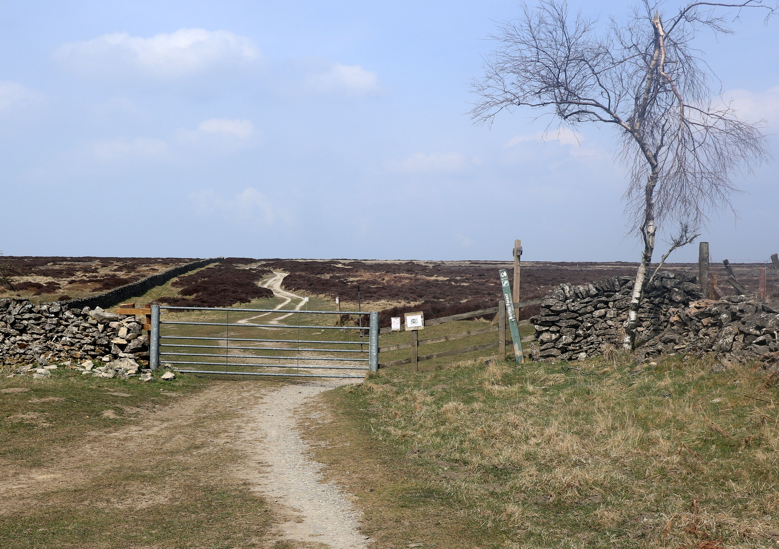
We left the chapel and dropped down to a field path which we followed, now on the Cleveland Way.
 |
| Through the gate and left onto the Cleveland Way |
 |
| Looking down at the A19 and beyond to Teesside |
 |
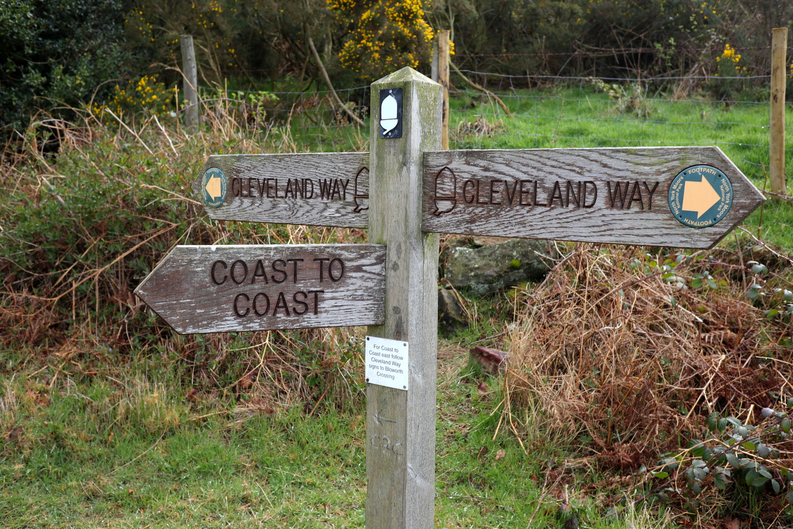
| The Cleveland Way joins the Coast to Coast here |
 |
| C2C turns left to join the Cleveland Way |
We walked uphill through the birch trees of South Wood to reach transmitter masts. Passing through gates at the side of the masts we followed the Cleveland Way upwards towards Scarth Wood Moor, all the time enjoying a fine prospect towards the Cleveland Hills, and in the foreground Whorl Hill.
 |
| Through South Wood |
 |
| Transmitter Station |
 |
| New gate to confound horses and motor cycles |
Eventually we reached a wooden sign at the deep trough of Scarth Nick, pointing towards Cod Beck Reservoir, and we left the Cleveland Way to soon join a tarmac road that runs from Swainby to Sheepwash.
 |
| Ingleby Cross below |
 |
| Over Scarth Wood Moor |
 |
| Whorl Hill and Swainby below |
 |
| We turn right and leave the Cleveland Way |
 |
| Scarth Nick |
TSB explains that during the Ice Age of approximately 20,000 years ago, a glacier from the north enveloped an area 20 - 30 miles wide and 1,000 or more feet thick. It failed to cover the moors but crept into Scugdale depositing materials from Scotland, Cumbria and Durham. Sand, gravel and stones left by meltwater formed the conspicuous mound of Round Hill, the present car park at Sheepwash.
Reaching the water splash at Sheepwash we crossed the bridge and went down to Crabdale beck's stony bank to get out of the wind. Here, like trolls below the bridge, we enjoyed coffee and scones in the sun.
 |
| New toad sign at Sheepwash |
 |
| We sat below the bridge out of the wind |
After enjoying the break we climbed to Pamperdale Moor, our path running alongside the woods that drop down to Cod Beck reservoir. This path is known as High Lane and is the old Drovers' Road. TSB suggests that it was probably used by prehistoric man, the Romans and, before the present day road was made, as a corridor through the Cleveland Hills.
As we walked along High Lane we noticed an unusual brick building across the field to our left and as we had plenty of time decided to investigate it further.
 |
| The Drovers' Road |
 |
| "What's that building?" |
 |
| Entrance to Starfish |
 |
| Concrete base nearby |
 |
| Locked steel door |
We crossed a boggy field and reached the unusually shaped building. Nearby was a concrete base and we speculated that it might be a gun emplacement from WW2. In fact a Google search reveals it to be one of five 'Starfish' sites built during the last war to protect industry at Teesside by the following means:
A series of iron tanks, raised on gantries, would be set out. These tanks held inflammable liquid that could be ignited and quenched on demand. The fires were lit as soon as German bombers began an attack. When they were quenched, the resulting steam looked like the smoke of a burning city, and enemy pilots would drop their bombs harmlessly on the moors instead. Such decoys were officially known as ‘SF’ or ‘Special Fire’ locations, but were generally called ‘Starfish’ sites.
https://en.wikipedia.org/wiki/Starfish_site
https://www.countryfile.com/go-outdoors/walks/walk-gisborough-moor-north-yorkshire/
Curiosity satisfied we wandered back across the field to the Drovers' road and continued on our way.
As we reached the tarmac road from Osmotherley we saw the ruins of Solomon's Temple, which was built by the eccentric Solomon Metcalf in 1812 and had images of the sun, moon and stars on its walls.
 |
| I stride out on the Drovers' road |
 |
| The ruins of Solomon's Temple |
We followed the tarmac road to Chequers Farm. This interesting building was an old inn and held a licence for 300 years until 1945. When it was a hostelry it was famous for keeping an old peat fire alight for 150 years! The sign of the Inn was a chequers board signifying that it would change money for the drovers and on the sign was the cryptic message "Be not in haste, Step in and taste, Ale tomorrow for nothing.' As we all know, tomorrow never comes! The old sign has been mounted behind glass on the farm wall.
 |
| Chequers Farm |
 |
| Old pub sign |
 |
| The pub signpost remains at the front of the building |
TSB notes that drovers used to bring vast herds of cattle from the Highlands of Scotland across the Hambleton Hills on their way to the markets of East Anglia, the Midlands and London. Their average pace was just 2 miles per hour.
We turned right off the Drovers' road onto a green track and almost immediately saw a small shrine against the wall on our left side. When I reported this shrine in my blog a couple of years ago I received a nice email explaining its significance, which I'll copy here:
a sutton6 March 2015 at 11:29
The shrine you mention is that of my Mam. The significance is my Mam and Dad spent a glorious day together walking around Osmotherley in 1945 and they had a photograph taken there as a young couple, Dad in his uniform. He was a Paratrooper in the 6th Airborne, 9th Battalion. He was only 18 years old when he dropped on D day in Normandy and on the Rhine crossing, he had a miraculous escape, saved by a tiny cross which stopped a machine gun bullet. He has written a book called 'A Teenager's War' by Ron Tucker, it is a moving, heartwarming, funny story and there are photographs of them at the very same spot in Osmotherley! and if anyone is interested we sell his book for £13 (inc p&p) and all the proceeds go to S.A.F.A.
We can be contacted at g.a.sutton@ntlworld.com, please feel free to email.
We noticed that a new sign shows that sadly Ron passed away last year.
Our path headed gently downhill to the two small reservoirs at Oakdale, where we crossed the beck by an old packhorse bridge.
Leaving the reservoirs we joined the farm road across Slap Stone Beck (apparently this name refers to slippery stones at the ford) and admired an attractive conifer garden before entering Green Lane to pass by White House Farm.
 |
| Down to Oak Dale |
 |
| Passing Oak Dale Farm and its dogs |
 |
| Lower reservoir can be seen through the trees |
 |
| Fine conifer garden |
 |
| Weather vane near Oak Dale |
 |
| Leaving the road for Green Lane |
 |
| White House Farm |
At this point we rejoined the Cleveland Way as we headed back towards Osmotherley. The path descends past White House Farm and then continues across a small bridge over a stream, then steeply uphill to where it crosses a field and leads into Osmotherley.
As we followed the paved path we came to a rabbit kitten that wasn't moving and was obviously blind. The milky discharge from its eyes is the sure sign of the fatal disease Myxomatosis. Clive, who knows how to do these things, quickly dispatched it thus saving it from a more miserable end at the mercy of cats or crows. We were sorry and it was a sad end to our walk.
 |
| Entering Osmotherley |
 |
| Sick Rabbit kitten |
 |
| Myxo |
We entered the village passing an old chapel which is obviously still in use. Tom Scott Burns tells us that John Wesley preached in Osmotherley in 1745 and the chapel was built nine years later. Wesley returned to preach again at Osmotherley in June 1761, and probably used this chapel.
 |
| Old chapel |
We crossed the road and went behind the Queen Catherine Hotel to look at the 12th Century St Peter's Church, which is almost hidden from view on the High Street.
 |
| St Peter's Church |
It was unlocked and we went inside to look around. The tower is 15th century and the walls were built on Norman remains. There are fragments of Saxon crosses and part of a hogback in the porch.
 |
| Looking towards the altar |
 |
| A Relict is an archaic term meaning widow or widower |
Returning to the High Street we crossed to the Golden Lion where we sat outside in the April sunshine to discuss today's walk and interesting events.
 |
| The hiker's reward |


