The Rosedale Railway and Botton Head from Ingleby Greenhow
8.5 miles Dry but cold wind
We parked in Ingleby Greenhow in the overflow car park for the Dudley Arms and walked back to the main road in the direction of Kildale.
Tom Scott Burns notes in his Walker's Guide to the Cleveland Hills that the name Ingleby has been written in various ways over the years, including Angleby, Engelbi, Yngleby and Yngylby.
The route parts from the road alongside a newly built house where we followed an overgrown path onto meadows. Over to the right we could see Ingleby Manor which is now holiday accommodation.
 |
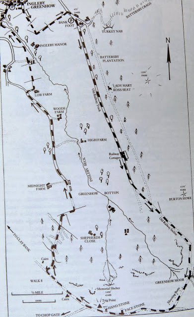
| Today's walk from The Walker's Guide to the Cleveland Hills |
 |
| Walking through Ingleby Greenhow |
 |
| Look for the footpath sign and turn right.... |
 |
| ... into a narrow path between houses |
 |
| Walking towards Bank Foot Farm |
 |
| Ingleby Manor |
We soon reached Bank Foot Farm, situated under Turkey Nab which is probably derived from the old personal name Thorlkil. Tom Scott Burns says in the Walker's Guide that in 1729 William Parkin was hung from gallows mounted on Turkey Nab for murdering his brother-in-law at Great Broughton, but our plan was to see Mary Ross's Seat, described by TSB as being at grid reference 594055.
TSB says that Lady Mary Ross was the eldest daughter of the Earl of Kildare and her daughter had married Sir William Foulis of Ingleby Manor. The seat may have been constructed on one of Lady Mary's favourite walks when visiting her daughter and son-in-law.
The seat is situated on the forest track running about 100 metres behind and parallel with our route and after seeing it one can cut back through the trees to rejoin the 'official' path.
 |
| Bank Foot Farm |
 |
| Weather vane appears to have been a target! |
 |
| Lady Mary Ross's Seat |
Leaving Lady Ross's Seat we returned to the old railway bed which we followed past a row of railway cottages to reach the incline bottom where we paused to read a new information board.
 |
| Railway cottages |
 |
| Weather vane at railway cottages |
 |
| 'Is that a new information board?' |
 |
| We pause to read the board |
Tom Scott Burns tells us that the old railway was completed in 1861 and leads to the foot of the incline bank where the trains were loaded with ironstone. The incline reaches a maximum gradient of 1 in 5 and a brake drum house was situated at the top. Three empty wagons were hauled by steel ropes as three loaded wagons descended, an operation which took 3 minutes at a speed of 20mph, regulated by the drum house.
Leaving the new sign we started our long climb up the old incline railway. We climbed steadily and passed by some old graffiti of a man wearing a stovepipe hat with a bird in front of his face. TSB suggests that this is a satirical caricature carved by a railway navvy in a moment of inactivity.
Reaching the top we found a sheltered spot to enjoy our coffee and scones out of the biting wind.
 |
| A long climb.. |
 |
| Old mine workings over to our right |
 |
| Clive pauses to admire the graffitti |
 |
| Stovepipe hat and bird |
 |
| Out of the wind |
 |
| The view back down the incline |
At the top of the incline was another new information board and a table top which should have featured a model of the old railway, but this was missing.
 |
| Site of the old drum house |
We continued along the old railway line, pausing to take a look at the huge stone blocks and bits of old iron work that once were part of the drum house which was dismantled in 1941. We followed the railway bed which officially closed on 13th June 1929 and now makes a nice 11 mile path to Farndale, Westerdale and Rosedale. Turning off the railway at a broad track we joined a trail to Cockayne Head and Botton Head, which is also part of the Cleveland Way.
 |
| We join the Cleveland Way |
 |
| Too windy to fly away |
As we walked this trail we came to two old boundary posts, the first known as The Face Stone is mentioned in a 1642 document for the Helmsley Estate, and the second showing a carved hand near to Round Hill dates from 1711. Near the Hand Stone is the trig point at Botton Howe which is located on a Bronze Age burial mound at 1490 feet, the highest point on the North York Moors.
 |
| The Face Stone |
 |
| The Hand Stone |
 |
| Hand Stone |
 |
| Trig Point at Botton Howe |
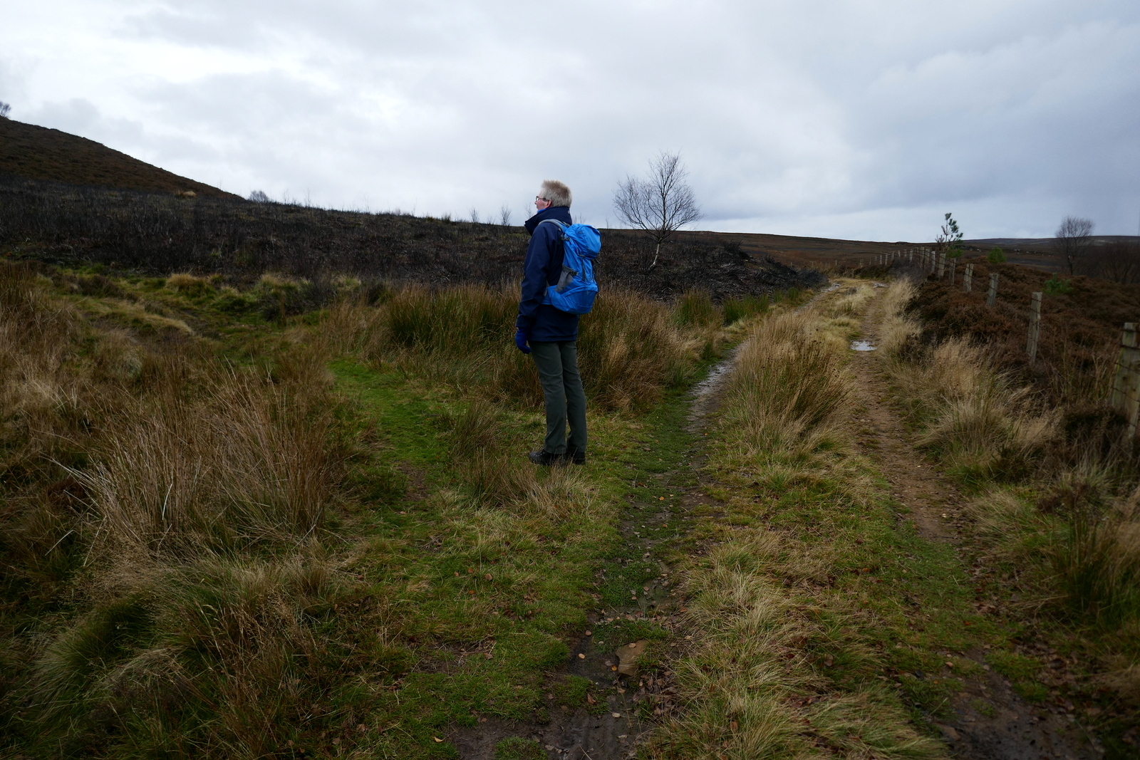
We walked back to the wide path and continued walking across Urra Moor, which according to TSB derives from the Old English 'horh' meaning 'filth'! Eventually we came to a new signpost where we left the Cleveland Way and bore right on an indistinct path which drops off the moor down Jackson's Bank and into Greenhow Plantation.
 |
| Bear right at the junction |
 |
| Looking across to the Wainstones |
 |
| Turn right at this new sign |
We reached the lane down Greenhow Bottoms and over to the right we could see the incline railway while ahead of us Roseberry Topping appeared in the distance. A mile or so on and several farms further, the tarmac lane took us to Low Farm.
 |
| The Incline Railway from Jackson's Bank |
 |
| Jackson's Bank |
 |
| Walking through Greenhow Plantation |
 |
| A fine ram |
 |
| "Where've you gone, I can't see you!" |
 |
| "I'm a fine ram too." |
 |
| "And me!" |
Our path turned left just before the farm buildings of Low Farm, into fields which we crossed one after another, at first following a newly fenced path but later the unseen rights of way by aiming for the yellow right of way signs on each field boundary.
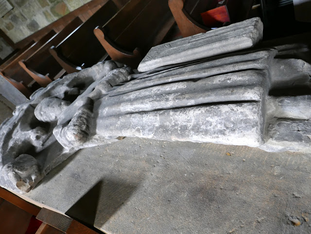
Eventually we reached the bridge over Ingleby Beck and we crossed into the churchyard of St Andrew's beyond it. The church was unlocked and we enjoyed a browse around the ancient building. TSB says that the original church was granted to the abbots of Whitby in 1143 by Adam de Ingelby and still retains traces of Norman work. We liked the pigs carved onto stone pillars near the altar and the fine stained glass window.
 |
| Weather vane at Low Farm |
 |
| Low Farm |
 |
| New path |
 |
| Bridge over Ingleby Beck |
 |
| St Andrew's Church |
 |
| St Andrew's |
 |
| A priest (Willimus Wrelton, incumbent c.1300) |
 |
...and a knight (probably C15)...
|
 |
| Pig? |
We both agree that this walk of TSB's is very enjoyable, with a bit of everything; hills, moors, farms and woods, and we were soon discussing its finer points over a well earned pint.
 |
| To Siberia! |


