Hazel Head to Arnsgill and Cow Ridge
7 miles Cool and showery
We approached Hazel Head Car Park via a 7 mile drive from Osmotherley on the Hawnby road. We passed Square Corner and after driving past the ford at Blow Gill ('ravine with the dark ford') parked our cars at Hazel Head car park, some distance uphill.
 |
| Today's walk from The Walker's Guide to the Cleveland Hills |
 |
| View from Hazel Head Car Park |
We walked back to Blow Gill, where we admired the waterfall and an old lime kiln at the side of the road before climbing back up the road to the entrance to Street Gate Farm.
 |
| Lime Kiln at Blow Gill |
 |
| Blow Gill |
 |
| Leave the road at Street Gate Farm |
Tom Scott Burns explains that a number of farmers in the region had their own lime kilns for burning lime, which was used for lime washing walls and dressing the land, a custom going back to Roman times. The lime neutralises the acid in the moorland soil allowing more varied crops to be grown.
The farm track is overgrown and very muddy. It leads past Street Gate Farm and into South Wood. This is an old lane and TSB tells how these lanes were used by tinkers and pedlars who became very numerous in the Middle Ages. These travelling salesmen not only sold their goods but also played a big part in circulating news and delivering letters between settlements.
 |
| Street Gate Farm |
 |
| Muddy lane |
 |
| A noisy welcome at Hagg House Farm |
 |
| We wondered what these were - traps? |
The track leads past another farm, Hagg House, where our arrival was heralded by a deafening cacophony of barking from a pen of spaniels.
We continued along the wet lane until we reached Birk Wood Farm where we turned right just before the building and climbed steeply to reach the Osmotherley to Hawnby road. Here we paused to examine another lime kiln, which probably once belonged to Plane Tree farm.
 |
| Tree house at Hagg House |
 |
| We followed the old lane between farms |
 |
| We saw a few large ants' nests at the side of the lane |
 |
| Very busy! |
 |
| Birkwood Farm - turn right after gate |
 |
| Climb past a couple of fields |
 |
| Lime kiln at Plane Tree Farm |


 |
| Weather vane near Plane Tree Farm |
We left the Lane at a gate opposite the Birkwood Farm entrance, to start another steep climb to reach the moor. Passing the moor gate we walked along the edge of the moor, looking west to the grand building of Snilesworth Lodge. Eventually the path drops from the moor to reach Arnsgill Beck which is crossed by a footbridge, just before Hill End Farm.
 |
| Easterside and Hawnby Hills in the distance |
 |
| Walking along the edge of the moor |
 |
| Oyster catchers |
 |
| Snilesworth Lodge |
 |
| Keeper's cottage |
 |
| We leave the shooters' track.. |
 |
| .. to drop down a hollow lane |
 |
| Iron fox target |
 |
| Dropping down to Arns Gill |
 |
| Crossing the bridge is easy, getting off it not so. |
Getting from the footbridge to Hill End Farm means crossing some very wet ground and we picked our way carefully, using clumps of reeds as supports in the marshy ground. Then a steep climb took us to the side of Hill End Farm, all the time watched and barked at by the farm's spaniels, fortunately penned in.
 |
| Hill End Farm, dog pen to right |
 |
| Looking back down to Arns Gill |
 |
| Passing the old farm buildings |
 |
| Hill End Farm's lime kiln |
 |
| Hardy hill cattle |
Our climb took us past the farm to the top of Arnsgill Ridge where we joined a shooters' track to pass through the moor gate and walk towards a distant plantation of conifers.
In the past we have stopped along this ridge with its fine views to enjoy our coffee but today a brisk wind kept us moving and we followed the track until it drops down to the ruin of Head House.
 |
| Head House |
 |
| Head House |
 |
| Exploring the out building ruins... |
 |
| ... we find a sheltered spot for coffee |
While we enjoyed our coffee and scones we were kept amused by a solitary lamb, which edged closer and closer to us, bleating as it did so. It turned out to be merely curious and not a pet, as it was soon off when we approached it.
Refreshed we had a look inside the building, which is always unlocked and makes a useful shelter if caught in a storm.
 |
| We are approached |
 |
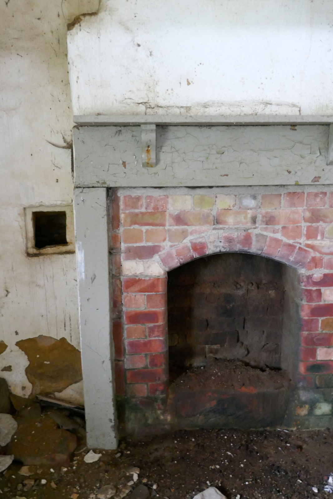
| Inside Head House |
 |
| New ceiling |
 |
| Remains of a swallow which probably came down the chimney |
 |
| They get some tough visitors here |
 |
| The next room is not so tidy |
Leaving Head House we dropped down to re-cross Arns Gill and then climbed to Cow Ridge. We strode out along the moor path for a couple of miles passing fairly near to Bilsdale Mast, the top of which was lost in low cloud.
 |
| Leaving Head House |
 |
| Arns Gill |
 |
| Looking back |
 |
| A new trap |
 |
| The rat or stoat touches the plastic in the middle and the trap snaps down from the far side |
 |
| Head House and its shelter of conifers viewed from Cow Ridge |
 |
| Bilsdale Mast, top in cloud |
We came to a cairn which marks the location of Iron Howe. TSB points out that all along this stretch are well preserved field boundaries, enclosures and over 300 cairns dating from 2,300 to 800 BC. Although they don't show well in the photographs they are in fact very noticeable as you walk along this stretch of the path.
 |
| Walking along Cow Ridge |
 |
| Some early heather in sheltered spots |
 |
| Iron Howe |
 |
| Many iron age settlement remains |
After Iron Howe we descended gradually back towards Blow Gill.
On our left we spotted the old Wesleyan Chapel ruins, where we have stopped to rest on TSB's Hawnby to Hazel Head walk. Below us we saw the unusually named Scotland Farm, and now on tarmac we dropped back to Blow Gill and our cars.
 |
| Scotland Farm |
 |
| Weather vane near Scotland Farm |
 |
| Blue Leicester sheep with late lambs |
 |
| Ruined chapel |
 |
| Looks like someone has misjudged the bend at Blow Gill |


