Nether and Over Silton to Hanging Stone and Oakdale Reservoir
7.8 miles Fine with a cold wind
The slight relaxation in Coronavirus restrictions has allowed Clive and I to put on our walking boots again, and what better walk for us than this, one of our favourite Tom Scott Burns walks. It has a bit of everything; moors, villages, forests and even a reservoir. We parked at Square Corner, the moors car park which is two miles from Osmotherley on the Hawnby road.

Today's walk from The Walker's Guide to the Hambleton Hills

Leaving Square Corner, Black Hambleton ahead

Osmotherley below is getting a bit of a shower
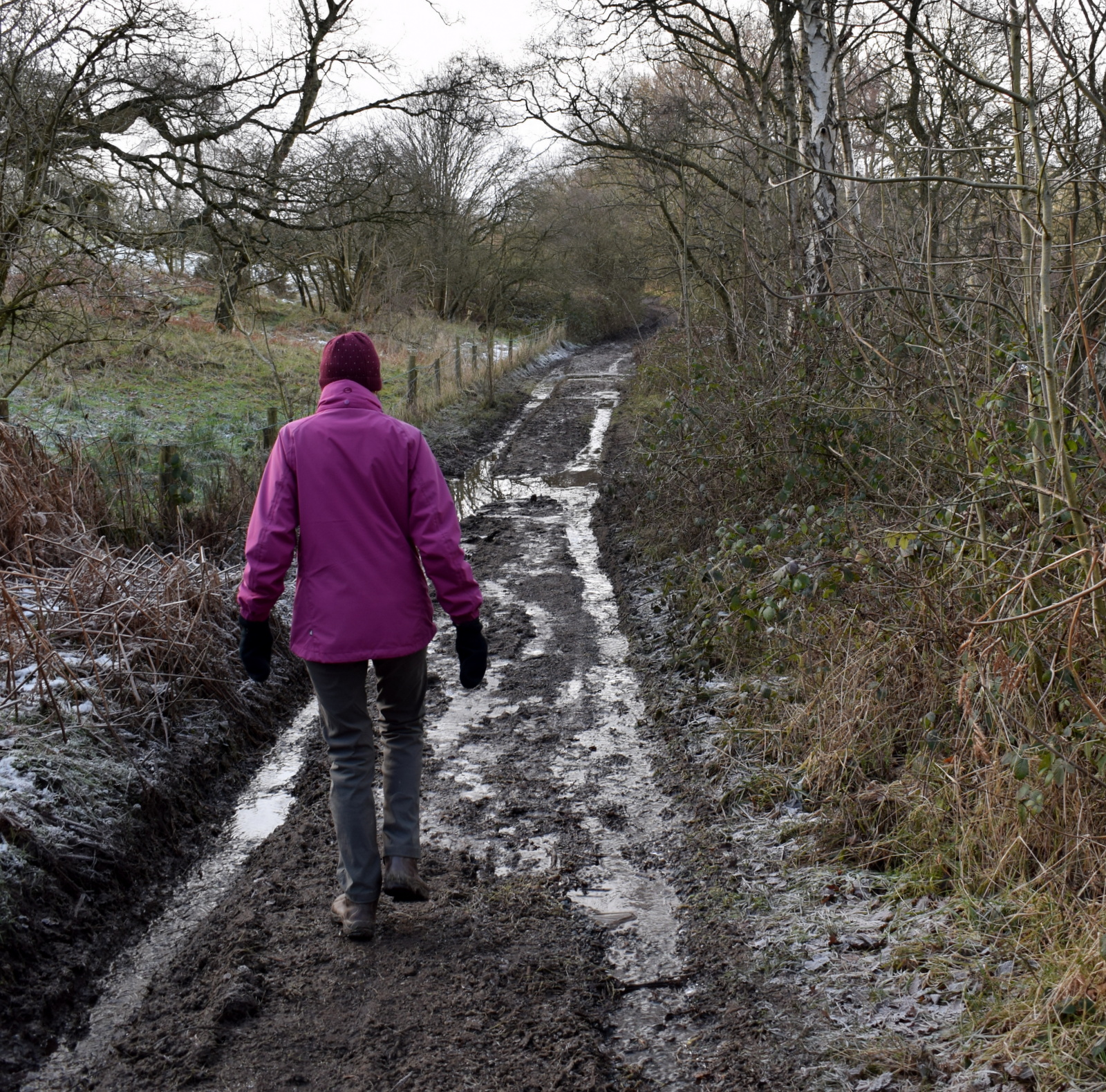
Leaving the car we walked southwards along the forest path up the shoulder of Black Hambleton.
We turned right through a gate giving access to the remains of the conifer plantation where the path, known as Moor Lane, takes one steadily downhill for about 2.5 miles. This is a pleasant start to the walk and took us out of the stiff cold breeze.

National Cycle Path sign on Moor Lane

Remains of a lime kiln on Moor Lane

Imposing Moor House
We walked through through conifers, passing the ruins of a lime kiln and the imposing Moor House. In a field nearby we saw Southdown sheep in a field that were obviously pets, as they ran over to be fussed.

Southdown Sheep

"Just a bit further back.."

Clive checks that they do have eyes!
A little further along Moor Lane we came to Rose Cottage and on the right an ancient drinking trough, before joining the lane leading into Nether Silton.
Kepwick over to the left


Ancient drinking trough
The forest path becomes a tarmac lane which eventually leads to Kirk Ings Lane, where we turned left, then right, to enter the lovely village of Nether Silton. Turning left off our path, just before the church, took us to the Manor Stone with its mysterious inscription. The monument was apparently the idea of Squire Hicks to mark the site of the medieval manor house. His inscription takes the form of a mnemonic. It is necessary to know that the first letter of each word is all that is provided and this isn't terribly helpful to the modern reader!

The 'new' manor house at Nether Silton

The Manor Stone

The letters stand for, "Here the grand old manor house stood, the black beams were oak, the great walls were good, the walls at the east wing are hidden here, a thatched cottage like a barn was erected here, AD 1765 A wide porch spans a yard and alcove"
Leaving the Manor Stone we returned to All Saints Church which has re-opened to the public.

All Saints Church, Nether Silton

Covid friendly font

Clive admires the wood, from HMS Dreadnought

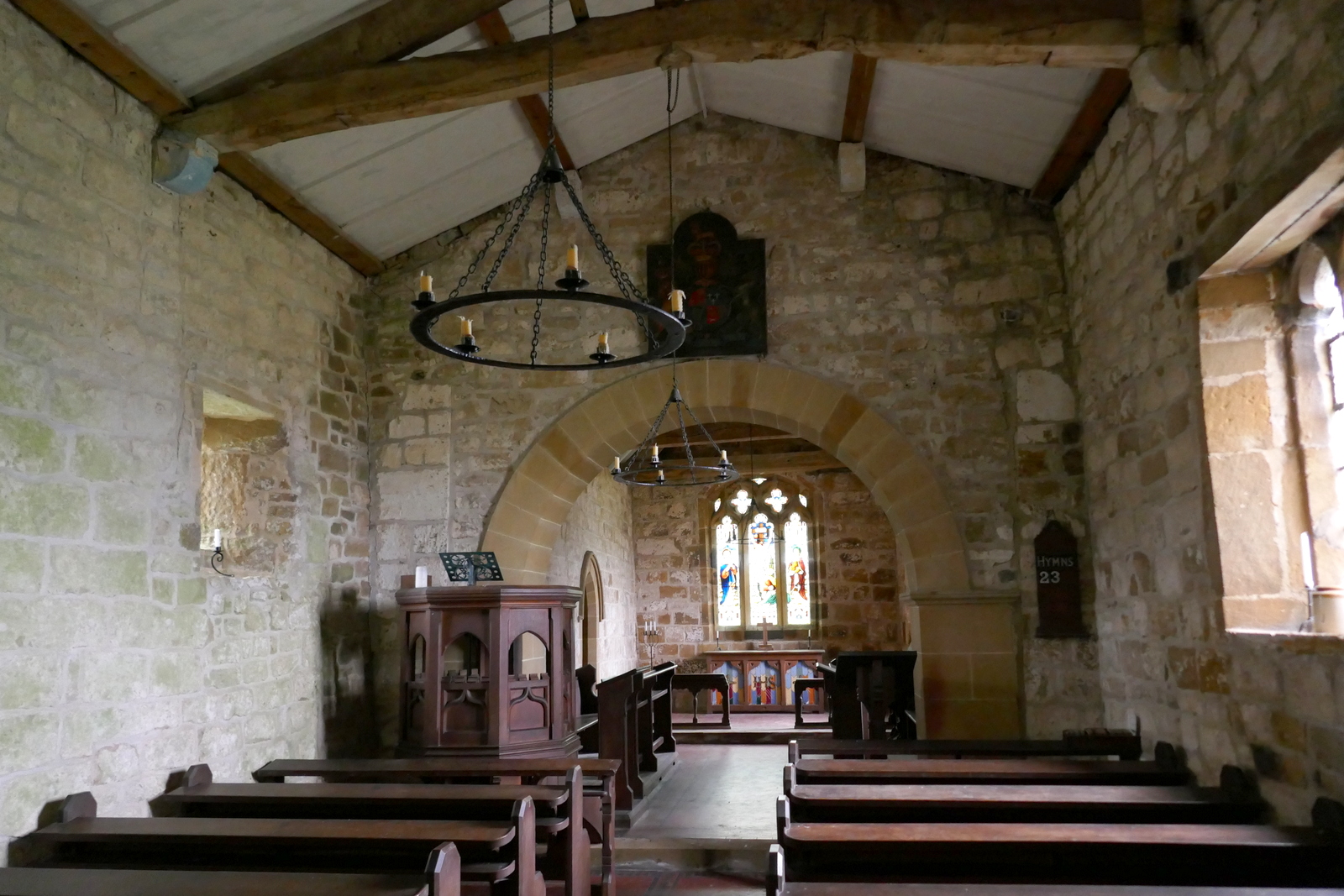
All Saints is a chapel of ease which was rebuilt in 1812. Such a chapel is built for the convenience of parishioners who would find it difficult to access the main church, in this case isolated St Mary's which we would pass by shortly.
Tom Scott Burns explains that wood used in the altar rails and other refurbishments was presented by a R M Jaques, and were from HMS Dreadnought of Lord Nelson's day.
We left the church and immediately turned off the road at a white gate opposite, just near to the post box. At last someone has affixed a waymark sign to the gate leading to the narrow passage that takes us between houses to open fields.

Through the white gate...

... to fields beyond
After crossing several fields we came to the ancient and isolated church of St Mary, Over Silton, standing alone in the middle of fields without any path leading to it. We seem to have caught the very best time to visit as daffodils filled the graveyard and made a marvellous sight!

We see St Mary's in the distance


The daffodils were in full bloom and could only have looked better if the sun had been shining.
We sat in the graveyard on the Jubilee Bench and enjoyed our coffee and scones before spending some time exploring the church and reading the inscriptions on the old gravestones. The church is always open to visitors and has a very peaceful air. No electricity of course and candelabras hanging from the roof. Tom Scott Burns tells us that it still has its original Norman zigzag mouldings around the doorway.


Altar window


Scones amongst the daffodils


Base of ancient cross


| 'Just in the darling of my youth,Then death to me was sent, And you that have a longer stay, Be certain to repent' |

'Remember man as thou goes by, as thou is now so once was I, As I am now so will you be, Prepare yourself to follow me'
As we wandered the graveyard Clive spotted a hare hidden in the grass. It remained perfectly still for a moment as we examined its nest or 'form', then suddenly shot out and away, far too quickly for my camera to get a good shot.

What has Clive spotted?

Can you see it yet?

And it's off!
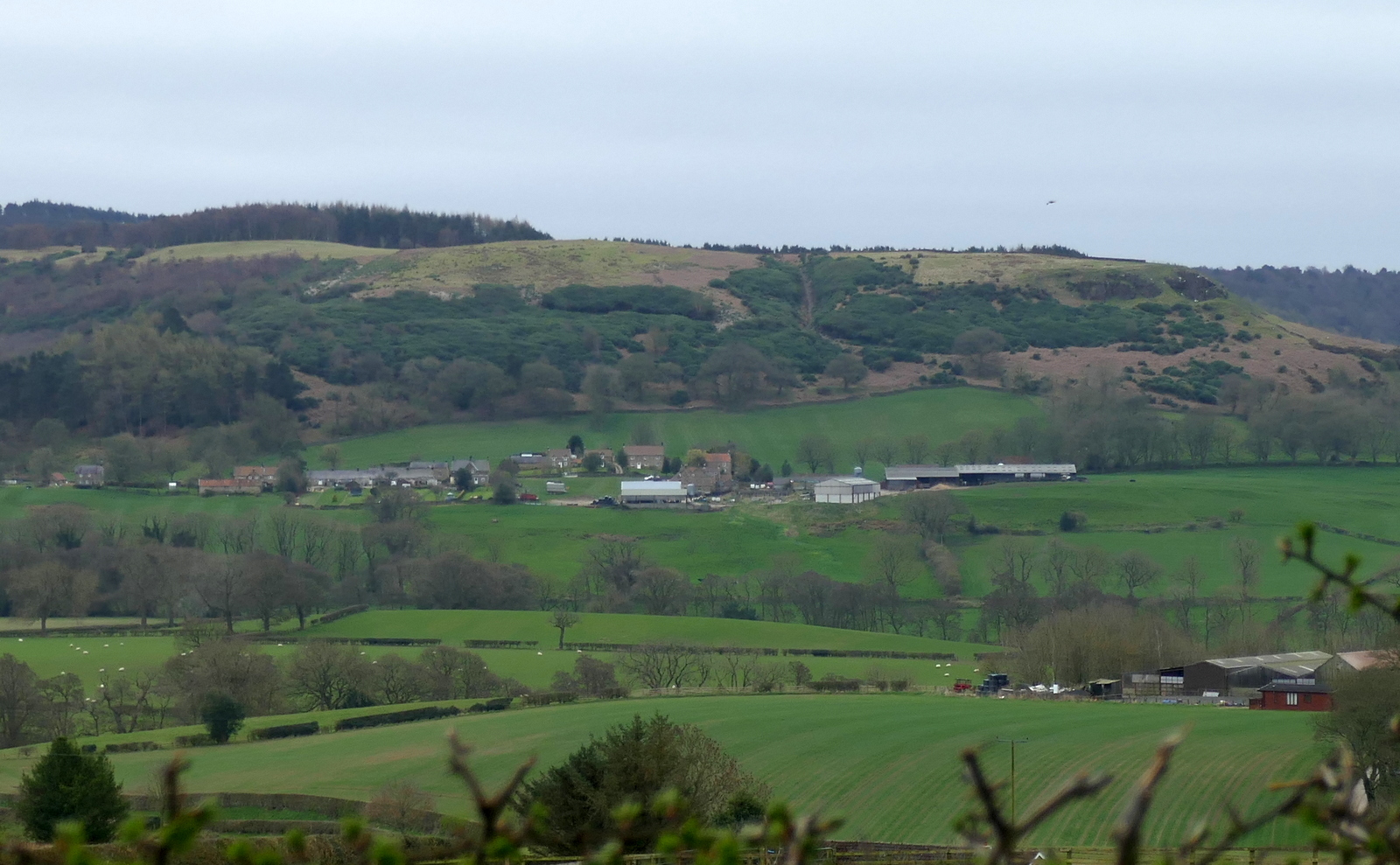
We walked across the fields away from the isolated church and towards the village of Over Silton where we passed by the old manor house. TSB tells us that this was once owned by the gallant gentleman Sir George Orby Wombwell, baronet, who served with the 17th Lancers and took part in the charge of the Light Brigade at Balaclava on 25th October 1854. His horse was shot from under him and he was taken prisoner but escaped on a Russian horse to rejoin his brigade and charge again, without sword or pistol! He died in 1913 aged 81. We turned right and walked beyond the houses to a left turn where our path parted from the road and climbed steeply into Crabtree Bank Plantation.

The old manor house at Over Silton

The old schoool

A Hen Pod!


Turn left into Crabtree Bank Plantation...

... and climb straight up
We could not find the path to Hanging Stone shown on TSB's map above and Hanging Stone can no longer be seen, having disappeared from sight behind saplings.
In the 1980s when TSB walked through these woods he would have had a fine view of Hanging Stone and of the countryside below but sapling growth has spoiled both views to a certain extent.

Two deer deep in the trees

Good camouflage

This hare remained absolutely still as we approached..

About to disappear

Spring finery
We followed a distinct path into the dense trees of Big Wood and crossed a clearing where felling had taken place, to re-enter dense conifers and follow a way-marked path until we came to a slippery descent into Oak Dale.

Checking for frogspawn

Yep, plenty there

Always a muddy spot, we need to take the path uphill

A long climb


And then go past the Xmas decorations.. Xmas Decorations?!
The long walk through these conifers is a bit like walking through a war zone as you are accompanied by constant bangs from Thimbleby Gun School situated in the fields below the woods.
Reaching the bottom we exited the trees and crossed a bridge over Jenny Brewster's Gill and emerged from the wood.


Walking down to Jenny Brewsters Gill

Tom Scott Burns explains that Jenny Brewster's Gill was named after a famous witch and was once the haunt of smugglers who peddled liquor to the surrounding villages. Several secret stills were dotted around the moors, one being at Solomon's Temple, another Wildgoose Nest, near what is now Cod Beck Reservoir and another at Swainsty Crag on Nether Silton Moor.

Oakdale Reservoir
We now walked alongside Oakdale Reservoir which was built in the 19th century to provide water to the local area but which has been decommissioned. The reservoir has been downgraded to a small lake that it is hoped will attract wildfowl. Nothing to be seen today however!
After passing by the reservoir we dropped down to recross Jenny Brewsters Gill and noticed a large trap further downstream, so diverted to have a look at it. Nothing had been caught so we resumed our path, now uphill back to Square Corner.

That's a big trap!

Bigger than usual. We wonder if they're after mink?
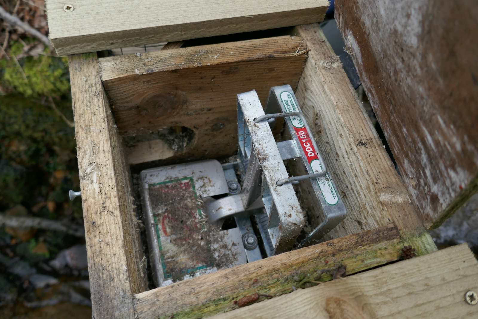
Stand on the metal plate and you're dead!

Looking down to Oakdale Reservoir from the climb to Square Corner

The end of a good walk