"There must be dales in Paradise
Which you and I will find.."

Saturday 21 August 2021

Hasty Bank, Cold Moor and Upper Bilsdale


Hasty Bank, Cold Moor and Upper Bilsdale


 8 miles                         Fine and mostly dry


We parked at Clay Bank Car Park and crossed the road to climb Hasty Bank.   Instead of following the Cleveland Way route to the escarpment we branched left just after the gate, on to a small path above the farm track to Hasty Bank Farm.  This winds its way upwards, eventually reaching the Old Quarry, shown on the map below, where we would pay our respects to the Lady of Bilsdale.

As we climbed we could see a herd of  belted galloway cattle in the bracken above and we wondered if they were on our path - it turned out they had been, but had blundered uphill and wouldn't cause us any problem.

Today's walk from The Walker's Guide to the Cleveland Hills

Belties!

Bracken!

Looking down into Bilsdale from our climb

"Make a note - not to be walked in August!"


What did cause us a problem was bracken.  Our path, which was uneven and littered with stones, was almost entirely covered by bracken making the ascent of Hasty Bank somewhat tricky.

Eventually we reached the quarry, at the same time as the belted galloways, and saw the Lady Of Bilsdale gazing down at us.

Tom Scott Burns describes the ancient carving of a woman's head as 'the enigmatic face of a lady carved on a rock wall who gazes eternally down into Bilsdale', and reflects that it was probably carved by a quarry worker long ago. 

The Lady of Bilsdale


Leaving the Lady we followed the moor path which leads through more bracken, along the side of Cold Moor to reach the Wainstones.

TSB explains that the name Wainstones is believed to derive from the Saxon 'wanian' - to howl, and that the naming of the stones means 'stones of lamentation'. He mentions that his favourite graffitti to be found on the Wainstones is 'RO WOOING TD 1712' but we have yet to come across it.

A slow path through the bracken

Beak Hills Farm below us

We arrive at the Wainstones


Clive checks the graffiti


We descended from the Wainstones and then climbed on to Cold Moor. Once on its summit we turned left to walk along the ridge of Cold Moor (1318') for 2.5 miles with fine views towards the Pennines in the west and Roseberry Topping and Easby Moor to the east.  

Young pheasants - their shooting season doesn't begin until 1st October

Through the gate and climb to Cold Moor

A lovely smell of flowering heather 

The cairn on top of Cold Moor at 1318'


Eventually we took a clear fork to the left, taking us gently down to the village of Chop Gate.  This track is known as Cold Moor Lane and we passed through a gate where the path becomes a hollow lane.  TSB says it is possible that this passageway was established by prehistoric man and has continued in use throughout history to the present day.

The red roof of Bilsdale Hall below

Cold Moor Lane...

... a hollow lane

Hollow lanes are ancient pathways which have been hollowed out over time, very often where peat or turf was repeatedly dragged down from the moor on sledges.  Below is a photograph of Thomas Leckenby of Mount House Farm Bilsdale, leading his sledge of turves off Urra Moor in the early 1930s.  The strips of cut turf were dried in heaps called 'rooks' and were used as fuel and for building walls.

Thomas Leckenby on Urra Moor, from 'Round and About the North Yorkshire Moors' by Tom Scott Burns

Cold Moor Lane led us to Chop Gate where we emerged at the old Wesleyan Chapel that is almost hidden between houses. 

Weather vane at Chop Gate

Approaching the rear of the Wesleyan Chapel

The front has had a modern letterbox added to the door


TSB says the reason for the strange location of the chapel is that the landowner, Lord Feversham, was C of E and totally against a non-conformist church being established in the dale.  However a local shop keeper sold the Methodists this plot of land and the chapel was built in 1858.  It reportedly contains an interesting harmonium (pump organ) but its doors were firmly locked today and the building appears empty.  A couple of years ago the chapel was for sale but the sale does not seem to have taken place and the building and grounds appear to be deteriorating.


TSB says that the name Chop Gate is thought to be derived from the old Scandinavian term kaup meaning pedlar and with a number of pannier tracks converging on the village it must have been like a market place in times gone by.


Approaching Seave Green

Seave Green Farm

Rose Cottage, Seave Green

Recently re-roofed Bilsdale Hall


We turned left into the B1257 and walked along to Seave Green whose name is thought to derive from its owner back in 1301, Nicholas del Seves.  Here we crossed the road to the tarmac track to Bilsdale Hall, where we turned left away from TSB's map, in order to walk to St Hilda's Church just a couple of hundred yards away, this being a good spot to pause for coffee and scones.

St Hilda's Church

A new bench makes for a comfortable coffee break. The plastic sheeting had been hung in an attempt to keep out nesting swallows


St Hilda's is on the site of an ancient church and was rebuilt in 1851 in the shape and style of the original church.  We enjoyed our coffee with fine views of the Bilsdale valley.  Unfortunately the church was locked but there were several old gravestones to decipher before moving on.

A perpetuate

"Sleep blest creature in thy urn, Our sobs and tears cannot wake thee, Weel stay untill it be our turn"


Our break over, we wandered back to Baysdale Hall and re-joined TSB's route to begin the steep climb up to follow the alternative dotted path on the map above, going steeply uphill to reach Urra Moor at Medd Crag.


Looking back down to Bilsdale Hall

Old store house

Through the moor gate

... and up to the top

... of Medd Crag


After pausing to admire the view and regain our breath we turned left and followed the ridge north for a couple of miles, with a succession of sweeping views of Bilsdale below.  As well as being on the ridge of the moor we noticed we were walking alongside the remains of an earthworks, shown clearly on TSB's map above.  This earthworks stretches for 2.5 miles and its origin is forgotten, perhaps defensive, or it might have been an animal enclosure. It was known at one time as Cliff Dyke, and a couple of centuries ago as Cromwell's Lines.

A wet bit

Urra Farm and Mount House Farm below


TSB mentions two witches who inhabited Bilsdale's moors, Peg Humphreys and her companion Alice Wood, who was said to take the form of a cat or hare. 

We followed the earthworks and eventually came to a little valley where we crossed a stream known as Maiden Spring, at 1300'.  The track and surrounding ground were very boggy at this point even though there has been little rain for weeks.

Stone slabs across the marshy ground near Maiden Spring

Maiden Spring to our left


Leaving the beck we continued to follow the earthworks until rejoining the Cleveland Way track on Carr Ridge.  We were interested to see a large boundary stone not mentioned by TSB, with 'Feversham 1848' on one side and 'Foulis' on the other.


We continued along Carr Ridge before turning sharp left and walking steeply down to Haggs Gate where we rejoined the main road for a few yards to return to Clay Bank Car Park.

On Carr Ridge

Descending to Haggs Gate


On the way down Clive was interested to see a memorial bench to a man he used to work with and who, he was surprised to discover, shared his date of birth.

A short drive took us to Lordstones where we de-briefed over a pint or two.

"To Peg Humphries!"


Sunday 1 August 2021


Kirby Knowle to Felixkirk and Boltby


8.5 miles          Fine and dry


We approached Kirby Knowle from the Knayton A19 turn-off and parked on the grassed area set aside for parking, opposite St Wilfred's Church.  We saw that the church door was open but on walking over found the painters were in, no admittance for us today.


Today's walk from The Walker's Guide to the Hambleton Hills

St Wilfred's, Kirby Knowle


We walked out of the village along the tarmac road towards Upsall (up-salir, Old Norse 'high dwellings') .  Over to our right, high on the hill, we saw the imposing 'Newbuilding.' Originally called Kirby Knowle Castle and sometimes referred to as Newbiggin, Tom Scott Burns explains that it actually dates from the 13th century.  It has been restored and modernised but still contains many of its original features. 

Village house in Kirby Knowle


Newbuilding

Weather vane at Kirby Knowle


Just before Upsall we turned off the road into fields at a metal footpath sign to follow a little walked path towards Turton Beckstead.  Tom Scott Burn's walks often follow rarely visited paths but today's route must be the least walked of all, the tracks were lush with vegetation and there was no sign that other boots had passed this way.

Turn into fields before reaching Upsall

The first fields contain cattle with calves, we stick close to the fence

Our path follows the field margins

... before entering Millers Wood

... and fighting our way through the brambles


'Beckstead' means 'a farm near a river' and as we reached the beck we saw a large stone on which we could just make out the engraved words,  'The Turton Beckstead.'  This old stone is deteriorating lying in the stream and was completely covered with moss, however Clive had a wire brush in his bag and set to work cleaning it up.  We suspect it had once formed part of a bridge, long collapsed, as there are many old blocks of stone here.


Clive spots the engraved stone...

.. and gives it a bit of TLC

Moss removed to reveal... The Turton Beckstead


Tom Scott Burns relates a strange event that apparently happened here. In the 1860s some mourners were carrying a body from Felixkirk to Kirby Knowle for burial.  The bearers set down the coffin to rest briefly at this spot, but on raising it up again it felt much lighter and they discovered that the corpse had disappeared. The empty coffin was buried and the site at Beckstead Wood became known as Lost Corpse End.

It is a fact that bodies were carried by this route from Felixkirk to Kirby Knowle for burial, so that much at least is true.

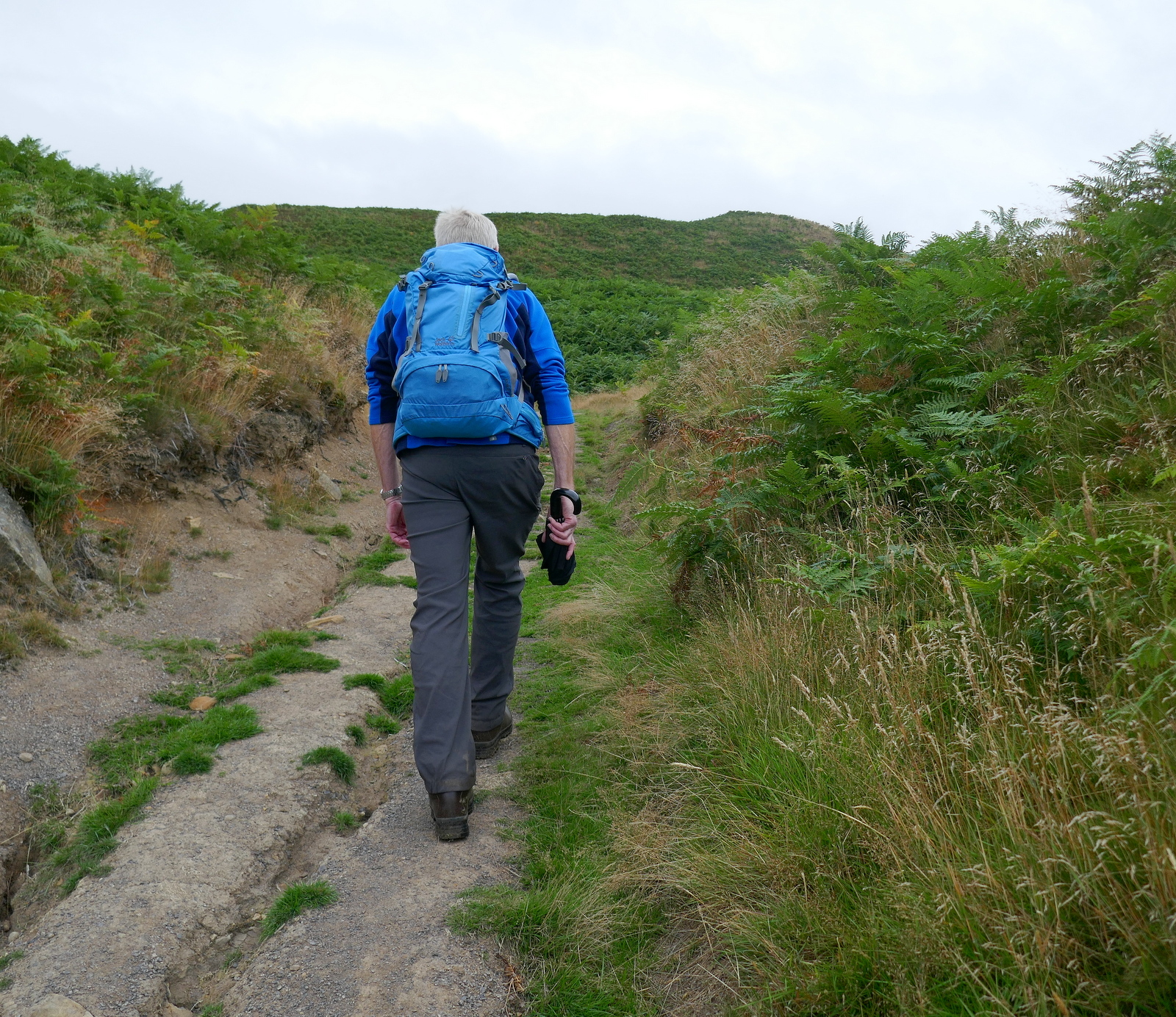
Leaving Turton Beckstead we climbed gently over Carr Hill to approach the village of Felixkirk through the overgrown fields.

More bean fields, no margin left for right of way

This made us chuckle, it was impossible to cross this stile as the barbed wire is much higher than one's inseam!  We had to improvise...

Nevison Beckstead


Another tricky stile, this time dropping down onto a rotten timber over a stream


.. and then a climb through undergrowth

The houses of Felixkirk appear in the distance


We reached the tarmac road at Mount View and turned right to walk into Felixkirk and the church of St Felix which we found to be unlocked.  The most striking feature is the domed roof.  There are only six churches dedicated to St Felix in the UK.  He was a 7th century monk from Burgundy who converted the kingdom of East Anglia to Christianity.  The use of the name suggests there has been a church here since Saxon times.  The church was restored in 1860 but much of the stonework is original and dates to the 12th century.


St Felix Church, Felixkirk

The unusual domed roof

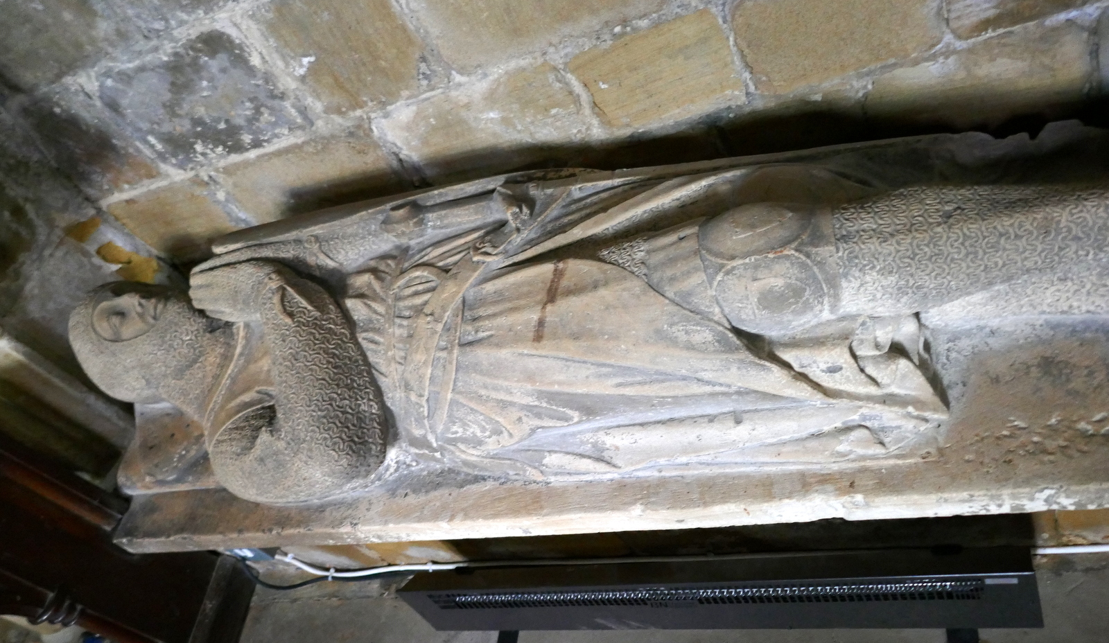
A Lady and her Knight lie near the altar


Those underlined died in combat

Graffitti or mason's name?  'Thomas Carlton 1629' on door arch


Ther mouseman of Kilburn has provided the church gate

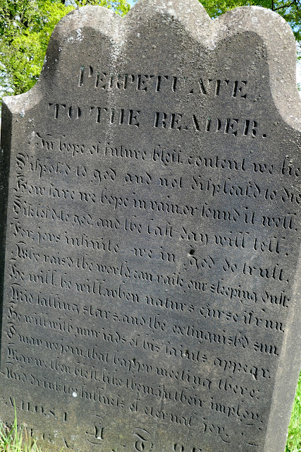
As always we paid our respects at the grave of tragic Hannah Cornforth, who died at 21 and has possibly the saddest epitaph we've seen.

Hannah Cornforth 'Twenty years I was a maid, 1 year I was a wife. 18 hours a mother, and then departed life'


Retracing our steps to the road junction we turned right and climbed the lane to pass the lodge to Mount St John, famous for its equestrian centre and gardens.  Shortly afterwards we turned right off the road and onto a farm track that we followed towards Cinque House, but here the track diverts from TSB's map above, as it has been re-routed around the rear of Cinque House, across a sheep field.

In fact the sheep field was extremely full of sheep today but we resolved to stop here, sheltered from the breeze by Cinque House and its hedges, to enjoy our coffee and scones with a fine view over towards Boltby Scar.

Mount St John Lodge

Leaving the road at the farm gate

Always lots of horses in these fields


Our path is diverted through fields as we approach Cinque House..

... into a sheep field

..where we pause for coffee and scones


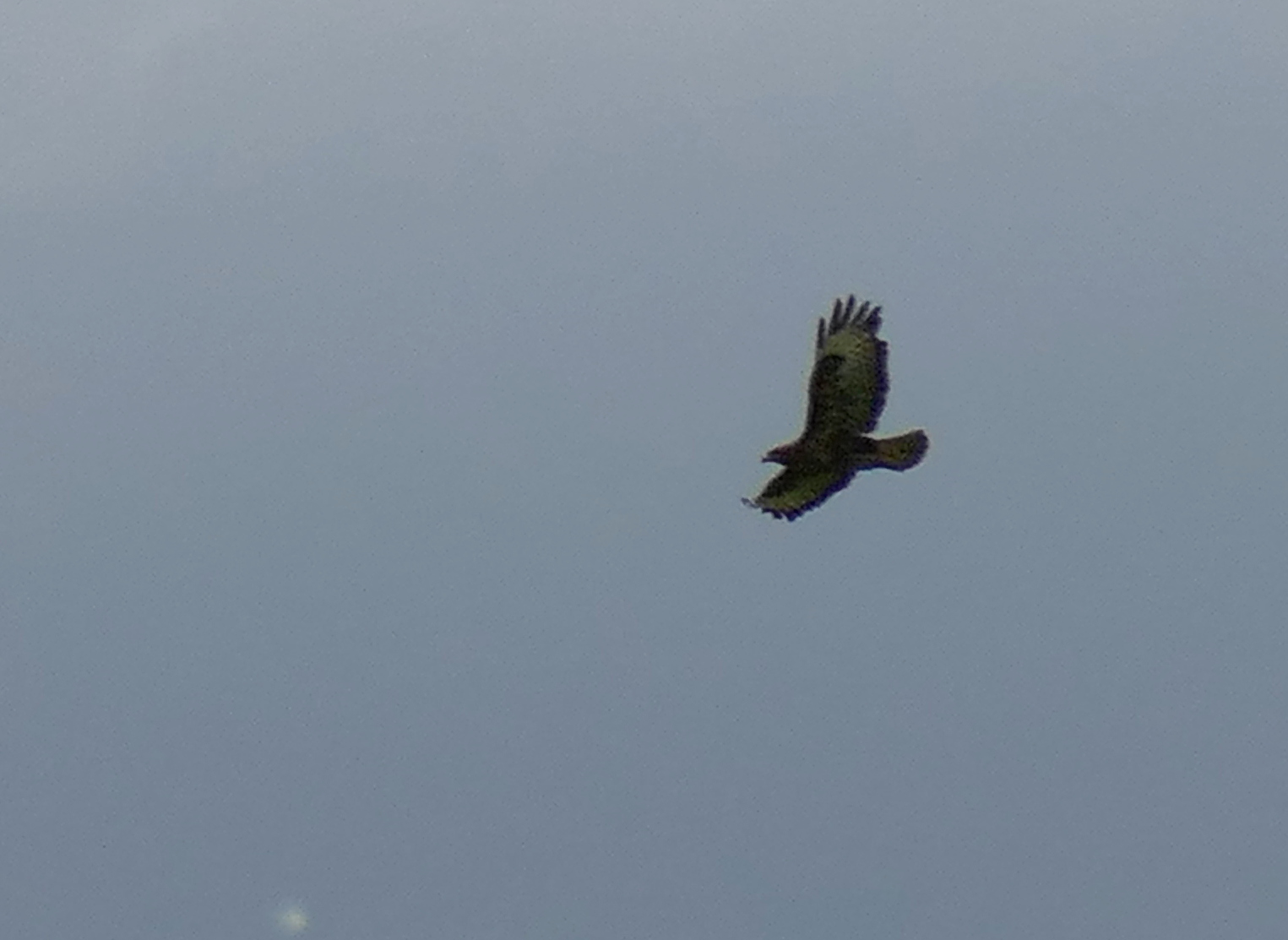
A buzzard checks us out as we dine

Cinque House


We set off once more and our diversion rejoined the track below Cinque Cliff House to follow a grassy lane to the road, where we turned left and walked into Thirlby. 

Thirlby is a very pretty village and the road is bordered with neat rural cottages.  One of these, Keepers Cottage, has a roadside stall which sometimes sells home made jam, but today offered only free range eggs.  


Weather vane at Thirlby

Keepers Cottage


A point of interest is that Alf White, aka James Herriot, lived in Thirlby and today we were on a mission to find a plaque dedicated not to Herriot but to his boss Seigried Farnon, or Donald Sinclair as he was really named.

Thanks to Steve for information about this plaque. We eventually found it near to the village hall and almost obscured by ivy.  Clive took his brush to it and all is revealed once more.


No mention of his alter-ego Seigfried Farnon

Walking down the high street we came to Pear Tree House where Thirlby's own woodcarver lives; Bob Hunter, who worked with Mouseman Thompson at nearby Kilburn, and whose trademark is the wren.

Pear Tree House


We continued along the lane through the village, crossed the ford and left the tarmac at Thirlby Farm, turning left to follow a track through a grassy meadow.


Pretty Gurtof Beck at Thirlby

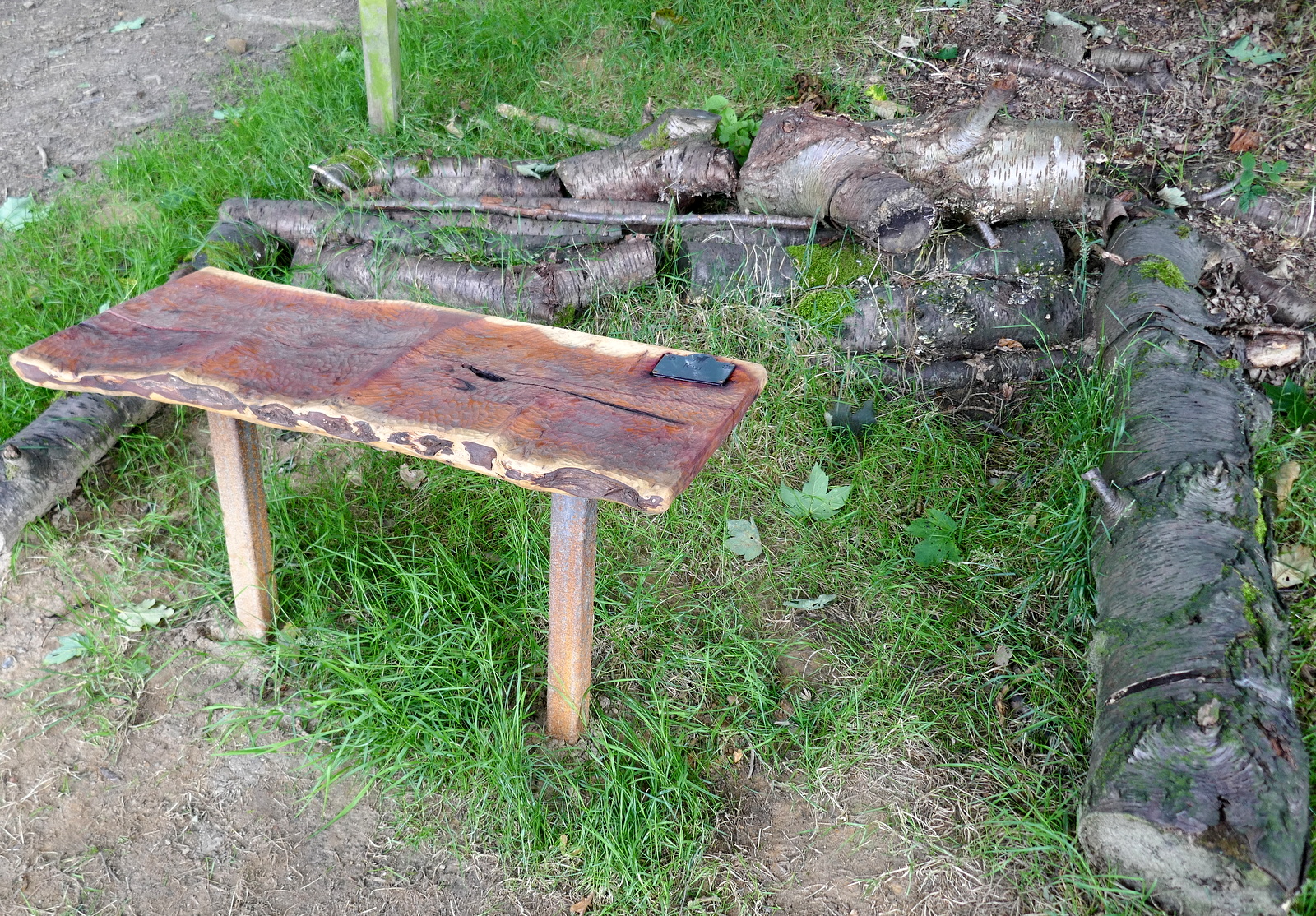
'No shop or inn is there here about, so why not sit down and enjoy summat for nowt'  - donated by 'two good sorts in memory of Bill'.  The memorial bench has the wren emblem


Leaving Thirlby

We followed our path, sometimes across fields and sometimes through trees, steadily approaching Boltby.

At Boltby we turned left at the packhorse bridge and walked through the pretty village before turning right at a waymarked sign at the lane between Spring Garth and Gurtof House. 


The packhorse bridge at Boltby

Cottage in Boltby


We followed a series of field boundaries to reach the modern mansion of Ravensthorpe Manor, which we climbed above into Westow Plantation.  Here we followed a muddy track behind Ravensthorpe Manor, which was now invisible to us because of the plantation's trees.


Boltby Scar 

Looking back to Boltby

Ravensthorpe Manor

Climbing above Ravensthorpe Manor

In Westow Plantation

We get a glimpse of Raventhorpe's large box hedge feature below us.

The path became easier and we walked gently downhill, eventually emerging in Kirby Knowle near the old school house, where we turned left and walked back to the car.

This is a nice walk taking you through pretty villages but needs some navigation preparation because, as stated in the text, many paths appear unwalked.

There is no pub in Kirby Knowle but a short drive took us to Osmotherley where we discussed today's walk.


Leaving Westow Plantation


A new memorial...


Kirby Knowle

To Turton Beckstead!