The Hanging Stone and High Cliff from Gribdale Gate
8 miles Cold and still
We parked at Gribdale Gate, booted up and headed straight up Great Ayton Moor.
 |
| Today's walk from The Walker's Guide to the Cleveland Hills |
 |
| The car park at Gribdale Gate |
In The Walker's Guide to the Cleveland Hills, Tom Scott Burns relates a curious belief from a 19th century book called 'Customs of North Riding' which states, 'Anyone who dares to stand near Gribdale Gate at midnight on New Year's Eve will see an old man pass through the gate and vanish'. No such ghosties for us today it being the 1st day of December, not January.
After reaching the moor the footpath follows a dry stone wall where there are views over to Roseberry Topping. We came to a gate at Newton Moor but turned right just before it. Tom Scott Burns mentions that this is the site of a chambered cairn, part of a complex Neolithic burial site dating from the Bronze Age, roughly 2300 - 800BC, a time when these moors were covered with mixed forest and woodland clearance was just beginning to take place. By the Iron Age the site was treeless and cultivation was in progress. Following that period heather spread across the moor replacing farmland, so the moors have in fact looked much as they do now since the Iron Age.
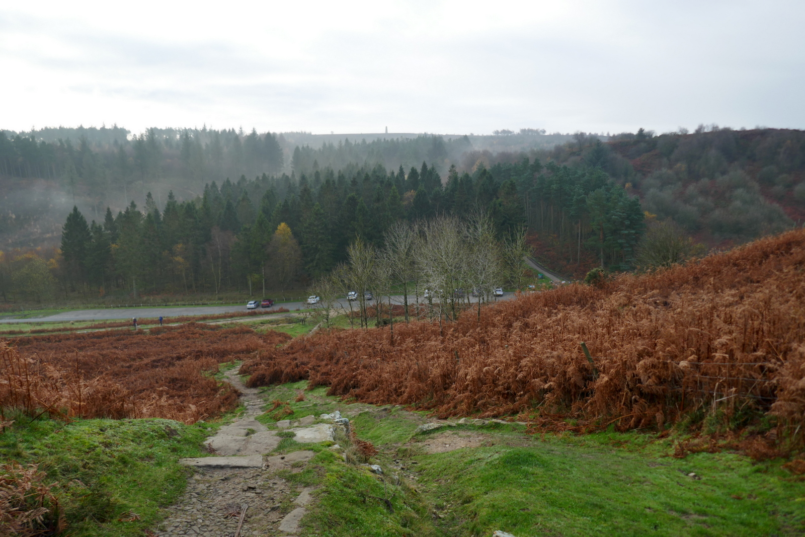
We followed the distinct path through the remains of a conifer wood which TSB describes as 'a corridor of trees rinsed with the scent of pine.' No more, I'm afraid, as those trees have gone to the Biomass power station. However, new growth in the form of mixed woodland is springing up around our path and is quite dense. In fact it would now be very easy to miss the turn which leads to a surprise view of Hanging Stone and Guisborough below.
 |
| The remains of the conifer plantation |
 |
| Our path almost hidden by new growth.. |
 |
| .. leads through to emerge |
 |
| .. above Hanging Stone |
The path eventually led us through the saplings to a surprise view of Hanging Stone, which is a massive block of sandstone that TSB believes may have been part of an old quarry.
 |
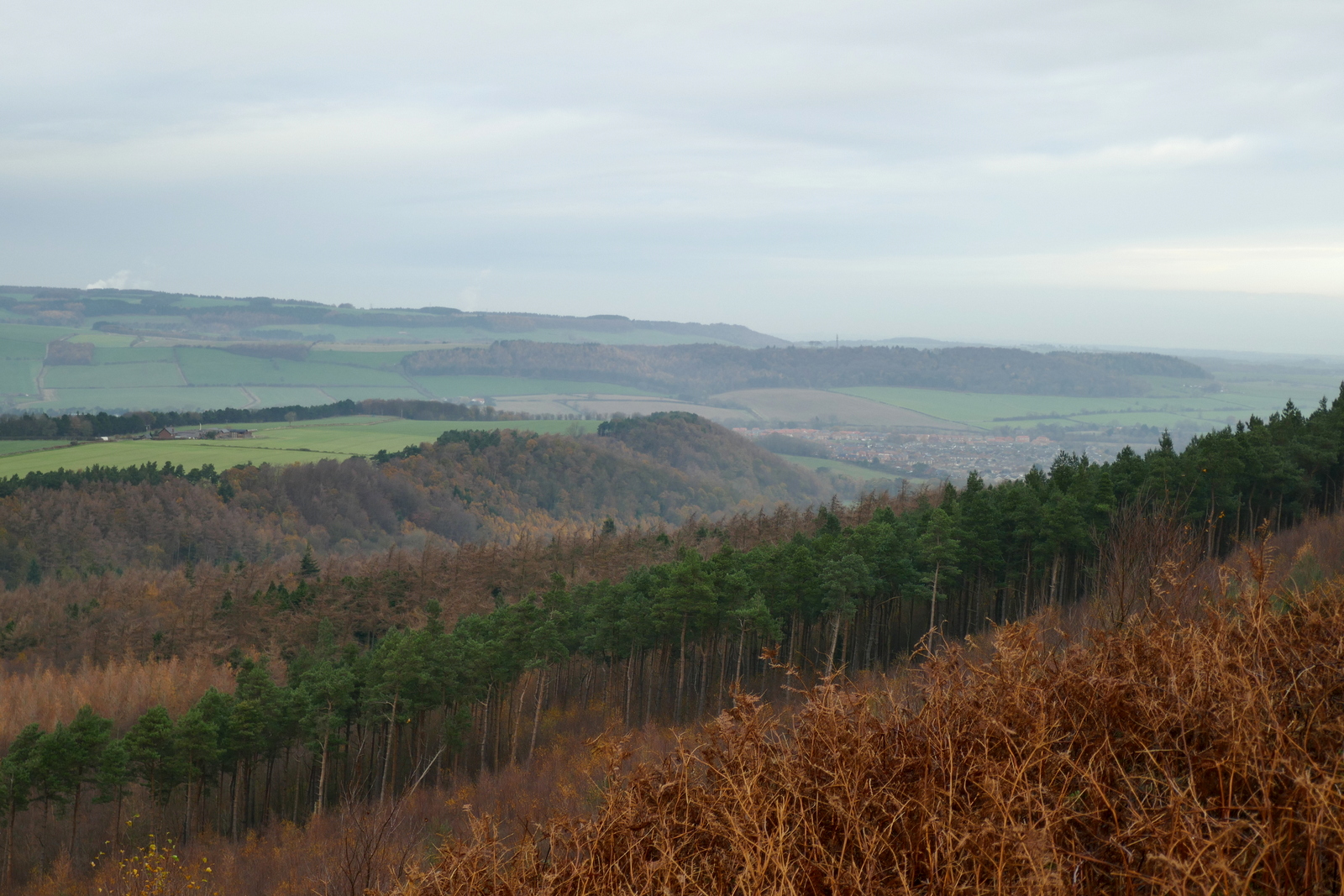
| Our next stop, High Cliff, is over to the right |
 |
| We pick out landmarks |
 |
| Gothic Hutton Hall from Hanging Stone with zoom |
 |
| I strike a heroic posture on Hanging Stone |
 |
| Passing the stone we notice new steps |
The descent from Hanging Stone used to be treacherously slippy but we were pleased to discover stone steps all the way down to the woods below. I'm not sure whether this is new stone or whether it's an old path that has been uncovered. Whichever it is, it's a big improvement on the last time we were here.
We took our time descending through the trees to briefly join a connecting track through Hutton Lowcross Woods, then turning left to again descend to reach Hutton village road. Turning right along the road we entered Hutton village, which was built as a model village during the ironstone mining of the 1850s. At the end of the village our track climbed towards Bold Venture Gill.
The village road leads to Bold Venture Gill and a steep concrete track into forestry land. We stayed on this track ignoring all turn-offs and noted much recent forestry work. No longer are there 'endless rows of conifers' as described in 'The Walker's Guide to the Cleveland Hills'. Eventually High Cliff Nab came into view and a convenient bench near to the nab made an ideal coffee stop. We ate our scones with a fine view.
 |
| High Cliff Nab comes into view |
 |
| A convenient bench |
 |
| "Share your scones with me" |
 |
| Clive spreads crumbs on the gatepost |
Vacating our bench we left the main track to walk beneath Highcliffe Nab. Now on Guisborough Moor we looked down on Highcliffe Farm and strode out across Codhill Heights; 'Cod' being derived from the Viking word 'Keld', which means 'spring'.
Above the farm we came upon a dead rabbit and a few feet away, a dead hare. Both looked recently deceased and we wondered if poachers had thrown them away.
 |
| Highcliffe Farm |
 |
| Rabbit and near Clive, a hare |
 |
| A beautiful hare |
We were sorry to see such healthy animals dead, especially the hare, and looked round for anyone with hunting dogs but there was no-one to be seen.
We were now walking along the side of Sleddale, whose name is apparently derived from the old English 'slaed', a wide flat valley. Soon isolated Sleddale Farm came into view and here we turned right, away from the farm.
 |
| On Codhill Heights |
 |
| Male grouse with winter plumage |
 |
| Sleddale valley side |
 |
| Sleddale |
 |
| Sleddale Farm, excavations for new build? |
We joined a road that serves as the access road to Sleddale Farm. After a while we came to a T junction with Percy Cross Rigg Road and turned right into it, enjoying the views in all directions.
 |
| Sleddale Farm entrance last visit |
 |
| New stone walling on entrance this year |
 |
| Sleddale Farm access road |
 |
| Tup and ewe |
 |
| We reach Percy Cross Rigg |
We followed Percy Cross Road until we came to a small fenced area which is the site of several Iron Age huts that were excavated in the 1960s. On our last visit the heather had been cut back to reveal the shape of the huts but this has now re-grown and some of the fencing has been knocked down.
 |
| Iron Age huts site |
 |
| You can just make out the shape of the circular hut in the heather |
 |
| Percy Cross Road |
We walked along Percy Cross Rigg, once a prehistoric track connecting settlements at Eston Moor, Great Ayton Moor and the Crown End Settlement in Westerdale, until we reached a gate and information board at Percy Cross Rigg. Here there is a meeting of paths that is actually the junction of four parishes, Guisborough, Kildale, Great Ayton and Hutton Lowcross, although there is no sign to that effect.
This junction is where we turned left from Percy Cross Rigg to cut across the moor on a green path with Lonsdale Bowl to our left. Looking at the map of the walk (above), you will see that this took us alongside Lonsdale Plantation. The trees shown on the map have now been felled, but in this case with the advantage that there is now a good view of Lonsdale Bowl.
 |
| High Cliff Nab in the distance |
 |
| Views of Lonsdale Bowl |
We followed our path across Great Ayton Moor for the final leg of our walk, dropping down from the moor to retun to the car at Gribdale Gate. A short drive took us to Great Ayton where, after a short diversion via Petch's pie shop, we adjourned to the Royal Oak to discuss today's winter walk over a pint.
 |
| Back to Gribdale Gate |
 |
| Pies, crisps and beer at the end of the walk |


No comments:
Post a Comment