Stonegrave and Caulkleys Bank from Nunnington
7 miles Fine and dry
This is the most southerly walk in Tom Scott Burn's book, The Walker's Guide to the Hambleton Hills. Set in the gently rolling Howardian Hills this route would be graded very easy and the going is good underfoot.
We approached Nunnington on the B1257 from Helmsley and parked in a lay-by opposite Nunnington Hall, next to the river.
 |
| Today's walk from The Walker's Guide to the Hambleton Hills |
 |
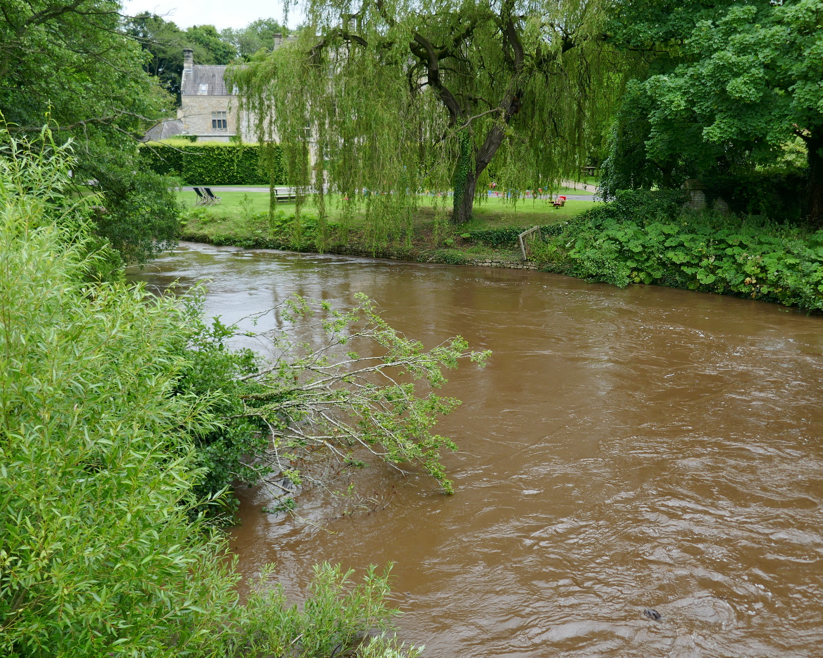
| The river in spate - note the head just appearing bottom right |
We walked on to the bridge over the River Rye and looked down to see the river in spate, branches and debris floating downstream. I took the above photo and as I put my camera away Clive spotted an otter swimming below us. I grabbed my camera but too late, the otter dived out of view with its powerful tail showing above the water for a second. I was sorry not to have photographed the otter, the first we have seen while walking, but on looking at my photos later I saw that I had caught him without realising, in the bottom right of the above photo. |
| Otter! |
We stood on the bridge for a few minutes but the otter didn't resurface in our view so we set off walking into the village.Tom Scott Burns explains that the name Nunnington is derived from the old English personal name Nunna and not from the Saxon nunnery that once stood where the hall now stands.
Nunnington is a very pretty village with streets laid out in a grid formation. All the houses are decorated in the same pale green and cream paintwork.
 |
| The Old School House |
 |
| Neat streets |
As we passed Nunnington studios we paused to admire the weather vane which we were once told is a life sized memorial to a much loved dog, a spaniel called Percy. Apparently the spaniel was a real character who led a very independent life, doing exactly what he pleased. At the other end of the village is a small copse of trees named after the dog and known as Percy's Plantation. |
| Life size weather vane of Percy |
 |
| Leave the village by the gate near Bridge Cottage |
Leaving Nunnington at Bridge Cottage we walked for about a mile alongside the river which recent rain has swollen. We watched flotsam rushing downstream. Eventually we crossed a small bridge over a beck and here we turned sharp left and walked away from the river into fields.
 |
| River Rye |
 |
| As usual with TSB walks, paths are little walked |
 |
| Turning away from the river |
After walking through several fields we turned left onto the tarmac of High Moor Lane and after a hundred yards or so turned right at a signpost to return to fields.
 |
| Dropping towards Stonegrave |
After half a mile or so we dropped down to reach the busy Malton road and the village of Stonegrave.
 |
| The Minster comes into view |
 |
| Houses in Stonegrave |
Crossing the busy B1257 we followed the wooden sign to the rear gate of Stonegrave Minster, England's smallest minster.
TSB explains that Stonegrave is derived from steinn-gryfia meaning a 'stone cleft', and that there were important quarries of building stone to be found here in the Middle Ages.
 |
| Approaching the Minster |
 |
| Stonegrave Minster |
 |
| Have you been putting it round that we're barmy..? |
After coffee we entered the Minster, which is invariably left open for visitors, and admired its Celtic Cross which dates from the 8th century.
 |
| Celtic Cross |
 |
| Medieval stone coffins |
 |
| Altar window |
Leaving the Minster we walked past the old manor house and crossed back over the Malton road to join a grassy path that veers left from the road to climb Caulkleys Bank.
The name Caulkleys is a corruption of 'Chalk Lands' and in The Walker's Guide to the Hambleton Hills one reads that the terrain here consists mainly of rich deposits of reef limestones and detritus known as Coral Rag, all pointing to the marine origins of this hillside.
 |
| Leaving the Minster |
 |
| We think this might be a walnut tree |
 |
| Stonegrave Manor House |
 |
| Looking down on the old manor house as we climb.. |
 |
| ... Caulkleys Bank |
 |
| A thatched house in Stonegrave |
Reaching the top of Caulkleys Bank we walked along the grassy ridge and after passing Caulkleys Wood we had fine views in all directions.
We followed the ridge walk for about 2.5 miles: at its highest point it is marked by a trig point. TSB says that no less than 22 towns, villages and hamlets and sixteen churches can be seen from here. We didn't check.
 |
| Log seat on Caukleys Bank |
 |
| Hovingham from Caulkleys Bank |
 |
| The Trig Point |
Eventually our path began to lose height and we reached the houses of the tiny hamlet of West Ness, where we passed an old Wesleyan Chapel, long disused.
 |
| Rejoin the river path at West Ness |
 |
| Follow the river to.. |
 |
| ... Mill Farm. The old mill building is on the right |
We were amused to see a sheepdog apparently at the wheel of an old tractor. It seemed to be using it as a kennel.
 |
| Sheepdog driver |
TSB says there has been a mill here since Domesday and the present mill dates from 1875. Until 1950 the mill race powered a generator providing electricity for Nunnington Hall. The mill race was looking very dramatic in today's flooded river.
 |
| Another view of Mill Farm- |
 |
| The mill race is very dramatic today |
Continuing alongside the river we reached Nunnington Hall, where the screeching of peacocks can be heard. This was owned by Sir Thomas Parr in the sixteenth century so it's possible that Catherine Parr, Henry VIII's last wife, played in the village as a child.
 |
| Nunnington Hall |
We emerged on to The Avenue and went back over the bridge to the car. There is no longer a pub in Nunnington so we called at Helmsley Brewery and sat in their bijou beer garden where we discussed today's walk over a pint of Yorkshire Legend.
 |
| To Tarka the Otter! |


No comments:
Post a Comment