Nether and Over Silton, Big Wood and Oakdale Reservoir
7.8 miles Fine and sunny
Clive is on holiday in Spain (my turn next week) so Carole agreed to accompany me on this great Tom Scott Burns walk which is an annual favourite of mine. We parked at Square Corner, the moors car park which is two miles from Osmotherley on the Hawnby road.
 |
| Today's walk from The Walker's Guide to the Cleveland Hills |
 |
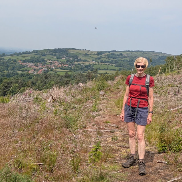
| Ready for the off - Black Hambleton in the distance |
Leaving the car we walked southwards along the forest path up the shoulder of Black Hambleton. Just before reaching a gate we saw the standing stone on the left which bears the inscription 'Cray Hall Stone'. The origin of this stone is shrouded in mystery (see this Megalithic Portal page) as there is no Cray Hall hereabouts. I think the most likely explanation for it is to be found here. The Ordnance Survey team mapping the area simply misunderstood the local dialect for the area, 'Crayaldstane', which is first encountered in 1150. That explains the name... but who had the stone made and erected?
 |
| 'Cray Hall Stone' |
 |
| We saw a few Marsh Orchids along here |
Passing through a gate we continued uphill to the next gate where we turned right off the main track dropping down to the remains of the conifer plantation, where the path, known as Moor Lane, takes one steadily downhill for about 2.5 miles. This is a pleasant and easy start to the walk.
 |
| Strolling along Moor Lane |
We passed imposing Moor House then arrived at Rose Cottage where, just opposite and almost hidden in undergrowth, there is an ancient drinking trough.
 |
| Moor House |
 |
| Rose Cottage is having a facelift |
 |
| Ancient drinking trough |
The forest path becomes a tarmac lane that eventually leads to Kirk Ings Lane, where we turned left, then right, to enter the lovely village of Nether Silton.
 |
| Houses in Nether Silton |
 |
| North Farm |
 |
| Silton Hall |
 |
| All Saints Church |
 |
| Horseshoe stag |
Opposite the church is a white gate next to the old post office, leaving Nether Silton through this gate, which takes one alongside a garden to reach meadows, where we followed the faint path to reach the ancient and isolated church of St Mary's at Over Silton.
 |
| Through the wicket gate |
 |
| ... and over the stile |
 |
| ... into meadows |
 |
| St Mary's appears in the distance |
 |
| Isolated St Mary's Church, Over Silton |
No roads lead to St Mary's which stands alone in fields. It is a very peaceful place to stop and enjoy coffee and scones, and thus it was.
 |
| Looking around the old church |
 |
| The altar |
 |
| Candelabra as no electricity |
 |
| Coffee at St Mary's |
We walked across the fields away from the isolated church and towards the village of Over Silton where we passed by the old manor house. TSB tells us that this was once owned by the gallant gentleman Sir George Orby Wombwell, baronet, who served with the 17th Lancers and took part in the charge of the Light Brigade at Balaclava on 25th October 1854.
The next 2.5 miles were to be through conifers, sometimes on wide forestry tracks and sometimes on narrow footpaths. The first mile or so is a steady climb and as we neared Thimbleby Shooting Ground, a clay pigeon gun school, we walked to the sound of guns echoing up Thimbleby Bank.
 |
| Crabtree Plantation |
 |
| Thimbleby plantation |
These conifer plantations run into one another and form a huge wood known collectively as Big Wood. We followed a distinct path through the wood, occasionally passing areas which had been cleared but sometimes in very dense conifers.
 |
| A muddy bit |
 |
| Conifers |
 |
| Clearance |
 |
| Conifers |
 |
| More clearance |
 |
| Osmotherley appears in the distance |
Eventually we came to the end of the felling, just as we turned right in Big Wood above Oakdale Lower Reservoir and we exited the trees to make the steep descent to the bridge over Jenny Brewster's Gill.
 |
| Flowering rhododendrons to be seen throughout this walk |
 |
| Starting the descent |
 |
| Tricky in places |
 |
| Bridge over Jenny Brewster's Gill |
Tom Scott Burns explains that Jenny Brewster's Gill was named after a famous witch and was once the haunt of smugglers who peddled liquor to the surrounding villages. Several secret stills were dotted around the moors, one being at Solomon's Temple, another Wildgoose Nest, near what is now Cod Beck Reservoir and another at Swainsty Crag on Nether Silton Moor.
We crossed the bridge and left the wood to climb to the reservoir service track, which we joined to follow towards what used to be the upper reservoir. Oakdale Reservoirs were built in the 19th century to provide water to the local area but have been decommissioned. The upper reservoir has been downgraded to a small lake that it is hoped will attract wildfowl, but no wildlife was to be seen today. In fact the lake appeared almost dry.
 |
| Looking back at Big Wood |
 |
| On the reservoir service track |
 |
| Oakdale - more mud than water today |
After passing the upper reservoir we descended to cross Jenny Brewster's Gill once more before leaving Oak Dale and climbing steeply back to Square Corner and the car.
 |
| "To Big Wood" |


No comments:
Post a Comment