8 miles Fine and breezy
This moorland walk that visits the secluded village of Westerdale is not a Tom Scott Burns walk but is across an area he will have known well.
The walk starts at Castleton then progresses through Eskdale and Danby Dale before branching off to Westerdale.
We approached Castleton from the Whitby Moors road and parked at a designated parking spot just outside the village as shown on the map below.
 |
Today's walk, GPS track available on request
|
 |
| Walking into Castleton from the car park |
Castleton takes its name from the castle which stood on Castle Hill from 1089 to the 15th century, and is situated along the end of Castleton Rigg, an outcrop of Danby Moor.
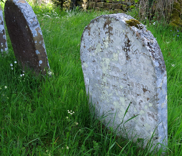
Leaving the car we walked straight downhill towards Castleton, after a couple of hundred yards we turned right shortly after passing a small Quaker graveyard. This area was a hotbed of religious non-conformity and the Quakers and Primitive Methodists had chapels here. John Wesley preached in Castleton and the nearest C of E church was at Danby.
 |
| Quaker graveyard |
 |
| Turn right off the high Street towards Didderhowe Farm |
 |
| A young family near Didderhowe Farm |
We were now walking on the Esk Valley Walk and following its clear way marks always bearing the image of a fish.
Passing Didderhowe Farm we entered meadows and for the next mile or so walked along the bottom of Danby Dale where we would pass several farms, before leaving the valley at Stormy Hall.
 |
| Sitting on eggs and pretending we are not there! |
 |
| Walking towards Didderhowe Farm |
 |
| Ducklings at Didderhowe Farm |
 |
| Entering Danby Dale |
 |
| Always following the sign of the fish |
 |
| Looking back to Castleton |
As we followed the valley bottom we saw the tower of a secluded church to our right. We decided to leave our route for a while to satisfy our curiosity about the building.
 |
| We spot a church tower... |
 |
| "Coming through...." |
 |
| Ancient St Hilda's Church |
We discovered that the church is St Hilda's Church, the parish church of Danby although situated two miles outside Danby. Literature at the church informed us that the church tower was built in the 14th century and a balcony which houses the organ was added in 1808.
It was unlocked and we entered for a look around and chatted to a friendly local lady who was doing a bit of cleaning.
In the 1800s the vicar of Danby was a Daniel Duck (1743-1825) and on his death someone wrote on the back of a pew,"Yes Daniel, faithful Daniel – gone / We faithful few lament their loss / No more we fix our eyes upon / That Zealous preacher of the cross." Even graffitti was more literary in those days!
 |
| Old grave stones at Danby Church |
 |
| St Hilda's Church of Danby |
 |
| Balcony and organ |
 |
| Old carved head, probably Saxon |
 |
| Leaving the church we descended to the valley bottom |
 |
| Crossing the River Esk in Danby Dale |
 |
| We can see you! |
Back on our route once more we followed the farm track to West Green Farm where I admired its dog weather vane before marching on to Plum Tree Farm, a building more plain than its name suggests.
 |
| West Green Farm |
 |
| Dog weather vane |
 |
| Guest at West Green Farm |
 |
| Passing Plum Tree Farm |
 |
| Clive checks out the ancient pigeon coop - it's empty |
 |
| Dated 1810 |
 |
| Continuing along the Esk Valley Way |
 |
| Do not disturb |
 |
| Good camo! |
After Plum Tree Farm we came to West Cliff Farm where the presence of a converted Land Rover told us the local dry stone waller was about. We soon came to his tools and evidence of his work but he was not be be seen.
What was to be seen, and heard, were the farm's peacocks and one watched us pass from a rooftop.
 |
| Danby Head |
 |
| West Cliff Farm |
 |
| We recognise the Dry Stone Waller's truck |
 |
| No sign of the craftsman |
 |
| Peacock watches us pass |
 |
| Blackmires Farm |
 |
| Peacock weather vane at Blackmires Farm |
 |
| British White Cattle |
 |
| An old breed dating to the 17th century |
 |
| Yes, you're very handsome |
Our next farm was Stormy Hall and here we turned right onto a steep farm track leading us up to Castelton Rigg. We paused occasionally to look back at superb views of Danby Dale.
 |
| Turn right at Stormy Hall |
 |
| Looking back |
 |
| Coffee and scones... |
 |
| ... with a view |
Just before reaching the top of our climb we stopped for coffee and scones at a disused quarry, giving us shelter from the breeze and a fine view back down Danby Dale.
Refreshments over we crossed the main road to follow a footpath across Castleton Rigg. Here we paused again to take in the fine view in to a new valley and to pick out our two immediate objectives, Dale Head and Broad Gate Farms.
 |
| Dale Head Farm |
 |
| Dale Head Farm |
We descended steeply to Dale Head Farm where we were interested to see a strange stone building which apparently was a Bee House. This was built in 1832 to house the straw bee hives or 'skeps', as they were called at the time. We were impressed to see that even as lowly a building as this featured decorative cornices.
 |
| The Bee House |
We turned right just beyond the Bee House and walked across several more fields to Broad Gate Farm. We followed the farm track and passed through a tiny stile set in the wall, crossing a field to reach a seven step stone stile which required concentration to get across.
 |
| Still plenty of bluebells to enjoy |
 |
| Broad Gate Farm |
 |
| Duck weather vane at Broad Gate |
 |
| Up and over! |
 |
| The roofs of Westerdale |
Across a field and over another step stile and we were entering the tiny village of Westerdale. We walked along the street and stopped to admire Christ Church. The building was open so as usual we popped in for a look around.
 |
| Westerdale |
 |
| Cockerel in Westerdale High Street |
 |
| Church House, Westerdale |
 |
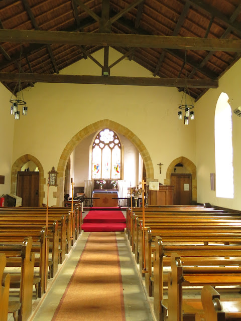
| Christ Church, Westerdale |
Westerdale was Knight Templar Country and leaflets in the church informed us that Christ Church was re-built in 1838 but the decorative stone over-arching the date stone is from the 12th century and the chevrons date it to the late 1100s. Drawings preceding 1838 remain of the old church and show that it was not in the Norman design, apparently because the Night Templars who were lords of the manor here in the 13th Century, had made changes. This new church is built in the footprint of the old using the original stone when possible.
We enjoyed looking around the church. The older windows are from the 14th century and were placed by the Knights Hospitaller who became lords of the manor following the demise of the Knights Templar.
 |
| Grave slabs probably from graves of Knights Templars |
 |
| Christ Church |
 |
| Altar window |
 |
| Bell tower window |
 |
| The arch stone above the date is from the 12th century |
|
Leaving the village we walked past pretty gardens with bird feeders where woodpeckers were feeding, and followed the road down to the River Esk where we stopped to look at its ancient bridge, restored in the 1800s.
 |
| Woodpeckers |
 |
| Hunter's Sty Bridge |
This bridge is Hunter's Sty Bridge and is a single span medieval bridge which was restored by the Duncombe family in 1874. It dates from the 13th century and Hunter's Sty means Hunter's Steep Path, and was built to provide access to the Royal Forest of Pickering.
We crossed the village cricket field and climbed through several rough and un-waymarked pastures to reach the moor and John Breckon Road.
 |
| Cricket pitch |
 |
| Back on the moor... |
 |
| ... and back on the Esk Valley Walk |
 |
| The houses of Castleton appear in the distance |
 |
| A climb back to the road |
We were soon back on Castleton High Street and seeing the open doors of the Downe Arms Inn made our way to sit in the beer garden, where we could look back at our outward path along Danby Dale.
A nice end to a nice walk.
 |
| That didn't last long! |


